The first
settlers of the Nambour area
Who
were these people... Petrie,
Blackall, Currie, Bury, Murtagh, Whalley, .... ?
The first Europeans arrive
Captain
James Cook named the Glasshouse Mountains when he sailed by in the Endeavour
on 17th May, 1770. His journal describes them as being 'remarkable for the singular form of their elevation, which very much
resembles a glass house, and for this reason I called them the Glass Houses:
the northern most of the three is the highest and largest: there are several
other peaked hills inland to the northward of these, but they are not nearly
so remarkable'.
Lieutenant
Matthew Flinders came ashore from the sloop Norfolk and climbed Mount
Beerburrum in July 1799. Flinders also made accurate charts of the local
coastal strip, and revisited the area during his circumnavigation of Australia
in 1802-3. The first Europeans to tread the soil of the Maroochy district were
the cedar getters, Thomas Pamphlett, John Finnegan and Richard Parsons who
were sailing from Sydney south to the Illawarra district to take on a cargo of
timber. After days of cyclonic weather in which they were blown hundreds of
miles north of Sydney, they were shipwrecked on Moreton Island in November
1823.
Believing
that they were south of their destination, they crossed to Bribie Island and
then the mainland, and trekked northwards in a mistaken attempt to reach the
Illawarra. They waded across the Mooloolah River at low tide, whereupon
Pamphlett found the going too hard and decided to return to the aborigines on
Bribie Island who had befriended them. Finnegan and Parsons reached the
Maroochy River, followed its south bank upstream, and passed through the
Diddillibah area before turning north. They eventually reached the Noosa
River, whereupon Finnegan turned back. Parsons continued on to the Mary River.
Pamphlett
and Finnegan met up again and explored parts of Moreton Bay before being
picked up at Skirmish Point on Bribie Island by
John Oxley who was
fortuitously sailing past in the Mermaid.
Oxley was returning from an unsuccessful expedition to Port Curtis to look for
additional sites for a convict settlement. They told Oxley about a large river
they had discovered that flowed into Moreton Bay, and accompanied him as he
sailed up it for fifty miles in a rowing boat.
Oxley
named this the Brisbane River after the then Governor of New South Wales, and
the next year, 1824, he returned to help establish the first penal settlement
on its banks. While Oxley was there, he was pleased to meet the third man,
Parsons, who had returned to civilisation after living for a time with the
aborigines. Thus the City of Brisbane was founded.
In Sydney in 1830,
Dr John
Dunmore Lang wished to build a much-needed school. He returned to England to
seek approval and financial assistance, and won the support of the Secretary
of State for the Colonies. He chartered a ship, the Stirling Castle of
350 tons, arranged the supply of stores, and recruited suitable migrants to
accompany him back to New South Wales.
Andrew Petrie
When the Stirling Castle set
sail in June 1831, among its passengers were Andrew Petrie, his wife and five
children. Andrew was an architect and builder, and upon arrival in Sydney he
built Dr Lang's new school and other buildings.
Andrew worked for himself for
a time, but found that he could not compete with cheap convict labour. He
therefore accepted a position as Clerk of Works in the Ordnance Department. In
1837 he was sent to the Moreton Bay penal settlement as acting Superintendent
of Works. He arrived at Stradbroke Island with his family on the James
Watt, the first steamship to reach Moreton Bay. The ship anchored at Dunwich, and the Petries were rowed across the bay and up the
river to the settlement in a small boat crewed by convicts. There they found
that the nascent town of Brisbane consisted of only ten buildings, and that
they were the only free settlers.
One of Andrew's first jobs
was to get the flour mill (now the Observatory on Wickham Terrace)
functioning. He found that the machinery had been incorrectly assembled,
preventing the wind from turning the sails. It had been converted into a
treadmill worked by convicts, but Andrew rectified the faults and soon had it
operating as it should. The Commandant of the settlement, though, continued to
use it as a treadmill, as a punishment for unruly behaviour.
Petrie was also interested in
exploration, not only because of his desire to know more about the country,
but, as a builder, it was important to find new timbers and building
materials. In 1838 Andrew, John and two aboriginal guides had ridden from Brisbane
to the Maroochy River in search of gold. They had collected specimens of the Bunya
Pine (Araucaria bidwillii) from the district and Andrew was the first white
man to climb Mt Beerwah.
A bronze
tableau on a pedestal in Brisbane depicts Andrew on horseback with sons John
and Tom, preparing for an exploring expedition. (The reconstruction of King
George Square in 2007 has required that the tableau be removed from the Square
and placed in storage. After the work is completed, the tableau will be
restored to its position in front of the Brisbane City Hall.)
Tom was unable to accompany
his father on that trip, as he was just seven years old, the only white child
in the settlement. He grew up with the local aboriginal children, learning
their Turrbal language and customs, how to make their toys and weapons, and, what was
to be of great significance in his later life, their code and creed. As a
boy, he moved freely and safely among aborigines and convicts alike. This may
have been helped by the fact that he smuggled food and tobacco to them
whenever he could. During journeys with his father,
he also gained knowledge of bushcraft and surveying and so became
indispensable as a messenger or companion to early exploration parties.
As the Foreman
of Works in Brisbane, Andrew was responsible for many of the town's early
government buildings, and when Brisbane was declared a free settlement in
1842, he was transferred back to Sydney. He did not wish to leave his new home, so he resigned
from government service and established himself in Brisbane as a builder,
stonemason and undertaker with his son John.
For fifty years before the
first settlers arrived on the Blackall Range, white men were travelling the
aboriginal tracks through its scrubs and forests. John Fahey, an escaped
convict, lived with the Aborigines in the Range foothills from 1840 until he
was recaptured in 1854. When passing through Brisbane, the botanist and
explorer Dr Ludwig Leichhardt spent some time as a guest of the Petrie family.
In December 1843, a party comprising Dr Leichhardt, John Archer of the
Durundur sheep-run, a Mr Waterstone and three aboriginal carriers walked
through from the southern end of the Blackall Range to attend the bunya feast
celebrated by the aborigines every year at Baroon Pocket. They then followed
the Mary River as far as Tiaro before returning home. On their way back, they
explored the Maroochy district between the Blackall Range and the coast.
The Bunya Proclamation
Squatters and settlers began
arriving, particularly after 1842, when the transport of convicts to the
Moreton Bay district stopped and the area was opened up to free settlement.
Timber getters and pastoralists alike were moving into the area north of
Moreton Bay, forcing the Aboriginal people off their traditional lands. Andrew Petrie saw this
happening, and suggested to the New South Wales Governor, Sir George Gipps,
that he recognise the significance of the area to the native people by restricting the access of white
settlers. The result was that Governor Gipps, on Petrie's advice, published an Order in the Government
Gazette on 19th April 1842 to reserve the area for the Aborigines. This became known as the Bunya
Proclamation, and stated:
"It
having been represented to the Governor that a District exists to the
northward of Moreton Bay, in which a fruit-bearing tree abounds, called Bunya
or Banya Bunya, and that the Aborigines from considerable distances resort at
certain times of the year to this District for the purpose of eating the fruit
of the said Tree:- His Excellency is pleased to direct that no Licences be
granted for the occupation of any Lands within the said District in which the
Bunya or Banya Bunya Tree is found. And notice is hereby given,
that the several Crown Commissioners in the New England and Moreton Bay
Districts have been instructed to remove any person who may be in an
unauthorised occupation of Land whereon the said Bunya or Banya Bunya Trees
are to be found. His Excellency has also directed that no Licences to cut
Timber be granted within the said Districts."
The effect of this
Proclamation was to make most of what
we now call the Sunshine Coast, especially the lands between the Mooloolah and
Maroochy Rivers, into an aboriginal reserve.
In 1846, when two hundred
Aborigines of the Brisbane area took fifteen-year-old Tom Petrie to the bunya
feast in Baroon Pocket, they showed him where his father and brother had
camped eight years before at Razorback and Doolong.
Andrew and John Petrie built the substantial two-storey 'Adelaide House' in 1853,
which was Brisbane's finest residence at that time. On 7th September 1859
the Municipality of Brisbane was proclaimed, and John Petrie became
Brisbane's first mayor.
The
colony of Queensland is founded
On 10th December of that year, the Moreton Bay settlement detached
itself from New South Wales and became a separate colony with a population of
24 000 and its own governor. In honour of Queen Victoria, it named itself
'Queensland'. The first Governor
appointed was Sir George
Ferguson Bowen, GCMG, after whom the Brisbane suburb of Bowen Hills is named, as well as the town of Bowenville.
(The town of Bowen is located on Port Dennison, which was originally named 'Port Bowen' by Matthew
Flinders in 1802 after Captain James Bowen of the Royal Navy.)
Adelaide House was leased to
the new Government for use as the Governor's residence. Sir George and Lady
Diamantina Roma Bowen lived there for 21/2
years until a permanent Government House was
built adjoining the botanical gardens. Adelaide House is remembered as the
place from which the establishment of the colony of Queensland was proclaimed.
Today it is the deanery of St. John's Anglican Cathedral.
The developing town of
Brisbane required an ever-increasing food supply, and this led to expansion of
the surrounding farming areas. This progress, combined with the positive
reports about the fertile volcanic soils north of Brisbane, led to the
enactment of the Unoccupied Crown Land Occupation Act in 1860, which resulted
in the embargo on settlement and logging of our district being lifted. This
was one of the first Acts passed by the new parliament and given Royal Assent
by Governor Bowen after he took up duty.
Sir George was an energetic governor and during his term
of office great changes occurred in Queensland. Immigration and land schemes
were started, as was a railway system. Gold and other minerals became
important to the development of the colony, beginning with the discovery of
gold at Gympie. A practical man as well as a scholar, he believed that no
governor should be appointed who could not ride and shoot.
After eight years in office,
Governor Bowen moved on to become the Governor of New Zealand. He was followed by
Colonel Samuel Wensley Blackall,
who served from 14th August 1868 to 2nd January 1871.
[List
of Governors of Queensland.]
During his short term as
Governor, Colonel Blackall endeared himself to all classes of the community. Upon his
untimely death in office at the age of 62, he was the first person to be buried in
Toowong Cemetery, and his impressive memorial continues to dominate the hill
there. In 1874 the surveyor C. S. Bradbury named the Blackall Range in his
honour.
Tom Petrie
Tom Petrie
was a popular figure with the local Aboriginal tribe, the Turrabul, because he
grew up playing amongst them and spoke their language. As a young man there
were times when Tom had to ride out to protect his aboriginal friends from the raids of
land-hungry colonists. It was said that one group of young Turrabul men even
asked him to brand their shoulders with his initials 'T.P.', so that other
colonists would realise that they were Tom Petrie's men and not shoot them.
In 1862, now aged 31 years,
Tom returned to the Maroochy area
by boat with a timber-cutting gang of 25 Aborigines. He navigated his way over the bar of the Maroochy River and
they made their way upstream. They entered a creek and followed it for three
miles until it became too shallow. There they found that a crowd of five
hundred aborigines had assembled for a corroboree. The aborigines liked and
respected Petrie, and honoured him with the title of 'Turrwan', meaning 'a great man with remarkable
powers'. Tom and his men set up camp nearby, in a clearing in the thick vine scrub that covered the area. They
stayed for two weeks and cut two hundred cedar logs. The creek became known as Petrie's Creek, and the whole surrounding
area was known by that name for the next thirty years. Tom later wrote a definitive book about the way of life
of the local aborigines.
Early in 1863, William and
Richard Westaway, with Edmund Lander and Thomas Maddock, drove five hundred
head of cattle from Eagle Farm in Brisbane to the Petrie's Creek area and
built a slab hut and cattle yards at Deepwater, now known as Bli Bli. They
later retraced their steps a few miles and settled at 'Maradan Downs' (now
known as 'Meridan Plains') on the Mooloolah River, where they were joined by their father John Westaway. The
area now known as Kawana was part of their holding.
William Pettigrew, a surveyor by profession, had arrived in Brisbane on the Fortitude in
1849. Observing that the growing settlement urgently needed building materials,
he established one of the first steam-driven sawmills in the Moreton Bay
district within four years. In 1855 the two-year-old mill burned down. He
rebuilt it, and ten years later that mill also was destroyed by fire. In 1867 he
built his third sawmill in Brisbane.
After the Bunya
Proclamation was repealed in 1860, Pettigrew had become interested in harvesting the abundant timber in the
area north of Brisbane as far as the Maryborough district. In September 1865, he and James Low
of Yandina spent five days on horseback exploring the areas drained
by the Maroochy River, Petrie's Creek, Paynter's Creek and Eudlo Creek.
Pettigrew established his fourth sawmill on the Maroochy River and a depot with
a well-equipped wharf at the mouth of the Mooloolah River.
He operated a small steamship, the S.S. Tarshaw, and also two small
paddle steamers of less than 100 tons each, the Gneering and the
Tadorna Radjah. Pettigrew became a Member of the Legislative Council in 1878 and
Chairman of the Caboolture Divisional Board in 1881. Both of his sawmills were destroyed in the great floods of
1892-93. Also in 1893 his two paddle steamers were wrecked - the Gneering on
the bar off the Maroochy River's mouth and the Tadorna Radjah in the
flooded Brisbane River. He was bankrupted in 1897.
In 1867, William Clarke planted the first
sugarcane in the Maroochy district, near Deepwater (Bli Bli). Government surveyors were working in the area, measuring
the land and dividing it into blocks.
Gold is discovered at Gympie
In October 1867
James Nash
discovered gold at Gympie, and a rush of settlers northwards from Brisbane
began. The original track north from Brisbane passed the McConnell property
of Durundur (west of Caboolture) and then headed through the Glasshouse
Mountains. It then climbed over the Conondale Range near Maleny and passed through the site of Conondale itself
before following the Mary River valley to the goldfields.
The government of the
day decided that it would be better to have a route north that avoided the Conondale Range, so they asked
Tom Petrie to find a better way through, closer to the coast, as he knew the country.
The general manager of Cobb & Co., James Rutherford, promptly announced that as soon as a new road was completed,
his company would run a regular stagecoach service between Brisbane and the Gympie goldfields. On his expedition to find the new
track, Tom Petrie took with him Hiram Barnes, the Brisbane road manager and driver of Cobb & Co., who had already set up
stagecoach services between Brisbane, Ipswich and the Darling Downs. Barnes would be able to offer advice on the
best routes for coaches across creeks and gullies.
Tom was
contracted to simply ride through from near Brisbane to Gympie and then on to
Maryborough, putting a 'blaze' on trees to mark the way. His new route ran from north of
Brisbane through Caboolture to Mellum Creek (Landsborough) and then Petrie's
Creek (Nambour). At today's Yandina, the route turned north-west and went
past Mt Eerwah into the Mary River valley. He completed this work in a matter of a few
months, and later marked tracks to Buderim and many other places. Tom died in
1910, and in 1911 the town of North Pine changed its name to 'Petrie' and
raised a monument to him there, unveiled by the then Governor Sir William
MacGregor. To this day its inscription proclaims that it
was built to 'honour the memory of Tom Petrie (1831-1910) and to
commemorate his great services to Queensland as a Pioneer, Patriot,
Philanthropist'.
Tom's
blazed route soon became used by people walking or riding their horses from
Brisbane to Gympie to search for their 'lucky strike', and before long it
became known as the North Road or the Gympie Road. Although the 'road' was
still untrafficable by carts, sulkies, drays or wagons, it was the only way to
reach the gold fields by land, as a railway north of Brisbane had yet to be
built. People using the road no doubt admired the virgin country that they
were passing through.
Those who could not face the arduous journey up the North Road could travel by
steamer from Brisbane up the coast and into the Noosa River, disembarking at
Tewantin. A local coach service then provided
transport to Gympie. Soon the track was being used enough to permit passage by
drays, sulkies, waggons and even wheel barrows, and the track developed
beneath the iron tires, horseshoes and tramping boots.
The first road in our area, and a
stagecoach service
On 8th May 1868 the Government
announced that it had allocated 2700 pounds to construct a trafficable road along Tom's track
to the goldfields. Before the year was up, the road from Brisbane to Gympie
had been cleared and improved sufficiently to allow Cobb & Co. to begin a
daily service to the gold fields. Hiram Barnes drove the first stagecoach from
Brisbane to Gympie on 12-13th November, 1868. The advent of this new road had
the effect of making the upper Mary Valley (today's districts of Maleny,
Conondale and Kenilworth) into a backwater.
Cobb & Co. established
numerous depots about fifteen miles (24 km) apart along the North Road for the purpose of changing horses, but their main
depot along the route was at Middle Camp (later Cobb's Camp, now
Woombye), for that point was the 'half-way house'
between Brisbane and Gympie. Acting for his employers, their road manager Mr Whatmore built the Nil Desperandum Hotel near the depot,
together with a keeper's residence, horse stables and horse yard. The hotel was ready
for business in time for the first Cobb & Co. stagecoach from Brisbane, which arrived at sundown on 12th November 1868. The
62 mile (100 km) trip from Brisbane had taken fourteen hours, including three stops of fifteen minutes
each to change horses.
The hotel was located about
100 metres south of where Paynter's Creek crosses today's Nambour
Connection Road. Downhill from the stables was a water reserve where the creek
had a good supply of clear, running water. Not only did Cobb & Co's
horses drink there, but travellers with horses and bullocks often camped on
the reserve and watered their animals too. As the official name 'Nil
Desperandum' was too much of a mouthful for the travellers and local
residents, the name 'Cobb's Camp Hotel' was soon adopted instead. In
1870 the hotel keeper, James Costa, was granted a liquor licence.
The daily coaches from
Brisbane and Gympie would meet at Cobb's Camp in the late afternoon and the
passengers would have their evening meal and sleep overnight in the hotel. The
next morning, the passengers would board the other coach at 7.00 am, which
would then return to its base, taking its new passengers on to their
destinations.
There was a smaller depot set
up at Yandina, where James Low had built a hotel named Mooroochie House.
Brisbane to Gympie stagecoaches also overnighted at Low's. The existence of
the two depots meant that drivers and horse handlers were needed, and the
hotels required cooks, maids and other staff. These people made their homes
near their places of work, and so the hamlets of Cobb's Camp and Yandina began
to grow.
The famous British author Anthony Trollope visited
Queensland in 1871 and travelled by Cobb & Co's coach from Gympie to Brisbane. Describing this trip, he wrote:
"There was a fixed
idea that coach-driving was a British accomplishment, and quite beyond the reach of anyone out of Britain. Since that time I
have seen something of the driving over the Alps and other European mountains, something also of driving in America, which
lessened my belief in the 'unapproachability' of the excellence of the Englishman. I have now travelled over the Gympie road, and I
feel certain that not one of my old [coach-driving] friends - and I have many such friends - would, on being shown that road, have
considered it possible that a vehicle with four horses should have been made to travel over it.
"There is often no road, and the coach is taken at random through the forest. Not infrequently a fallen tree blocks up
the track, and the coach is squeezed through some siding which makes it necessary for the leader to be going one way while the
coach is going another. But the great miracle is in the sudden pinches, looking as though they were almost perpendicular, down
which the coach is taken - and then the equally sharp ascents - not straight, but at a sharp angle, up and around
which the coach is whirled.
"The art of driving on such roads depends very much on the foot. The vehicle is provided with strong machinery for dragging
the hind wheels, so as to almost stop their rotation - and this the coach-man manages with his right foot. I heard of previous
accidents to the coach, but of none to passengers. I at any rate went through in safety, and I recommend others to make the journey.
"We slept during the night between Gympie and Brisbane at a place called Cobb's Camp, at which the pleasant manners of the
pretty German hostess almost atoned for the miraculous profusion of fleas. I here pronounce my opinion that the man who drove me from
Cobb's Camp to Brisbane was the best driver of four horses I ever saw. Had he been a little less uncouth in his manners, I should
have told him [so]."
The first settler in the Petrie's Creek area was 34-year-old
Mathew Carroll, who selected 160 acres of land fronting the Gympie Road and bounded by the road to Bli Bli and
Petrie's Creek on 31st January 1870. After pitching his tent on land now used by the Nambour Bowling Club, he built a slab house on top of the hill
that now forms part of the Nambour Showgrounds, that became known as Carroll's Hill.
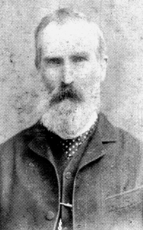
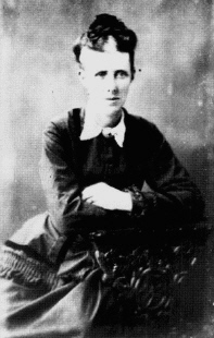
Mathew Carroll in 1900, aged 64 years, and his wife Ellen.
Photographs courtesy Sunshine Coast Libraries
The first settlers at Petrie's
Creek
Before white people came to the area around Petrie's Creek, there was an
aboriginal camp there that the Kabi people had named 'Nambour', after the
flowering trees that were growing in the area.
They pronounced the word 'Narm-borr', with a long sound on the 'borr'. A map dated 1862 by William Pettigrew shows the camp
indicated by a dot on Petrie's Creek, near Painters Creek (sic). William Samwell selected 1625 acres to the west of the
Gympie Road on 30th March 1870. He used this land to run cattle, and named the property 'Namba Station', (or 'Naamba' or 'Nambah'),
using his version of the Kabi tribal word. Although it has been widely
believed that the word referred to red-flowered flame
trees (Brachychiton acerifolium, a type of kurrajong which are still common in the district),
or the
red-flowering
bottle-brush (Callistemon viminalis), or the coastal Tea-tree (Leptospermum laevigatum),
recent research by Dr Ray Kerkhove suggests that it could be a different
tree altogether, one with white blossoms.
Dr Kerkhove writes that Sydney May, who represented the authoritative body on
place naming for south-east Queensland during the 1890s to 1940s, collected data before that time. Mr May recorded that Yeringba, a Kabi aboriginal,
explained to Fred Watson, a government linguist, that 'Nambour' meant 'the white flowering tea tree or paper-bark tree'. Yet in another of his Kabi
word lists, Watson wrote that Nam-bur referred to the 'red flowering ti-tree or paperbark tree'.
From the study of Kabi words and a very early report on the subject, Dr Kerkhove has reached the conclusion that the most
likely candidates for the 'Nambour' tree are the willow bottlebrush or ti-tree (Callistemon salignus) as most likely, and the broad-leafed paperbark ti-tree
(Melaleuca quinquenervia) as somewhat likely. It is also possible that Tom Petrie may have been correct when he said that 'Nambour' referred only to the bark of the
ti-tree, which the Aborigines used as a blanket in winter. Though the original meaning of 'Nambour' is not recorded with certainty,
it is known that William Samwell used Pettigrew's spelling of 'Nambour' in a letter written to the Department of Lands in 1872, referring to his cattle station.
Mr Samwell hired
George Land Bury to build a six-roomed homestead on a
ridge there, overlooking the Petrie's Creek valley. Namba was a successful cattle property, although the animals were sometimes
disturbed by travelling Aborigines passing through in the bunya nut season, on their way up to Baroon Pocket. The land covered by
this cattle-run has now become the residential areas of Burnside and Nambour Heights, stretching west as far as Highworth., and the
site of the homestead is now occupied by Crescent Drive, not far from the present Nambour Heights shopping centre. The eastern
boundary was the North Road to Gympie, the southern boundary a line from the North Road down Arundell Avenue and
continuing west, and the northern boundary near Tuckers Creek.
By the late 1870s, a small
number of pioneer families had settled in the area. In 1882, Daniel Currie selected 640 acres, including Currie's Knob,
a big hill over which the Gympie Road ran. The present Nambour Connection Road still runs over it, in the vicinity of Lamington
Terrace and Panorama Drive in Nambour. The Currie family were commission agents, and opened the first general store and butcher shop
in the fledgling settlement. Their homestead was in today's Magnolia Street, which is named after a large tree there which the
Curries planted.
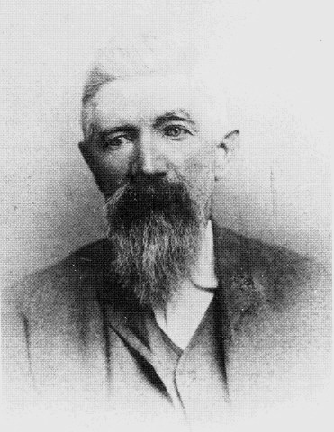
Daniel
Currie, father of John, in 1905.
Photograph courtesy Sunshine Coast Libraries
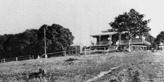
Daniel
Currie's house 'Bundara' on the site of today's Magnolia Street, Nambour.
Photograph courtesy Sunshine Coast Libraries
Thomas Howard selected a block
with frontage to the Gympie Road near the present intersections of Currie Street with Howard and Maud Streets.

Thomas
Howard in 1905, and Catherine Howard in 1900.
Photographs courtesy Sunshine Coast Libraries
By 1880 most of the land in
the Petrie's Creek valley had been selected, but not yet built on. In 1884
Matthew Carroll put up the first hotel in the Petrie's Creek district at the
corner of Gympie Road and Bli Bli Road. This was a ten-roomed inn built of
pit-sawn timber, with a detached dining room and kitchen. Passing travellers
often stopped there, and it was the scene of many large all-night social
gatherings, a spacious ballroom being provided for dancing.
In August 1881 a railway line had been completed between Maryborough
and Gympie, enabling people to travel to the gold fields by ship to Maryborough and then by train. This led to the stagecoach service
from Brisbane through Cobb's Camp to Gympie becoming unprofitable, so Cobb & Co. ceased its operations on the route later that
same year.
The North Coast Railway from Brisbane to Yandina was not opened until
1891, so for ten years the major commercial link between Brisbane and
Petrie's Creek was by sea. Foodstuffs
such as bags of flour, sugar and tea, clothing, boots, household requirements and furniture were shipped from Brisbane across
Moreton Bay, unloaded near Mooloolaba, carried by waggon to the Maroochy River, and then loaded into small boats or a punt for
transport up the river or Petrie's Creek to the settlements. The North Road continued to be used for private transport, carts,
waggons, and movement of animal herds.
Frank Murtagh, an Irishman,
arrived in Queensland
with his wife Mary and baby son Larry
on the Duke of
Buckingham in February 1883. Three brothers of Frank were also on that
ship, two of whom, Jim and Denis, also settled in the Nambour district. In
1884 Frank took up a 320 acre selection below Kureelpa and named it
‘Highworth’ after Mary’s home town, which is south of Birmingham. Due to
his inability to eke out a subsistence on the steep wooded land, Frank
sought work in Brisbane and as a consequence forfeited his selection. He
was able to re-select 124 acres in 1892, and this is the land traversed by
the tramway. Frank’s sons, Larry, John, Denis and Frank Jr. worked bullock
teams hauling timber in the Dulong, Mapleton and Kenilworth areas. John was
killed in action in France in World War I. Frank was a staunch supporter for
the tramway construction. He later held positions of importance as a Cane
Inspector and then as founding Director on the board of the Moreton Central
Sugar Mill.
James Stark, a timber
getter, selected a block close to the bottom of what became known as the
Highworth Range, now generally known as the Dulong Range.
William Whalley
James Whalley was a
Yorkshireman born in 1834 who brought his second wife and five children to
Australia on the S.S. Roma in August, 1883. He applied for a 160 acre
block near Brisbane on the Mount Cotton Road, but the land turned out to be
unproductive. An acquaintance, a Mr Bradshaw, told him that he was going to a
place called Petrie's Creek where good land was available. James decided to
undertake an inspection and, with his thirteen-year-old son William for
company, walked from Tingalpa in Brisbane up the Gympie Road to Petrie's
Creek in April 1884.
The trip took three and a half
days, the overnight stops being at South Pine, Grigor's Bankfoot House (Glass House
Mountains) and the Cobb's Camp Hotel. On the fourth morning they called in at
'Nambour House' (the homestead of the Nambour Cattle Run) where they met
Pat Riley, manager, and Patrick King, stockman. Mrs King, the cook, called out
to William, "Give me your billy, son." She took it and filled it with milk
for him. Irish immigrants, Paddy King and his wife were still working there
although he had three years earlier selected a block of 314 acres adjoining
the southern boundary of the Nambour Cattle Run. They had named this block 'Burnside' as it was on the side of a
'burn' (Gaelic for 'creek'- today's Whalley Creek).
The Whalleys then walked a
short distance to a mineral reserve which they were very impressed with and
decided to claim. It was in the vicinity of today's Henebery Road. That
afternoon they headed back to Brisbane but it began to rain and they were
forced to spend the night in a hollow tree near the site of today's
Palmwoods. They spent the remaining nights camped on people's verandas. When
they reached Brisbane at 4.00 pm on the seventh day, James Whalley remained in
the town that night so that he could make his application for the land the
very next morning. He sent William on home (another ten miles) to report that
all was well. In total, William walked 180 miles (290 kilometres) in the space of a week.
Their application for a
section grant was approved a few weeks later and the Whalleys, with the rest
of the family loaded in a horse and dray, returned to Petrie's Creek. Young
William (with his brother Nattie) had to walk the whole distance again, as
they had to lead the family cow. The Whalleys cleared their land, which was
three miles west of Petrie's Creek. Whalley Creek can still be seen crossing
Windsor Road at Burnside. They cleared the scrub and built a humpy, but young
William did not like farm work and took a job at Mitchell's Sawmill at
Sylvania (Rosemount) for fivepence per week. He wanted to learn a trade, so
set off for Brisbane where he served an apprenticeship as a plumber.
Eventually he returned to the growing settlement of Nambour, and in 1896, aged 25, opened
a shop as a plumber and general storekeeper. He was, at that time, the only licensed plumber between Brisbane and Gympie.
William Whalley called his shop the 'Universal Store', and later built a second store in Mapleton. A spur of
the Mapleton Tramway terminated at its front door.
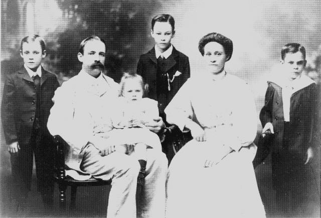
William and Alice Whalley
and their children in 1912.
Photograph courtesy Sunshine Coast Libraries
Whalley Chambers still exists today in Currie Street in the heart of Nambour, facing Centenary Square. His fine colonial home
'Stoneleigh' remains in excellent condition at No. 37 Blackall Terrace in Nambour, although it is now converted into professional offices.

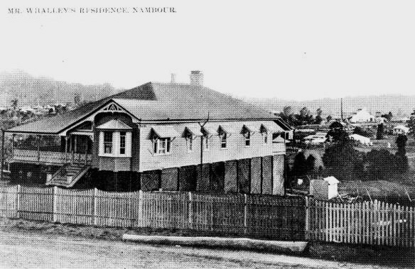
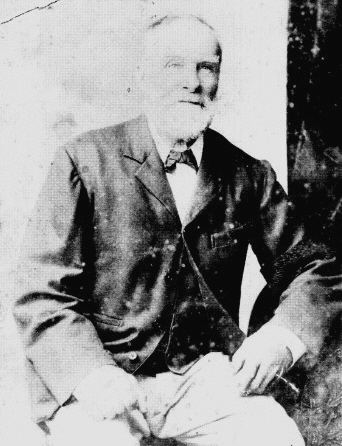
Left: Alice and William Whalley in 1949.
Right: Their residence 'Stoneleigh' in Blackall Terrace, Nambour.
Photographs courtesy Sunshine Coast Libraries
William
became one of Nambour's leading businessmen and made a valuable contribution
to community life. He was president of the Chamber of Commerce, chairman of
the first Maroochy District Hospital Board, president of the Agricultural Show
Society for almost 20 years, and served on the Board of Directors of the
Moreton Central Sugar Mill for 38 years. He died aged eighty-one in 1952 and
is buried in the Nambour Historical Cemetery.
Index
Back
Top
Next