First Impressions are important
Tourists or prospective citizens receive their first impressions of a small
township when passing along the main street and its environs. When
approaching the central business district of Nambour, from the south in
particular, the visitor is first presented with the pleasing aspect of the town
situated in a picturesque valley surrounded by verdant hills. Once in the
town centre, the visitor can observe the buildings and other features shown
below - the colour photographs were taken on 4 February 2014:
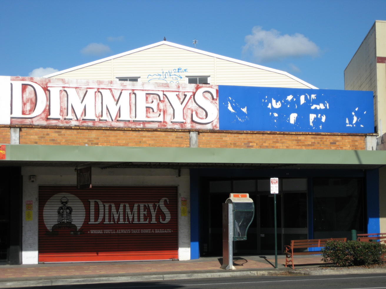
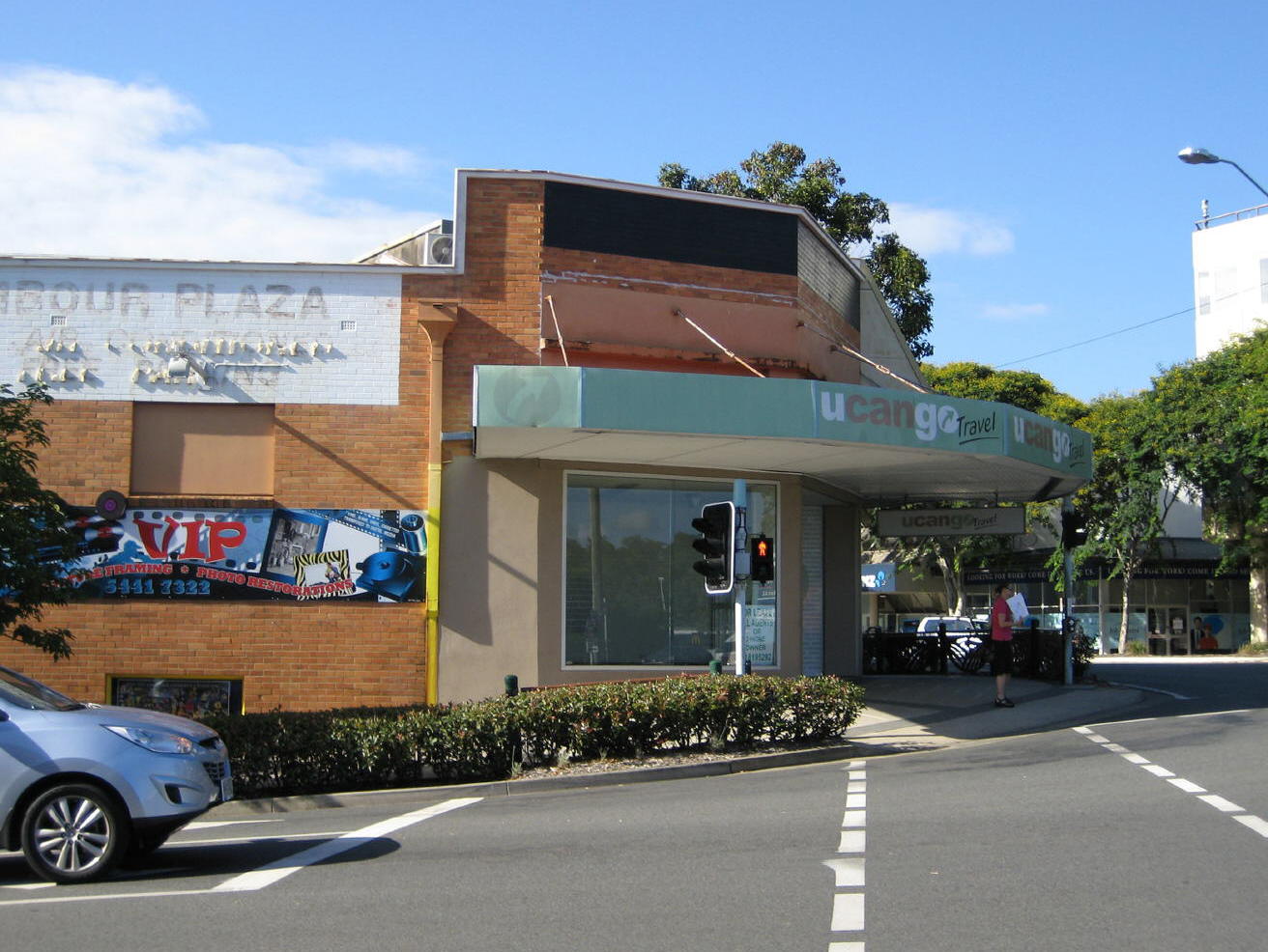
1: A closed store at the main intersection in the heart of Nambour, once the Vogue cinema (see the arched auditorium behind).
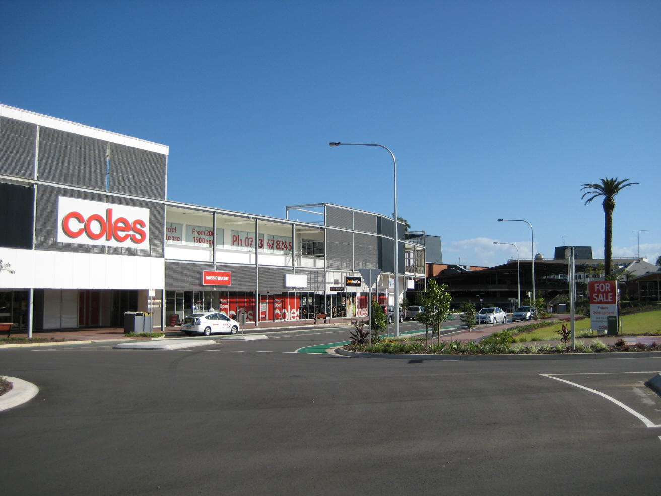
2: The new Nambour Mill Village shopping centre
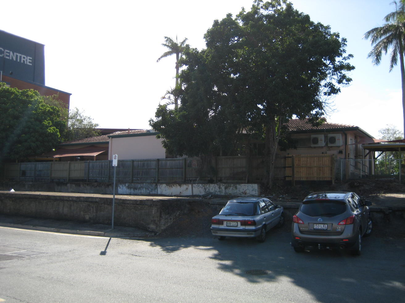
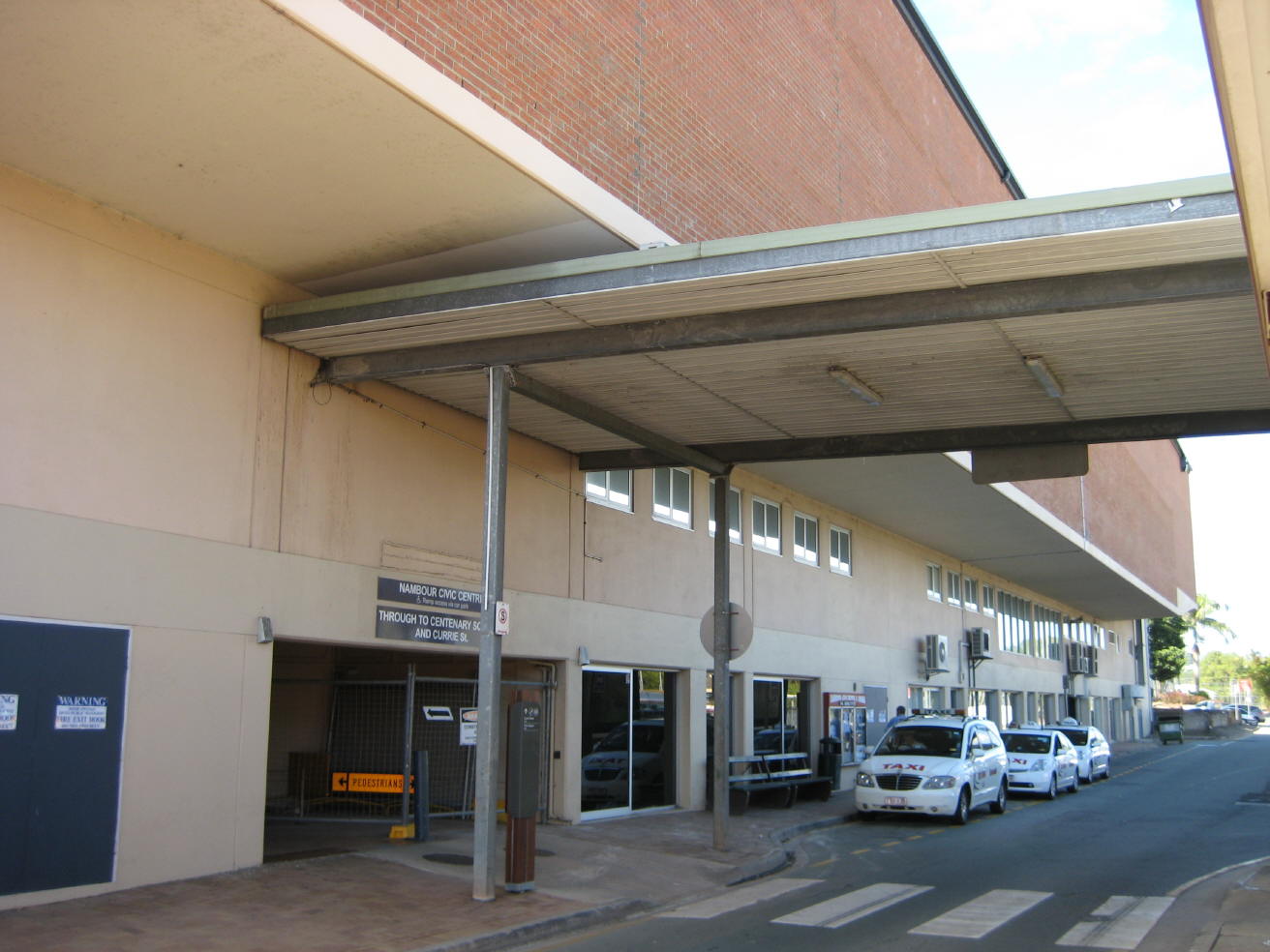
3: A vacant child-care centre at the entrance to the Nambour Bus-Rail Interchange
4: The entrance to the Nambour Bus-Rail Interchange
5: In earlier decades, the view of Nambour from the entrance of the Railway Station was of a park sporting a raised band-stand called Railway Square. The view also included an elegant Shire Council Chambers with a majestic main entrance in the classic style, flanked by Ionic columns - see photograph 18 below. Now, all one sees is a featureless brick wall.
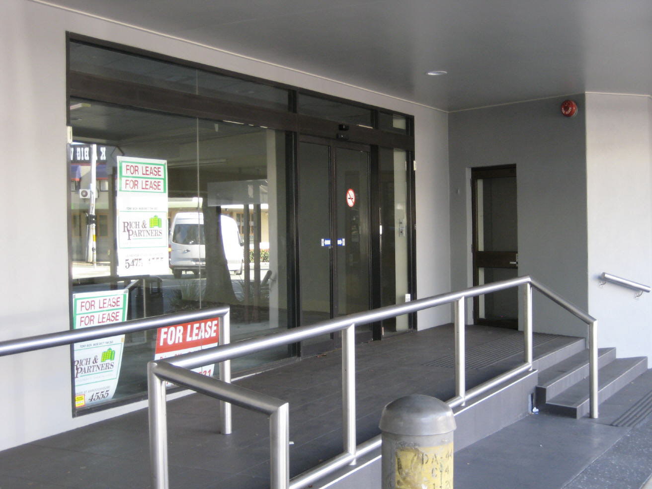
6: A building in the centre of Nambour
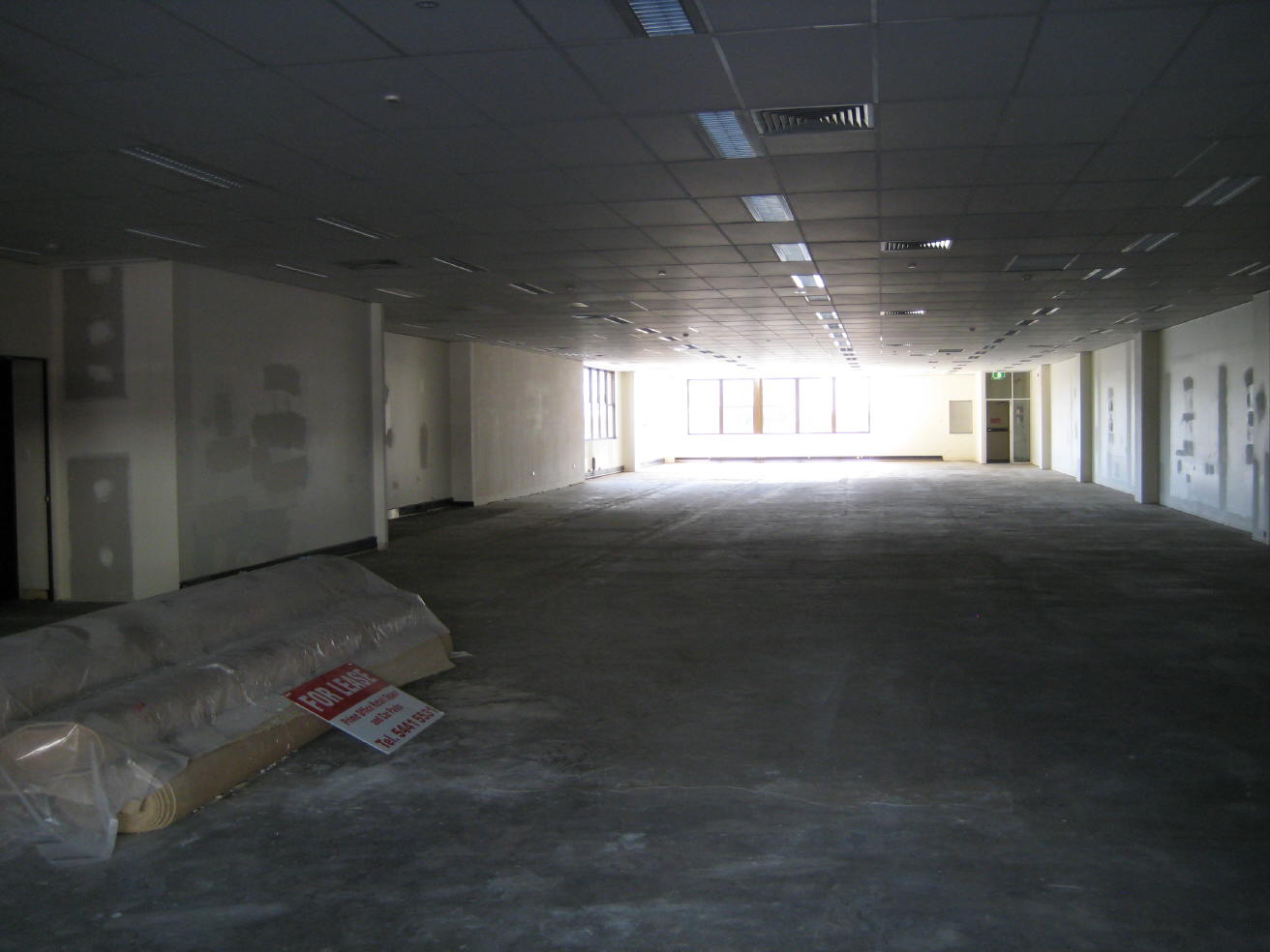
7: Inside that building. It has been empty for some time.
8: Nambour's second main intersection - the corner of Currie and Lowe Streets - compare with photograph 20 below.
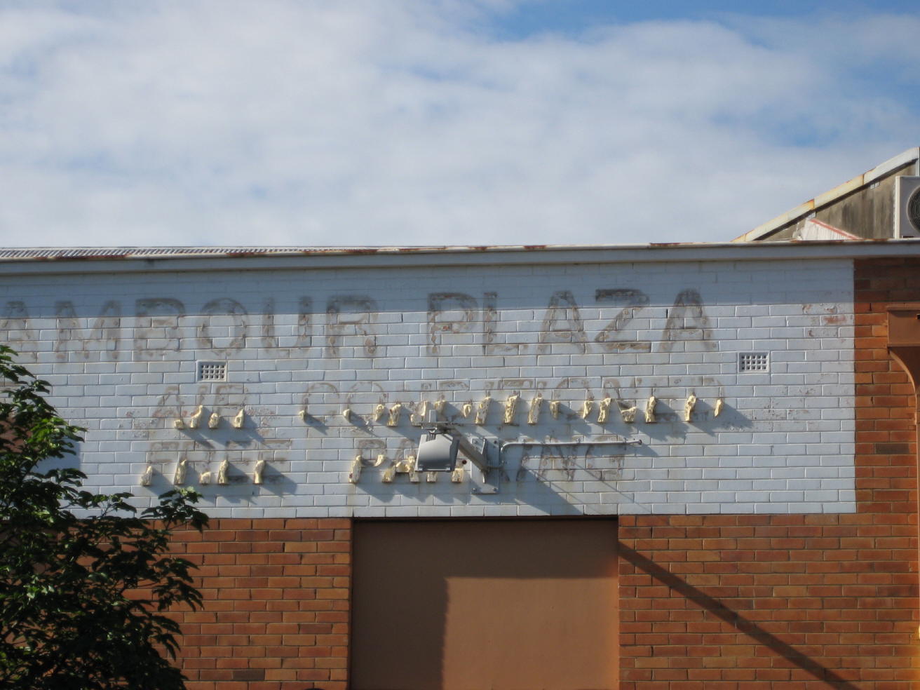
9: A sign that once showed the way to the Nambour Plaza shopping centre
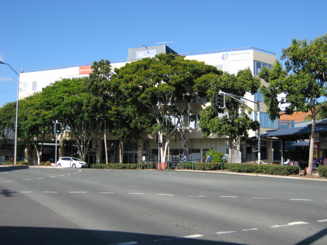
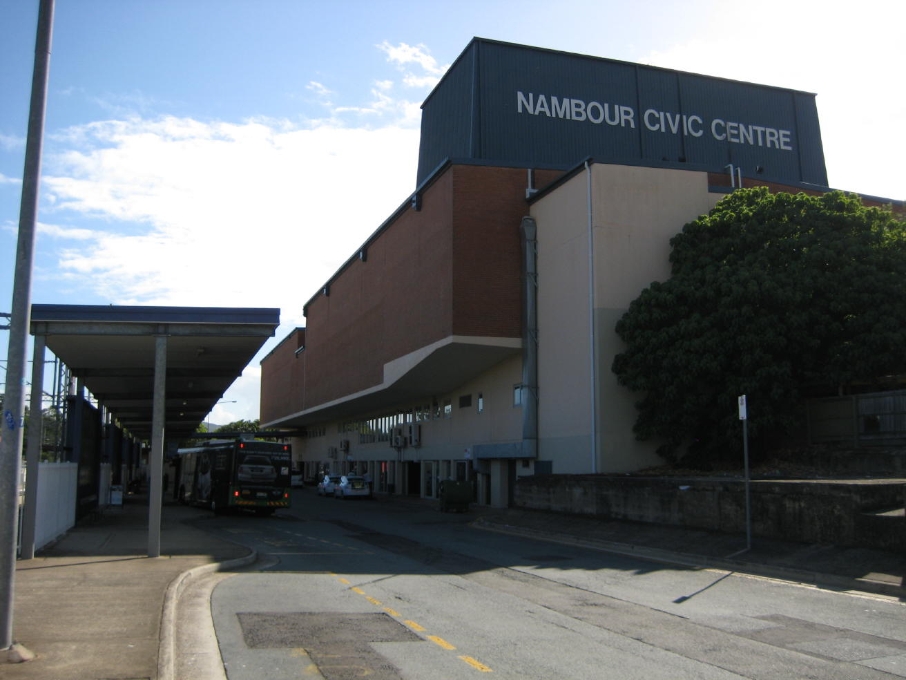
10: Nambour's largest office building, known variously as the Seymour Centre, Nambour Civic Centre, or Centenary Square. Locals have another name for it. It is functional, but that is all that can be said in its favour.
11: The Coronation Avenue bridge over Petrie Creek is grimy above and covered with graffiti underneath
12: Petrie Creek upstream from the Price Street railway bridge
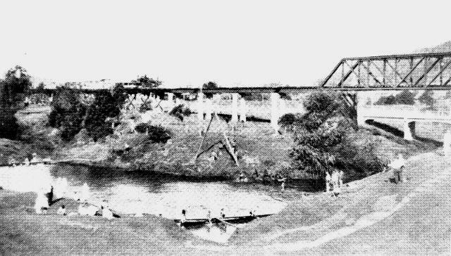
13: In 1932, Petrie Creek at this same spot was a popular swimming and boating venue. The water was clean then, as was the three-year-old concrete road bridge. Around 1950 a boulevard was planned to run along the south bank so that people could enjoy the creek as a recreational facility, but it never happened.
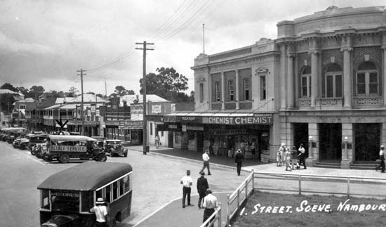
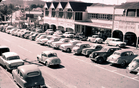
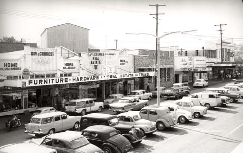
Nambour is an excellent place to make your home. It is much better than the impression one gains from passing down Currie Street, although there are some great shops and eating places there, too. The lack of parking spaces cripples the businesses in the main block. This contrasts strongly with the parking situation (and the commercial activity it attracts) as seen in the photographs of Currie Street from the 1930s to the 1960s illustrated below. By counting the parked vehicles on both sides of the street and in its centre in photographs 14 to 16, we see that there could be approximately 70 vehicles parked in Currie Street between Howard Street and Lowe Street, and that was at a time when all Bruce Highway traffic, including touring coaches and heavy semi-trailers passed along this very street. There are parking spaces at the present time for only 18 cars.
The pictures below show that in the past Currie Street was a busy, vibrant thoroughfare - observe the numbers of people on the footpaths. The Regional Council and Chamber of Commerce should rouse themselves and do something to restore the heart of Nambour, but talkfests accomplish very little. What is needed is action, not words - a radical strategic town plan. Is the provision of adequate car parking the key? Maybe the provision of retail outlets should be left to the shopping centres of Nambour Plaza, Nambour Central Mall and Nambour Mill Village, and the buildings in the town centre replaced by a green heart, a 'Central Park'. One thing is certain: the empty shops in Currie Street are a waste of space.
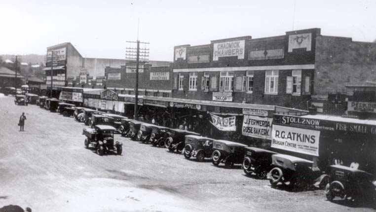
14: Currie Street in 1933 - it was still unpaved at that time
15: Currie Street in the early 1930s
16: Currie Street around 1935, after the surface had been bitumenised, kerbing and gutters put in and central parking introduced
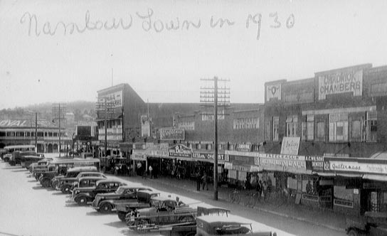
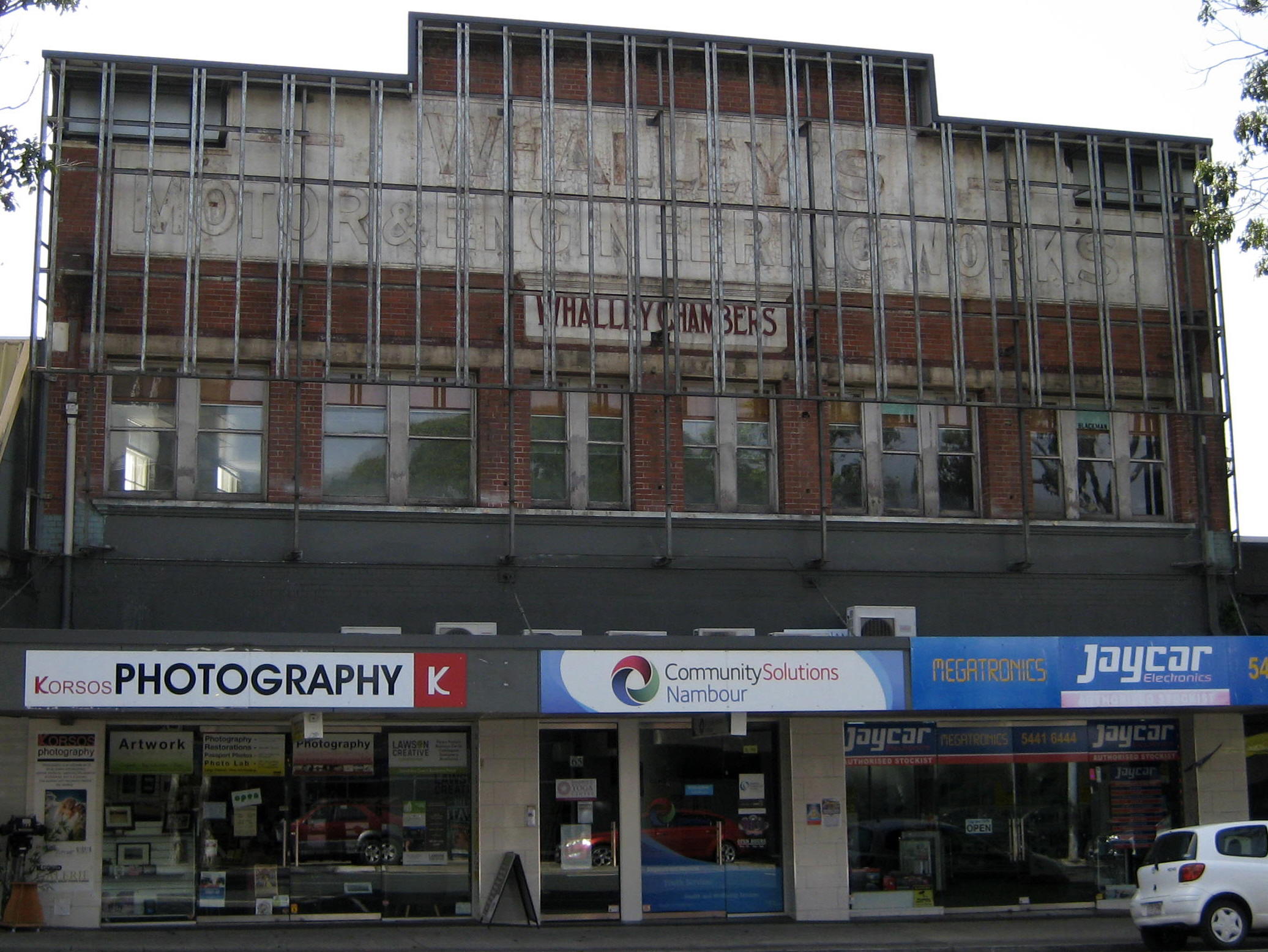
17: Currie Street in the late 1930s (despite the caption) - the cars are the clue
18: The Railway Square park and the Maroochy Shire Council Chambers with its Ionic columns in 1935
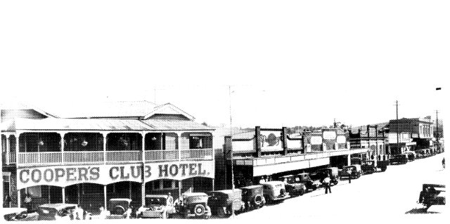
19: The environs of the Commercial Hotel and White Rose Café
(right) around 1960
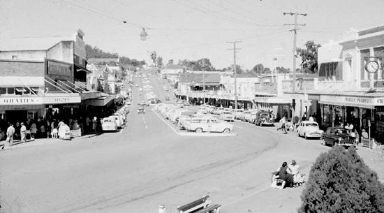
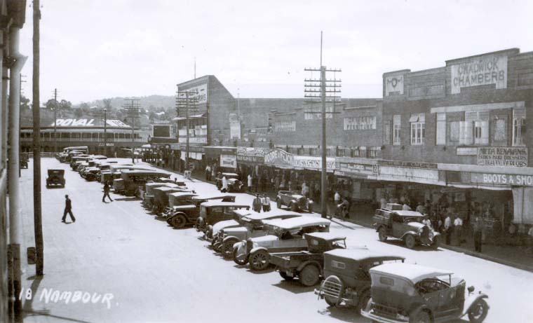
20: The main street in 1960, looking south. Woolworths and Penneys had large stores in the block at left. The street accommodated four lanes of traffic and two lines of parallel parking, as well as central parking for the length of the street. The clock on the wall of the Maroochy Shire Hall (right margin) is now installed and working at the Nambour Historical Museum's Bury Street entrance, facing the new Coles Shopping Centre. It is pleasing to see the old clock refurbished and serving the community once more.
21: The main street between the Club Hotel and the Shire
Council Chambers in 1961, after installation of fluorescent street lighting.
The aforementioned clock is again visible at the right margin.
Monochrome
photographs courtesy Sunshine
Coast Libraries
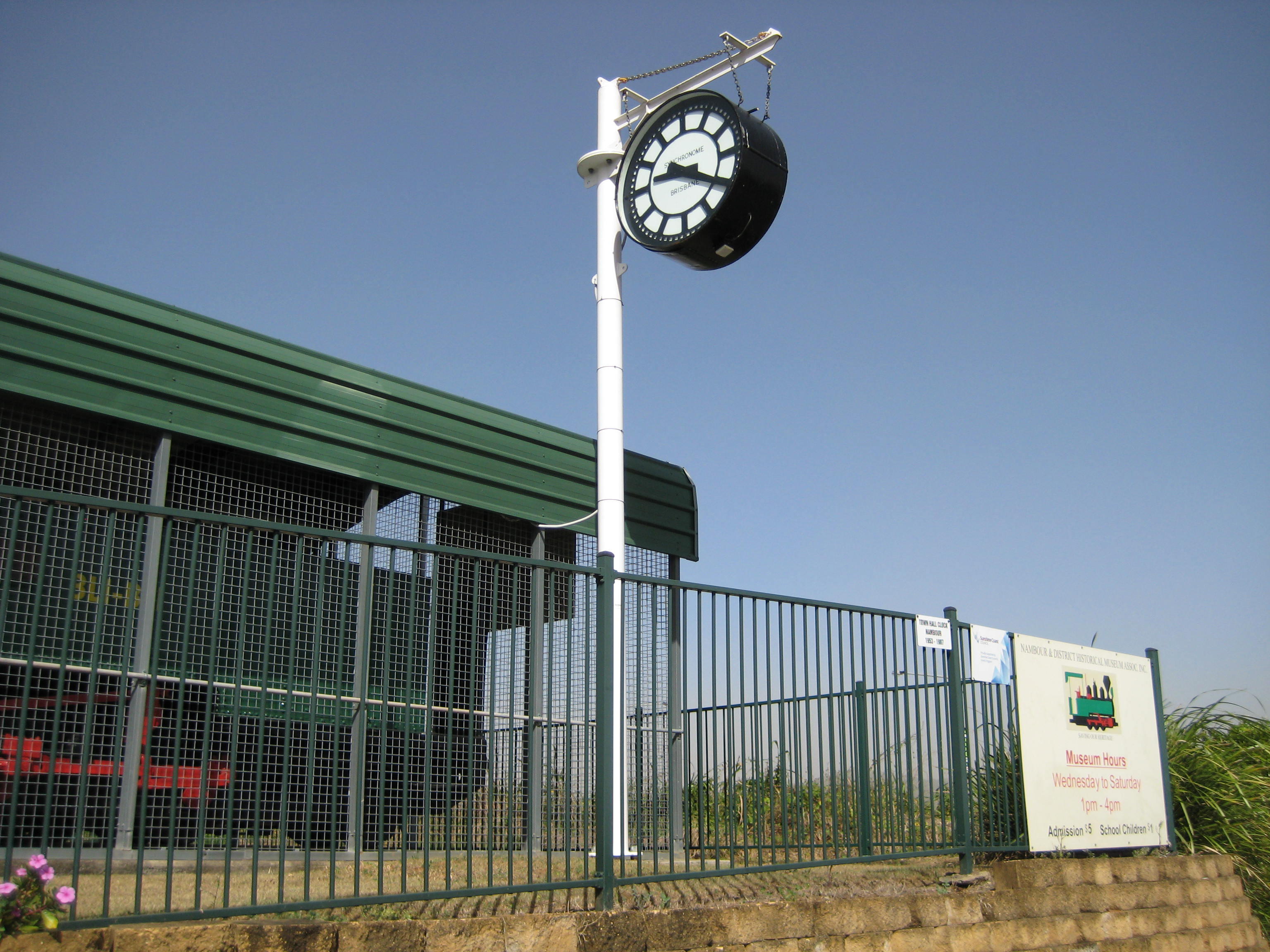
22: The clock outside the Nambour Historical Museum's rear entrance in Bury Street.
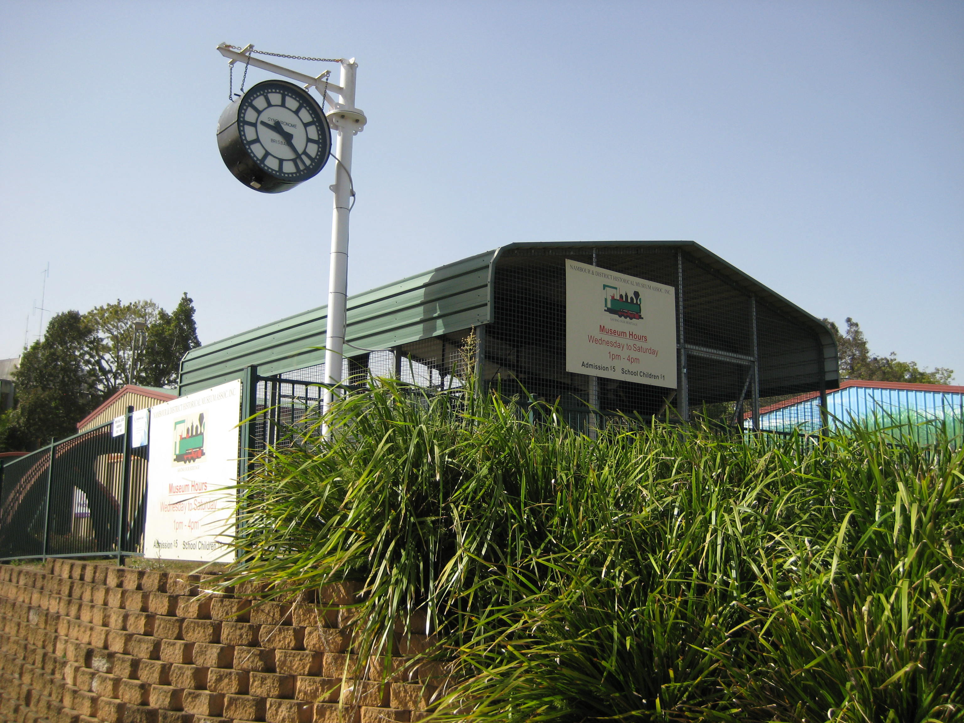
23: The clock is adjacent to two preserved steam locomotives from the Moreton Sugar Mill.
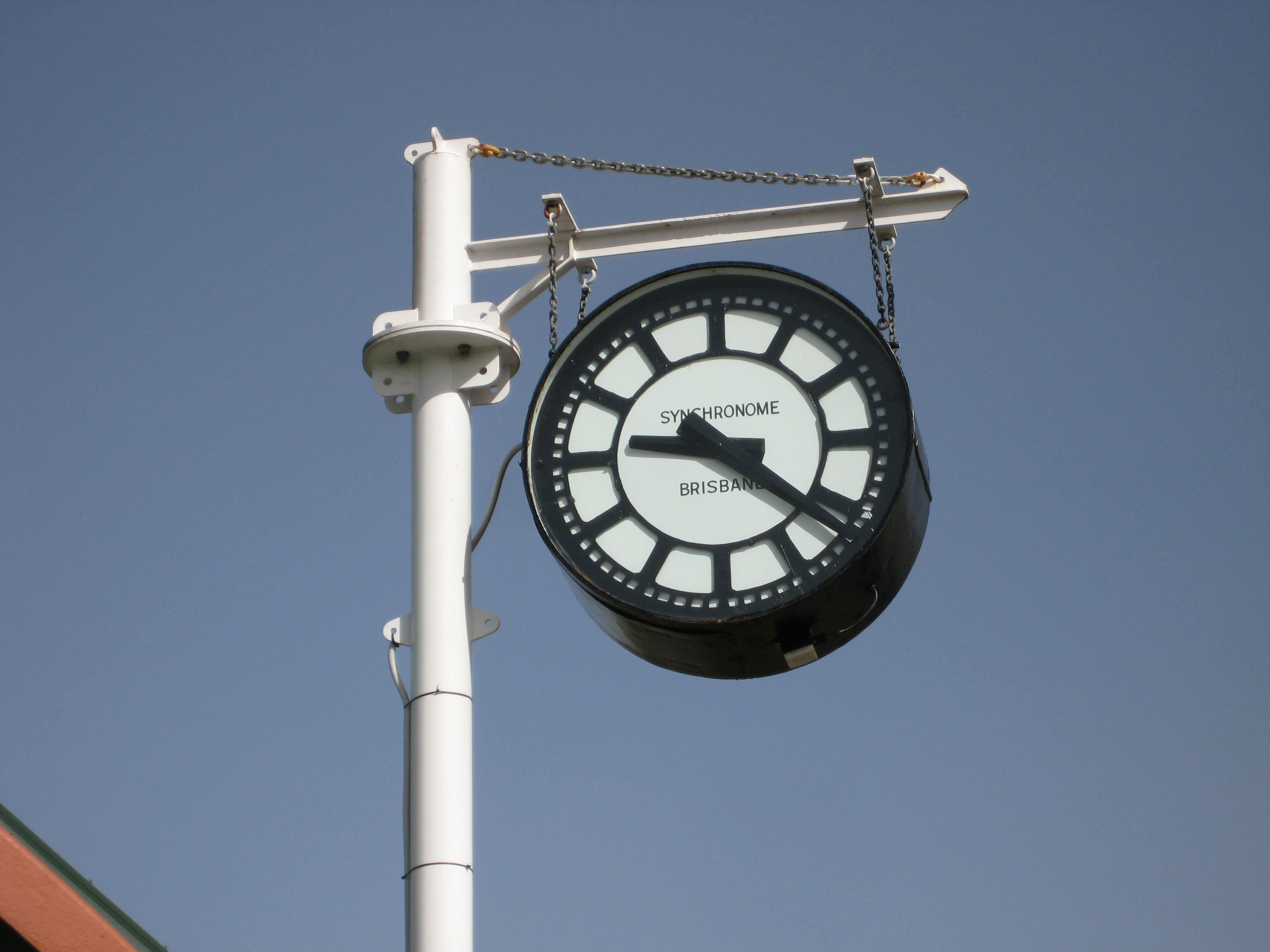
24: Close-up of the clock - "Synchronome, Brisbane".
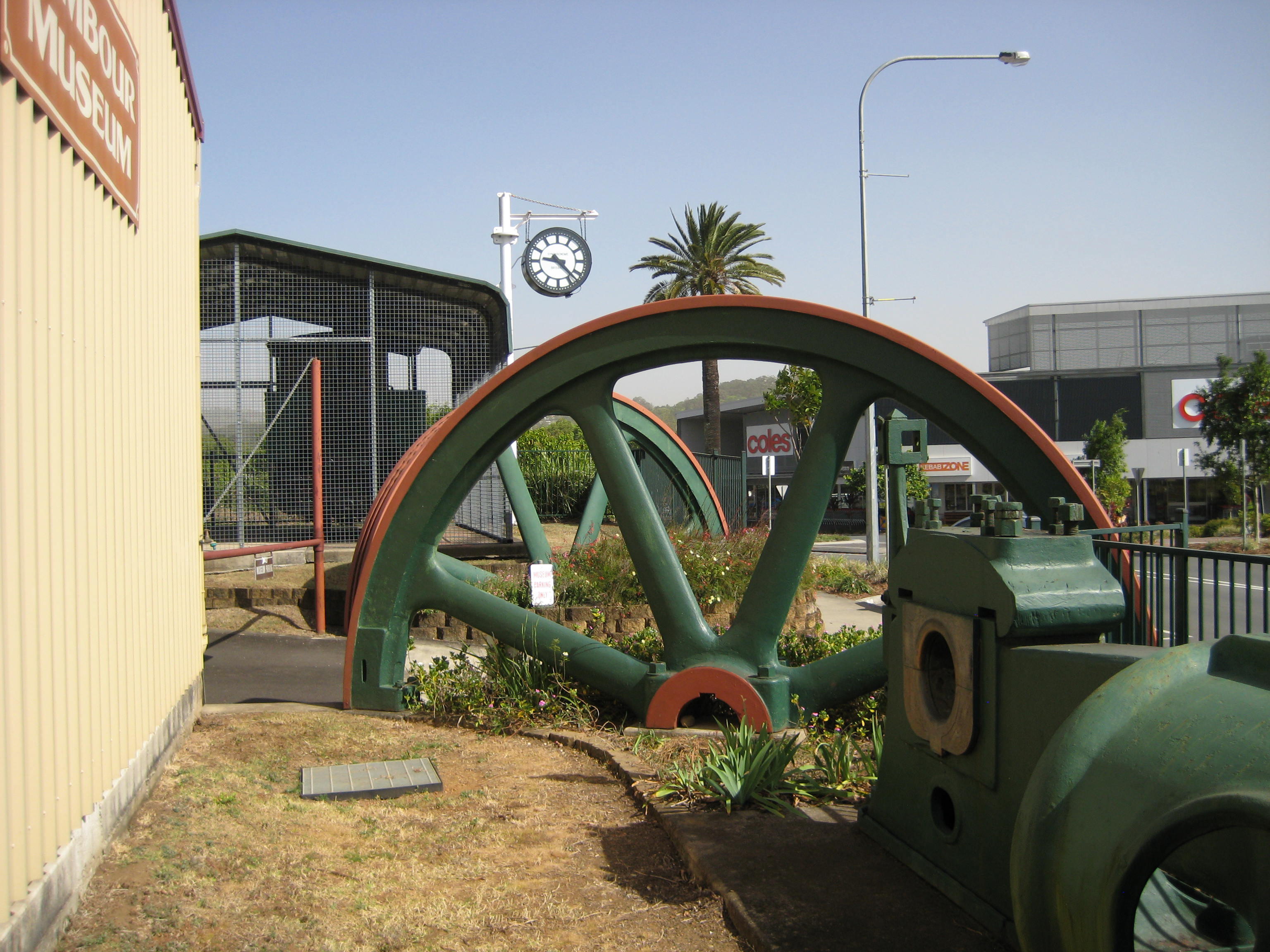
25: The clock overlooks the new Coles shopping centre on the Mill's site.
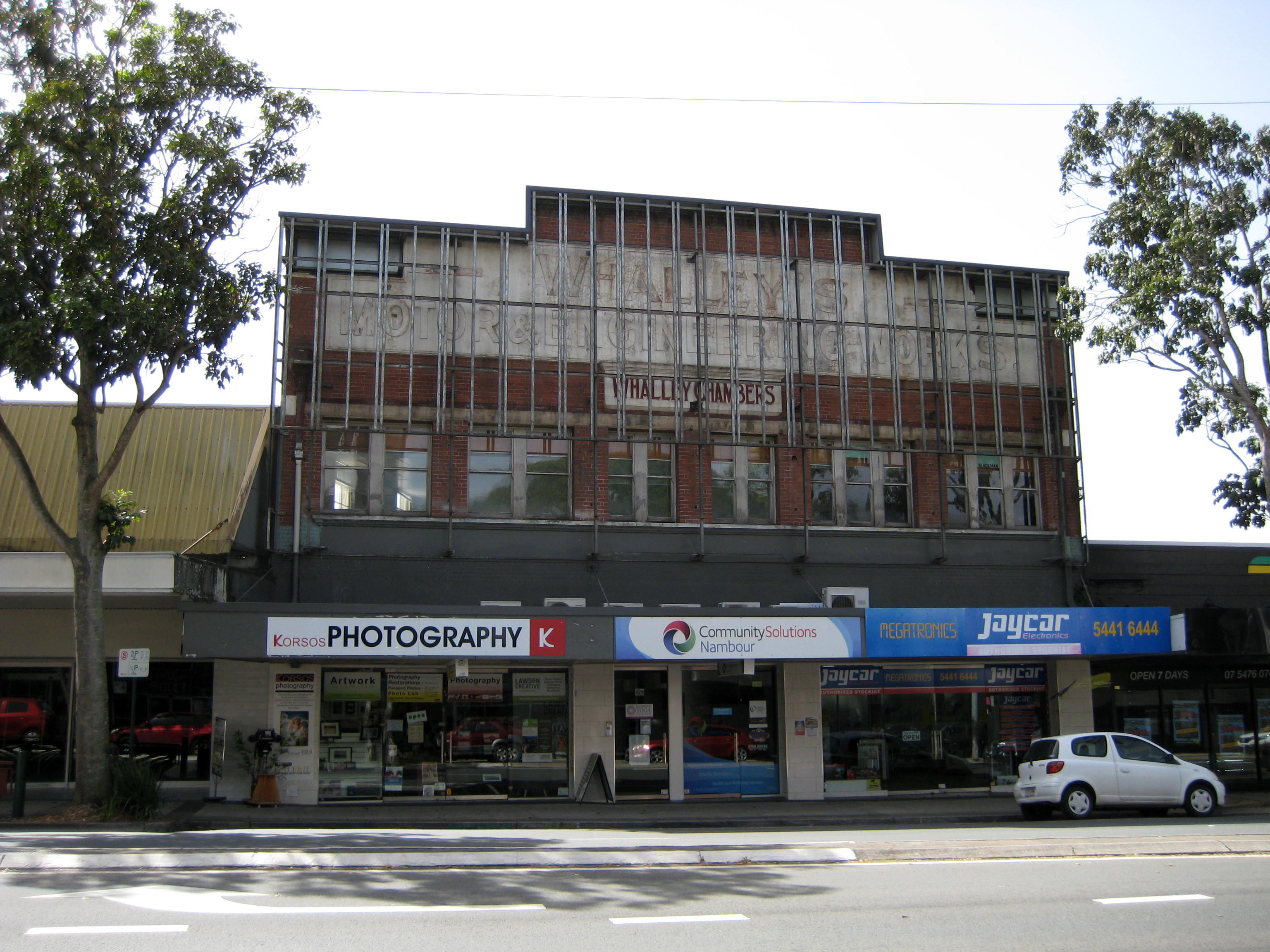
26: The false façade of the building once owned by William Whalley was removed in mid-2019, revealing the original front of the building that had been hidden for decades. See images 14, 16, 17 and 20 above to see how it looked pre-1961.
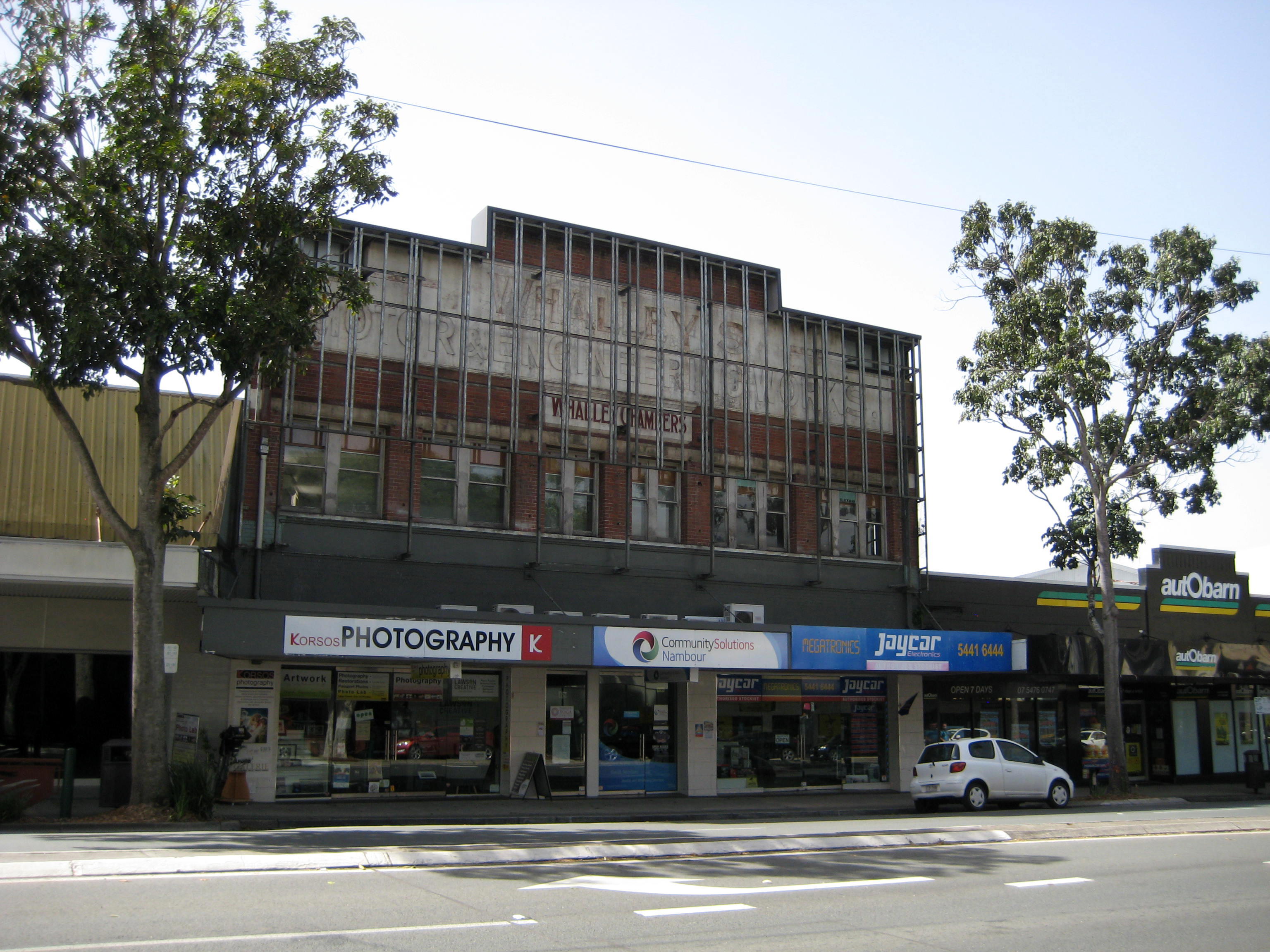
27: Whalley's building was called "Whalley Chambers". A Woolworths department store was located on its north side (left), and a Penneys department store on its southern side (right). The Penneys store became a Coles store, then a Target store, and is now occupied by Autobarn.
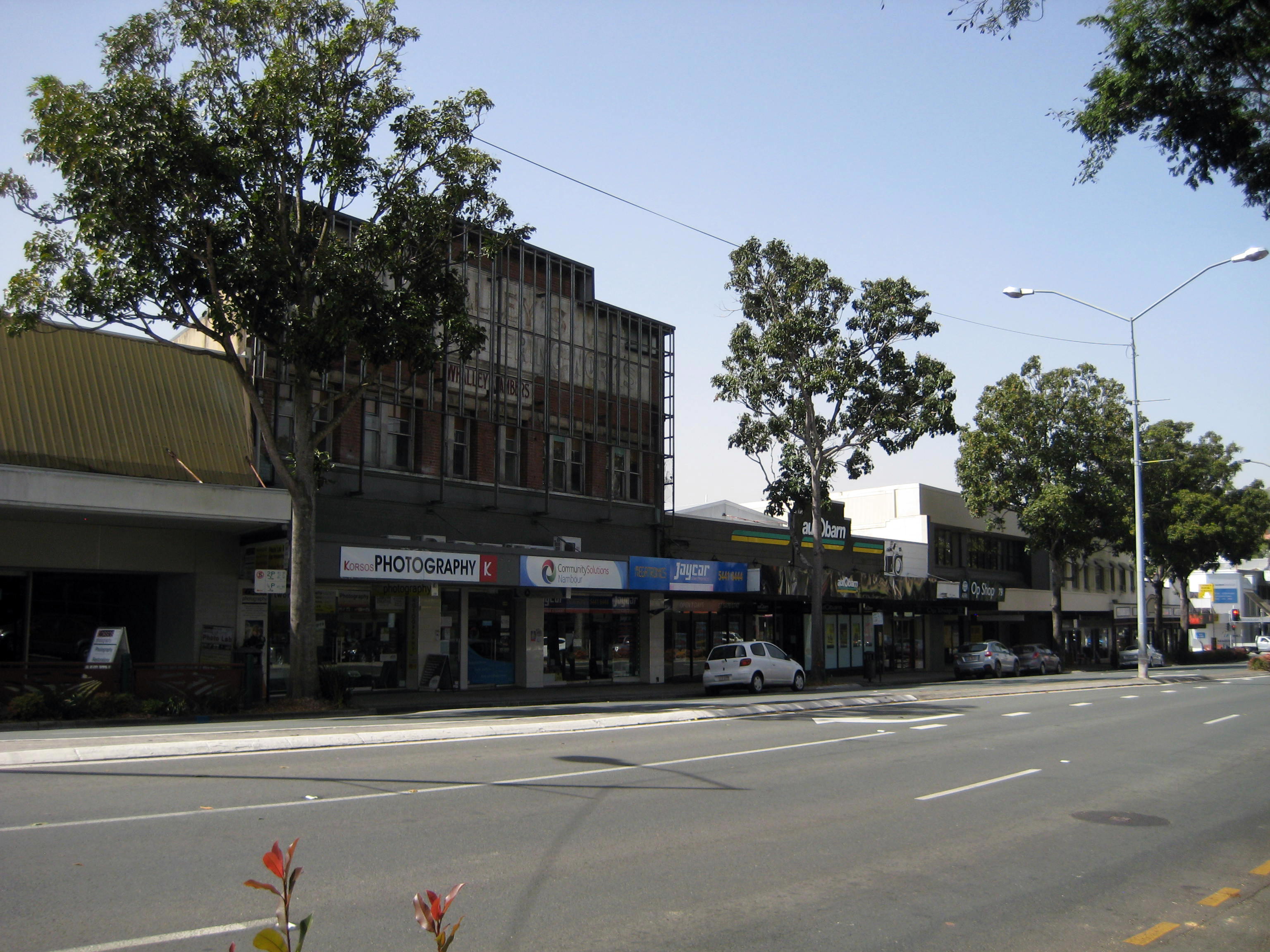
28: To the south (right) of Autobarn is the vacant ex-Commonwealth Bank of Australia building (see images 6 and 7 above) and then Chadwick Chambers.
29: The
inscription reads:
-----
WHALLEY'S -----
MOTOR
&
ENGINEERING
WORKS.
WHALLEY
CHAMBERS
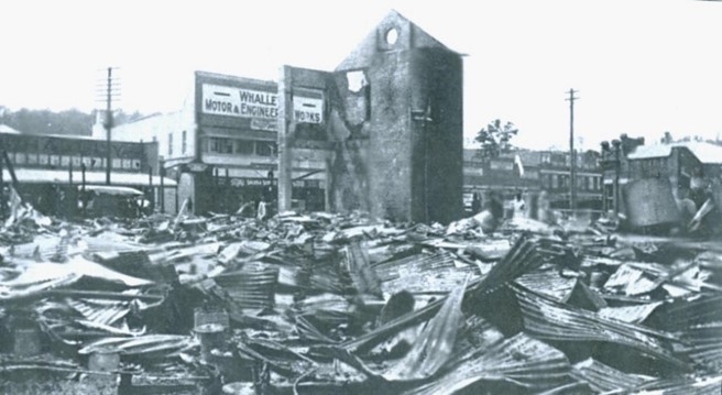
30: In 1929 the ruins of the razed Nambour Town Hall were directly opposite Whalley Chambers.
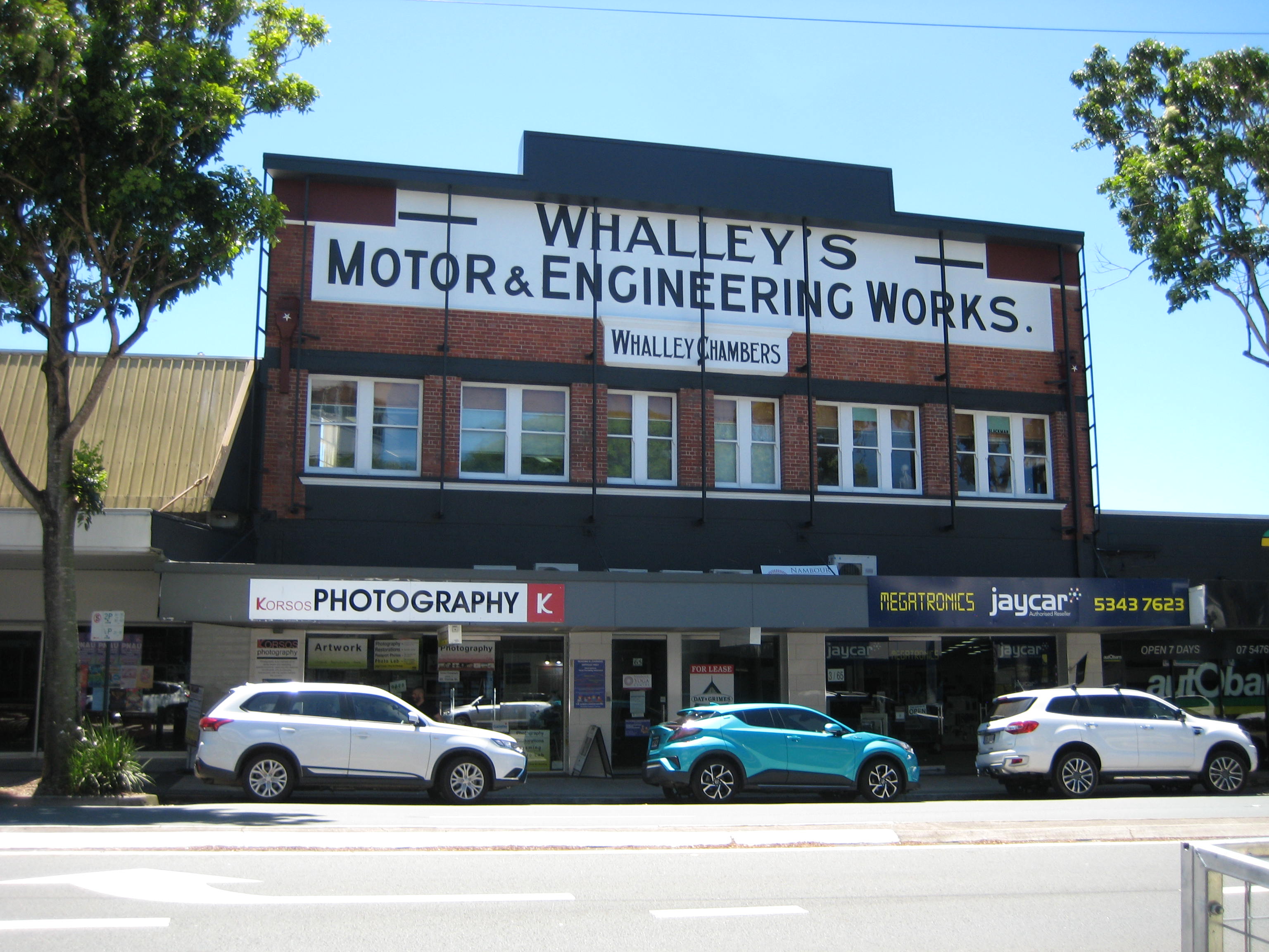
31: The storefront of Whalley's Chambers was repainted in 2021. The photograph was taken at 10:27 am on November 15, 2021.
Digital Nambour Chronicle Picture Sunshine Coast