
p align="center">

Updated:
1 July 2024
In September 2016 a new section
This page is an Archive of all the lunar features described from the beginning up until last month.
To help the lunar observer to find these features, each set of ten is preceded by an image of the Full Moon on which the locations of the ten photographs immediately following are shown according to their numbers in this series.
Finding your way around the Moon: 1 - Seas and an Ocean
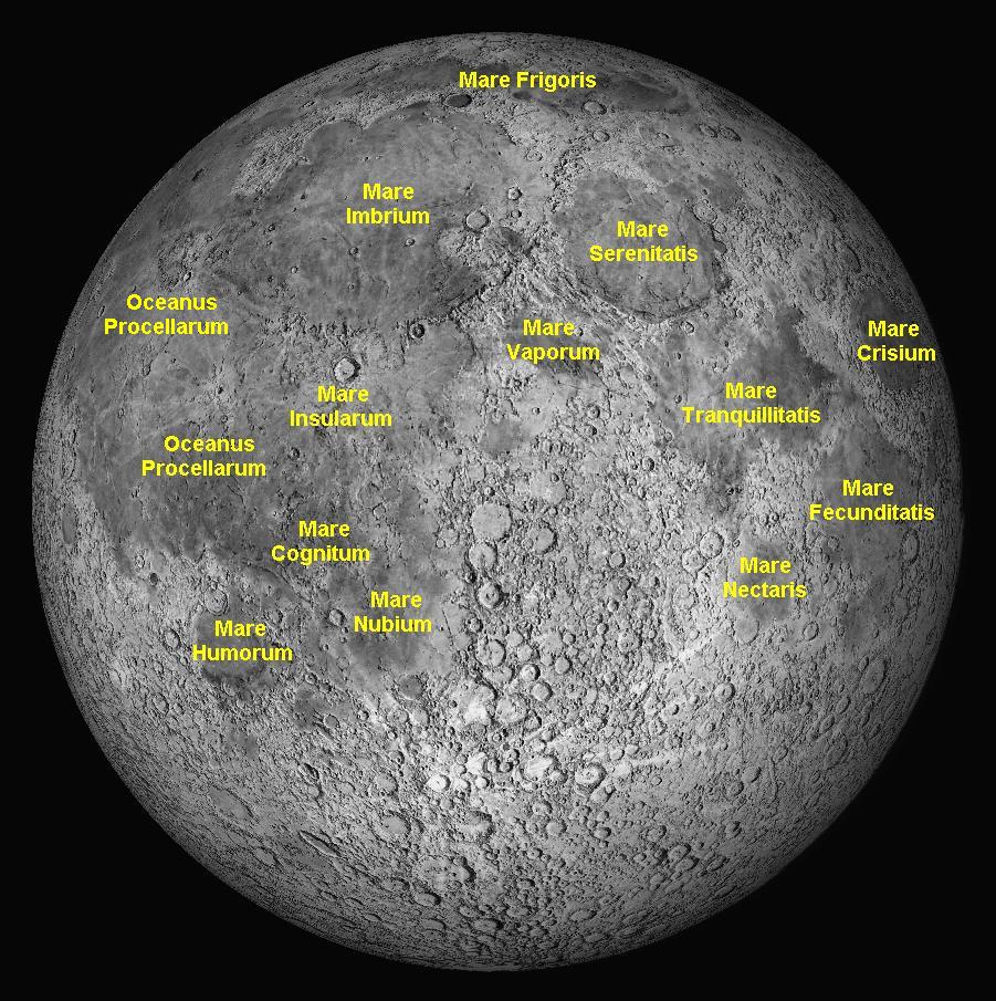
From north to south:
|
English Equivalent |
Mare Humboldtianum Mare Frigoris Mare Imbrium Mare Serenitatis Oceanus Procellarum Mare Vaporum Mare Crisium Mare Marginis Mare Insularum Mare Tranquillitatis Mare Smythii Mare Fecunditatis Mare Cognitum Mare Nectaris Mare Nubium Mare Humorum |
Humboldt's Sea Sea of Cold Sea of Rains Sea of Serenity Ocean of Storms Sea of Vapours Sea of Crises Sea at the margin Sea of Islands Sea of Tranquility Smith's Sea Sea of Fertility Sea that is Known Sea of Nectar Sea of Clouds Sea of Moisture |
(All of these are dry lava plains, and nine are basins. The names of most of them date from 1651.)
Finding your way around the Moon:
2 - Mountain Ranges
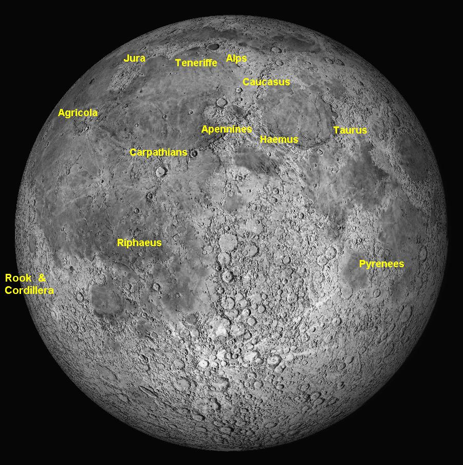
Latin Name |
English Equivalent |
Montes Jura Montes Alpes Montes Teneriffe Montes Caucasus Montes Agricola Montes Apenninus Montes Taurus Montes Haemus Montes Carpatus Montes Riphaeus Montes Pyrenaeus Montes Cordillera Inner Montes Rook Outer Montes Rook Montes Archimedes Montes Recti Montes Spitzbergen Montes Secchi Montes Harbinger
|
Jura Mountains Alps Teneriffe Mountains Caucasus Mountains Agricola Range Apennines Taurus Mountains Haemus Mountains Carpathian Mountains Ural Mountains Pyrenees Cordillera Mountains Inner Rook Mountains Outer Rook Mountains Archimedes Mountains Straight Range Spitzbergen Mountains Secchi Mountains Harbinger Mountains
|
Finding your way around the Moon: 3 - Craters, Mountains and Valleys

No. |
Lunar feature | No. | Lunar feature |
|
|
|
1 2 3 4 5 6 7 8 9 10 11 12
14 15 16 17 18 19 20 21 22 23 24
26 27 28 29 30 31 32
|
Clavius Gassendi Theophilus + Cyrillus
Ptolemaeus Alphonsus Petavius Copernicus to Eratosthenes Aristarchus + Schröter's Valley Tranquility Base, Apollo 11 Plato Mare Imbrium (north-east). Rupes Recta (Straight Wall) Pitatus + Hesiodus Apennines Range Volcanic Domes + Hortensius Posidonius Tycho Langrenus Sinus Iridum (Bay of Rainbows)
Archimedes Rupes Altai (Altai Mountains) North Polar Area (with Meton Gutenberg + Goclenius South Polar area Hercules and Atlas Cassini Atistoteles + Eudoxus Albategnius Fracastorius W. Bond
|
33 34 35 36
38 39 40 41 42 43 44 45 46 47 48 49 50
51 52 53 54 55 56 57 58 59 60 61 62 63
64 |
Bullialdus
Schröter + Gruithuisen's City
Hevelius Riccioli + Grimaldi Cleomedes
Hipparchus Humboldt Rima Hyginus (Hyginus cleft) Schickard + Wargentin Kies Pythagoras Montes Caucasus Fra Mauro + Apollo 14 base Rima Prinz (Prinz Rilles) Moretu Montes Haemus (Haemus
Stofler Maurolycus
Rima Marius Lacus Mortis Mare Humboldtianum Endymion Montes Carpatus Galilaei Ramsden Schiller Bailly
|
65
67 68 69 70 71 72 73 74
75 76 77 78 79 80 81 82 83 84 85 86 87 88 89 90 91 92 93 94
|
Montes Cordillera + Montes Aristillus + Autolycus Mersenius Lyot Maginus Bessarion Purbach Regiomontanus Walther Cauchy
Orontius, Huggins, Nasireddin Pallas and Murchison J Herschel Rima Sharp Hansteen and Billy Mons Rümker Meton Eratosthenes Kepler Vallis Krishna Archimedes Pyroclastic Area Rima Sirsalis Babbage Plinius and Apollo 17 Arzachel Descartes and Apollo 16 Picard, Yerkes, Lick, Tebbutt Rima Ariadaeus Guericke Catena Davy
|
Terrae and Maria
The Earth is 4.57 billion years old. The Moon is slightly younger, 4.425 billion. The Moon appears to have formed around the time the Earth's core was becoming solid and stable. Between 4.1 and 3.8 billion years ago, a high number of asteroids or minor planets left over from the formation of the Solar System were attracted by gravity into collisions with all the larger objects in the Solar System. The evidence of these impacts remains visible on all the terrestrial type planets and moons, but not the gas and ice giants whose surfaces we cannot see. The atmospheres on the Earth, Venus, and to a lesser extent Mars burned up all but the largest of these impactors. This cataclysmic event is known as the Late Heavy Bombardment or LHB.
The maria on the Moon were formed by collisions with asteroids or minor planets during the LHB. These impacts created large basins in the lunar crust which promptly filled with molten magma, which spread out onto the surface as lava flows, the basaltic nature of the magma causing the dark grey colour. Probably the first of these impacts created Mare Anguis, Mare Australe, Mare Fecunditatis, Mare Frigoris, Mare Insularum, Mare Marginis, Mare Nubium, Mare Smythii, Mare Spumans, Mare Tranquillitatis, Mare Undarum and Mare Vaporum (earlier than 3.92 billion years ago). After that, the Mare Crisium, Mare Humboldtianum, Mare Humorum, Mare Nectaris and Mare Serenitatis (3.92 to 3.85 billion years ago) were formed, then Mare Imbrium (3.85 to 3.8 billion years ago), and finally Mare Cognitum, Mare Orientale and Oceanum Procellarum (3.85 to 3.2 billion years ago).
There are numerous smaller areas on the Moon that exhibit dark lava flows from
strikes by less massive impactors. These are named as Lakes (there are 17, one
example is the Lacus Mortis - Lake of Death), or Marshes (there are 6, one is
Palus Epidemiarum - Marsh of Epidemics).
Lakes, Marshes, Bays and Promontories
There are hundreds of
mountain peaks on the Moon, many within craters, many as peaks in crater rims or
mountain ranges, but only a few as isolated peaks protruding above flat lava
plains. Two of the latter type are Mons Pico (2.4 kilometres high) and Mons
Piton (2.25 kilometres high), which stand proudly isolated in the Mare Imbrium.
There are 18 mountain
ranges, and 11 of them are around the margins of the maria, forming the
circumferential boundaries of the basins created by the LHB impacts. For
example, the impact that created the Mare Imbrium (Sea of Rains) threw up seven
mountain ranges around its perimeter. These, starting from the north-west and
moving clockwise, are the Montes Jura, Montes Recti, Montes Teneriffe, Montes
Alpes, Montes Caucasus, Montes Apenninus, and Montes Carpatus. Some ranges are
related to pyroclastic activity, such as the Montes Agricola, Montes Archimedes
and possibly Montes Harbinger.
The Moon has some valleys, too, cutting through mountainous areas. There are
eleven all told, but the most famous are the Vallis Rheita in the southern
hemisphere, and the Vallis Alpes (Alpine Valley) and Vallis Schröterii (Schröter's
Valley) in the northern. The latter two valleys are remarkable in that they both
have a very fine sinuous rille running for almost their entire length, which is
very challenging to detect.
There are some single fault scarps on the Moon, which cross flat plains like a
gently sloping cliff 100 kilometres long or more. The two most notable are the
Rupes Recta or Straight Wall, which crosses the Mare Nubium and is 300 metres
high. Another is the Rupes Liebig, which is on the western margin of the Mare
Humorum and is nearly twice as long. The appearance of both of these slopes
varies dramatically, depending on whether the Sun is rising or setting.
Mountains, Ranges, Valleys and Slopes
Rilles
The word 'rille' is German for 'groove'. These come in two types and are called Rima or Rimae (plural). One type is a V-shaped valley which can be straight or sinuous. Some are extremely long and begin at a small crater. They could possibly be collapsed lava tubes. There are many fine examples such as the Rima Marius, Rima Hyginus, Rimae Triesnecker and Rimae Prinz. The second type has two fault scarps two or three kilometres apart, running parallel often for hundreds of kilometres. Between them, the land has dropped down for a kilometre or so, leaving a flat floor between the scarps. On the Earth, similar features are known as grabens or rift valleys. Fine examples include the Rima Hesiodus, Rimae Goclenius and Rimae Hypatia.
Volcanos and Domes
Although no current volcanic activity has ever been observed on the Moon,
there is widespread evidence that there has been considerable activity in
the past. There are numerous shield volcanos visible either singly, e.g.
Kies Pi, in clusters of half-a-dozen or so (the Hortensius group) or in
larger groups. The major group is the Marius Hills of more than a hundred.
Many appear as low domes of about 10 kilometres diameter, and heights of a
few hundred metres. At the summit of many can be found a volcanic vent,
sometimes two, or a deep caldera as with Mairan T. The largest single
volcanic complex is Mons Rümker with 22 volcanic craterlets. In addition,
many craters and clefts are associated with ash vents which stain the nearby
moonscape with dark patches of ash. Some good examples are in the craters
Atlas and Alphonsus.
The lava plains that formed the maria cooled while still exhibiting waves
and ripples. These solidified, and now appear as Dorsa (singular form
"Dorsum"), popularly known as "wrinkle ridges". They are found in all the
maria, but are particularly notable in the Mare Serenitatis and the Mare
Imbrium.
The Moon is covered by small, round depressions due to bombardment by asteroids,
meteors and comets which hit the surface at high speed (roughly 25 kilometres
per second) and explode, as their kinetic energy is converted instantaneously
into heat, vapourising the impactor and blasting out a bowl-shaped crater. It is
estimated that there are 300 000 impact craters on the Moon's near side that are
larger than one kilometre across. Of course there are billions of smaller ones,
ranging in size down to a metre or less.
The largest impactors struck the Moon early in its history, more than 3.8
billion years ago. These caused the major features we see today, particularly
the dark lava plains called "mare" ("seas"). Over the eons the number of these
impacts has reduced to near zero, and since astronomers have been looking at the
Moon through telescopes, no new craters have been detected. Yet, occasionally
monitoring cameras pick up a flash of light on the dark side of the Moon, so
there are occasional meteor strikes, but not large enough to leave a visible
crater.
Many craters had been forming on the Moon since the beginning, especially prior
to the LHB which created the maria. There is much evidence on the Moon of
ancient craters being swamped by molten lava surging across the surface after an
LHB strike, so that they are almost or completely covered. Their presence can
still be faintly seen, and they are called "ghost craters". One example is
Stadius. Often, the lava surged around an existing crater without penetrating
it. Other times, the lava forced a breach in the crater wall and then swept in,
flooding the interior. Good examples of this are Fracastorius, Letronne and
Prinz.
Early selenographers such as Hevelius drew their maps showing the craters as
hollow mountains, as they thought that they were volcanic calderas similar to
those on Earth. Hevelius named them all as mountains, e.g. he named one feature
"Mount Sinai", but Riccioli, realising that it was a cavity in the surface,
named it "Tycho". Only a few people in the seventeenth century thought that
these "cavities" might be caused by impacts from space, but Robert Hooke
experimented by dropping lead balls into softened pipeclay and thought it might
be true. At the time, no-one knew about objects flying through interplanetary
space at random. The cavities were given their proper name "crater" (from the
Latin word for "cup") in 1791 by Johann Hieronymous Schröter - he also gave us
the word "rille" (German for "groove").
Craterlets have a diameter of less than 10 kilometres, and are generally
bowl-shaped with a raised rim and a small ejecta blanket around the outside of
the rim. Craters larger than this, but less than 150 kilometres across,
often have a cluster of mountains in the centre. This is because the initial
impact sends down a shock wave to the bedrock, which rebounds back up. It
fractures and lifts the newly-formed crater floor, creating the mountains more
or less in its centre. Huge amounts of melted rock are created by the impact,
which cover the surface all around the new crater like a darker basaltic halo.
Quite often, the initial blast sends rocks and boulders as big as flying
mountains skittering across the lunar surface for hundreds (sometimes thousands)
of kilometres, leaving great gouges in the moonscape. These are what cause the
light-coloured so-called "rays" that are seen around craters such as Tycho,
Copernicus and Kepler. Such craters often exhibit areas around their floors
where the walls have slumped down in landslides, creating spectacular terraces.
Other Features
Craters, craterlets and walled plains
It is often seen in such craters that the fissures in the newly fractured floor release the pressure on the superheated bedrock, which then becomes liquid and expands. It forces its way to the surface as molten magma, oozing out of the fissures and spreading out over the new bowl-shaped floor which becomes dark lava when it cools. Sometimes, only a small amount of lava emerges, as in the crater Copernicus; at other times it covers the entire crater floor, often completely swamping any mountains on the floor, as in the crater Plato, which Hevelius called "Lacus Niger" (Black Lake). If such flat-floored craters are larger than 80 kilometres in diameter, they are called "walled plains". Generally, the rising magma fills the new crater up to a level equal to the surrounding lunar surface or slightly lower or higher. One crater in which the upwelling lava filled it right up to the top of its raised rim and then overflowed down the outside slopes to create a level plain beyond, is Wargentin. It gives the appearance of a plateau or tableland. Large walled plains include Ptolemaeus, Alphonsus, Hipparchus, Endymion, Plato, Petavius, Posidonius, Grimaldi, Clavius and Humboldt.
Sometimes a flying mountain ejected from an impact will bounce across the surface, leaving a trail of secondary craters. These are called "Catena" (Latin for "chain"), and two of the best known are the Catena Davy and the Catena Abulfeda.
Basins
The largest crater on the near side of the Moon is Bailly
NOTE:
In the above section, reference is made to many named lunar features. A
majority of these are pictured in the following Archive, where they can be
examined. To locate their numbers in the Archive, find their names in the
Tables and Charts that have preceded this section. For example, you may wish
to look at a picture of the rilles known as the Rimae Goclenius.
Reference to the Table preceding this section will show that an image of
Goclenius appears as Image
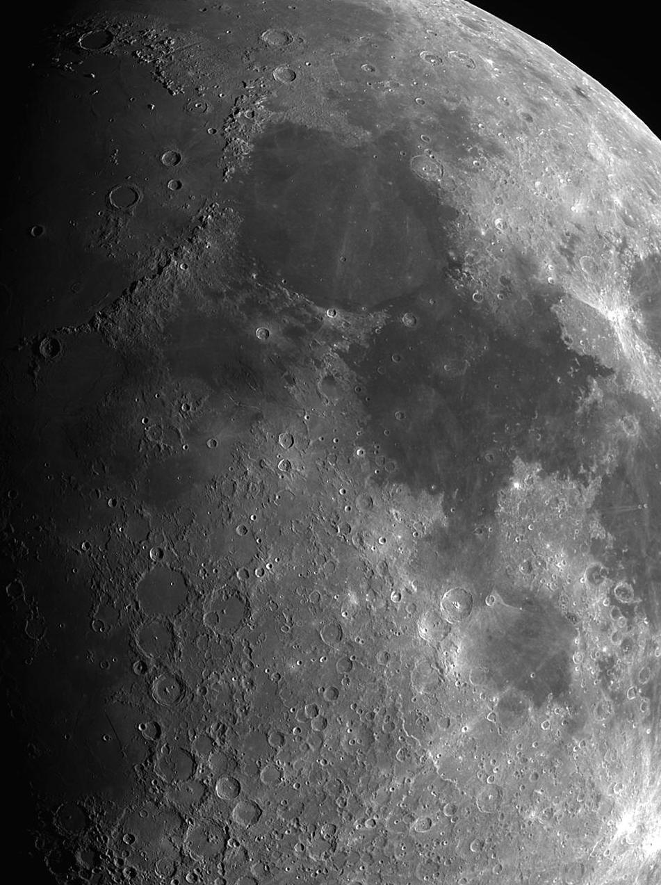
The waxing gibbous Moon.
The photograph above shows the Moon when approximately eight days after New,
just after First Quarter. The cluster of four large, circular walled plains
below left centre is shown in detail in the image below. A rotatable view of the Moon, with ability to zoom in close to
the surface (including the far side), and giving detailed information on each
feature, may be downloaded

The four largest walled plains in this image, from largest to smallest, are Ptolemaeus. Albategnius, Alphonsus and Arzachel. They are all located just south of the centre of the Moon's disc.

Above is a photographic
animation from Wikipedia Commons showing the lunar phases. It also shows the
Moon's wobble or libration, and how its apparent size changes as it moves
from perigee to apogee each month. Such downloads are freeware,
although the authors do accept donations if the user feels inclined to
support their work.
We can work out the scale of the images in the Archive below by using the first picture ( #1 Clavius ) as an example. The equatorial diameter of the Moon = 3476 kilometres. On the night the photograph of Clavius was taken, 2 August 2017, the Moon was at apogee (its monthly maximum distance from Earth, in this case 405 053 kilometres). Its angular diameter on the sky at that time was 29.5 arcminutes.
Clavius has a diameter of 225 kilometres, so its angular diameter on that occasion can be determined in proportion from that of the Moon: 3476 km : 225 km :: 29.5 arcminutes : x arcminutes ( 3476 is to 225 as 29.5 is to x , or 225 multiplied by 29.5 divided by 3476 equals x arcminutes ).
Simple arithmetic gives the angular diameter of Clavius ('x arcminutes') on that night to be 1.91 arcminutes or 114.57 arcseconds. If the image is printed to fill an A4 sheet in landscape format, and examined from a normal viewing distance of 28 centimetres or 11 inches, the image of Clavius will subtend an angle of 64 degrees or 230 400 arcseconds at the eye. To find the magnification of the image at that distance, we can calculate by which number 114.57 arcseconds must be multiplied to arrive at an answer of 230 400 arcseconds.
230 400 divided by
114.57 equals 2011. Therefore, to examine an A4 reproduction of
#1 Clavius at a
normal reading distance is equivalent to viewing it through a telescope with
a magnification of 2011 times ( magnification = 2011x ). Such a view is what
one would see through a spacecraft window if orbiting the Moon at an
altitude of 200 kilometres. Those pictures requiring a larger field,
such as maria or lengthy mountain ranges ( examples are the first two images
of
#12 Mare Imbrium and
also that of
#15
Montes Apenninus ), have been taken with the 2x
Powermate removed. This results in a field of view four times larger
in area, but with a magnification of only 1005x, similar to orbiting the
Moon at an altitude of 400 kilometres.
The techniques outlined above enable very fine details on the Moon and
planets to be detected in the final images. That of
Archive

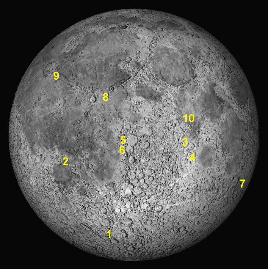
Key to features 1 to 10 below.
1: September 2016
This
month's feature is the huge walled plain Clavius.
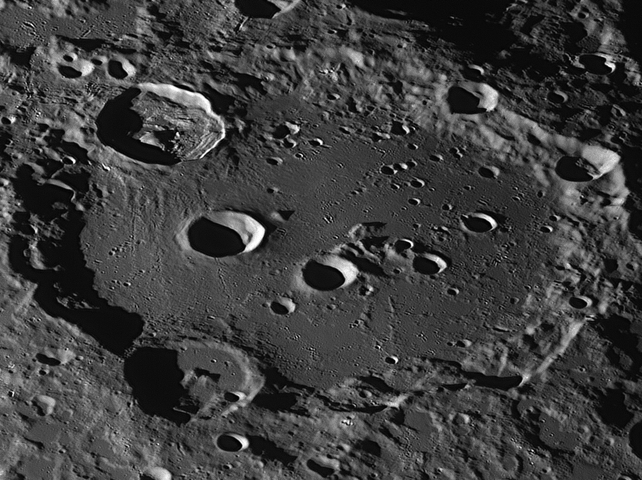
Clavius was photographed from Starfield Observatory, Nambour on August 2, 2017. South is to the top, east is to the left.

Clavius is one of the largest craters, with a diameter of 225 kilometres. It is completely circular, but due to its position at lunar latitude 43 degrees south, we see it considerably foreshortened. It is quite ancient, and since it was formed by the impact of a large meteor or small asteroid about 3.9 billion years ago, other more recent impacts have deformed parts of it. The walls are quite high and rugged, especially on the eastern side. Two large craters have deformed the southern and northern walls. Both are about 55 kilometres in diameter and are named after the American astronomer Lewis Rutherfurd (top) and the American optician Russell Porter. When Clavius was formed, lava welled up and flooded the bowl-shaped floor, hardening into a smooth, flat surface with some ripples.
The floor has now been impacted itself, and shows many craters of various sizes. Unusually, there is an elegant curved line of five craters on Clavius' floor of ever-diminishing size from east to west. Their sizes range from 28 kilometres to 6 kilometres. Many dozens of craterlets dot the floor, particularly on the south-western side. The eastern side has a smooth area between Rutherfurd and Porter, that is crossed by lines of damage caused by ejecta thrown north by the Rutherfurd impact. Numerous craterlets less than two kilometres in diameter can be seen in this area. Some mountains protrude above the lava floor of Clavius, especially near its centre. Their elevation is shown by the fact that, as the sunlight is coming from the east, their shadows are seen on their right-hand side, while craters and other depressions have their bright walls on the right.
Clavius

This spectacular crater is named after Christoff Clau, known to science as Clavius (right), who was born in Germany in 1537 and died in Rome in 1612. At that time, Europe was using the Julian Calendar, devised by
Sosigines in Alexandria in 46 BCE on the orders of Julius Caesar. That calendar worked on the length of a year as being exactly 365¼ days. Unfortunately, the actual year is about 11¼ minutes shorter than that, and this error means that
the calendar creeps ahead of the seasons by one day in 128 years. As Easter is a movable feast, not fixed to the calendar but determined by the seasons (Easter Sunday is the first Sunday after the first Full Moon after the northern
hemisphere's spring equinox - our autumn equinox), but Christmas is fixed to the calendar (December 25), this meant that Christmas was catching up to Easter and by 1582 it had caught up by nearly two weeks. If nothing were done, then
eventually Christmas and Easter would occur simultaneously, which alarmed the Church at the time.
In 1582, Pope Gregory XIII appointed Clavius, a Jesuit priest, to bring the civil and seasonal calendars back into synchronisation by realigning the vernal equinox with a part of the civil calendar that had been traditionally associated
with the beginning of spring, around March 20.
Clavius was a highly esteemed mathematician and astronomer who had written a well-regarded text book, Commentary on ‘De Sphæra’ of Sacrobosco. Clavius, like some other 16th century astronomers, had devoted much effort
to recovering the mathematical texts of Greek antiquity, and had translated Euclid’s Elements, which brought him fame as the ‘Euclid of his time’. He adhered steadfastly to the geocentric universe as described in Ptolemy's
Almagest, teaching his students that the Earth was the centre of the universe and that the Sun, Moon, planets and stars revolved around the Earth once each day. He did this for forty years until the third edition of the
Commentary on ‘De Sphæra’
in 1581, when he began to have some doubts, writing: “regarding Copernicus, it is not absolutely certain that the eccentrics and epicycles are arranged as Ptolemy thought.”
Clavius admired Copernicus as a mathematician, and used data from De
Revolutionibus, Sacrobosco’s De Sphæra, and Reinhold’s Prutenic
Tables as bases from which to work on the calendar. Although the total error
as described above was 12.7 days, Clavius calculated that Sosigenes had ignored
a pre-existing three-day error the other way, so by 1582 the error he had to
deal with was only about ten days. The simplest solution was to simply drop
those ten days in one hit, rather than by one day at a time. To prevent such
errors accumulating again in the future, Clavius modified the rule for
determining leap years. In the Julian calendar, every year that was divisible by
four was a leap year. But that practice clearly inserted too many leap days. How
many? Over 128 years, it added an extra day, so over a 400 year period, it would
add three extra days. So every 400 years, three days needed to be removed to
keep the civil calendar in alignment with the seasons.
What three days could be given up? Clavius decided that even century years would
no longer be designated as leap years, unless they were divisible by 400. This
meant that the years 1600 and 2000 would still be leap years, but 1700, 1800 and
1900 would not. Pope Gregory thought that these suggestions by Clavius were
splendid, and instructed all countries to adopt them. It was announced that the
evening of October 4 would be followed by the morning of October 15.
The ten days from October 5 to 14, 1582 simply would not exist. All Catholic
countries complied, and adopted this ‘Gregorian Calendar’ immediately,
but European Protestant nations refused to change. They eventually complied in
1700. Britain changed in 1752 – by then the number of days to be dropped had
risen to 11. The day after September 2 was September 14. The British people
rioted, chanting “Give us back our eleven days!" Sweden changed their
calendar in 1753, Russia complied in 1918 and Turkey in 1928.
When Galileo published his first spyglass observations in Siderius Nuncius (The Starry Messenger) in 1610, in which he described the phases of Venus, the craters of the Moon, and the satellites of Jupiter, Clavius was by then the top astronomer at the Collegio Romano, the Pope's university in Rome. He read Galileo's book with great interest, and began to correspond with its author about spyglasses. He invited Galileo to come down from Florence to Rome, which Galileo did in March 1611 and was treated with great ceremony by the priests at the Collegio. Clavius talked with Galileo for many hours about the new discoveries. Clavius had recently completed his sixth updated version of De Sphæra, which was already at the publisher as the third volume of his five-volume collected works, the Opera Mathematica.
After Galileo’s visit, he managed to have a new section inserted into the De Sphæra volume, enumerating Galileo’s discoveries. He also included a statement that, while slightly ambiguous, indicates to us that Clavius may have been thinking that his life’s work teaching geocentric astronomy had been ‘barking up the wrong tree’. He wrote, “Some things are thus, astronomers ought to consider how the celestial orbs should be arranged in order to save these [new] phenomena.” Whether he was recommending switching to the little-known Tychonic system or the Copernican is unclear, as both systems could explain the phases of Venus and could accommodate the moons of Jupiter and odd appearance of Saturn. Although he had opposed both theories for religious reasons, most historians agree that he was having second thoughts and was admitting that the Ptolemæic system in the form he had taught for a lifetime was no longer tenable. Perhaps he was beginning to accept the Sun-centred system. We would have known for sure had not serious illness laid him low in mid-1611, leading to his death eight months later.
On April 14, 1611, a few
days after Galileo had been fêted by the Collegio Romano, Rome’s Lincean Academy
held a banquet in his honour in Rome. Galileo thrilled the five members and
their many guests by letting them see sunspots and, after dinner, the satellites
of Jupiter and the star clusters of the Milky Way through one of his spyglasses.
They lingered long into the night, enjoying the novel views. To prove that what
the spyglass revealed was genuine, he aimed his instrument at a church over a
mile away. The guests were amazed to read clearly the inscription on the
building’s façade. Galileo then presented his spyglass to the Academy. They
entreated him to become the sixth member of their august group, which he did,
regarding it as a great honour. Thereafter, he proudly signed his name, ‘Galileo
Galilei, Linceo’.
The host, Prince Federico Cesi, announced that the Academy would be honoured to
be Galileo’s publisher from then on. He also said that one of the other men at
the dinner, Giovanni Demisiani (a chemist, theologian and mathematician to
Cardinal Ferdinand Gonzaga), had devised a better name for Galileo’s spyglass
(which he called a ‘perspicillum’), one that more aptly conveyed the
instrument’s amazing capabilities, and differentiated it from its crude,
low-power cousins. The name, Cesi explained, was a melding of two words in
Demisiani’s native Greek: tele, meaning ‘far away’, and skopéin,
meaning ‘to see’. Henceforth, Galileo’s instrument would be known as a
telescope. It would reveal astrology to be totally fraudulent, and
would elevate astronomy to the purest science.
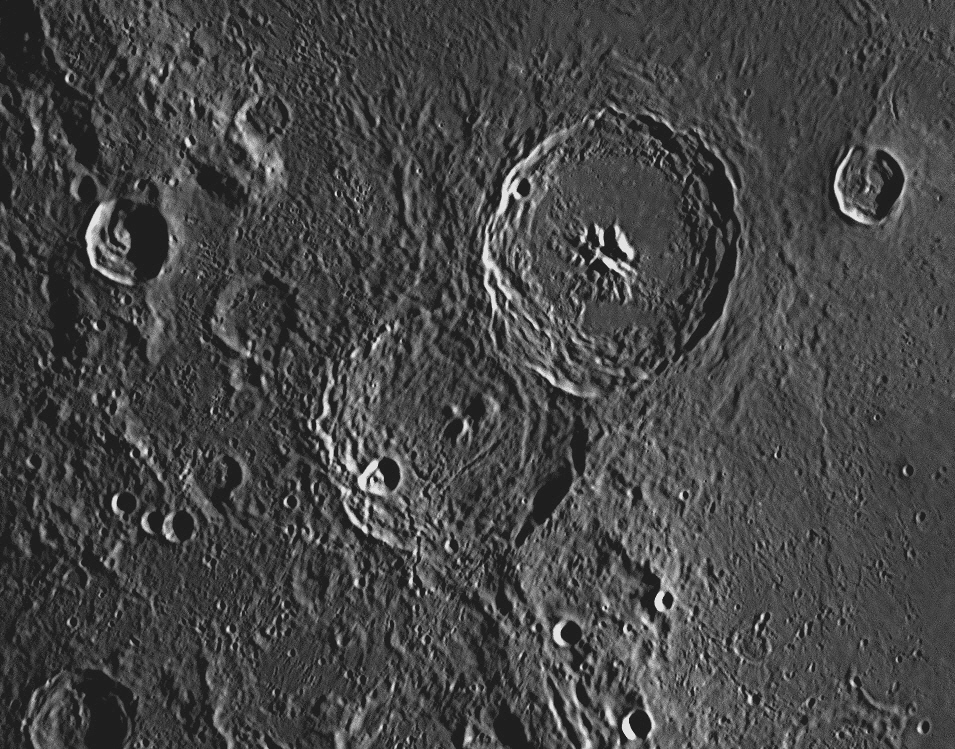
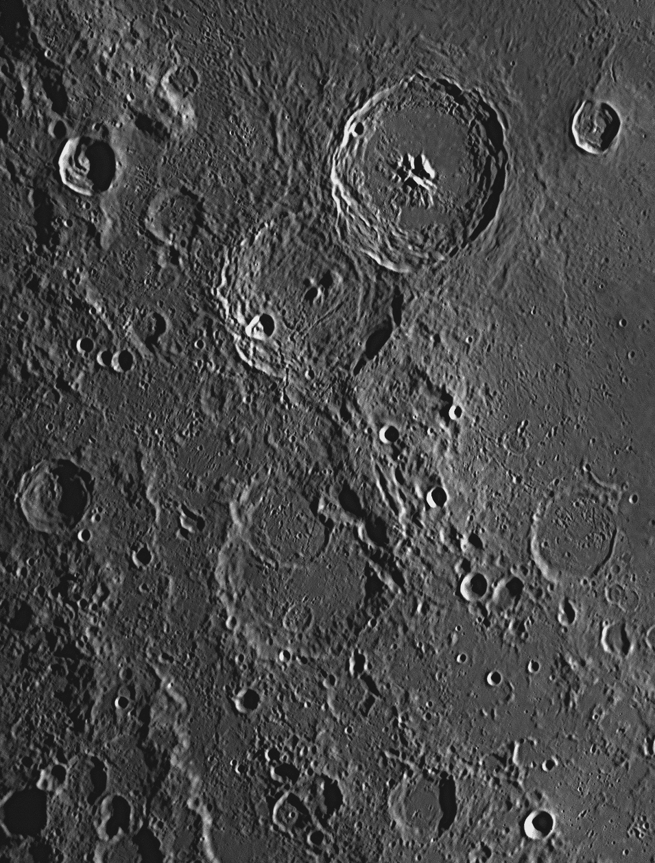
2: October 2016 This month's feature is the large crater Gassendi.
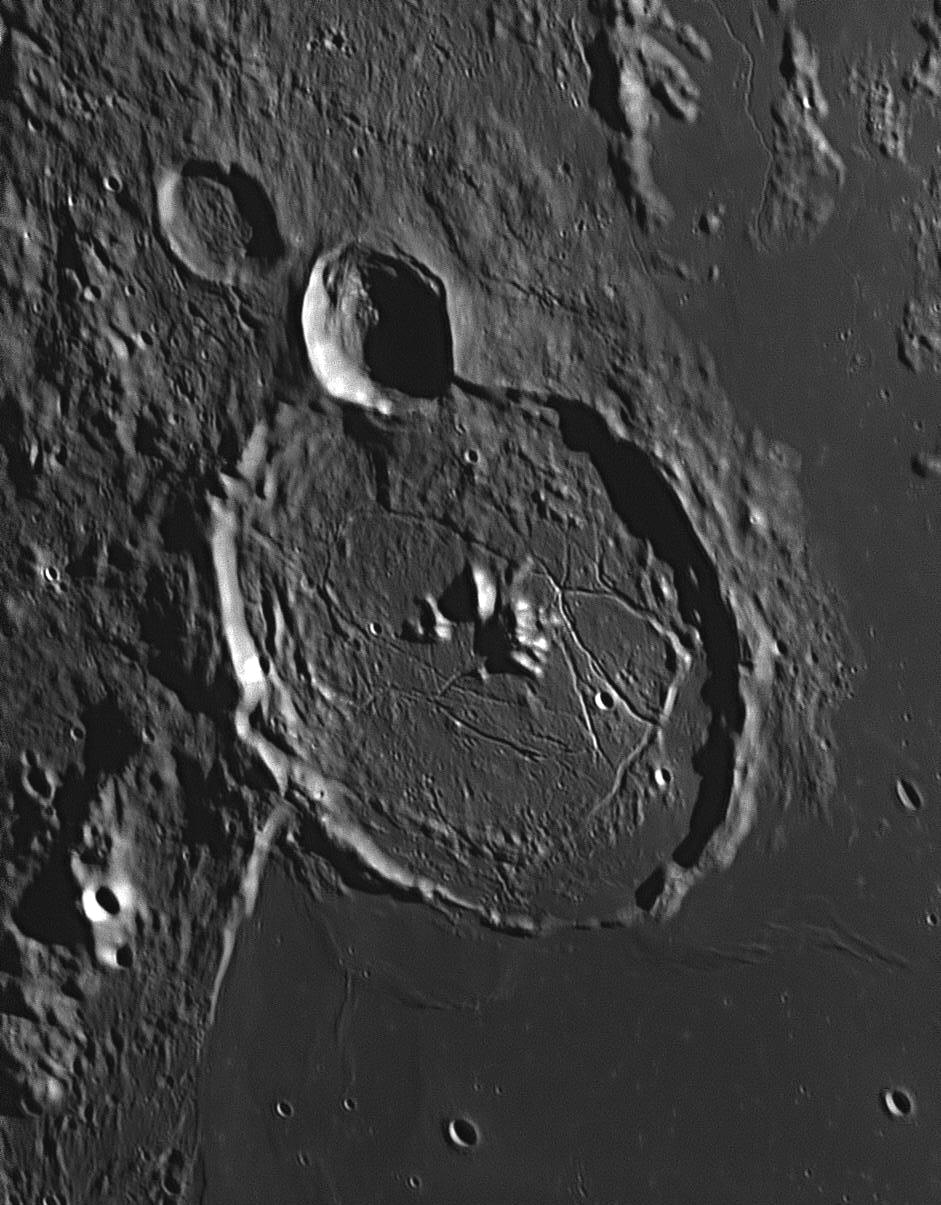
Gassendi was photographed from Starfield Observatory, Nambour on September 2, 2017. North is at the top, west is to the left.
This image of Gassendi was taken on December 16, 2021, when the Sun was higher in the Moon's sky, reducing the shadows.
Gassendi is a moderately large crater, with a diameter of 114 kilometres.
It is completely circular, but due to its position towards the Moon's
west-south-western limb, we see it considerably foreshortened. It is quite
ancient, and since it was formed by the impact of a large meteor or small
asteroid about 3.9 billion years ago, a large more recent impact has deformed
its northern wall (towards the top in the image above). This later crater is
called Gassendi A, and is 33 kilometres across. Almost adjoining it on its
north-western side is Gassendi B, which is 26 kilometres across. The floor of
Gassendi is flat, with a group of mountains in the centre that average 1200
metres high. To the south is a large, flat lava plain called Mare Humorum (the
Sea of Humours).
The Mare Humorum was caused by an asteroid striking the Moon in the epoch after
Gassendi was formed. This huge impact blasted out a crater 391 kilometres
across, fracturing the Moon's crust in the area. These fractures released
pressure on the hot rocky layers below, which immediately liquified, allowing
hot magma to come to the surface as lava, which filled up the crater that had
been formed, resulting in the large, level lava plain that was discovered and
named the "Sea" of Humours by Giovanni Riccioli in the mid-17th century.
As the lava spread out from the impact crater,
much of it reached the southern wall of Gassendi, sweeping over it and bursting
in to pool on the southern end of Gassendi's floor. We can see a gap in
Gassendi's southern ramparts where the wall has been completely breached, and
other parts of the southern wall have been smoothed over by the lava. As the
lava cooled, ripples in it became solid, and can be seen close to the south and
south-east walls of Gassendi. The eastern, northern and western walls,
unaffected by the lava flow, are rugged.
The floor of Gassendi is crossed by numerous
clefts and looks quite fractured. One small crater on the floor that can be
easily detected in the image above, is between the westernmost mountain in the
central cluster and the western wall. Called Gassendi P, it is 2
kilometres in diameter. Many much smaller craterlets are visible, one
being 10 kilometres north of Gassendi P. It is only 900 metres across. A narrow
valley or 'rille' starts near a cluster of hills near the upper right of the
image, and winds its way towards the north (to the top margin). Rilles are
common on the Moon, and this one runs past the crater Herigonius (not in
picture) and is called Rima Herigonius. It is 104 kilometres long. As it
progresses it widens from about a kilometre to two kilometres across. Though it
looks like a river valley, this cannot be so as there is no liquid water on the
Moon. Rilles are probably volcanic in origin.
At the time, there were three views of the
Universe for people to choose from. Firstly, there was the geocentric view that
the Earth was the centre of the universe, and everything else, star and planets,
Sun and Moon, revolved around the Earth each day. This was the view from the
ancient Greeks that had been promoted by Ptolemy in his Almagest of 150
AD, and embraced by the Christian churches. Secondly, there was the Tychonic
universe of Tycho Brahe, which had the Sun and Moon revolving around the fixed
Earth at the centre of the universe, but the planets Mercury, Venus, Mars,
Jupiter and Saturn revolved around the Sun, not the Earth. The sphere of fixed
stars enclosed all. The third view, promoted by Nicolaus Copernicus, was
heliocentric, in that the Sun was at the centre of the universe, with the Earth
and planets in orbit around it. The Moon was in orbit around the Earth and the
sphere of fixed stars enclosed all as with the geocentric view of Ptolemy.
The Catholic Church had rejected the Copernican
system and at the time was promoting the Tychonic system, for it seemed to
explain the movements of the planets without requiring that the Earth move as
well, for the Bible expressly said. "He set the earth on its foundations; it can
never be moved." (Psalms 104:5). Although Gassendi followed his church's
acceptance of the Tychonic world view, nevertheless he believed Kepler’s
Copernican prediction that the planet Mercury would cross the face of the Sun on
November 7, 1631. Setting up his telescope that morning, he made the first
observation of a solar transit by a planet. He only saw the second half – the
transit had started two hours before sunrise in Paris. Initially, when he saw a
tiny black dot on the Sun's disc, Gassendi thought it was much too small to be a
planet - he thought it was only a sunspot. Soon, however, its movement revealed
it to be indeed Mercury.
Gassendi also wrote a dissertation on parhelia or
sundogs, and was the first to propose a theory that light is composed of
particles. This theory, which was published posthumously in the 1660s, was read
by Newton in his student years, and was the basis for his later belief that
light was composed of particles of matter, and not ‘waves’ passing through the
æther as suggested by Huygens and Descartes.
The argument over whether
light was caused by particles or was a wave went on for over two centuries. We
now know that light has both wave-like and particle-like properties, so everyone
was partly right.
For modern technical
applications of any forms of electromagnetic radiation, both the wave and
particle properties are indispensable. To make all of our telecommunications,
radio, television, microwave ovens, mobile telephones, speed cameras and radar
systems work, we need to invoke the radiation’s wave character. Digital cameras,
gas discharge lamps (e.g. energy-saving light bulbs and street lighting), and
(importantly) spectroscopy would not work at all were it not for the radiation’s
particle nature. In March 2015, scientists at the Swiss Federal Institute
of Technology announced that they had photographed light acting as a wave and a
particle simultaneously, a historic and significant breakthrough if confirmed.
It is now thought that electrons also exhibit such duality.
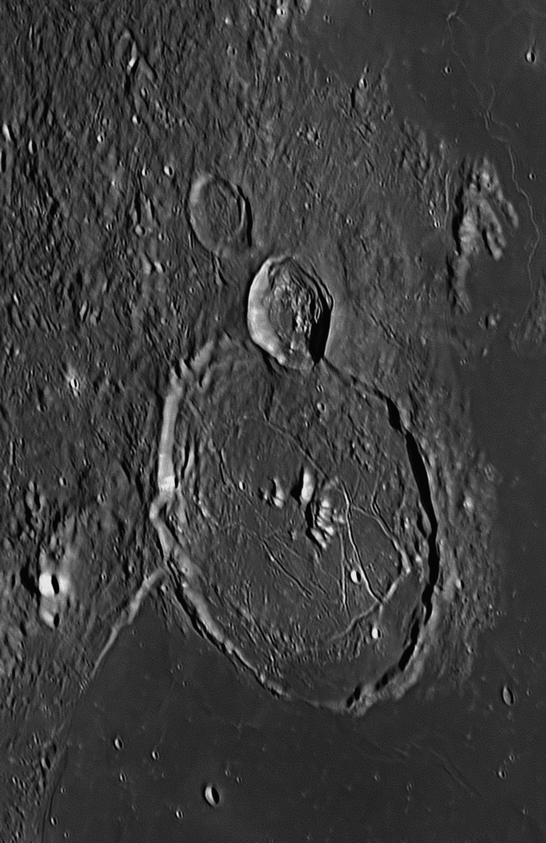
3: November 2016
Theophilus (top) and Cyrillus were photographed from Starfield
Observatory, Nambour on July 30, 2017.
Theophilus has a diameter of 104 kilometres and
was formed between 1.1 and 3.2 billion years ago, much later than Cyrillus. It
is bounded on the north by the Sinus Asperitatis (Bay of Asperity or
harshness) and to the east by the Mare Nectaris (Sea of Nectar). Its walls rise
about 1200 metres above those lava plains. The floor is flat, indicating that
lava welled up from below shortly after the impact occurred, and pooled on the
bowl-shaped floor, filling it to a moderate extent. There is a cluster of four
mountain peaks rising out of the flat floor to a height of about 1400 metres. On
the north-west wall is a craterlet 8 kilometres across.
Cyrillus has a diameter of 100 kilometres, and its
walls are highest in the south-east. It was formed between 3.85 and 3.92 billion
years ago. The floor is rugged and fractured, with a large mountain and two
smaller ones a little east of centre. A large meteor has struck the western
interior slopes and created a 17 kilometre wide crater called Cyrillus A. The
southern ramparts of Cyrillus are broken through by a wide, shallow valley which
leads to Catharina about 80 kilometres to the south.
The city of Alexandria
was founded on the orders of Alexander the Great (356-323 BCE), a pupil
of Aristotle, after his liberation of Egypt from the Persians in 332 BCE and the
absorption of Egypt into the Greek Empire. The Egyptians welcomed him as a
deliverer, and he was made Pharaoh. Standing on the shore of the Nile delta
looking at the blue Mediterranean harbour under a brilliant Sun, Alexander saw
at once that this could be the site of a great city. Named to honour him after
his death aged only 32, it soon became the principal city of the world, a vast
and sophisticated metropolis of marble, in comparison with which Rome and Athens
were just provincial cities. Perhaps one fourth of Alexandria consisted of royal
palaces and public buildings, but even private residences were made of stone.
Though Alexandria became the
literary, scientific, and commercial centre of the Greek world, what the ancient
city is best remembered for today are its Temple to the Muses (Museum)
and the Great Library of Alexandria, which were begun by Alexander’s
General Ptolemy as a tribute to Alexander after he died. Ptolemy became
Pharaoh Ptolemy I
Soter (Saviour),
the second Macedonian King of Egypt after Alexander, and is also famous for
building the Pharos of Alexandria on a small island adjoining the city’s
harbour. This 140 metre lighthouse was one of the tallest man-made structures on
Earth for many centuries, and is regarded as one of the Seven Wonders of the
Ancient World. Some remnants of it can still be seen.
Although the Museum was
wonderful, it was the Great Library that became the jewel in the Greek crown,
and a wonder of the ancient world. The gathering together of close to 1
million books and scrolls into a single collection in a world where books
were rare and hand-copied was not an easy project, but it brought thousands of
people into collaboration over many generations. Messengers were sent throughout
the Mediterranean to collect everything of value. Writers, readers, translators,
illustrators, artists, manuscript copiers, book traders, librarians, scientists,
administrators and emperors all contributed to the greatest monument to human
knowledge that ever existed until recently. In its halls, theatres and lecture
rooms, it became possible for the first time for people to engage in systematic
study.
The last scientist to remain after the destruction was a woman, Hypatia.
She became head of what was left of the Great Library, and specialised in
mathematics and astronomy. These particular areas of knowledge had come to be
regarded by the Christian church as magic, heathen and therefore sinful. In
great personal danger, Hypatia continued to teach and publish, and doggedly
tried to pursue her studies. One day in the year AD 415, on her way home from
work, she was set upon by followers of Cyrillus, the next Archbishop
after Theophilus and later Coptic Pope of Alexandria. She was dragged from her
chariot into a church, stripped, murdered and dismembered. The Christians flayed
the flesh from her bones with abalone shells, oyster shells and shards of broken
roof tiles. Her remains were burned and her works obliterated. A tall obelisk
close to the site of her killing was later taken to London and named
‘Cleopatra’s Needle’ where it may still be found. Cyrillus (or Cyril), a nephew
of Theophilus, was made an early Christian saint. [ A 2009 movie, Agora,
focuses on Hypatia’s final years, when she was studying heliocentrism and
performing experiments of a kind that were later conducted by Galileo. A nearby
crater to the two shown above is called Hypatia. The 117th Coptic Christian Pope
still rules in Egypt today, Pope Tawadros (Theodoros)
II
of Alexandria. ]
We don't know what Hypatia looked like. Her image shown here is from a painting,
The School of Athens, painted by Raphael between 1509 and 1511. This
painting includes the images of 54 great thinkers, but for the representation of
Hypatia, Raphael has used the face of Margherita, his mistress. The crater
Catharina will be described next month.
Gassendi
 This spectacular crater is named after Pierre Gassendi (left),
a French philosopher, priest, mathematician and astronomer who was born in
Champtercier in 1592 and died in Paris in 1655. He corresponded with Kepler and
Galileo, and wrote definitive biographies of Tycho Brahe, Nicolas Copernicus,
Georg von Peurbach and Regiomontanus, which received much praise. Gassendi was
an early user of the newly invented telescopes.
This spectacular crater is named after Pierre Gassendi (left),
a French philosopher, priest, mathematician and astronomer who was born in
Champtercier in 1592 and died in Paris in 1655. He corresponded with Kepler and
Galileo, and wrote definitive biographies of Tycho Brahe, Nicolas Copernicus,
Georg von Peurbach and Regiomontanus, which received much praise. Gassendi was
an early user of the newly invented telescopes.
This month's features are the two large adjoining craters in the image below.
They are named Theophilus and Cyrillus.
East (where the Sun is rising) is to the right, north is at the top.
These craters form a well-known threesome with Catharina (not shown), and
Theophilus is obviously the newest, for it is more clearly defined and
overlaps
Cyrillus. All three craters were named by Giovanni Riccioli in the
mid-17th century. He was a Jesuit priest who knew his history of astronomy and
astronomers very well, and used this knowledge when applying names to the lunar
features. The names were not chosen at random, and the three above were named
after people connected with the lost Great Library of Alexandria which is
described below.
Background - the Great Library of Alexandria
Theophilus and Cyrillus
4: December 2016
Last month's features were the top two large adjoining craters in the image
below, Theophilus and Cyrillus. This month's feature is the
third, lowest crater in this well-known threesome, Catharina.
Theophilus (top), Cyrillus and Catharina (bottom) were photographed from Starfield Observatory, Nambour on July 30, 2017. East (where the Sun is rising) is to the right, north is at the top.

Of these three craters, Theophilus (top) is obviously the newest, for it is more clearly defined and overlaps Cyrillus. Catharina is the oldest of the three, appearing much more degraded and damaged by continual impacts by small meteorites over billions of years, All three craters were named by Giovanni Riccioli in the mid-17th century. He was a Jesuit priest who knew his history of astronomy and astronomers very well, and used this knowledge when applying names to the lunar features. The names were not chosen at random, and the three above were named after people connected with the lost Great Library of Alexandria which was described last month.
Catharina has a diameter of 100 kilometres and a depth of 3130 metres. It has been damaged by a later impact on its northern wall, which has produced a 46 kilometre wide crater, Catharina P. The walls of Catharina are quite steep in places, but the rugged floor is reasonably flat with no large, central mountains. The floor does contain some small hills and fissures, and is disrupted in the south by a 16 kilometre crater called Catharina S. Nearby, on the southern wall of Catharina, there is a small, bright, bowl-shaped crater 7 kilometres across, Catharina F.
Catharina
According to tradition, she was the daughter of Constus, the governor of
Alexandrian Egypt which was then a province of the Roman Empire under the
emperor Maximian. When Maximian retired in AD 305, his son Maxentius was passed
over for succession as he had little military or administrative experience. By
the following year, two joint emperors were in power, Constantine and Galerius.
They allowed Maxentius to be regarded as emperor over central and southern Italy
(excluding Rome), the islands of Sicily, Sardinia and Corsica, and the African
provinces including Egypt.
Growing up in Alexandria, Catherine was a noted scholar, and after seeing a
vision of the Madonna and Child, decided to follow Christianity and converted
hundreds of people. When Maxentius began persecuting Christians, she went to him
and rebuked him for his cruelty. He summoned fifty of his wisest philosophers to
question her about her religious faith, but she described her beliefs in such
eloquent terms that many of her inquisitors declared themselves Christians and
were immediately put to death.
Catherine was then scourged and imprisoned, during which time over 200 people
visited her, including Maxentius' wife Valeria. Catherine converted all of them
to Christianity and they were subsequently martyred by Maxentius. The furious
emperor condemned Catherine to death on the breaking wheel, a terrible form of
torture. Here accounts differ slightly. One says that at her touch the wooden
wheel shattered. Another says that as she was forced to the wheel, it suddenly
began to spin rapidly, eventually flying to pieces. Maxentius then had her
beheaded.
Her symbol in paintings is the spiked wheel. As well as having a crater on the
Moon named after her, we remember her through the firework popularly known as
the rapidly spinning "Catherine Wheel".
5: January 2017
This month's feature is the walled plain Ptolemaeus.
Ptolemaeus was photographed from Starfield Observatory, Nambour on August
1, 2017. East (where the Sun is rising) is to the right, north is at the
top.
The Jesuit priest who named most of the places on the Moon in the mid-17th
century, Giovanni Riccioli, named this huge central walled plain after
Ptolemaeus or Ptolemy, a Greek astronomer working at the Great Library of
Alexandria in Egypt in the 2nd century AD, because Ptolemy played a central and
important role in the history of astronomy. Because it is close to the centre of
the Moon's disc, we see Ptolemaeus as if we were squarely above it, so there is
no fore-shortening.
When Ptolemaeus was formed by a huge impact very
early in the Moon's history (3.92 to 4.55 billion years ago), lava welled up
from its centre and filled the floor, levelling it out. Since that time, only
one large impact has marred the surface, although there are hundreds, if not
thousands, of craterlets. The one noticeable crater inside Ptolemaeus is in its
north-eastern quadrant, and is called Ammonius, after one of the last Greek
philosophers, who lived in the 3rd century AD. It is 9 kilometres across and
1850 metres deep. North of Ammonius is a larger 'ghost crater' faintly seen
above, which was completely swamped by the flow of molten lava.
The large crater to the north of Ptolemaeus is called Herschel, after the
German-born Englishman William Herschel (1738-1832). It is a young crater
43 kilometres in diameter, with walls reaching heights of 3770 metres. There is
a single mountain peak rising from the rugged floor, in an off-centre position.
Around the middle of the second century AD,
Claudius Ptolemaeus (Ptolemy, AD 90-168, no relation to the royal
Ptolemies who were Macedonian-Greek Pharaohs of Egypt) was a Greek working at
the Great Library. (The convention of Latinising one’s name, and then using
either version, began with the Romans and continued until the end of the 17th
century.) Ptolemy was the last of the great Alexandrian natural philosophers
(scientists). He read the ancient Greek texts which were available, especially
those of Hipparchus, and also the Babylonian records of observations that
had been brought there in Alexander’s time. He realised that all the fragmented
texts should be collated together, and preserved for posterity. Taking Euclid’s
Elements as a model, in AD 150 he summarised the existing works of all
the ancient Greek philosophers in mathematics, science and astronomy in a
monumental 13-part book.
It was a
textbook of astronomy as it was then known, not a revelation of discoveries that
he himself had made. Although he claimed that some of what he wrote was based on
his own personal observations, it now appears that some of these observations
were from other unattributed sources, or possibly fabricated to fit his
theories, a practice not unknown then or now. He called his book
η
Мαθηματικη
Συνταξις
or The Mathematike Syntaxis (The Mathematical Compilation).
If Ptolemy had not produced this monumental work, most of our knowledge of the
Greek philosophers would have been lost when the Great Library was destroyed.
Ptolemy amalgamated the
ideas of the Greek thinkers into a complete cosmological model, based mainly on
the teachings of Pythagoras, Plato, Aristotle,
Apollonius, Aratus and Hipparchus. He reiterated
that the Earth
was an immovable globe at the centre of the universe, and that the Sun, Moon,
planets, stars and the entire heavens revolved around it in circular orbits on
eight transparent crystalline spheres, completing one revolution each day.
This was the basis of his
version of the geocentric view of the universe, which was adopted by
astronomers without serious question for the next 1250 years, until the advent
of Nicolaus Copernicus.
On December 22, AD 640, Muslim armies under Amrou Ibn el-Ass conquered
Alexandria. They found the remains of the Library, and discovered thousands of
ancient scrolls still hidden there. These were all burned in the local
bath-houses to warm the water, except for the works of Aristotle. The
destruction of the Great Library of Alexandria by both Christians and Muslims in
the name of their religions was both thorough and tragic. Practically everything
that had been painstakingly collected over centuries was gone forever. We are
left with only fragments. All that remains of the building today is the cellar
of the Serapæum, the library annexe, with a few mouldering shelves, but a new
Library was built and opened in 2002.
Happily, some
full sets of Ptolemy’s Mathematike Syntaxis were found by Arab
soldiers and presented to Arabian astronomers as booty. These men immediately
recognised them as great treasure, al-Jahiz (one of their most advanced
thinkers), saying “The ancient writings are the key to wisdom.” They named
Ptolemy’s work
الكتاب المجسطي, (Al
Megiste
– The Great Book). It was translated from Greek into Arabic at
Damascus and later at Baghdad's House of Wisdom, and was widely distributed
throughout Arab lands. Eventually it found its way to Moorish Spain in the 12th
century. There it was translated into Latin and disseminated into Europe, where
it helped end the period of ignorance known as the Dark Ages. Known since those
times as Ptolemy’s Almagest, it is the main source of all that we
know and understand about the Greek astronomical heritage. After nearly 2000
years it is still being published, and an English translation running to nearly
700 pages can be purchased from Amazon.com for about $160. The crater Catharina is named after Catherine of Alexandria, a Christian
saint who was martyred in Egypt aged 18 in about AD 306, on the orders of the
pagan Roman emperor Maxentius.
The crater Catharina is named after Catherine of Alexandria, a Christian
saint who was martyred in Egypt aged 18 in about AD 306, on the orders of the
pagan Roman emperor Maxentius.
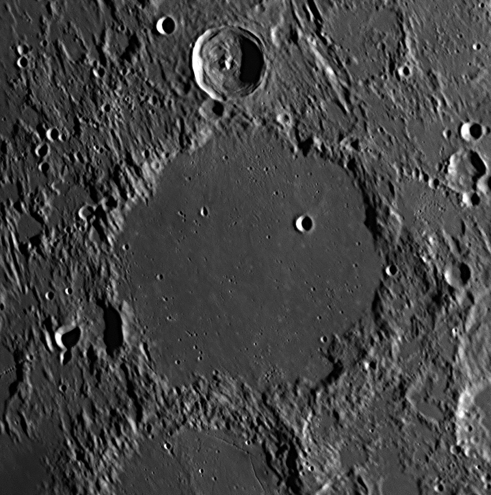

Ptolemaeus is a huge walled plain almost in the centre of the Moon's disc
as we see it. Its walls reach up to 2400 metres high, and its diameter is very
large (averaging 155 kilometres). Because the Moon is small compared with the
Earth, the surface is more sharply curved, and the horizon is much closer than
on Earth. With Ptolemaeus, even the highest peaks in the walls would be below
the horizon for a person standing at its centre.
Ptolemaeus
The Almagest
William Herschel
William Herschel (1738-1822) started off as an amateur astronomer in Bath, England. After he discovered a new planet in 1781, he named it 'Georgium Sidus' (The Georgian Star) after King George III. The French named the new planet 'Herschel', but the German astronomer Johann Bode suggested that it be called 'Uranus', in keeping with the names of the other planets, which were named after Roman gods. It took the English seventy years to finally adopt the name 'Uranus'. King George made William the King's Astronomer, his only duties being to provide astronomical entertainment when required by the King's guests at Windsor Castle. William moved to Slough, within walking distance of Windsor, and devoted his life to building telescopes and using them effectively. His telescopes were simply the biggest and best in the world at the time, and were capable of looking deeper into space than any others. With these instruments, Herschel amassed a lifelong record of astronomical discovery that would have been worthy of an entire research institute, much less one man.
A partial list of William’s discoveries compiled by his son John in 1825 includes the discovery of Uranus and two of its satellites, Titania and Oberon; discovery of two satellites of Saturn, Enceladus and Mimas; the first measurement of the rotation period of Saturn’s rings; confirmation of the gaseous nature of the Sun’s surface; measurement of the heights of lunar mountains; the discovery of 848 binary stars and 2500 nebulae and star clusters; the identification of planetary nebulae, the resolution of the entire Milky Way into stars; the finding that stars differ widely in their intrinsic luminosities; and the determination that the Sun and its solar system are moving through space towards a point in the constellation Hercules, the ‘solar apex’. Interested in the link between light and heat, he used a prism to disperse a ray of sunlight into a spectrum, and then placed the bulbs of thermometers at each colour, finding that the red was the hottest. Struck by a flash of inspiration, he then moved the thermometer at the red end of the spectrum into the unlit area further from the violet end, and found the temperature there even hotter. He decided that this area must be lit by invisible light rays which produced heat, and called these rays ‘calorific rays’. Soon they became known as ‘infrared radiation’, one of William’s most important discoveries.
Whereas previous astronomers had been either painstaking observers like Tycho Brahe and John Flamsteed, excellent telescope makers like Galileo, or ground-breaking theorists like Kepler and Newton, William Herschel was unique in that he was all three combined. Sir Patrick Moore said that Herschel was probably the greatest observer who ever lived.
6: February 2017
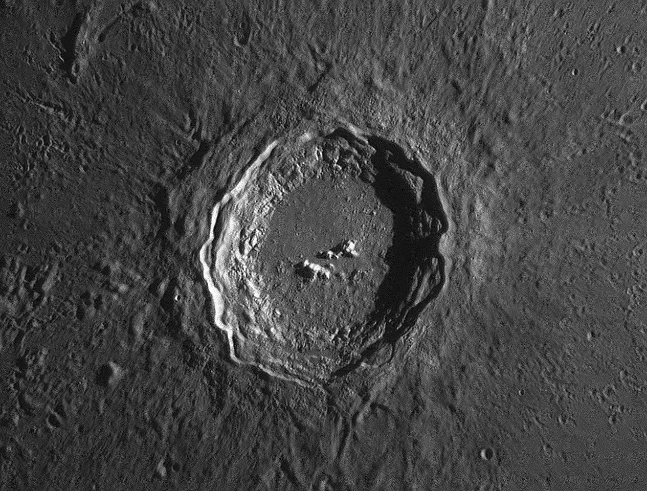
This month's feature is the crater Alphonsus.
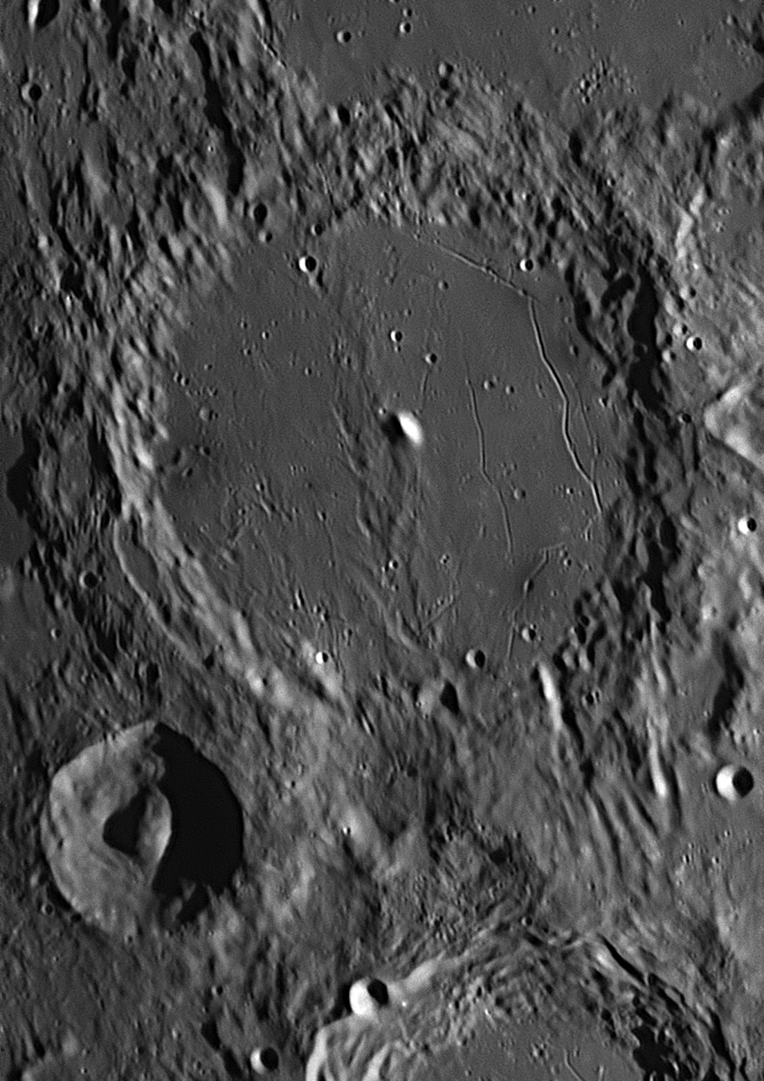
Alphonsus was photographed from Starfield Observatory, Nambour on June 22, 2018. East (where the Sun is rising) is to the right, north is at the top.

Ptolemaeus, described last month, is a huge crater almost in the centre of the Moon's disc as we see it. Adjoining it on its southern rim is another large crater, Alphonsus, which is 121 kilometres in diameter and has walls up to 2730 metres high. Some of the walls have terraces. The crater floor is fairly flat, but a central spine runs from north to south. Alongside this spine, a large mountain peak is a few kilometres north-east of the crater's centre. The mountain's base has been swamped by lava that has flooded the floor, so that only its peak pokes above the surface. The floor is broken by numerous faults and rilles, some of which are radial but some are roughly parallel to the walls.
In places on these faults and rilles, there are small craters with dark haloes around them. These are volcanic vents, obviously connected with the fault lines. Called ash volcanoes, they emit quantities of fine-grained dark-coloured ejecta which accumulates around the vent, sometimes filling in the closer parts of the fault trough. There are eleven ash vents visible in the above image.
The medium-sized crater to the south west (bottom left) is Alpetragius, 41 kilometres across with a bowl-shaped floor. It is unusual in that it has a large dome-shaped mountain in its centre.
The Jesuit priest who named most of the places on the Moon in the mid-17th
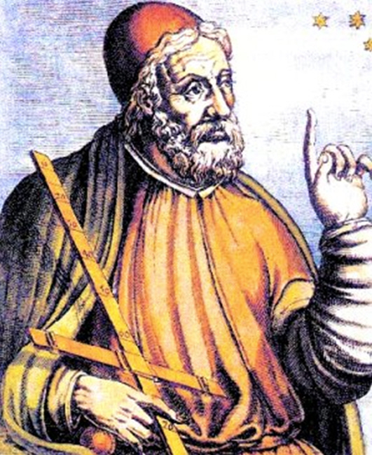
century, Giovanni Riccioli, named Alphonsus after King Alfonso
X
of Castille.
The rapid rise
of Islam following Mohammed’s flight to Medina in AD 622 had a major impact on
astronomy and the world. Muslim armies spread west from Mecca, subjugating
Syria, Egypt, Libya, Roman Carthage, North Africa, Morocco, and east to Persia
and the Indian border. When Muslim soldiers reached Egypt in AD 640, they
destroyed what remained of the Great Library of Alexandria (it had been sacked
by Christian mobs incited by the Coptic Archbishop Theophilus in AD 391). Yet
many of the works of pagan Greek philosophers of the previous ten centuries were
regarded as treasure, for the wisest Arab thinkers said, "The ancient writings
are the key to wisdom." The scrolls containing the works of Euclid, Archimedes,
Plato, Aristotle and Ptolemy were carried back to the Islamic capital of
Damascus, and translated from Greek into Arabic. In the next three centuries the
Muslim capital was moved to Baghdad and by AD 800 the Caliph al-Mansur had built
a 'House of Wisdom' for the translation, copying and distribution of the
ancient works. It was a research centre for the study of the humanities,
mathematics and science, and was unrivalled in the medieval world. In this way
the Arabic translations of the writings of the Greeks were disseminated across
North Africa to Morocco, and when the Muslim armies crossed the Strait of
Gibraltar and invaded the Iberian Peninsula.
By AD 750 Muslim armies had occupied the southern and central parts of what we
now call Spain, where they were known as 'Moors'. The northern provinces of
León, Castile and Galicia remained Christian, with their own Kings. As time went
on, the Moorish princes and caliphs became more interested in scholarship, art
and architecture than warfare, and established libraries, academies and other
seats of learning, particularly at Toledo, Seville, Córdoba and
Granada. These communities were very progressive, Córdoba being one of
the first medieval towns to have public street lighting. Muslim scientists were
encouraged to base themselves in these towns, and they brought with them their
Arabic translations of the ancient Greek texts such as Ptolemy's Almagest.
The Moors built great citadels and mosques in Spain, the greatest one still
existing being the Alhambra palace-fortress at Granada.
Alfonso
VI
(1040-1109), nicknamed ‘El Bravo (the Brave)’, was King of León from 1065, and
King of Castile and Galicia from 1072. He wished to release Iberia from Muslim
domination and enlisted one of his adversaries, Rodrigo Díaz de Vivar
(1043-1099), known to history as ‘El Cid (The Lord and Master)’, to lead
his army. The Christian forces of the combined kingdom of León-Castile
liberated Toledo in the Reconquista (re-conquest) of AD 1085. After that,
Toledo continued to be a major cultural centre. Its vast Muslim libraries were
made freely available to all. Alfonso established a translation centre in the
city, in which Arabian books were translated from Arabic or Hebrew to Spanish by
Arab and Jewish scholars, and from Spanish to Latin by Castilian scholars, thus
letting long-lost Greek knowledge spread into Europe. Most of the southern half
of the Iberian Peninsula including Andalusia remained in Moorish hands. Abu Ishaq Ibrahim al-Zarqali
(Arzachel, AD 1028-1087) was a Muslim astronomer living in Toledo, and as
Alfonso’s forces approached, he escaped to Córdoba where he continued his work.
He laboured to adjust and correct Ptolemy’s geographical data, specifically the
length of the Mediterranean Sea. He prepared accurate ‘zijes’ (a ‘zij’
was the Arabic name for a table of positions of stars and planets), using the
more recent observations of Arab astronomers
al-Khwarizmi and al-Battani to update Ptolemy’s work and correct for
precession. It is quite possible that he implemented his own program of
observation, or utilised even more sources, to modernise the older material.
Such books of zijes or tables were known by their Spanish-Arabian name
al-manakh
(calendar), from whence was derived the word ‘almanac’. In 1087 he
published the Almanac of Azarqueil.
Raymond of Toledo, Archbishop of Toledo from AD 1126 to 1151, continued the
efforts of Alfonso
Alphonsus
Gerard of Cremona, (AD 1114-1187), born in Cremona in northern Italy, came to the Toledo School of Translators in about AD 1144 in search of Ptolemy’s Almagest. Since he didn’t understand Arabic when he arrived, he had to rely on Jews and Mozarabs for both translation and teaching. He turned out to be the most productive of the Toledan translators at the time, with more than 87 books to his credit. He edited for Latin readers the Tables of Toledo, the most accurate compilation of astronomical and astrological data (ephemerides) ever seen in Europe up until then, These tables were completely up-to-date, and were partly based on al-Zarqali’s Almanac of Arzarqueil of AD 1087, and also on the works of Jabir ibn Aflah, the Banu Musa brothers, Abu Kamil, Abu al-Qasim, and Ibn al-Haytham (including his Book of Optics). The Tables of Toledomade a vital contribution to the rebirth of mathematical astronomy in Christian Europe.
Gerard was then given a huge task, to translate the Arabic version of the Almagest into Latin. Two Arabic translations of the Greek were then current, one by al-Hajjaj dated AD 827, and one by Ishaq ibn Hunayn dated AD 880. The second one had been revised by Thabit ibn Qurra in AD 901. Gerard had copies of both, and his translation into Latin combined the two. Where the two versions differed, Gerard wrote the alternative translation in a small hand, in the margin. The State Library of Victoria owns a priceless copy of Gerard's translation of the Almagest, hand-copied in Venice between 1200 and 1225.
In 1212 a coalition of Christian kings led by King Alfonso
VIII
of Castile drove the Muslims from the central Iberian Peninsula, forcing them
into the small Moorish Kingdom of Granada in the south, which lasted for another
280 years.
It was through
the work of Arzachel, Gerard of Cremona and Alfonso that the astronomical ideas
of the ancient Greeks (mostly sourced from Ptolemy's Almagest that had
been filtered by translation into Arabic and combined with Arabian mathematical
concepts such as the decimal system with its zero and place value, Hindu-Arabic
numerals, algebra and trigonometry), were translated into Latin and spread
throughout Europe, ending the Dark Ages and eventually leading to the
Renaissance. This mixture of cultural ideas is why today we have the majority of
constellations in the sky that are from the ancient Greeks, yet are populated
with stars that have Arabic names, e.g. Aldebaran, Altair, Deneb, Rigel and
Fomalhaut.
 By
1252, King Alfonso
X
(Latin form Alphonsus, AD 1221-1280, right), nicknamed ‘El
Sabio (the Wise)’ of Castile, León and Galicia, ruled northern and central
Spain. In Toledo he continued the tradition of translation enthusiastically,
having many Arabic scientific and philosophical writings translated into
Castilian Spanish by a team of 15 Christian and Jewish savants, including one
Muslim convert to Christianity. He took a personal interest in their work, and
even wrote introductions to some of the translated books.
By
1252, King Alfonso
X
(Latin form Alphonsus, AD 1221-1280, right), nicknamed ‘El
Sabio (the Wise)’ of Castile, León and Galicia, ruled northern and central
Spain. In Toledo he continued the tradition of translation enthusiastically,
having many Arabic scientific and philosophical writings translated into
Castilian Spanish by a team of 15 Christian and Jewish savants, including one
Muslim convert to Christianity. He took a personal interest in their work, and
even wrote introductions to some of the translated books.
Knowing the value of the Tables of Toledo, he assembled a team of
scholars and directed that they be translated into Castilian and updated, with
all the errors and anomalies removed. He had new instruments made and personally
supervised an extensive program of new observations that were needed. A famous
but probably apocryphal story says that while he was doing this work, Alfonso
commented that the Ptolemæic system was far too complicated mathematically, and
"if the Lord had consulted me before embarking on creation thus, I should have
recommended something simpler."
Alpetragius
Nur ad-Din al-Bitruji
("Alpetragius", AD circa 1130-1204) was born in Moorish Andalusia in the
south of the Iberian peninsula (Spain). He proposed a theory on planetary motion
in which he wished to avoid both epicycles and eccentrics of Ptolemy, and to
account for their varying paths and speeds by compounding the rotations of
homocentric spheres. It appears that the system he proposed was an amalgamation
of that of that of Eudoxus of Cnidus, combined with the motion of fixed
stars developed by
al-Zarqali (Arzachel). His knowledge of Eudoxus’ works would have
come through the filter of Arabic translations of the Almagest.
7: March 2017
This month's feature is the crater Petavius:
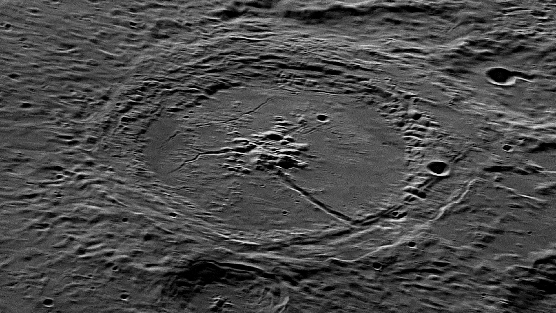
Petavius was photographed from Starfield Observatory, Nambour on
September 14, 2018. East (where the Sun is rising) is to the top, north is
to the left.
From this mountain group one of the finest clefts on the entire Moon runs
towards the south-west wall, cutting through the inner wall into a valley
between the walls. In places this great almost-straight cleft, which can be seen
with a very small telescope, has low raised banks, like a canal. The inner third
of its length is about 4 kilometres wide, but then it narrows to about 2
kilometres and becomes deeper as it approaches the outer wall. There are a
number of small dome-like hills on either side of this feature, known as the
Grand Cleft. When the Cleft reaches the western wall, it swings sharply to
the south, linking up with a narrow valley that has come south along Petavius'
wall from the adjoining crater
Wrottesley. The Grand Cleft merges with this valley and they continue as
one, heading south for 75 kilometres along the crater wall until turning
south-west away from it and petering out. An 11-kilometre crater called
Petavius C has impacted on the Cleft in this section.
Petavius is a large circular formation, but as it is near the Moon's limb
(edge), it appears to us greatly foreshortened. It is one of the finest crater
plains on the entire lunar surface and a grand object under low and medium
illumination, but difficult to see approaching Full Moon. It is 182 kilometres
in diameter measured from crest to crest, with massive, broad and very complex
walls rising to peaks of 3300metres on the west where the wall is double, and
2100 metres on the east. There are traces of a once-complete double rampart, the
inner one being lower and less regular than the outer and main wall. The
interior is decidedly convex, the central portion being 240 metres higher than
that adjoining the walls. In the centre of the floor is a grand, complex
mountain group, the principal peak rising 1700 metres and casting a long shadow
under a low sun. This, and the details of the group, are best seen when the Moon
is two or three days after Full.
The southern half of the floor of Petavius is quite smooth in comparison with the northern half, which is much more rugged and crossed by two winding clefts. One of these connects with the central end of the Great Cleft, and heads roughly north from a valley between the central peaks, before turning to the north-west and petering out. The other is finer, and crosses the crater floor midway between the peaks and the north-east rim. Whereas the Great Cleft and the north-heading one are radial to the crater's centre, this third, delicate cleft runs nearly parallel to the crater rim.
Three parallel clefts run from the central
mountains in a south-east direction towards a small 5 kilometre crater, Petavius
A, which is halfway from the centre to the main wall. These are quite delicate,
as are the numerous craterlets which dot the floor of Petavius. South-west of
Petavius A is a cluster of low domes, visible in the image above.
The surrounding region is very complex, consisting of ridges gradually radiating away from the rim of Petavius with shallow valleys between. The whole area around the crater has been swamped with superheated liquified rock, melted from the heat caused by the impact which created Petavius.
As Petavius is near the south-east limb of the Moon, we see the crater at an angle, which foreshortens its circular shape into an ellipse. On the southern wall of Petavius (on the right in the picture above, is an 11 kilometre wide crater, Petavius C. A peculiar double ridge 150 kilometres long passes through Petavius C and ends at the end of the Great Cleft. To the west of Petavius is the 60 kilometre wide crater Wrottesley which, like most large impact craters, also has a central mountain group. Petavius was created in the Lower Imbrian period (3.8 to 3.85 billion years ago), while the later crater Wrottesley, adjoining its western ramparts, dates from the Upper Imbrium period (3.2 to 3.8 billion years ago).
Petavius
The crater's name is the Latinised version of the name of a French chronologist, Denis Pétau (1583-1652). He was also a historian and theologian, but his connection with astronomy is quite obscure. The crater was named by Riccioli in 1651.
Wrottesley
This crater is named after John Wrottesley (1798-1867), a 19th century English astronomer who did valuable work in cataloguing double stars and measuring star positions. The crater was named by Birt and Lee in 1865.
8: April 2017
This month are featured three neighbouring craters: Eratosthenes, Copernicus and Stadius.
East (where the Sun is rising) is to the right, north is to the top.
Eratosthenes is the crater at top right, and part of Copernicus is
seen at the lower left corner. Above the centre of the bottom margin is the
ghost crater
Stadius, a little larger than Eratosthenes. 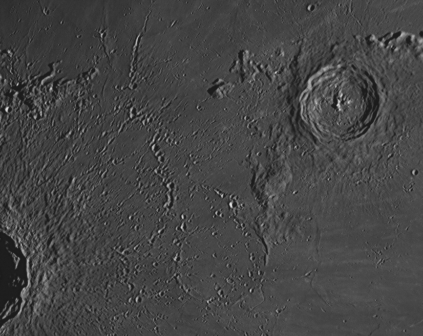
Eratosthenes is the 60 kilometre wide crater at upper right, at the
south-western end of a spectacular range of mountains called the Apennines (see
#15
below which adjoins). It is typical of a medium-sized crater, with a cluster of
central peaks. It was formed between 1.1 and 3.2 billion years ago. The debris
field caused by rubble blasted out from the Copernicus impact fills most of the
image, and the ghost crater Stadius can be faintly seen at bottom centre.
Some peaks at upper left are part of the Montes Carpatus or Carpathian
Mountains (see image #60
below).
This is the spectacular impact crater Copernicus in all its magnificence. A high peak on the eastern rim throws a conspicuous shadow onto the level floor. To achieve images of this clarity, the photographer must wait for a night when the atmosphere is very still. When the air is turbulent, astronomers say "the seeing is poor tonight" and turn to other tasks. On August 2, 2017 when the above images were acquired, the "seeing" was excellent. Even the best Earth-based optical telescope has its work restricted to some extent by the vagaries of atmospheric conditions, which is why there are quite a few orbiting observatories in space now.
The crater Copernicus, with a diameter of 95 kilometres, is only about 1
billion years old. Lava welled up through fissures caused by the impact and
pooled on the floor, which is about 3.8 kilometres below the outside lunar
surface. The north-western quadrant of the floor is quite level, with a few
small volcanic domes, but the rest of the floor is fairly rugged. There are two
clusters of mountain peaks near the centre of Copernicus. Tremendous landslips
are found all around the circumference, where surface material has slumped down
to the floor, producing uneven terraces.
The oldest crater is 71 kilometre wide Stadius, found between Copernicus and Eratosthenes, and is so ancient that numerous lava flows have filled it up and almost obliterated it, making what is called a 'ghost crater'.
These three impact craters are not far from the centre of the Moon, so they are seen almost directly from above, and are not much foreshortened. Although there are some volcanoes on the Moon with craters at their summits, by far the vast majority of deep, circular features with raised rims that cover much of the Moon's surface are caused by the impacts of flying pieces of rock onto the lunar surface. In 1791 Johann Schröter named these features 'craters', from the Latin word for 'cup', because of their profile. He also named certain valleys 'rilles', from the German word for 'grooves'.
In the Moon's distant past, when the Solar System was very young, there was a lot of material circling the Sun which came into collision with the newly-formed planets and their satellites or moons. This material was in the form of rocks ranging in size from sand grains and pebbles up to car-sized and even as large as Tasmania. Each planet's gravity swept most of them up, but there are still plenty of them still flying free in space. We call them SSSBs (Small Solar System Bodies). The small ones are commonly known as meteors when they strike our atmosphere and burn up by friction; larger ones may develop tails of dust and vented gas when approaching the Sun and are known as comets, and the biggest ones are sometimes called asteroids. The largest asteroid, Ceres, has a diameter about a quarter of that of our Moon, and is called a 'dwarf planet'.
If one of these objects flying through space hits a rocky planet with little of no atmosphere to slow it down, then the impact creates a huge crater. Mercury, Mars, the Moon and satellites of the outer planets have areas which are covered with overlapping craters. Even the Earth has had numerous strikes, and the evidence of many is still visible today, despite two or three billion years of weathering and erosion. Two large 'astroblemes' in Australia are Wolfe Creek crater in the Kimberley District and Gosse's Bluff in Central Australia, where a collection of smaller craters at Henbury can also be found.
On the Moon, a large impact crater like Copernicus is caused when a large rock flying through space - say about the size of Nambour - hits the lunar surface when travelling at a typical 30 kilometres per second. This flying mountain has great mass and its speed gives it great kinetic energy. On impact with the Moon, the rock is stopped short in a tiny fraction of a second, and its kinetic energy is instantaneously converted into heat energy, which vaporises the rock in a stupendous blast that creates the crater. Great amounts of molten rock (called 'rock melt') are deposited all around the site of the impact, covering and blurring older features and clearly visible in the pictures. Rocks and boulders as large as city blocks are flung out in all directions for many hundreds (occasionally thousands) of kilometres. These rain down on the Moon's landscape, peppering the area with craterlets, many with shapes elongated radially from the impact. These types of craterlets are conspicuous in the central region of the picture above, some being in lines where a large block has bounced along the surface, leaving a craterlet each time it hit the ground.
The lunar surface was originally a light grey in colour, but as it ages, the continual rain of micrometeorites and particles from the Sun (mainly protons and ions) coats each soil particle with a very thin layer of metallic iron called nanophase iron (npFeo). This darkens each grain and hence the area of the surface in general, according to how long it has remained undisturbed. When there is a large impact nearby, material ejected from the new crater disturbs the surface in a pattern radial to the crater, bringing the lighter coloured subsoil to the surface and creating a pattern of light-coloured rays centred on the new impact crater. The craters Copernicus and Kepler have widespread ray systems. By far the most spectacular ray system on the near side of the Moon is centred on the southern crater Tycho (see #18 below), whose rays spread across the Moon for thousands of kilometres. They are most prominent around the time of Full Moon.
As well as the blast going outwards, it also sends a powerful pulse of energy downwards into the Moon. When this pulse hits the solid bedrock, it bounces back up to the surface, fracturing and lifting the floor of the crater just formed. This is the origin of the clusters of central peaks found in the middle of the floor of a majority of impact craters, such as Eratosthenes above. Copernicus also has a cluster of peaks, but they are only 1200 metres high. In the image above, their summits, being 2560 metres lower than the surrounding rim, are yet to be illuminated by the sun's rays.
If the downward pulse of energy is powerful enough to fracture the bedrock, thereby releasing pressure on the hot rocks below, they immediately liquefy into molten magma which forces its way up to the crater floor, where it pools, sometimes overwhelming the cluster of new peaks and creating a flat floor to the crater. The large crater plain Ptolemaeus (described above as
#5 ) and visible in the small Full Moon image and the waxing gibbous Moon image at the top of this page as a circular flat area almost in the Moon's exact centre) was created in this way. There have been no craters larger than a kilometre in diameter formed in the 408 years since Galileo first looked at the Moon through a telescope in 1609.Since the time of Pythagoras in the sixth century before Christ, all educated Greeks and Egyptians knew that the world was shaped like a sphere. Its actual size was still open to conjecture. They believed that the Earth was fixed and unmoving at the centre of the universe (a 'geocentric' view), and that the Sun, Moon, planets and stars revolved around the Earth once per day, being carried on transparent crystalline spheres. A few thinkers in the third and second centuries BCE, such as Aristarchus and Seleucus, thought that the Sun was at the centre of the universe (a 'heliocentric' view), and that the Earth was just another planet revolving around it in a year and rotating on its axis once each day, but they were not taken seriously.
At the beginning of the sixteenth century AD, the Renaissance was under way. The printing press has been invented, Columbus had discovered the New World, Vasco da Gama had found a sea route to India, and people like Leonardo da Vinci and Michelangelo were changing the art world. Niklas Koppernigk (Latinised to Nicolaus Copernicus, 1473-1543) was by 1506 a well-educated Renaissance man. He was a physician, economist, diplomat, mathematician, classical scholar, military leader, governor and artist. He worked as a Canon at Frauenburg Cathedral in East Prussia (now Frombork in Poland), but did not take holy orders. His hobby was astronomy.
He had read the Epitome of the Almagest by Regiomontanus, which described the fixed Earth and transparent spheres surrounding it, and thought the whole system as described by Aristotle and Ptolemy was mathematical sleight-of-hand. Though it gave fairly good predictions of planetary movements for astrologers, the whole complicated system with its epicycles, deferents and an equant seemed to be based on a lie. The more he studied Ptolemy's original Almagest when it was finally published by printing press in 1515, the more he realised that all the complications would vanish if the Sun replaced the Earth at the centre of the planetary orbits, and each planet would then snap into place.
He decided to begin work on a book of his own, using the Almagest as a model. In his book, he would clearly and patiently piece his theory together, fully explaining it with mathematical proofs and rigorous logic. He did not know it, but his book would restore interest in the heliocentric system suggested by Aristarchus in the 3rd century BCE, and lead directly to new laws of physics.
The book took about twenty years to write, but Copernicus was afraid to publish it as he felt that the Church, which strongly supported the geocentric view, would see his idea of an Earth moving around the Sun as an attack on the holy scriptures. After all, Psalm 105:5 said quite definitely, "He set the Earth on its foundations; it can never be moved." In his last years, he finally agreed to publish 500 copies of it, and an unbound copy fresh off the press was placed in his hands as he lay comatose on his deathbed. The book was called De Revolutionibus (On the Revolutions). It was indeed 'revolutionary', and gave us the word to use for anything that challenges the existing order of things.
There was no theory of universal gravitation existing at the time to provide physical support for Copernicus’ system. Initially, the book made little impact. Reading it in Latin was heavy going, and not many people read it through completely; but before long most scholars were aware of the substance of the heliocentric theory, and a small but growing group of astronomers were convinced of its veracity and studied it in great detail. It was treasured by all who had a copy pass through their hands, and the wide margins of the copies still in existence are full of comments and notes. 275 of the 500 first edition copies are still with us, and priceless. In the end, De Revolutionibus was enough. It would be recognised as the greatest scientific book of the sixteenth century. It would change the world forever, but not until the invention of the telescope in 1608 proved that the Earth and other planets did indeed orbit the Sun.
Eratosthenes
 The story goes that Eratosthenes was told by a visitor to the Great Libray that
at noon on the summer solstice (June 21), the Sun shone vertically down a well
further up the Nile River at Syene, its reflection appearing in the water. Also,
vertical sticks and tall columns were seen to ‘swallow their shadows’ around the
time of the summer solstice. He checked this the following year and found that
it was so, and that, at the same time on the same day, the Sun was 7.2º from the
vertical at Alexandria.
The story goes that Eratosthenes was told by a visitor to the Great Libray that
at noon on the summer solstice (June 21), the Sun shone vertically down a well
further up the Nile River at Syene, its reflection appearing in the water. Also,
vertical sticks and tall columns were seen to ‘swallow their shadows’ around the
time of the summer solstice. He checked this the following year and found that
it was so, and that, at the same time on the same day, the Sun was 7.2º from the
vertical at Alexandria.
Knowing the distance between the two observing sites to be 5000 stadia or about 800 kilometres, a stade or stadion being 157.5 metres (he hired professional ‘steppers’ to pace it out using a standard stride), he used this information to make a famous measurement of the diameter and circumference of the Earth, getting quite an accurate result. His method was simple: the 7.2º angle between the two towns is about one-fiftieth of a circle of 360º. This distance equals 800 kilometres.
Therefore the circumference of the whole circle (the Earth) equals 50 × 800 km = 40 000 km. His calculation of the Earth’s circumference turned out to be very close to the true figure of 40 025 km (polar circumference), but it seems that he had more than his share of good fortune. The fact that Syene is slightly north of the Tropic of Cancer should have made the Sun shine down the well at a slight angle, not vertically. We are not told how deep the well was, and if it was exactly vertical. Would the use of their primitive measuring instruments at Alexandria have provided the quoted accuracy? How accurate were the measurements of the man or men who paced the distance? Did he use an 'Egyptian Stadion' or an 'Attic Stadion'? All of these factors would have introduced small errors into his observations and calculations, but luckily they appear to have cancelled each other out. In any case, he was the first man to measure the size of a planet, and all he used was sticks, eyes, feet and brains.
One of the first astronomical almanacs to be based solely on the heliocentric system of Copernicus was the Ephemerides novae at auctae of Jan Stade (Latinised to Johannes Stadius, 1527-1579), published at Cologne in 1554. Avidly read and enthusiastically used by Tycho Brahe and Michel de Nostradamus, this set of planetary tables fearlessly stated that its calculations were made using the heliocentric system.
9: May 2017
This month's features include the craters Aristarchus and Herodotus, and the unusual Schröter's Valley.
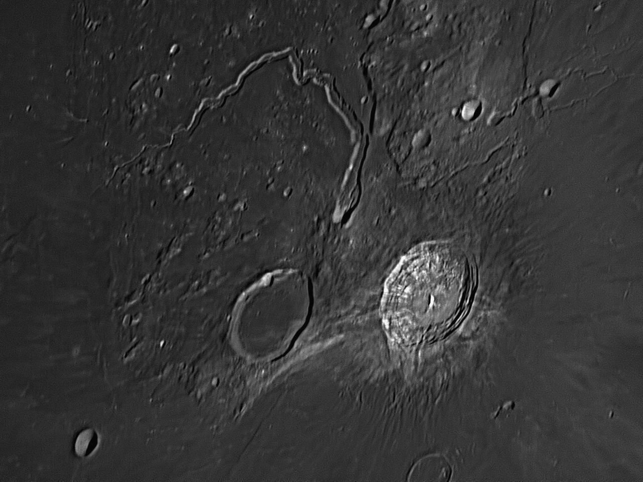
Aristarchus is the bright 41 km crater at right, Herodotus is the flooded 36 km crater to its left. Vallis Schöteri (Schröter's Valley) is the remarkable feature to their north, and is 165 km long. The valley begins at a small crater in the highlands between Aristarchus and Herodotus, widens out and then narrows again heading north, before zig-zagging to the north-west and then turning to the south-west, where it narrows further and peters out. It has been described as like a snake, in particular as a cobra, and its widest area near its starting point has become known as the 'Cobra Head'. A delicate rille 200 metres wide like a dry water course meanders along the margins of the valley, visible above for most of its length. There is a complex of narrow, winding rilles in the north-eastern corner of this image. North is to the top, east (where the Sun is rising) is to the right.
This area is in the north-western quadrant of the Moon, and is considerably
fore-shortened. The brightest crater is Aristarchus, 41 kilometres in
diameter and being less than 500 million years old is fairly recent. It is one
of the brightest lunar craters, and can be seen in the dark part of the waxing
crescent Moon, being faintly illuminated by Earthshine (sunlight reflected off
the Earth, which would be nearly Full if the Moon is New). It stands on a rocky
plateau, and its walls rise about 600 metres above the surrounding lava plain of
the Oceanus Procellarum (Ocean of Storms). The interior walls have rugged
terraces, and there is a small central mountain which is only about 350 metres
high. The western interior slopes have a number of dark, radial bands running up
them, two of which can be seen in small telescopes. The interior of Aristarchus
is bowl-shaped, except for a small flat section at its centre, where lava has
welled up and pooled.
Herodotus is a much older crater, being over three billion years old. It
is 36 kilometres in diameter and its dark interior is in striking contract to
that of Aristarchus. The narrow walls enclose a flat floor, which was once a
lake of molten lava. The northern part of the crater wall has been struck by
another meteor, leaving a 4 kilometre crater called Herodotus N. Between
Aristarchus and Herodotus is an upland region, probably volcanic in origin.
Schröter's Valley begins in this upland area, in a deep crater 8 kilometres across (the Cobra Head), which adjoins a larger crater about 10 kilometres across (sometimes called the Cobra's Hood). There is a large landslip on the western side of this larger crater. The Valley heads north, then north-west, then south-west, for a length of about 165 kilometres. Its width varies between 6 and 10 kilometres, tapering down to about 500 metres at its western end. The fine rille which runs the length of the floor is 200 metres wide. Schröter's Valley is without doubt one of the strangest and interesting formations on the Moon.
Aristarchus
Aristarchus of Samos (ca. 310-230 BCE), born ten years after the death of Aristotle, spent time conducting research at the new Great Library of Alexandria. He was one of the first to apply mathematical principles to astronomy, and taught that all the seven planets were spherical as was the Earth; what is more, the Earth rotated on its axis daily. Interested in improving mapping, he worked towards the concepts of latitude and longitude, which were developed further by Eratosthenses.
Aristarchus obtained reasonable estimates of the Moon’s size and distance by logical reasoning and sound application of Euclid’s geometry, after observing a lunar eclipse, thus: A full shadow of the Earth on the Moon has an apparent radius of curvature equal to the difference between the apparent radii of the Earth and the Sun as seen from the Moon. This radius can be seen to equal 0.75 degree, from which (with the solar apparent radius of 0.25 degree) we get an apparent radius of the Earth of 1 degree. This gives an Earth-Moon distance of 60 Earth radii or 384 000 km. This result can be compared with the Earth-Moon distances this month under
Lunar Orbital Elements in The Sky Tonight page.Aristarchus expressed the belief that the Sun was twenty times further away than was the Moon. He also deduced that the Sun was far bigger than the Earth, and this may have led him to the conclusion that the Earth should revolve around the Sun, rather than the reverse. Developing this idea further, he proposed a true heliocentric system, the first person to do so. He taught that the Earth rotated on its axis each day, and travelled around the Sun once in a year. In this he anticipated Copernicus by nearly two millennia.
Aristarchus pictured a universe many times larger than any that had previously been imagined. The geocentric theories of his predecessors cosseted the Earth snugly inside the planets’ crystalline shells like a cosmic egg, but Aristarchus placed the Sun at the centre of a huge void, with the Moon close to Earth, the planets much farther away, and the stars at such great distances as to be almost beyond comprehension. We do not know for sure if he realised that the stars were at different distances, or if he agreed with the accepted wisdom of the time (harking back three centuries to Anaximander) that they were all located on a remote black ‘sphere of fixed stars’.
The idea of a spinning Earth was ridiculous to the geocentrists, and indeed to practically everyone. Stand outside at night, they said, and watch the stars slowly wheeling overhead. The Earth feels solid and motionless under your feet. If it were spinning, you would feel it. Also, they knew that the Earth was large, and if it rotated once in a day, then mountains, rivers and cities would be careering around at many hundreds of kilometres per hour. Gale-force winds would rake the landscapes. Houses, animals and people would be flung off and whirled away up into the sky and out of sight. Surely, common sense dictated that the Earth doesn’t move, but the objects in the sky do. The Sun rises and sets, does it not? Geocentrists also claimed that, if the Earth were truly moving, a ball thrown vertically upward would not fall back into the hand of the thrower, but would be left behind as the Earth carried the thrower away. The concept of inertia was not known at the time.
The heliocentric theory of
Aristarchus was rejected by all major thinkers, with one exception, the
mathematician Seleucus of Seliucia (190-150 BCE). Living near Babylon,
Seleucus only heard about it 100 years after Aristarchus had proposed it.
According to Plutarch, Seleucus believed the Sun-centred, revolving Earth world
view was a fact, and was the first to prove it so through reasoning. We do not
know what arguments he used. The world was not yet ready for a heliocentric
solar system, and the Earth-centred universe would be the accepted model for
another 1800 years.
Herodotus
Herodotus (484-420 BDE) was a Greek historian in the fifth century before Christ. He was a contemporary of Philolaus and Socrates, in the generation before Plato. Cicero has called him "the Father of History", as he was the first writer to record historical events critically as a factual narration, rather than following the tradition of Homer in romanticising and embellishing the stories, as in the legend of the Odyssey. His work is the earliest Greek prose that has survived intact.
Schröter
Johann Hieronymus Schröter (1745-1816)was a wealthy German lawyer in Hanover who became interested in astronomy. In 1779 he acquired a three feet long (almost one metre) achromatic refractor with a 2¼ inch (57 mm) lens by Dollond to observe the Sun, Moon and Venus. Herschel’s discovery of Uranus in 1781 inspired Schröter to pursue amateur astronomy more seriously. He resigned his post and moved out of Hanover to the darker and clearer skies of the countryside, becoming chief magistrate and district governor of Lilienthal.
In 1786 he paid 600 Reichstaler (equivalent to six months earnings) for a 2.14 metre focal length, 16.5 cm aperture reflector by Schrader, with eyepieces allowing up to 1200 magnification. He paid another 26 Thaler for a screw-micrometer.
Soon he had become an accomplished selenographer, and in 1791 he published an important early study on the topography of the Moon entitled Selenotopographische Fragmente zur genauern Kenntniss der Mondfläche, (Fragments of the Moon’s Topography for a more accurate Knowledge of the Lunar Surface). By this time, Latin had been phased out as the language of science, and such books were being written in the common language of their authors. This book introduced the Latin word ‘crater’ (cup), and the German word ‘Rille’ (groove) to the lunar terminology.
Schröter knew his history of astronomy and named 76 new features, including the craters Alhazen, Bernoulli, Bradley, Cassini, Euler, LaCaille, Tobias Mayer, Mercator, Picard and Rømer. He named two craters Hooke and Newton, but, knowing of the bitter enmity between these two men in their lifetimes, he placed them as far apart on the Moon as he could, Hooke away up in the northern hemisphere and Newton near the South Pole.
Also named were Mount Huygens, Mount Hadley, Mount Pico, Mont Blanc and the Leibniz Mountains. Like most astronomers, he preferred Riccioli’s names over those of Hevelius and Langrenus, and this fact influenced the official acceptance in the 20th century of most of Riccioli’s names by the International Astronomical Union. He discovered Schröter's Valley in 1787, which was named after him by later astronomers.
10: June 2017
This month's feature is the Apollo 11 landing site, Tranquility Base.

This area was photographed from Starfield Observatory, Nambour on July 30, 2017. The landing site is shown by an ' x '. Three craterlets have been officially named after the astronauts. Armstrong is 4.6 kilometres in diameter, Collins is 2.4 kilometres, and Aldrin is 3.4 kilometres. The lunar module's landing approach was from the east (right). North is to the top.
Tranquility Base is the place where human beings first stepped onto another
world. Three astronauts from the USA lifted off from the Kennedy Space Center in
Florida on July 16, 1969 in a space vehicle comprising a three-stage Saturn V
rocket on which was placed the three-part spacecraft that would travel to the
Moon. The three parts were the Service Module (SM, unmanned) to
which was attached the Command Module (CM, named "Columbia")
in which the astronauts travelled, and the Lunar Module (LM, at
the time called the 'Lunar Excursion Module' or LEM, named "Eagle")
which was designed to descend to the Moon's surface with two astronauts on
board. The LM was housed at lift-off in a 'garage' or adapter on top of the
third Saturn V stage and behind the SM. During trans-lunar orbit the SM + CM had
to separate from the third rocket stage, use their thrusters to turn through 180
degrees, dock with the LM, and then withdraw it from its 'garage'. The SM + CM +
LM then headed for the Moon as a unit, the LM leading. The third Saturn V stage
went into orbit around the Sun.
After travelling for four days, the Commander Neil Armstrong and Lunar Module Pilot Edwin 'Buzz' Aldrin climbed through from the CM into the LM, and the two vehicles separated. The Command Module Pilot Michael Collins remained in the CM in lunar orbit and did not take part in the landing. The landing site is on a great lava-plain called Mare Tranquillitatis or the Sea of Tranquility. It is within a degree of the Moon's equator.
On a few orbits over the area before the descent, Armstrong and Aldrin were able to identify the landmarks they needed to pinpoint the chosen level landing area. Some of these landmarks were the twin craters of Ritter (32 kilometres diameter) and Sabine (31 kilometres), both seen near the left margin of the above image about a third of the way down from the top. They are the largest craters in the image. Another was a long rille, double in places with a flat floor, running for nearly 200 kilometres from just south of Sabine in an east-south-easterly direction. This is called the Rimae Hypatia or Hypatia Rille - it was unofficiallty dubbed by NASA "US Highway 1". Just north of this "highway" near its eastern end was a small but bright crater, Moltke (7 kilometres across). It can be seen above, just below and south-south-east of the actual landing site, which is shown with a yellow ' x '.
Three craterlets in a line north of the landing area were unofficially named Armstrong, Collins and Aldrin, in order from right to left as that was the direction of the LM's flight path. These craters appear in the image above, just below the printed names. The first was 5 kilometres across, the other two were 3 kilometres. These names are now official, the International Astronomical Union (IAU) having made an exception to the rule that craters can only be named after a person posthumously.
The LM, using the engine in its lower half as a brake, slowed down and landed on the Moon at 6:17:40 am on July 21 (Australian Eastern Standard Time). The touch-down was at the far western end of the planned landing area, about 15 kilometres south of the craterlet Collins. Six hours and 38 minutes later, Armstrong placed his left foot on the Moon's powdery surface at 12:56:15 pm AEST. Queensland school children watched his "one small step for man" on television during their lunchtime and most of the afternoon's lessons were set aside so that they could participate in the historic event. Armstrong and Aldrin spent 21½ hours on the lunar surface, taking pictures, deploying experiments and collecting 21.55 kilograms of rocks and soil. Seven of those hours were spent in resting inside the LM after their strenuous activities.
At 3:54 am AEST on July 22 the ascent stage of the Lunar Module lifted off the Moon and docked with the orbiting Command Module, after which the LM was left in orbit around the Moon and subsequently crashed. The LM's descent stage remains on the Moon where it has been photographed occasionally by mapping satellites, such as the Lunar Reconnaissance Orbiter on March 7, 2012. The three astronauts, now together again in the CM, fired the SM's rocket motor to return them to the Earth. Prior to re-entry into the Earth's atmosphere, the SM was jettisoned and the CM turned so that its heat shield was facing forward. The CM splashed down in the mid-Pacific Ocean 24 kilometres from the recovery ship, USS Hornet on July 25 at 2:51 am AEST, after a total trip lasting 8 days 3 hours and 19 minutes. Of the 3000 tonne Saturn V + Apollo space vehicle, only the 5 tonne Command Module returned safely to the Earth. Neil Armstrong departed this life in 2012 aged 82, and Michael Collins in April 2021 aged 90. On January 20, 2024, Buzz Aldrin celebrated his 94th birthday.
Key to features 11 to 20 below.
This month's feature is the large walled-plain named Plato.
This image of Plato was acquired on the morning of March 6,
2021, at 6:15 am. At Nambour, the Sun had risen at 5:44 am and was six degrees
above the eastern horizon. This timing was necessary to capture this view which
to an observer at Plato would be in the afternoon, with the Sun setting in the
west (to the left), and shadows stretching away to the east (right). Plato is a huge walled plain with a diameter of 104
kilometres. As it lies at lunar latitude 51 degrees North, we see Plato greatly
foreshortened, but if we could see it from directly above, it would be almost
perfectly circular. It is even more foreshortened in the images in item #12
below. The impactor which caused Plato struck the Moon in a rugged, mountainous
area called Montes Alpes (the Alps), lying between the
Mare Frigoris (Sea of Cold) and Mare Imbrium (Sea of Rains). The
floor of Plato is remarkably flat, and is evidently the solidified surface of a
great lake of molten lava, which welled up and half-filled the crater after the
initial impact fractured the underlying bedrock. In the western half there is a
very low lava dome or shield volcano that is 30 kilometres wide and 40
kilometres long. The dark floor is dotted with dozens of small craterlets. The
five largest of them average two kilometres in diameter and have interior
shadows. There are over twenty tinier craterlets detectable in the image above. The bright walls average 2000 metres in height, with some peaks
being much higher. Under a low Sun, the peaks throw long shadows across the
floor. The western wall exhibits a huge landslip, where a large mass has slumped
down and now intrudes upon the floor. Two smaller landslides can be seen in the
north-western wall. A narrow but prominent valley leads from the interior
floor through the south-eastern wall, then immediately turns south-west and runs
parallel to the wall, eventually reaching the plain of Mare Imbrium. The largest
other crater in this image is 23 kilometre Bliss, lying to the north-west
of Plato.
To the south-west of Plato, in the lower left corner of the image, is a bright
mountain range protruding from the cooled lavas of the Mare Imbrium. It is
called the Montes Teneriffe or Teneriffe Mountains (after the volcanoes
that rise out of the Atlantic Ocean to form the Canary Islands). Two of the
mountains in the northern spur exceed 2000 metres in height, and the furthest
one to the east reaches 2500 metres.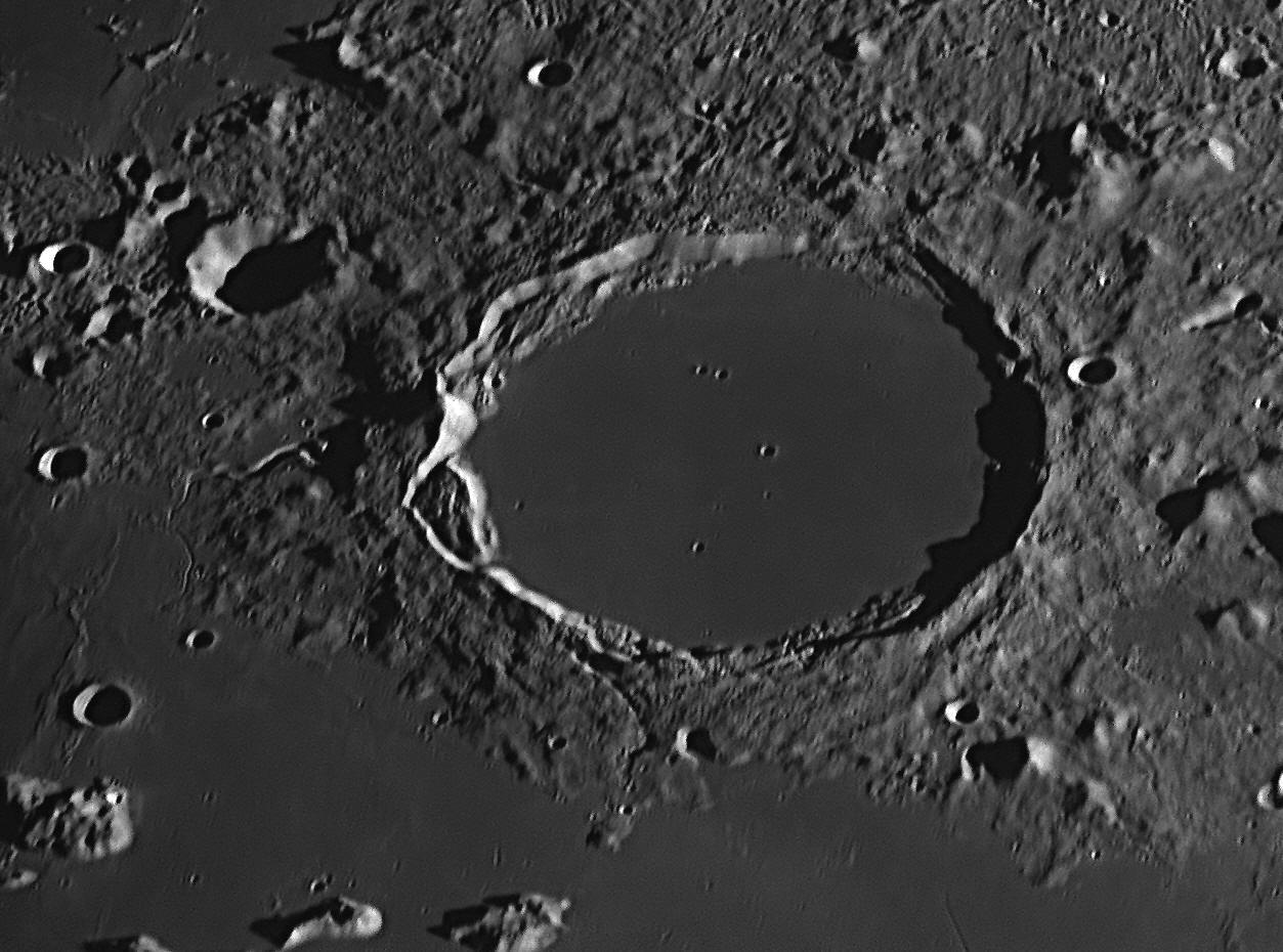
This area was photographed from Starfield Observatory, Nambour on January 26,
2018. North is to the top. It was morning to an observer at Plato,
with the Sun rising in the east (right), and the shadows stretching away to the
west (left). The area is dominated by the large oval formation at centre, which
was named by Riccioli and Grimaldi in 1651 after the ancient Greek philosopher
Plato.

Naming the Moon
As far as we know, the first person to name lunar features was William Gilbert (1544-1603), an Englishman, who made a sketch in 1600 of the Moon, showing dark and light areas. He assumed that the dark areas were land, and the light ones were seas, an assumption that he shared with Leonardo da Vinci and the young Kepler, but which was the opposite to most other observers, who thought that the 'seas' were the dark areas. Gilbert invented thirteen names for features in his drawing, which actually are familiar places on the Moon today. One dark oval area he named "Brittannia" (sic), thinking it was an island. It was later named "Mare Crisium", as later observers considered it to be a 'sea'. Gilbert died of bubonic plague aged 59 in 1603, five years before the first telescopes made their appearance. His naked-eye drawing was not published until 1651, by which time it was merely a curiosity. However, Gilbert's real claim to fame is for his work on magnetism, and as one of the originators of the word 'electricity'.
The first realistic map of the Moon, made with a good quality telescope, was produced by Michael van Langren (Langrenus, 1598-1675) in 1645. He used the names of famous and historic people to identify lunar features, and some large dark areas were named after places on Earth, two being the Belgian Sea and the Caspian Sea. Only three of his names are still in use, for the craters Endymion, Pythagoras and Langrenus (which he named after himself).
Only two years later, 1647, Johannes Hevelius (1611-1687) in East Prussia produced a book, Selenographia, which contained maps of the Moon made with a 3.6 metres long telescope which could magnify 50 times. He also showed maps of the Moon at different phases. The maps were hand-tinted, and the colours chosen seem to indicate that his telescope was unable to convince him that the ‘seas’ on the Moon were not really water, for he has had them coloured blue. This project took four years, and entitles him to be called a founder of lunar cartography. He began this work before van Langren's map was published, and may not have been aware of its existence or of van Langren's names for lunar features.
Hevelius decided to name all of the lunar features after places on the Earth, but in their classical Latin and Greek forms. Why did he choose the names he did? People had argued since antiquity that the Moon is a mirror of the Earth. They had believed the patterns of dark and light on the Moon’s surface to be seas and continents that paralleled those on the Earth. Just as humans, animals and plants inhabit the Earth, so ‘selenites’ and other life-forms were presumed to inhabit the Moon. This parallel between the Earth and the Moon was important to Hevelius, and he compiled his lunar maps from multiple, detailed telescopic observations, adopting some of the symbolic conventions of geographical mapping. He did not seem to fully understand the interplay of light and shadow on the Moon’s surface, and mapped the shadow-casting ridges and crater rims as if they were chains of terrestrial mountains. For some reason, he called most hollowed-out depressions (craters) ‘Mons’, meaning ‘mountains’, e.g. the crater Tycho was named Sinai Mons (Mount Sinai), the crater Copernicus was named Mons Ætna (Mount Etna), and the crater Ptolemæus was named Mons Sipylus. The three terrestrial mountains just named are all volcanic in origin, but only Mount Etna has an actual crater, which may be why he chose it for the great formation of Copernicus. He called the dark crater-plain Plato illustrated above ‘Lacus Niger Major’ (Large Black Lake), which is an apt description given his 50x telescope.
On his map of the Moon's western side he shows ‘M. Ætna’ (Mt Etna) in the island of ‘Sicilia’ (Sicily), sitting in the middle of the ‘Mare Mediterraneum’ (Mediterranean Sea). The islands of Corsica and Sardinia are nearby, with Majorca and Minorca not far away. At the southern end of the Mare Mediterraneum, we see ‘Mare Ægyptiacum’ (Egyptian Sea), with ‘Fl. Nilus’ (‘Fluvius Nilus’, the Nile River), flowing into it as three streams. The islands of Crete and Cyprus are also shown. By applying familiar names to the lunar features, perhaps Hevelius aimed to make it a more understandable and recognisable place, and to reduce any strangeness the observer might experience.
Like van Langren before him, Hevelius exhorted other astronomers to adopt his system of naming lunar landmarks, and threatened litigation if anyone else should devise different systems of names in opposition to his. However, this was an empty threat, as there was no legal requirement for any competitor to comply with such requests.
Giovanni Battista Riccioli (1598-1671) discovered the first binary star (Mizar in Ursa Major) in 1650. He worked with his former pupil Francesco Grimaldi (1618-1663) at Bologna. Both were Jesuit clerics in the Catholic Church. They shared an interest in astronomy, and decided to work together in producing an accurate map of the Moon, among other things. This map, or selenograph was the result of Grimaldi’s telescopic study of the Moon and was drawn by himself. It is fairly accurate, although for some reason the spectacular crater Cassini is missing.
Riccioli, with some help from Grimaldi, contributed a new series of names for lunar features, in which mountains and valleys were named as such, and the bowl-shaped depressions (not yet called ‘craters’) were named after famous astronomers and philosophers, some still alive. The 'seas' ('maria') were named after various meteorological ideas of the time, for it was thought that the Moon influenced the weather. We still use Riccioli’s names today, and those of Langrenus and Hevelius are mostly dispensed with, but there are some exceptions.
Riccioli published the map in his two-volume work on astronomy entitled Almagestum novum, astronomiam veterem novamque complectens or New Almagest, in 1651. By necessity, as an official of the Catholic Church, when writing about astronomical matters he had to comply with Church doctrine. He therefore opposed the Sun-centred world view of Copernicus, Kepler and Galileo, though he ventured to praise the heliocentric theory as a useful hypothesis for calculating planetary positions. Riccioli and Grimaldi experimented with falling bodies in an attempt to refute Galileo’s findings. Instead, they found that Galileo was correct, which impressed them greatly.
It appears that, when they began assigning names to the lunar craters, Riccioli and Grimaldi had a hidden agenda. Despite their professed opposition to Copernicus’ theory, they named the Moon’s most spectacular crater after him, and a nearby prominent crater after Kepler. Another relatively close crater was named after Aristarchus, the originator of the heliocentric theory. Not far away, they named a crater after Galileo. Twelve craters were named after other Jesuit astronomers, such as Bettinus, Clavius, Curtius, Cysatus, Furnerius, Gruemberger, Kircher, Moretus, Scheiner, Schomberger, Simpelius, and Zucchius, but they are in a far-off part of the Moon, near its south pole and the crater Tycho, as the Society of Jesus supported the Tychonic world view. When questioned, they said that they had “flung the heliocentrists away into the Ocean of Storms”, far from the Jesuits.
But Riccioli and Grimaldi named two large adjoining craters near the Moon’s limb after themselves. Where are those craters? Not in the far south of the Moon with other Jesuits, but near its Equator, bordering the Oceanus Procellarum (Ocean of Storms), close to the crater Galilæus and in the same quadrant of the Moon as Copernicus, Kepler and Aristarchus. This is considered to be covert support for the Copernican theory, which as Jesuits they knew that they could not publicly express.
As telescopes improved, smaller and smaller features became detectable, and so later astronomers such as Schröter, Mädler, Birt, Lee, Neison, Schmidt, Franz, Krieger, König, Fauth, Lamèch and Wilkins applied new names to them. With the mapping of the far side by satellites, official bodies such as NASA were allowed to name features, as long as they abided by rules laid down by the International Astronomical Union or IAU.
Plato
Plato (ca. 429-348 BCE, a student and friend of Socrates, described the
spherical nature of the Earth in one of his Dialogues,
Timaeus. He also taught that the world (universe) was composed of tiny
atoms comprising four fundamental elements – earth, water, air
and fire, with the least heavenly element, earth, at the bottom. He said
that water flowed over the earth, air floated above both, and fire rose through
the air to the sphere of the Moon, above which the planets and stars moved
within a fifth element, the quintessence or æther.
The word ‘æther’ in Homeric Greek means ‘ever-moving, pure, fresh air’ or ‘clear
sky’, and was believed in Greek mythology to be the pure essence where the gods
lived and which they breathed, different from the impure air breathed by mortals
which only reached as high as the Moon. On rare occasions the æther was seen as
a glow around the Sun’s disc during solar eclipses. Its name comes down to us
today in the words ‘ethereal’ (‘heavenly’) and ‘ethernet’. Æther had no
qualities at all (was neither hot, cold, wet nor dry), was inviolate,
everlasting and incapable of change (with the exception of change of place), and
by its nature moved in perfect circles. It was also personified as a god itself,
Æther, the son of Erebus and Nyx.
Plato taught that the seven planets (which included the Sun and Moon) and the
fixed stars revolved around the Earth on eight crystalline spheres, as first
postulated by Pythagoras. The spheres were made of a solid, transparent form of
quintessence or æther, and the planets and stars were denser, luminous nodules
on the spheres. Gaseous quintessence enclosed all the spheres and was perfect
and immutable. The celestial bodies moved forever in perfect circles at constant
speed. Like others of his time, Plato said that seeing
was not necessarily believing: the eye could be deceived – optical illusions
proved that. Only the human mind could reveal how things really were, by the
application of logic and reasoning to create mathematical models of reality.
This was the basis for his acceptance of a system of concentric, transparent
spheres for carrying the planets. Plutarch, a student at Plato’s Academy some 500
years later, tells us that, in his old age, Plato changed his geocentric beliefs
and entertained some of the Pythagoreans’ latest ideas. He came to accept that
the diurnal (daily) movement of the heavenly bodies was due to the axial
rotation of the Earth and was interested in Philolaus’ concept that the Earth
orbited a central fire. Maybe he even thought that Heracleides’ idea that the
Earth was one of a family of planets orbiting a central Sun could be possible.
All we really know for sure is that Plutarch quotes Plato as saying that he
“repented of giving to the Earth the central place in the universe, which did
not belong to it.”
12: August 2017
This month we look at some of the interesting features in the vicinity of Plato.

This area was photographed from Starfield Observatory, Nambour on October 10,
2017. East (where the Sun is rising) is to the right, north is to the top.
The area is dominated by the large walled plain Plato at upper left, and
the impact crater Cassini at lower right. Between the two is a
rugged mountainous area called the Alps, to the west of which is a large
basin filled with solidified lava, called Mare Imbrium (the Sea of
Rains). Some of the more notable features are named.
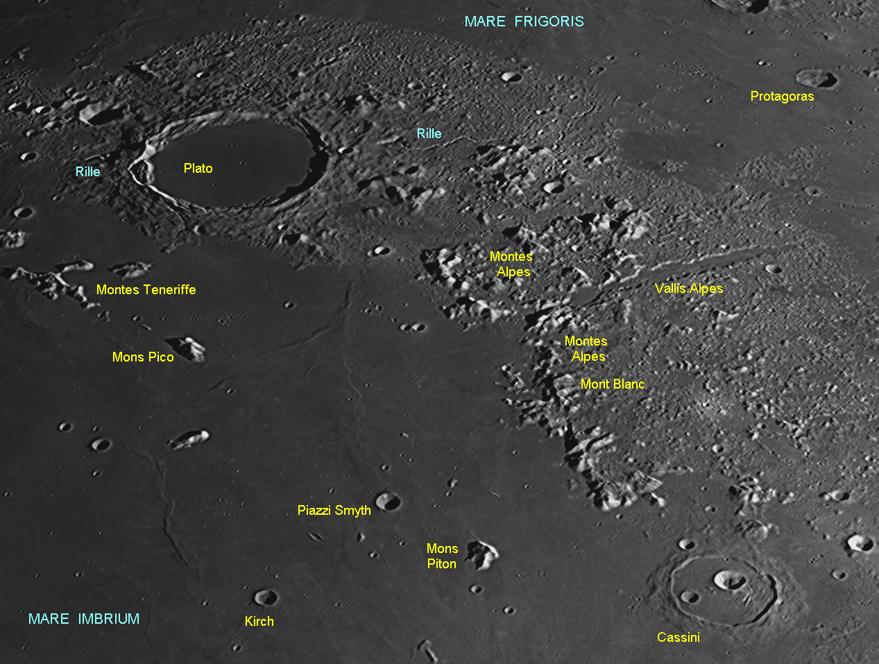
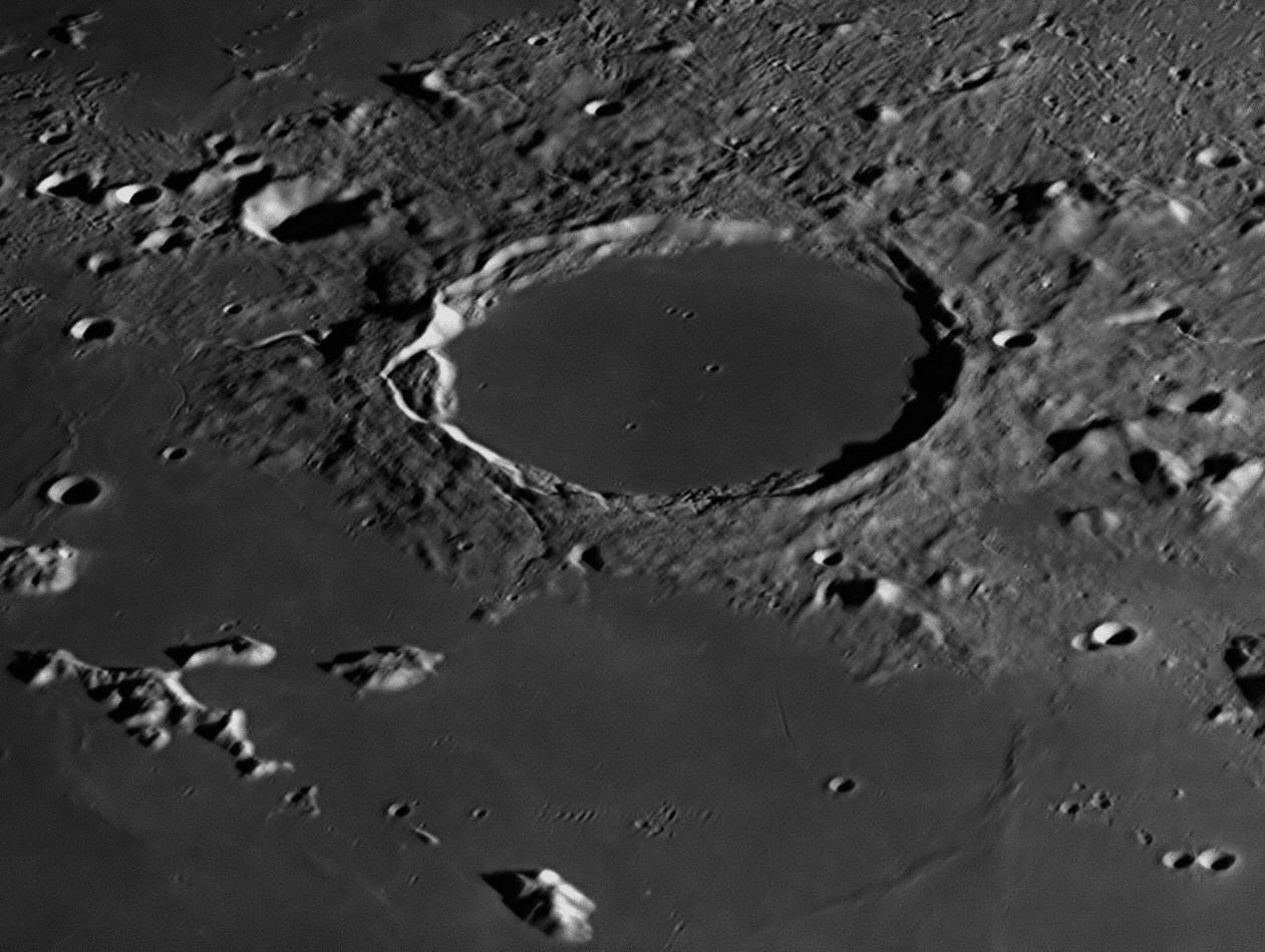
Plato in close-up. Compare this image with the one shown in photograph #11 above, which was taken six months later. In that image, the monthly libration or 'wobble' of the Moon on its axis had brought Plato closer to the centre of the Moon's disc, making it appear less foreshortened and more circular in appearance.
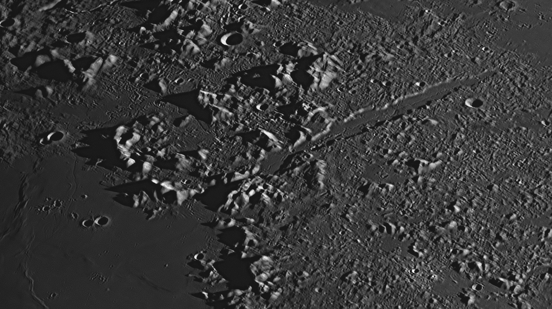
Sunrise over the 166 kilometre long Vallis Alpes (Alpine Valley) on 17 September 2018.
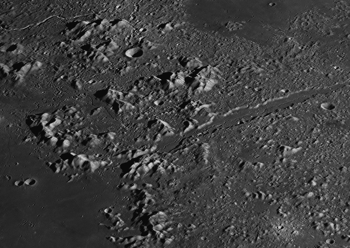
The Vallis Alpes (Alpine Valley) when the Sun was higher in the lunar sky, on 2 August 2017. The valley is 130 kilometres long and is up to 11 kilometres wide. Along its length runs a delicate rille which varies between 500 and 700 metres across, and averages 78 metres deep. Although it looks like a water course, there is no running water on the Moon. It is probably volcanic in origin. Both images above were photographed at Starfield Observatory through the Alluna 20 inch Ritchey Chrétien telescope. The second image is enlarged below.
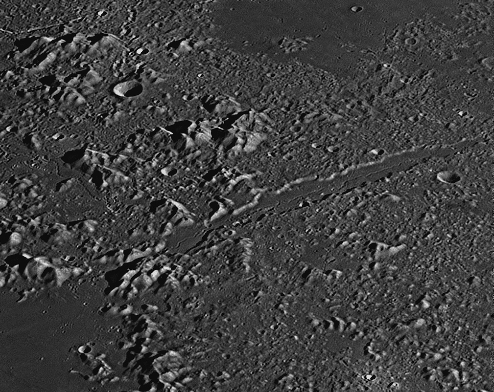
As Riccioli and Grimaldi have given us most of the names of places on the Moon that they could see with their primitive telescope, the darker areas in the pictures above are the Mare Imbrium (Sea of Rains) and the Mare Frigoris (Sea of Cold). The Mare Imbrium is a great circular plain on the Moon, caused by a massive asteroid impact - see "The Imbrium Event" below. All of the seas and the solitary ocean were formed by such impacts and are also dry, cold plains of solidified lava. The terrae around them are much more ancient and are totally covered with fairly large craters, most overlapping older craters, but the Seas are more recent, and show fewer large craters, although they also are peppered with thousands of craterlets.
The impact of asteroids, meteoroids, rocks, and micrometeoroids with the Moon’s surface over the eons has left it covered with a thick layer of dust, soil and shattered rocks. This layer averages 4 to 5 metres deep over the maria, but can be up to 30 metres deep in the valleys of the ancient highlands or terrae. This layer is called the regolith. The dusty upper surface is fine and powdery, like talcum powder, and holds astronaut’s bootprints very well. The Apollo 16 astronauts landed near the crater Descartes, at a small recent crater with rays, called North Ray Crater. The regolith near this crater was found to be only a few centimetres thick. Many samples of the regolith have been brought to Earth for analysis. Those from sites on maria are generally rock fragments o f basalt, with pyroxene and plagioclase. Those from highland sites are mainly broken plagioclase rocks and crystals.
Beneath the regolith of the maria there is a layer of basalt, averaging 20 kilometres deep, formed when the initial asteroid fractured the surface down to a depth of 60 kilometres, to the Moon's mantle. These fractures released pressure on the superheated rocks in the top layers of the mantle. They immediately liquefied into molten basaltic magma which forced its way to the surface and spread out over the landscape as lava, swamping or partially swamping existing craters and mountains, and spreading out over thousands of square kilometres. The lava cooled and hardened to form the "seas" that are such a notable feature of our side of the Moon.
In the pictures above, the lava has covered the bases of the Teneriffe Mountains, Mount Pico and Mount Piton to a great depth, although their lofty peaks protrude above the plain of Mare Imbrium. The crater Plato was caused not long after the Imbrium Event, but just south of Plato can be seen the faint outline of a similar but slightly larger crater, that was completely submerged under the lava except for some of the ramparts of its wall which were high enough not to be swamped - these ramparts are now called the Teneriffe Mountains (1.4 kilometres high) and Mount Pico (2.4 kilometres high).
Three impact craters on Mare Imbrium of more recent origin are Piazzi Smyth (22 kilometres), Kirch (12 kilometres) and spectacular Cassini (60 kilometres).
Between Mare Imbrium and Mare Frigoris (Sea of Cold) is a rough chain of lofty mountains, trending from north-west to south-east. Johannes Hevelius called this mountainous area the "Montes Alpes", and Riccioli named it the "Terra Grandinis (High Land"). This was one case where the name given by Hevelius was preferred over Riccioli's alternative, and the range is usually known simply as the Alps. Its highest mountain is Mont Blanc (White Mountain) and is 3.6 kilometres high.
The Alps are divided in two by a straight valley called the Vallis Alpes (Alpine Valley). It is 134 kilometres long and is a linear fault or graben that was filled with lava. Along its length runs a delicate rille that is shown in the picture above and on our Gallery webpage.
The Imbrium Event
The Moon and planets coalesced out of debris in the solar proto-nebula about 4.6 billion years ago. Most of the craters on the Moon were formed early in its history, during the first 500 million years. At that time, there was a lot of solid material in orbit around the Sun, and the planets attracted much of it to themselves by their own gravity. There were major collisions of asteroid-sized rocks with all the rocky planets and moons, and they still show the scars. Earth, despite the effects of weather and erosion, still has some large impact craters or astroblemes, two in Australia being Wolfe Creek Crater and Gosse’s Bluff.
After the main bombardment had ended, most of the Moon was covered in craters overlapping each other. The south polar region of the Moon and the far side still have this appearance. Some large asteroids later struck our side of the Moon, the huge impact craters being filled with lava which produced the large, dark-coloured level area which give the Moon its patchy appearance to the naked eye. Early astronomers thought that the dark areas were water, and in the 17th century the Jesuit astronomers Grimaldi and Riccioli, working with primitive telescopes, named them, giving us 3 marshes, 17 lakes, 11 bays, 20 seas and one ocean. Of course, there is not one drop of liquid water on the Moon - all of the dark areas are plains of cooled lava.
The final large asteroid collided with the Moon about 3.85 billion years ago. We don’t know its size, but it was probably half as big as Tasmania. It struck the northern hemisphere, blasting out a crater over 800 kilometres across. Magma immediately rose from the Moon’s mantle through fractures in the crust and flooded out across the surface, swamping the destroyed area with great lava flows which filled the floor of the great new crater. This cataclysm is known as the 'Imbrium Event'.
The circular area resulting from this gigantic blast is known to us today as the Mare Imbrium, the Sea of Rains. The area is circled by great mountain ranges, the Alps, the Caucasus, the Apennines and the Carpathian Mountains, which are in fact the original ramparts of the impact crater. Because of its l ocation halfway between the Moon's equator and its north pole, it appears foreshortened to us, looking oval in shape. Protruding from the lava floor of Mare Imbrium are isolated mountain peaks, such as Pico and Piton. Their bases are kilometres below the Mare surface. As different flows of lava occurred, ripples in the surface were caused, which are visible today as wrinkle ridges.
Some craters were formed after the initial lava flows had solidified, and then partially or completely flooded by later flows. These are called ghost craters. When the initial Imbrium Event occurred, large blocks of rock the size of mountains were sent crashing for hundreds of kilometres across the lunar surface, particularly heading south-south-east. These caused lines of smaller crate5s and great longitudinal scars to be formed as the blocks bounced along, all of this damage radiating from the centre of the Imbrium Event impact site. Most of these scars are seen in the area north, north-west and north-east of the central crater Ptolemæus.
Since those
times, new craters have been formed on what was once the level, smooth Mare
Imbrium. We can see some in the pictures above. One large later collision
occurred at the northern edge of the Mare, creating the crater Plato. This was
severe enough to fracture the crust and allow lava to well up and almost fill
the crater, so that instead of being bowl-shaped it has a flat floor at about
the same level as the nearby Mare. Being made of the same basaltic lava, the
floor is the same dark grey colour as the Mare, while the surrounding mountains
are much lighter in tone.
13: September 2017
This month we examine an unusual escarpment in the Moon's southern hemisphere,
the Rupes Recta or "Straight Wall", and see how lunar surface
features can change their appearance according to their illumination
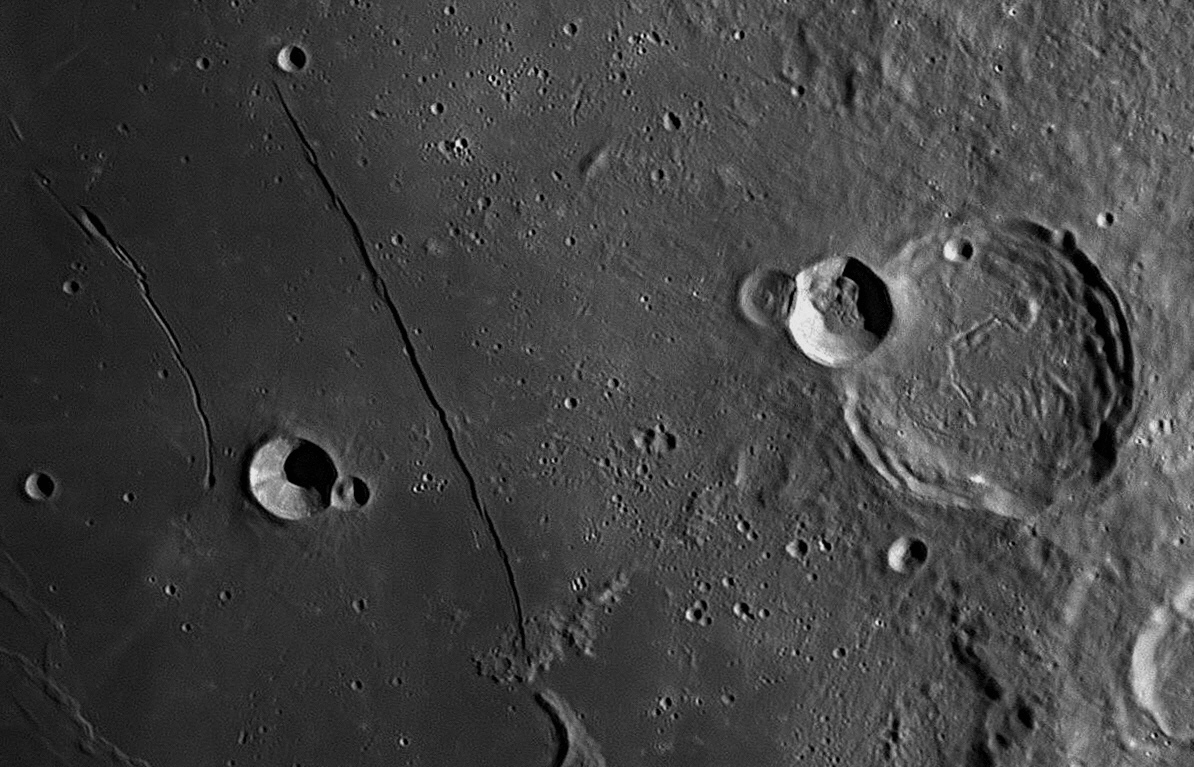

The Rupes Recta or Straight Wall is a fault scarp in the Mare
Nubium (Sea of Clouds), between the small crater Birt and the larger
crater
Thebit. The Wall or cliff is 114 kilometres long, and the eastern (right)
side varies between 240 and 300 metres higher than the western side. The view at
top was taken when the Moon was just after First Quarter, with the light coming
from the Sun rising in the east (to the right). This caused the Wall itself to
be in shadow, appearing as a dark line. The second view was taken when the Moon
was just before Last Quarter, with the light coming from the Sun setting in the
west (to the left). This caused the Wall itself to be illuminated, appearing as
a bright line. All features on the Moon present widely varying aspects depending
on the angle of illumination.
Despite its appearance under a low Sun as above, the Wall is neither particularly high nor steep. The slope is actually quite gentle, some sources quoting it as being as little as seven degrees. It can be detected with quite a small telescope.
To the west (left) of the Wall, is the 17 kilometre crater Birt, the eastern rim of which is deformed by the later impact that created 6.8 kilometre Birt A. Starting in a craterlet just to the west of Birt is a curved valley or rille called Rima Birt, which is 51 kilometres long and turns towards the north-west before fading out. It has a gap in its middle and a slight S-bend.
The large crater to the right of the image is 60 kilometre Thebit. It has
a rille on its floor which is unusual in that it is composed of four straight
sections joined at abrupt angles, almost like half of a hexagon. Most rilles are
sinuous. Thebit A (20 kilometres) has deformed the western rim of the
larger crater, and is itself deformed by Thebit L (12 kilometres). In
Thebit A quantities of soil and rocks have slumped down the walls and covered
much of the floor.
Birt
William Radcliffe Birt (1804-1881) was an English amateur astronomer who
worked extensively with Sir John Herschel in the middle of the 19th century. He
was connected with the Kew Observatory in London. Mainly interested in
meteorology and atmospheric phenomena, he was also very interested in mapping
the Moon. The crater Birt was named after him by Schmidt in 1878.
Thebit
The crater Thebit is named after Thabit ibn Qurra (AD 826 to AD 901). Thabit was born in Assyria (Turkey) but moved to Baghdad which was at the time the greatest seat of Arab learning. It was there that a House of Wisdom had been established in AD 800, for the translation into Arabic of the works of the Greek and Alexandrian philosophers. Thabit was a physician, mathematician, astronomer and translator, and made important discoveries in algebra, geometry and astronomy. He translated Ptolemy's Almagest from its original Greek into Arabic, and made corrections to Ptolemy's work where he thought they were needed. For example, Ptolemy had described Hipparchus' discovery of Precession of the Equinoxes, but Thabit and others saw that there was an irregularity in the precession, a slow wobble which varied back and forth over an average, causing planetary tables to need constant correction. Thabit described this wobble in his De motu octavae sphaerae (On the motion of the eighth sphere), the eighth sphere being the sphere of 'fixed' stars.
To account for this irregularity, which was later called Trepidation(unease), later astronomers sometimes added an extra crystalline sphere between the sphere of precession and the Primum Mobile. They named this new sphere ‘Trepidationis’. Not until 1728 was it found that this irregularity is caused by a small 18.6-year swaying of the Earth’s axis called nutation, which is superimposed upon the large 26 000-year swing of 46.87º diameter that causes precession of the equinoxes. In comparison with precession, the wobble in nutation is very tiny, with maximum variations of ±17 arcseconds in longitude and ± 9 arcseconds in obliquity. Although many astronomers did not think that this minuscule movement warranted the inclusion of a Trepidationis Sphere, the map-maker Andreas Cellarius believed that it did in his star atlas Harmonia Macrocosmica of 1660.
Copies of Thabit's version of the Almagest were carried to Spain by the Moors, and one was used at the Toledo School of Translators by Gerard of Cremona in the 12th century when he was given the task of translating the Arabic Almagest into Latin for dissemination into Europe. The translation of such ancient Greek texts (at first by means of the Arabic versions) provided the stimulus for the ending of the Dark Ages in Europe. By the 14th century, when the original Greek versions of the ancient texts were rediscovered at Constantinople, their translation into Latin helped bring about the Renaissance.
14: October 2017
This month's features are a pair of craters in the Moon's southern hemisphere, Pitatus and Hesiodus.
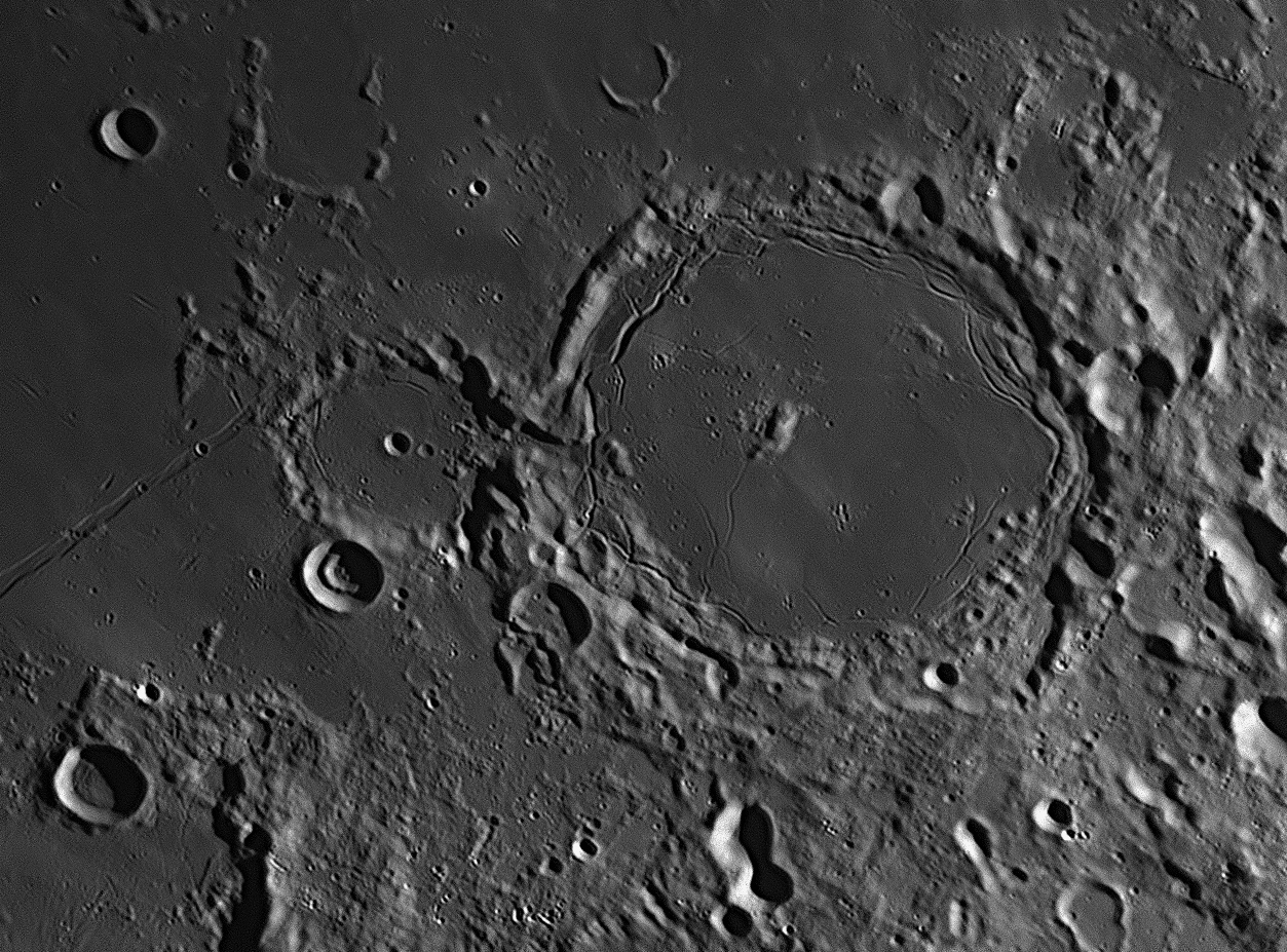
The
largest crater in this image is Pitatus which is 100 kilometres in
diameter. To its west (left) is its 44 kilometre diameter neighbour
Hesiodus.
North is to the top, and east (where the Sun is rising) is to the right.
Both of these craters have flat floors with multiple rilles around their circumferences. Pitatus has an off-centre mountain massif on its floor, while that of Hesiodus has two newer impact craters, both bowl-shaped. There is an unusual valley joining the floors of Pitatus and Hesiodus. A 12 kilometre 'ghost crater', partially submerged by the lava flows from the north, is about 30 kilometres north of Pitatus, with another to the west. From the western ramparts of Hesiodus, the 309 kilometre long rille called Rima Hesiodus runs to the south-west and off the image. There are three craterlets visible on this narrow and shallow valley. They are so well-aligned on the rille that they are probably volcanic vents associated with the creation of the rille. It is unlikely that random impacts from space could have landed together exactly on the rille.
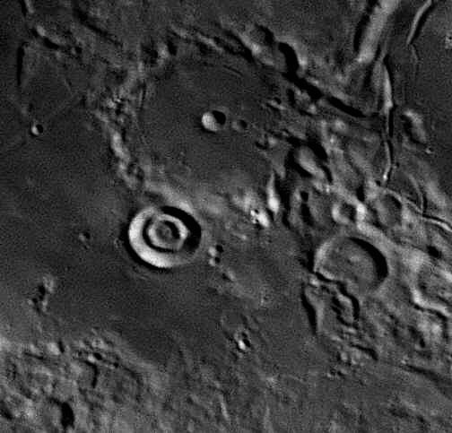
This image shows the crater Hesiodus (above centre) when the Sun was higher,
reducing the shadows and flattening the contrast. Adjoining Hesiodus to the
south-south-west is the 15 kilometre crater Hesiodus A. This crater
is remarkable in that it contains two concentric rings like a bulls-eye. The
rings only become visible when the Sun is high enough to shine over the steep
walls and illuminate them. The picture was taken on September 2, 2017. The rings
are only partially visible in the larger picture above, which was taken on
August 2, 2017.
Pitatus is named after
Pietro Pitati, a 16th century Italian mathematician and astronomer. As the
Julian calendar of his time had become out of phase with the seasons and was
then running 10 days late, some form of calendar reform was required. Pitati
suggested that three out of every four even-century years be made non-leap-years
to keep the calendar true. The man who corrected the calendar in one bold step
four decades later in 1582, Christoph Clavius, accepted this suggestion,
declaring that the even century years 1600, 2000, 2400 etc should remain as
leap-years, but the intervening even centuries (1700, 1800, 1900, 2100 etc)
should not. This avoided any more accumulating errors. To remedy the existing
10-day lag, Clavius dropped 10 days from the Julian Calendar. Pope Gregory
XIII ratified this, and the day after Thursday, October 4, 1582 was
decreed to be Friday, October 15, 1582. This was the beginning of the Gregorian
Calendar which we use today. Catholic countries complied immediately, but others
were slower to act. Great Britain and her colonies did not adopt it until 1752,
and Turkey was the last in 1926.
Hesiodus
Hesiodus is named after
Hesiod, an ancient Greek poet who was active in the 8th century BCE and was
a contemporary of Homer. Hesiod is a major source for our knowledge of Greek
mythology, religious customs, agriculture, early astronomy and time-keeping.
Some call him the world's first economist.
15: November 2017
This month features one of the most spectacular ranges of mountains on the Moon,
the Montes Apenninus, or
Apennine Mountains.
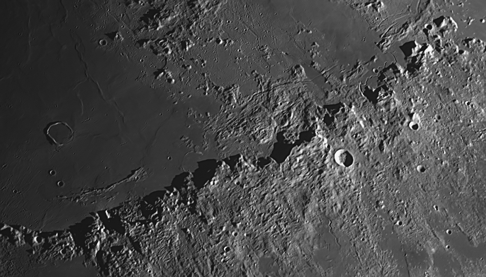
Sunrise on the Montes Apenninus on the Moon, photographed from Nambour on May 20, 2021. Hadley Rille, where the Apollo 15 astronauts landed, is near the upper right-hand corner (see item #36 below). North is to the top, and east (where the Sun is rising) is to the right.
A contemporaneous observer, Johannes
Hevelius, had already named this line of mountains after the Apennine Range in
Italy, and an adjoining range to the north after the Alps. Although the Alps are
not shown in the image above, they can be seen in image
#12 above. Hevelius in fact named all the most
prominent lunar features after well-known places on the Earth. For example, on
his maps of the Moon you will find the Mediterranean Sea with the islands of
Sicily, Sardinia, Corsica and Majorca, and a large crater (Copernicus) named Mt
Etna. People thought that this was a confusing idea and his system of names
failed to win popularity. When Riccioli produced his new nomenclature a few
years later, in which craters were named after famous and historic people, the
names given by Hevelius were superseded by Riccioli's. But these two ranges were
exceptions - later observers preferred to keep the Moon's Alps and Apennines. Both of those ranges form the eastern rim
of Mare Imbrium, a great circular 'sea' on the Moon - although it looks
oval from Earth - that was caused by the tremendous impact of a large asteroid
(see #12
The Montes Apenninus or Apennine Mountains is a range of peaks in
the Moon's northern hemisphere at about latitude 20º North. It forms a gentle
curve on the south-east margin of Mare Imbrium (Sea of Rains), and is just a few
kilometres short of being 1000 kilometres long. Some of the peaks reach up 5.4
kilometres above their bases on the lava plain to the north. The Jesuit priest
who named most of the features on the Moon, Riccioli, named the range "Terra
Nivium" (Land of Snows), and the picture above shows that at lunar sunrise the
peaks can have the appearance of being snow-capped.
16: December 2017
This month we will look at a cluster of volcanoes on the
Moon, near the crater Hortensius.
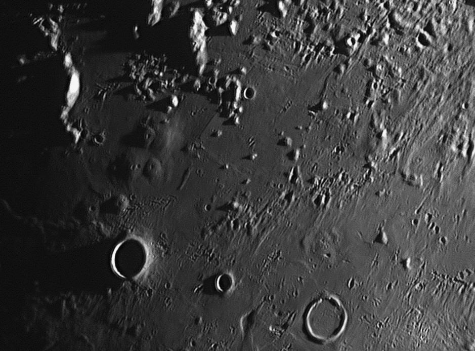
The crater Hortensius is the large crater filled with shadow towards the lower left-hand corner of the image. It is 15 kilometres in diameter. A crater of a similar size, Hortensius E, is near the southern (bottom) margin, just right of centre. Molten lava flowing across the Moon's surface has breached the north wall of Hortensius E and has flooded the interior, almost filling it up and creating a flat floor.
The mountains in the northern (upper) part of the image form the southern ramparts of the Mare Imbrium, or Sea of Rains. They are called the Montes Carpatus or Carpathian Mountains. Like all the mountains found around the border of the Mare, they were formed during the Imbrium Event, a major collision when a large asteroid struck the Moon's northern hemisphere 3.8 billion years ago. A much later impact struck just off the image's top right-hand corner, creating the crater Copernicus (see item
#8 above).
There is a fine cluster of
six volcanoes, most with vents at their summits, just north of the
crater Hortensius. They are seen to be domes averaging 8 to 12 kilometres
in diameter, but very low for their size, having heights ranging between 300 and
400 metres. The image includes at least four other volcanic domes apart from
those in the cluster, scattered around the image. Can you find them ?
North is to the top, and east (where the Sun is rising) is to the right.
The photograph was taken at Starfield on 2 August, 2017.

This second image was taken at 6:58 pm on 20 June 2021. The Sun was higher in the Moon's sky, and has illuminated more features to the west of those in the first image. Another impact crater has come into view, near the upper left-hand corner. This crater is Milichius, 13 kilometres in diameter. 26 kilometres to the west of Milichius is a prominent volcanic dome, larger than any in the Hortensius cluster. Called Milichius P1, it stands isolated on the lava plain, and is about 10 kilometres across the base. On its summit is a deep, circular volcanic crater, about one kilometre in diameter. Like the Hortensius volcanoes, this one appears to be extinct. Between Milichius and the crater T. Mayer which lies about 170 kilometres north and off this image, can be found dozens of volcanic domes, (see item
#60 below.)Ever since people began to look at the Moon through
telescopes, they have wondered about the myriads of circular indentations which
are found all over its surface. Some of these are very large, over 200
kilometres in diameter. Many are in the range of 50 to 150 kilometres across,
and can be seen with even a very small telescope. There are thousands in the
range of 10 to 50 kilometres, and even the areas of the Moon that look
reasonably flat and featureless are themselves peppered with depressions down to
a few metres across, covering every part of the surface.
The first people to make maps of the Moon thought that these hollowed-out
features were rings of mountains, or possibly volcanoes. In the early 1660s
there was an English scientist Robert Hooke, a man who always thought 'outside
the square' and who with Christopher Wren rebuilt the City of London in seven
years after the Great Fire of 1666 destroyed it. Robert felt that the Moon might
have been hot and soft in the past, and bombarded by large rocks flying through
space. In 1664 he experimented with this theory by dropping lead balls into
softened pipeclay, to see if the circular depressions on the Moon were formed by
impacts. Though encouraged by the results, he felt that the impact theory could
not be feasible, as the Moon looked quite hard, not soft like pipeclay, and he
was not aware of any flying objects in space that might collide with the Moon.
The discovery of asteroids was still 136 years in the future.
He boiled gypsum alabaster in pans (melting point ≈150º C), and when it cooled
the surface was covered with circular pits like those on the Moon. He therefore
decided that the circular depressions could be made by bubbles of gas welling up
in the past from inside a hot and molten Moon, then bursting and quickly cooling
and hardening. These would leave cup-like depressions with raised rims. On the
other hand, they could indeed be volcanic vents like similar ones on Earth. He
described these experiments in the final six pages of his book, Micrographia
of 1665. His ideas were thought to be feasible up until about sixty years ago.
High resolution photographs of the Moon taken by satellites in lunar orbits have
shown that most of the craters are indeed caused by impacts. The name 'crater'
(Latin for 'cup') was given to these depressions by Johann Hieronymus Schröter
in his book of lunar drawings published in 1791. Yet there are also many
volcanoes on the Moon. Most are in the form of low domes, less than 500 metres
high, but distinguished from other hills by their circular shape and the
presence of one or more volcanic vents at the summits. There are several hundred
on the near side of the Moon, dotted all over the surface but usually in
clusters. The cluster shown above is one of the best, with another two clusters
not far away to the north-west, one group near the crater Milichius and another
near the crater Tobias Mayer.
The best time to observe these domes is when they are close to the terminator
(the sunrise or sunset line). At such times the angle of sunlight is very small,
i.e. the Sun is just rising above the Moon's horizon. This produces shadows
which reveal the elevated nature of the domes, which are generally less than 500
metres high. As the Sun rises over the Moon, the shadows diminish and soon
disappear entirely, the only remaining features to be observed being the tiny
crater vents at the top of most of them. These vents rarely exceed 1000 metres
in diameter.
Other examples of lunar vulcanism are the ash volcanoes in which dark ash has
been ejected from vents found in fractures or clefts in crater floors, where the
ash does not build up into a dome but instead makes a dark halo around the vent.
The best examples of these are the ten found in the crater Alphonsus. Many other
craters such as Atlas, Sulpicius Gallus and Gaudibert have large areas showing
pyroclastic activity. The Apollo 17 astronauts landed in the Taurus-Littrow
pyroclastic area.
Although there have been sporadic reports of 'mists', 'clouds', 'obscurations' and 'red glows' associated with these domes, vents and pyroclastic areas, there have been no confirmed observations of current volcanic activity on the Moon.
17: January 2018
This month we will look at the spectacular crater, Posidonius.
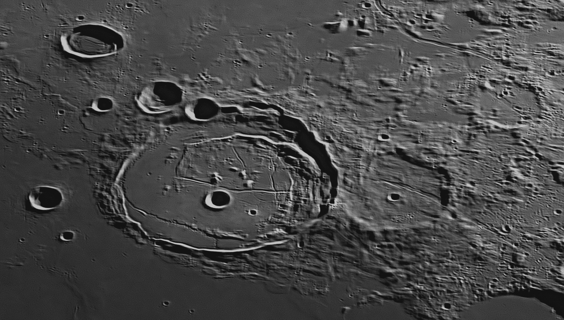
Posidonius is a large impact crater 99 kilometres in diameter in the
Moon's northern hemisphere. The image was taken on 14 August 2021.
During the 150 years before the Christian era, the city of Rhodes on the island
of the same name (off the south-western tip of what is now Turkey) was to some
extent a rival of Alexandria as a centre of literary and intellectual life.
Posidonius of Rhodes (135-51 BCE) believed that the tides are caused by the
Moon, but was, however, wrong about the physics. Thinking that the Moon was a
combination of the elements air and fire, he attributed the tides to the heat of
the Moon, hot enough to cause the water to swell but not hot enough to evaporate
it. He tried to improve on the measurement of the Earth’s circumference by using
the second-brightest star, Canopus. As explained by Cleomedes, Posidonius used
the elevation of Canopus to determine the difference in latitude between Rhodes
and Alexandria, and used the estimated distance between the two cities to
determine his result. Due to observational inaccuracies, possibly caused by
atmospheric refraction (Canopus culminated only little more than one degree
above the southern horizon at Rhodes), his answer was 240 000 stadia (38 400
kilometrs), not quite as good as Eratosthenes’ result.
We can also thank Cleomedes for handing down to us the story of Eratosthenes’
procedure for determining the size of the Earth by measuring noon-time shadows
at widely separated sites, which was described last November and can be read in
item 18: February 2018
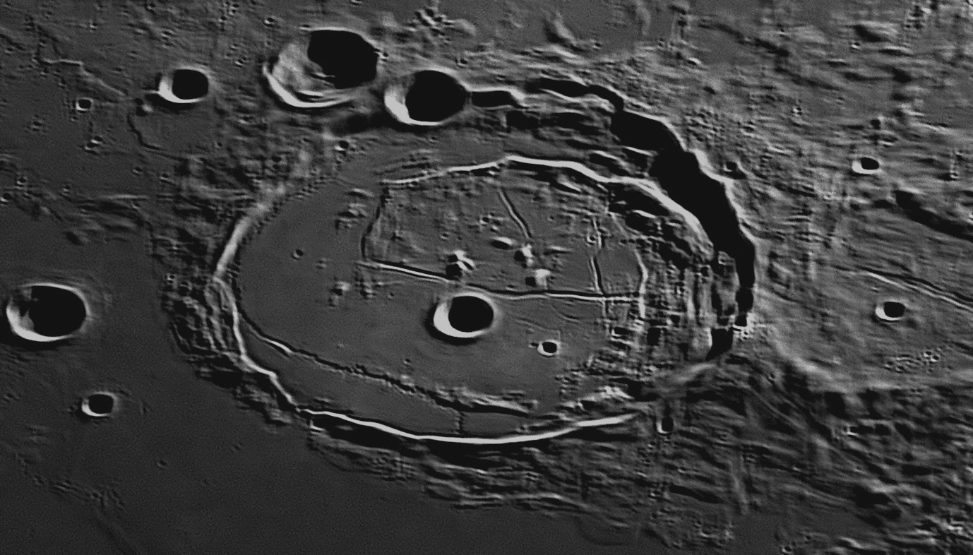

Posidonius is circular in shape, but its position at latitude 32º north
means that, from the Earth, it appears elliptical due to foreshortening. The
level floor is heavily fractured due to tectonic uplift. There is a secondary
rim of mountains in the eastern interior. The largest crater inside Posidonius
has a diameter of 11 km and near it is a fresh 3 km crater and some smaller
craterlets. There are also five volcanic domes inside Posidonius and three more
outside. Of interest is the very sinuous and narrow rille which starts just
inside the northern rim (at left above), and follows the rim to its
north-western curve, where the rille suddenly turns towards the interior and
heads south, aiming for the south-western wall. After reaching a line of hills
it turns abruptly to the right and heads directly to the western wall (lower
margin in the image above), and hugs the base of this wall until it finds a gap
where it exits the crater. Where the wall is breached near the bottom margin,
shadow reveals that the floor of Posidonius is higher than the level of
Mare Serenitatis outside the wall. In its 160 kilometre length, this
rille has over 100 tiny S-bends, making it quite a curiosity. Many of these
small S-bends can be detected in the image above.
Posidonius
This month we will look at the spectacular crater, Tycho.
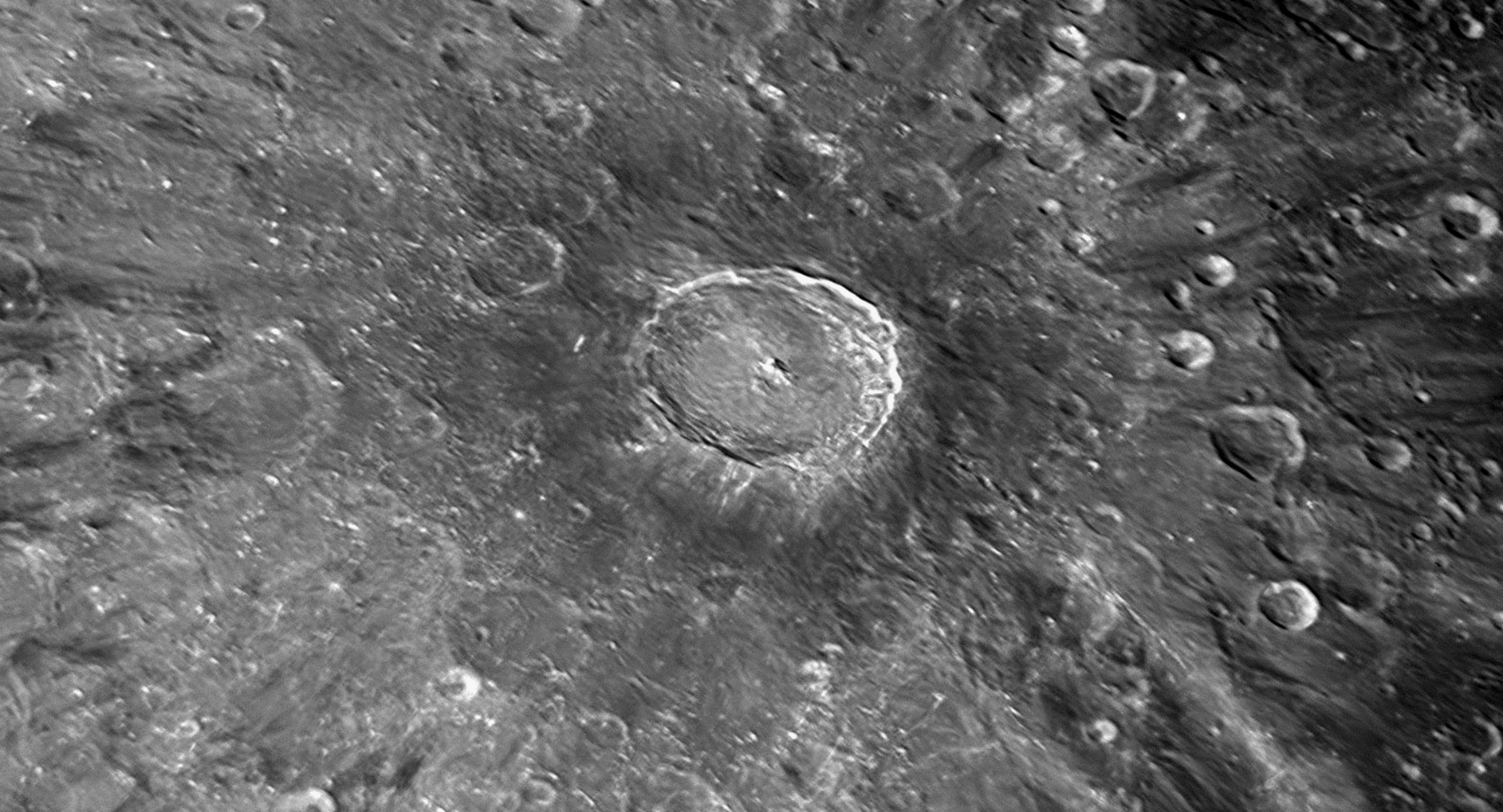
Tycho as it appears one day before Full Moon, showing the dark annulus around it. This wide-angle view shows Tycho to be at the centre of a huge ray system. Photograph taken at 9:49 pm on 25 May 2021.
Ty
Tycho
Between 1580 and 1700, the notion that transparent, solid, crystalline spheres
surrounding the Earth were a physical reality gradually lost ground, and was
largely abandoned by the time of Newton's death in 1727. In the 1580s and 1590s,
this was mainly due to the influence of a Dane, Tycho Brahe (1546-1601,
pronounced ‘Twee-co Brar-hee’,
right), who was the greatest and most accurate observer of the
pre-telescopic era, and a worthy successor to Copernicus. Tycho was first-born
into a noble family in the Danish province of Scania (now at the southern tip of
Sweden), but when he was quite young, a second sibling was born. His father Otto
permitted Tycho to be adopted by his childless Uncle Jørgen and his wife, a move
designed to elevate the boy's ranking in the nobility. Later, In a drunken
incident, Jørgen rescued the King of Denmark Frederik 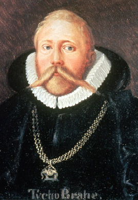
Becoming interested in astronomy as a teenager after seeing a solar eclipse in 1560, Tycho soon found that existing planetary tables were very imprecise. Resolving to remedy this, he built an observatory equipped with quality instruments near his home at Herrevads Abbey in Scania. In 1572 Tycho made an astronomical observation from this observatory that was to change his life. He was well aware of the positions of many stars, but on November 11 he saw a ‘new star’ in the constellation of Cassiopeia, which at its peak was even visible by day and outshone Venus for some weeks. In fact, he was not the first person to see it, but because he studied it in detail, it will always be remembered as ‘Tycho’s Star’.
According to the Ptolemaic theory of cosmology, changes in the sky (such as comets, meteors and clouds) could only occur between the sphere of the Moon and the Earth. Tycho proved that the new star did not change its position against the background stars if charted simultaneously by two observers at different, widely spaced locations, whereas the Moon did. In other words, the new star showed no parallax as the Moon does, so it had to be further away than the Moon. The appearance of the new star (actually, a very old star exploding in its death throes) therefore contradicted the accepted view that the universe from the sphere of the Moon up was unchanging. In the light of this, Tycho began to question the whole validity of the geocentric theories of Ptolemy and Aristotle, and investigated the new Copernican heliocentric theory that had first appeared 30 years earlier. Thrilled by his discovery, Tycho rushed into print with a book describing the phenomenon, De Nova Stella (On the New Star). The book was published within a few months of the discovery, in 1573.
Tycho’s book made his reputation and he moved to Copenhagen in 1574. He was already well known to the Danish royal family, but the new discovery brought generous royal patronage. King Frederik
With the number of visiting astronomers rapidly growing as Uraniborg’s fame spread, the manor soon proved to be inadequate. Also, the outlying observing platforms, some supported by a single pillar, proved to be unstable and prone to deflection by the wind and the movements of observers. Tycho therefore decided to remove his instruments from the elevated platforms and place them at ground level or below ground. He built a new observatory across the road from Uraniborg, and called it ‘Stjerneborg (Castle of the Stars)’. Above the entrance was the motto: “Neither high office nor wealth, only the power of art [science] endures.”
Solid granite formed the foundations and the instruments were mounted on short granite pillars. The smaller instruments were protected by low enclosures with roofs of a much lower profile than those used across the road. Hatches were used which opened the enclosures to the heavens. The work rooms and sleeping quarters were underground. The largest instrument was covered by a large dome, which could be smoothly rotated in any direction. These ideas became the models for other European observatories, as the visiting astronomers carried them back to their homelands.
Tycho rejected all previous observations as dubious, and aimed to ‘reconstruct astronomy’ by personally surveying all heavenly phenomena from scratch. Unlike many other observers, Tycho measured the positions of stars and planets, not just near opposition, but along their whole orbits right around the heavens, to the limit of naked-eye precision. His measurements of the positions of stars and planets were of unprecedented accuracy, being within 2 arcminutes of the correct values. He measured the length of the year to within one second of the modern value. He worked at Uraniborg for 17 years. Among Tycho Brahe’s many results was his proof that a comet was a heavenly body and not an atmospheric phenomenon as some had previously assumed. In addition, he discovered two hitherto unknown anomalies in the movements of the Moon. To assist with his planetary work, by 1592 Tycho had completed a catalogue with the positions and magnitudes of 777 fixed stars. This was the first new star catalogue known in the Latin West since the time of Ptolemy.
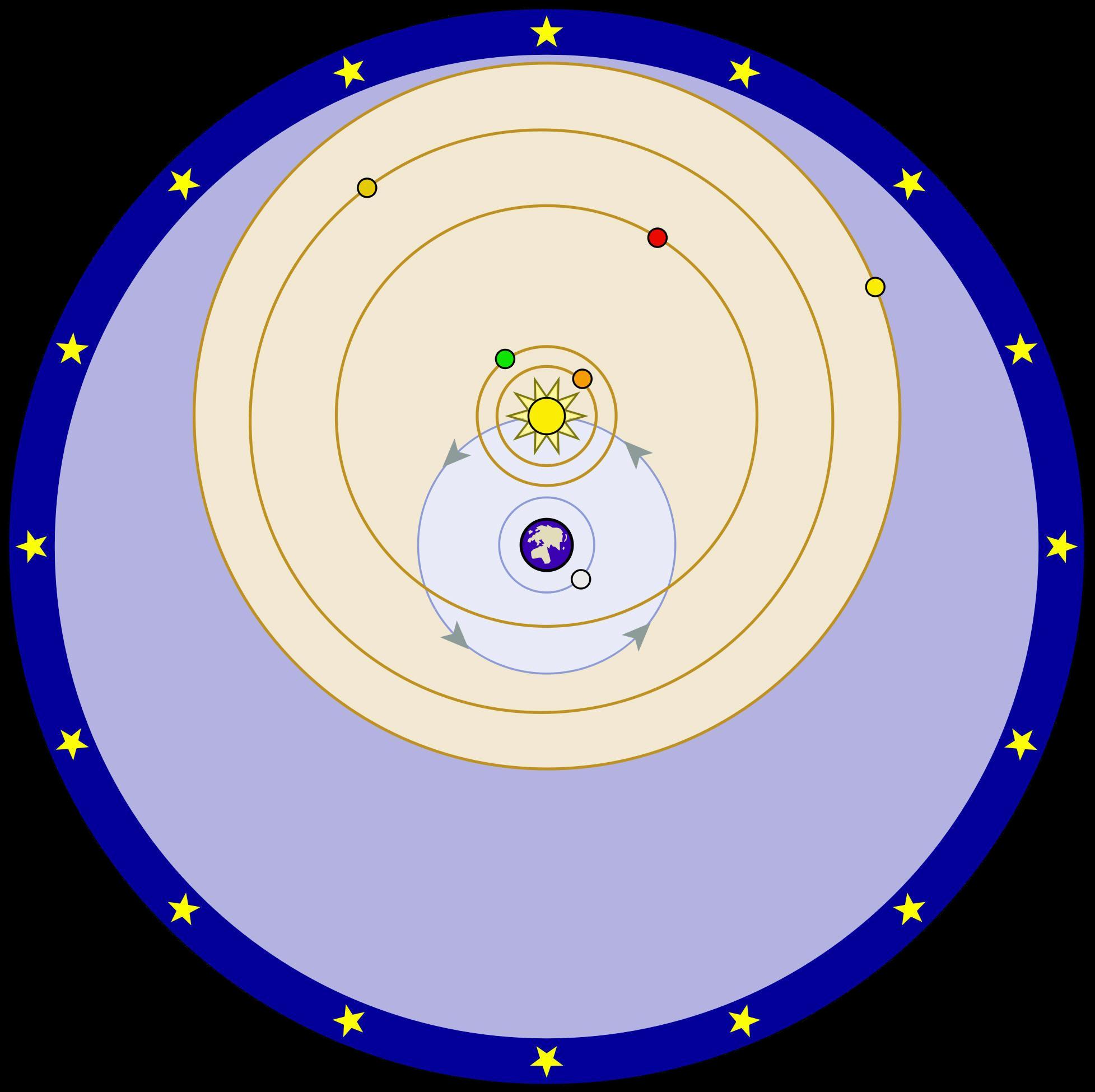 Tycho
studied the Earth-centred universe of Ptolemy and the Sun-centred universe of
Copernicus, but could not fully accept either of them. Instead, he devised a
third version of the universe, which he claimed embodied the best features of
the other two, without their problems. In Tycho's universe, the five planets
Mercury, Venus, Mars, Jupiter and Saturn all circled on their transparent
spheres around the Sun, but the Sun and Moon both circled around the Earth on
their spheres. The Earth, as in Ptolemy's universe, lay fixed and unmoving at
the centre of everything.
Tycho
studied the Earth-centred universe of Ptolemy and the Sun-centred universe of
Copernicus, but could not fully accept either of them. Instead, he devised a
third version of the universe, which he claimed embodied the best features of
the other two, without their problems. In Tycho's universe, the five planets
Mercury, Venus, Mars, Jupiter and Saturn all circled on their transparent
spheres around the Sun, but the Sun and Moon both circled around the Earth on
their spheres. The Earth, as in Ptolemy's universe, lay fixed and unmoving at
the centre of everything.
The "Tychonic Universe" is seen at right. As Tycho knew that Mars came closer to the Earth than the Sun did, its sphere needed to cross inside that of the Sun for part of its orbit. This meant that the spheres could not be solid, as many believed. He proposed that they were made of a "fluid medium" (an amorphous version of Plato's æther or quintessence).
King Frederik
II died in 1588 and his 11-year-old son became King Christiaan IV. The boy King's councillors made life difficult for Tycho, cutting his funding and then his pension. He packed up his instruments and left Denmark in disgust, never to return. He found work at the court of the Holy Roman Emperor Kaiser Rudolph II in Prague as Imperial Mathematician, and was given the job of producing a new, up-to-date almanac to be called the Rudolphine Tables. He enlisted a young Johannes Kepler to assist.The work had barely started when Tycho died unexpectedly after attending a banquet on October 24, 1601. He was only 54 and had been in good health, so the circumstances of his death have always been suspect. Kepler took his post of Imperial Mathematician, and completed the Rudolphine Tables in 1627, using Tycho's data. In doing this work, Kepler discovered his Three Laws of planetary motion.
Tycho is regarded as the greatest naked-eye observer. It is a great shame that
he did not live into old age, as only eight years after his early death the
first telescopes appeared and were turned to the sky, proving that the
Copernican version of the universe was more accurate than either the Ptolemaeic
or the Tychonic.
19: March 2018
This month we will look at the spectacular crater, Langrenus.
This photograph of Langrenus and its environs was taken on September 14,
2018. East is to the top and north is to the left.
Michael Florentius van Langren
(1598-1675), known as Langrenus, made the first Moon map that appears to
us to be fairly accurate, in 1645 (below). He used the names of famous
people to identify the various surface features, and collaborated with Petrus
Plancius in producing terrestrial and celestial globes. His intention in making
detailed Moon maps was an ill-advised attempt to find a way for sailors to
determine their longitude, based on observations of the positions of lunar peaks
and craters. Three of his crater names are still in use: Endymion, Langrenus
(named after himself) and Pythagoras. The rest of his names for lunar features
were superseded by those of Riccioli and Grimaldi within seven years, but they
let him keep the crater which he named after himself, which is illustrated
above.
Somerville
The crater near the centre of the top margin is Somerville, 15 kilometres
in diameter. It is named after Mary Somerville (1780-1872), one of the
most interesting lady scientists in the early 19th century. Born Mary Fairfax,
she was a Scottish science writer and polymath, at a time when women’s
participation in science was not encouraged. She studied mathematics and
astronomy in secret, and was the second woman scientist to receive recognition
in the United Kingdom after Caroline Herschel. She married a cousin, a naval
captain, Samuel Greig, and had two children before he suddenly died three years
later. After his death, the inheritance gave her the freedom to pursue her
intellectual interests. In 1812 she married another cousin, Dr William
Somerville (1771-1860), inspector of the Army Medical Board, who encouraged and
greatly aided her in the study of the physical sciences. They had a further four
children.
During this marriage she made the acquaintance of the most eminent scientific
men of the time, among whom her talents had attracted attention before she had
acquired general fame. Having been requested by Lord Brougham to translate for
the Society for the Diffusion of Useful Knowledge the Mécanique Céleste
of de Laplace, she greatly popularised its content. Its publication in English
in 1831, under the title of The Mechanism of the Heavens, at once
made her famous. She stated, “I translated de Laplace’s work from algebra into
common language.” De Laplace himself told her “There have been only three women
who have understood me. These are yourself Mrs Somerville, Caroline Herschel and
a Mrs Greig of whom I know nothing.” (Of course, Mary Somerville was first
and third of these three.) De Laplace later turned this anecdote against
himself, joking that the only three women who truly understood his theory were
Mary Fairfax, Mary Greig and Mary Somerville.
Her other works are On the Connexion of the Physical Sciences
(1834), Physical Geography (1848), and Molecular and
Microscopic Science
(1869). In 1833 the historian of science William Whewell had devised a new
term for natural philosophers – he called them ‘scientists’ – and his review of
Mary’s 1834 book is the first appearance of that word in print. Slow to be
accepted at first, it was in common use by 1900. Much of the popularity of
Mary’s writings was due to her clear and crisp style and the obvious enthusiasm
for her subjects which pervaded them. In 1835, she and Caroline Herschel became
the first women members of the Royal Astronomical Society, and from that year
she received a pension of £300 per annum from the government. In 1869 she was
awarded the Victoria Medal of the Royal Geographical Society.
She was on convivial terms with many of the astronomers, geographers and
physicists of her time, including William Hyde Wollaston, Charles Babbage,
Admiral Smyth, Lord Rosse, Sir James South, Michael Faraday, John Couch Adams,
the Astronomer Royal George Biddell Airy, Pierre-Simon de Laplace, François
Arago, Alexis Bouvard and Alexander von Humboldt. She was close friends with the
Herschels, and was godmother to and named their daughter Matilda Rose. England’s
greatest landscape artist J. M. W. Turner also regarded her as a much-admired
friend. Mary’s personal recollections of these people and her correspondence
with them were published by her daughter and serve to bring them to life,
revealing them as people in relaxed social settings such as at dinner parties,
rather than at work. With her husband she spent much of her later life in Naples
where she died aged 91. The prestigious private Brisbane High School for Girls
adopted the name ‘Somerville House’ in 1920, in her honour. 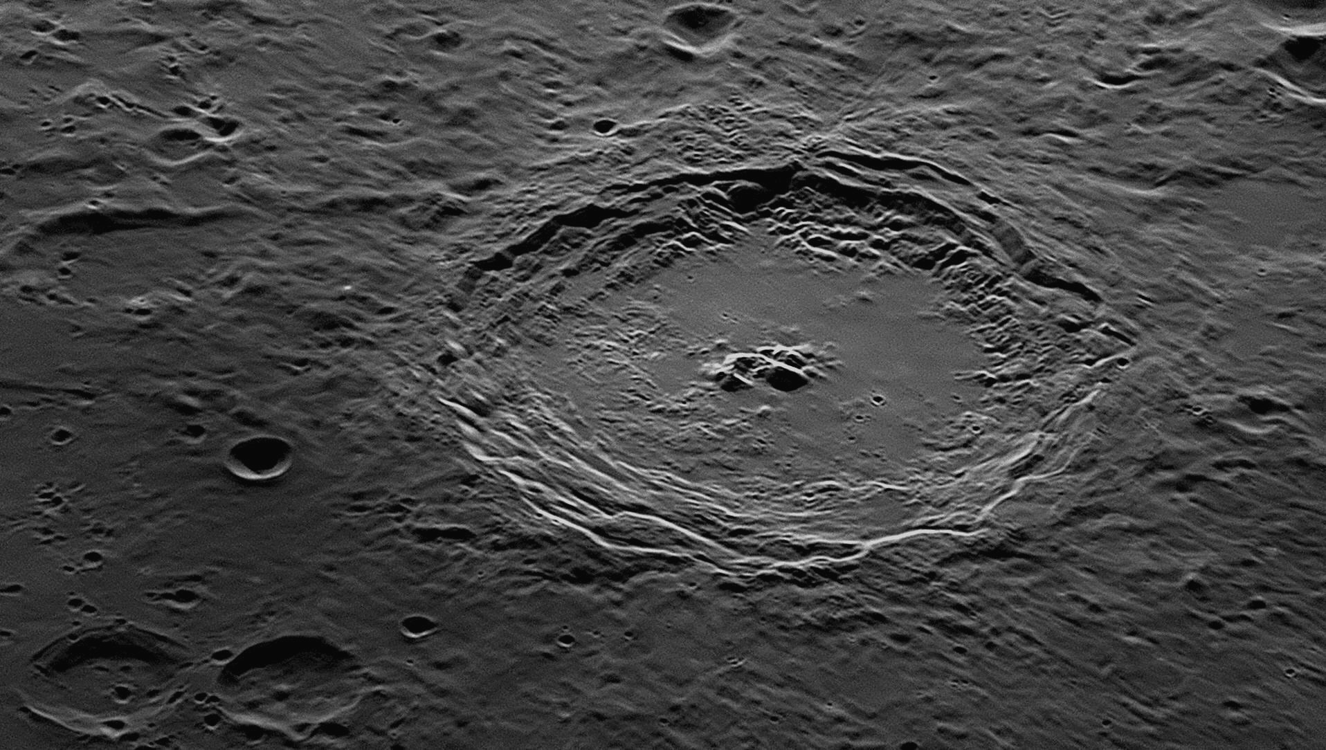
The small crater Somerville is at the top margin, a little to the right
of centre.
Langrenus is the oldest named feature on the Moon, going back to 1645. It is
136 kilometres in diameter, and middle-aged as craters go. In the photograph
above, north is to the left and east is to the top. The Sun is illuminating the
scene from the east. Being near the eastern limb of the Moon, we see Langrenus
and its environs substantially foreshortened. The impactor was probably a small
asteroid, possibly 15 to 25 kilometres across. Moving at a speed of about 20
kilometres per second, it was vaporised on impact, the heat instantaneously
liquifying the Moon's surface at the site and causing a huge blast. The
surroundings of the resulting crater are covered with a layer of liquified rock.
This damage is easily seen in the area immediately surrounding the crater, where
surface features have been covered with rock melt.
The floor of Langrenus is very rough and hilly in the north-western third (to
the left), the rest being reasonably flat. In the centre is the typical cluster
of mountains, being uplifted from the rest of the floor by the impact forces
rebounding off the bedrock. These are only about 1000 metres high. The smallest
craterlet on the floor is less than 1 kilometre in diameter. The walls of
Langrenus have collapsed into terraces which are very much damaged on the
southern side. The slopes down to the terraces are quite steep.
Langrenus
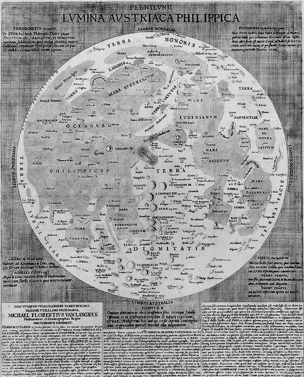
20: April 2018
This month we will look at the unique Sinus Iridum (the Bay of Rainbows).
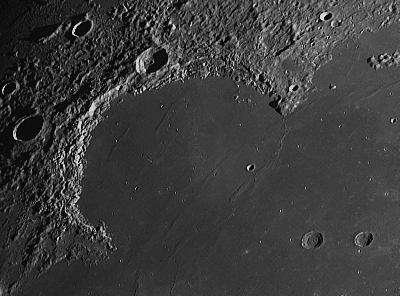
This photograph of the Sinus Iridum (the Bay of Rainbows)
and its environs was taken on December 29, 2017. North is to the top and
east (where the Sun is rising) is to the left. The Bay is a large
semi-circular formation in the north-western part of the Mare Imbrium,
(the Sea of Rains).
The 40 kilometre diameter crater in shadow near the middle of the western
(left-hand) margin is named Sharp. There is a remarkable pair of impact
craters in the south-eastern corner of the image. They are Helicon (left,
26 kilometres across), and Le Verrier (20 kilometres across). Helicon was
a Greek Astronomer who was active around 400 BCE.
Le Verrier
Urbain Le Verrier
The Sinus Iridum or Bay of Rainbows is a very large feature, and
is visible with the smallest telescope. It is bounded on the north-east by the
Promontorium Laplace (Laplace Promontory) and on the south-west by
the Promontorium Heraclides (Heraclides Promontory). The
mountainous western rim of the Bay is called the Montes Jura or Jura
Mountains, named after a range near the Alps, on the border between France
and Switzerland. The Bay is 411 kilometres across. It has been filled with
molten lava from the Imbrium Event about 3.8 billion years ago, which created
the Mare Imbrium. As the lava cooled, waves in its surface solidified and can be
seen in the image above as 'wrinkle ridges', of which there are more than ten.
The Bay was not completely filled, as its surface is about 600 metres lower than
that of the adjoining Mare Imbrium.

It was obvious that there was an unknown eighth planet further out that was affecting the speed of Uranus, and both Leverrier and Adams decided to apply the mathematics of celestial mechanics to find out where the unknown planet needed to be in the sky, in order to cause the observed variations.
Le Verrier publicly announced his final predicted position for Uranus’ unseen perturbing planet to the French Academy on August 31, 1846. Two days later, Adams privately mailed his final solution to the Astronomer Royal, George Airy, at the Royal Observatory, Greenwich. As the solution did not include all the calculations, Airy wrote back to Adams asking for the mathematical proof. Adams went immediately to Greenwich, but Airy was away on a trip to Paris. Adams went again, but Airy refused to interrupt his dinner to see him, telling him to make an appointment. When Airy realised that Le Verrier’s position and that of Adams were both in the same part of the sky, near what is now the boundary of Aquarius with Capricornus, he belatedly asked James Challis, the Plumian Professor of Astronomy and Experimental Philosophy at Cambridge who was also in charge of the Cambridge Observatory, to look for the proposed planet. Challis did so in an offhand manner, but without finding it (Adams’ position was a few degrees off).
At the Paris Observatory, Le Verrier was having difficulty in persuading Arago to put off his current work in order to search the sky in the vicinity of the predicted position of the proposed planet. He knew that Johann Franz Encke had been appointed to the Berliner Sternwarte (Berlin Observatory) after Johann Elert Bode retired in 1825, and Encke, supported by the famous German naturalist and explorer Alexander von Humboldt, had convinced the King of Prussia to equip it with a high-quality 9 inch (240 mm) Fraunhofer refractor. Encke had transferred this superlative instrument to the New Berlin Observatory, which had been commissioned in 1835.
With this in mind, Le Verrier sent the position to Berlin and asked them to take a look. The letter arrived on September 23, 1846, and that evening Encke allowed one of his astronomers Johann Gottfried Galle (1812-1910) and an assistant Heinrich Louis d’Arrest (1822-1875) to conduct a telescopic search with their excellent Fraunhofer telescope.
Within thirty minutes they discovered the new planet within a degree of Le Verrier’s prediction. It was low in the south, only 1.3º from Saturn. Galle immediately wrote to Le Verrier, “Monsieur, the planet of which you indicated the position really exists.” Le Verrier replied, “I thank you for the alacrity with which you applied my instructions. We are thereby, thanks to you, definitely in possession of a new world.” Neptune was the first planet found by mathematical calculation rather than by visual observation. A chagrined François Arago, who had thought he was too busy to conduct a search, responded to the discovery with these generous words: “Le Verrier is the man who discovered a planet by the point of his pen.” When Arago died in 1853, Le Verrier became Director of the Paris Observatory, a post he held for 24 years until his own death in 1877.
When the discovery became known in England, there was a great public outcry, and Airy was heavily criticised, being accused of lethargy, procrastination or worse, hubris. He tried to make a case of priority for Adams, partly through regret at his missed opportunity. Challis was embarrassed to learn that he had observed Neptune three times in his search, but had not taken enough care, and thought it was a star. To make some amends, Adams was awarded the Copley Medal by the Royal Society in 1848. When Challis resigned from the Cambridge Observatory in 1861, his post was given to John Couch Adams. Though the aspect of priority remained contentious, the discovery of Neptune was a sensational moment of nineteenth century science, and dramatic confirmation of Newton’s theory of gravitation. Today, the credit for Neptune’s discovery is shared equally among Le Verrier, Adams and Galle. Le Verrier had the honour of naming it. Neptune’s moon Triton was found seventeen days later by the wealthy English amateur astronomer William Lassell, who was a friend of John Herschel, but none of the planet’s other twelve moons was seen until the mid-twentieth century.
In recent years we have found that Galileo observed Neptune when it was close to Jupiter on December 28, 1612 and again a month later on January 27, 1613. On both occasions he was concentrating on Jupiter and its satellites, and recorded Neptune as a fixed star. Both planets were near the star Porrima in Virgo. On each occasion the two planets were less than 15 arcminutes apart, and able to both be squeezed into his telescope’s restricted field of view together. If he had been fortunate enough to look between those two dates, during the pre-dawn hours of Friday, January 4, 1613, he would have had the chance to see a very rare event, the end of an occultation of Neptune by Jupiter. The occultation began at 6:32 pm on January 3, 1613, but both planets were below Galileo’s horizon until 10:52 pm. At 4:01 am on January 4, Neptune began to emerge from behind its large neighbour, and was in full view by 4:39 am. Sunrise occurred at 7:51 am. In 2009, Jupiter and Neptune were together once more, but this time near the border of Capricornus and Aquarius. Neptune is now near the same position as it was when discovered. With an orbital period of 60 190 days, or 164.79 years, on July 7, 2011 Neptune completed one full orbit since its discovery. In the same period, Jupiter completed 14 orbits.
Key to features 21 to 30 below.
This month we will look at the fractured area around the craters Hyginus and Triesnecker.
At top centre is the
10 km wide crater
Hyginus. Its northern wall is deformed by a 4 km wide smaller crater.
A long rille passes through it. This area of the Moon shows numerous clefts,
extending south past the crater Triesnecker at lower centre. North is at
the top, east to the right. The photograph was taken on November 16, 2018.
At top centre is the 6 kilometre wide crater Hyginus. Its northern wall
is deformed by a 2 kilometre wide smaller crater. Passing through Hyginus is a
notable valley or rille, 226 kilometres long, rather disjointed in outline,
appearing in places to be made up of chains of collapse craterlets (see also #42
below). Franz Triesnecker (1745-1817) was an Austrian Jesuit
mathematician and astronomer who published a number of treatises on astronomy
and geography. Much of his work was in making measurements of celestial bodies
at the Vienna Observatory, which were published from 1787 until 1806.
Hyginus
During the medieval period in Europe, interest grew in the stories of Greek
mythology, and the Poeticon astronomicon was rediscovered. The
illustration at right is from a hand-written copy that was translated into Latin
in Italy in AD 1475. It shows the obsolete constellation Argo Navis (the name ‘Argo’
can be seen in the upper-right-hand corner). The engraver has depicted a
stylised fifteenth century ship of his own time, not one of Hyginus’ time. The
star positions are fanciful. The Poeticon astronomicon was not formally published
using the movable-type printing technology invented by Johannes Gutenberg until
1482 by Erhard Ratdolt in Venice. This edition carried the full title
Clarissimi uiri Hyginii Poeticon astronomicon opus utilissimum. Ratdolt
commissioned a series of woodcuts depicting the constellations to accompany
Hyginus’ text.
As with many other star atlases that would follow it, the
positions of various stars were indicated overlaid on the image of each
constellation. Also available as hand-coloured copies, Ratdolt’s version was
quite popular and was re-issued a number of times. Unfortunately, the relative
positions of the stars in the woodcuts bear little resemblance to the
descriptions given by Hyginus in the text or the actual positions of the stars
in the sky. Though this approach was typical at the time, it would soon end, as
scholars and sailors demanded more accurate star maps and constellation
pictures.
The northern constellation of Cassiopeia in the Ratdolt edition
is shown at left. As a result of the inaccuracy of the depicted star positions
and the fact that the constellations are not shown within any context (such as
neighbouring or adjoining constellations, the celestial equator, poles or
ecliptic), the Poeticon astronomicon is not particularly useful as a
guide to the night sky. However, the book is of historic value as the
illustrations commissioned by Ratdolt served as patterns for future sky atlas
renderings of the constellation figures and pictures. Even more significant,
along with the writings of Eratosthenes, the text is an important source, and
occasionally the only source, for some of the more obscure Greek myths.
22: June 2018
This month we will look at the crater Archimedes.
Close-up of Archimedes, 85 km in diameter. The smallest craterlets inside
it are less than 1 km in diameter. North is to the top, east (where the Sun is
rising) is to the right. The photograph was taken from Nambour at 8:14 pm on
August 2, 2017.
There are well over 40 craterlets visible on the floor of Archimedes in the
image above. The two largest craterlets are 3 kilometres across - one is close
to the western (left) wall, and the other is adjacent to the eastern wall. On
the outside of the wall in the south and south-west may be found two chains of
tiny 1 kilometre wide craterlets, six in one and five in the other.
Clearly visible are light-coloured streaks of debris deposited horizontally
across this entire image by the blast that created the impact crater
Autolycus, which is located 100 kilometres to the east of Archimedes, off
this image. South-west of Archimedes is a 14 kilometre impact crater named
Bancroft. South-east of Archimedes is a similarly-sized crater, Spurr, but it is
much older, and when the Mare Imbrium was formed, lava flows swept over it,
completely demolishing the northern ramparts and flooding the interior. Only the
southern wall survives, and it is what we call a 'ghost crater'. Around
Archimedes are some other craters and a few isolated mountain peaks. To its
south and north-east are rugged mountainous areas.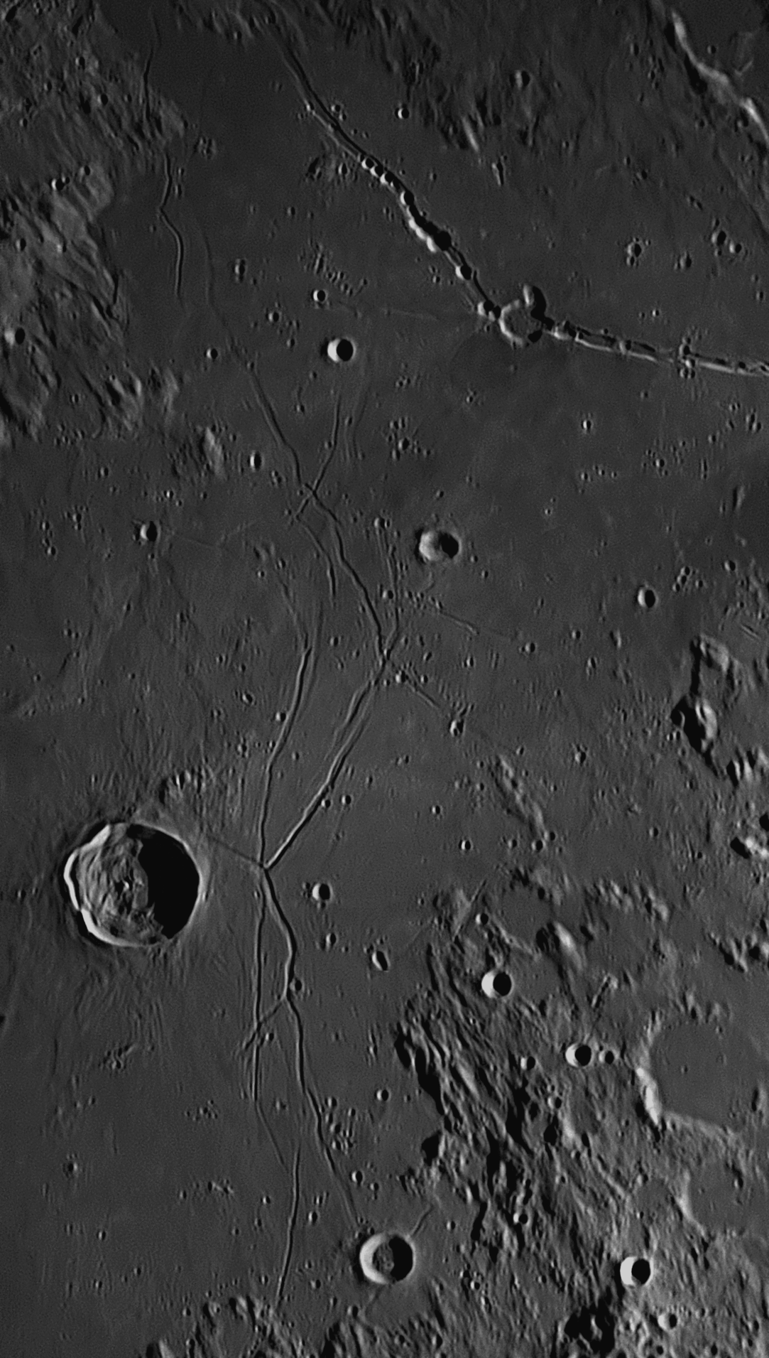
This area is just above the centre of the Moon's visible disc. The largest
crater in this area is 27 kilometre Triesnecker, below centre. It sits on
a lava plain, and its fame is due to the complex series of clefts or rilles that
are found on the plain to its east. These rilles stretch for over 100 kilometres
to the north and a similar distance to the south of Triesnecker, and in many
places they cross over each other.
Triesnecker
 Gaius Julius Hyginus
(64 BCE – AD 17), a Roman historian, wrote the Poeticon astronomicon,
also known as the Astronomica, 160 years before Ptolemy’s
Mathematike Syntaxis or Almagest. The book has drawings of
numerous star constellations, and tells the myths and legends associated with
them. Some astronomical historians think that a later Hyginus was responsible
for the text in the 2nd century AD, claiming that because the Poeticon
astronomicon describes 47 out of 48 constellations listed in Ptolemy’s
Syntaxis of AD 150, then it must have used the Syntaxis as a starting
point. This ignores the fact that the 48 constellations predate Hyginus, Ptolemy
and Hipparchus by centuries, and in fact most of them were described by Eudoxus
in his Phaenomena in the 4th century BCE.
Gaius Julius Hyginus
(64 BCE – AD 17), a Roman historian, wrote the Poeticon astronomicon,
also known as the Astronomica, 160 years before Ptolemy’s
Mathematike Syntaxis or Almagest. The book has drawings of
numerous star constellations, and tells the myths and legends associated with
them. Some astronomical historians think that a later Hyginus was responsible
for the text in the 2nd century AD, claiming that because the Poeticon
astronomicon describes 47 out of 48 constellations listed in Ptolemy’s
Syntaxis of AD 150, then it must have used the Syntaxis as a starting
point. This ignores the fact that the 48 constellations predate Hyginus, Ptolemy
and Hipparchus by centuries, and in fact most of them were described by Eudoxus
in his Phaenomena in the 4th century BCE.
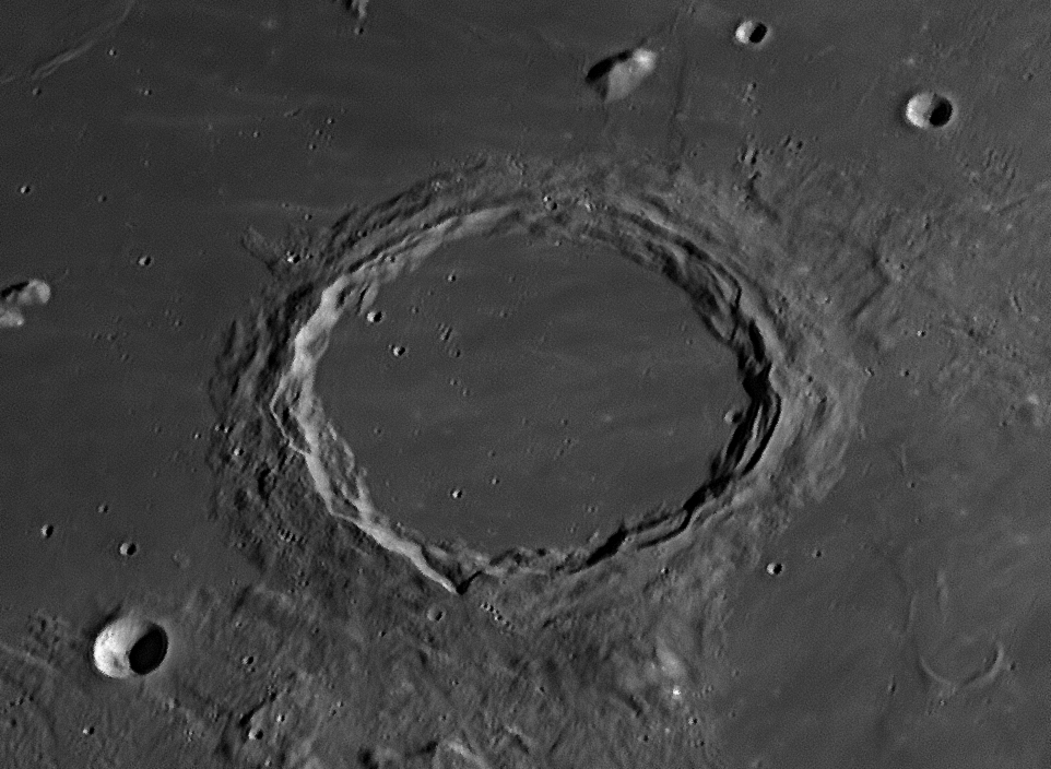
This feature is the largest ringed plain on the Mare Imbrium. It has
broad, complex walls which average 1.2 kilometres in height above the interior,
although some peaks reach a height of 2.2 kilometres. The interior is flat and
level, and is about 200 metres below the outside surface of the Mare. Several
landslips from the walls intrude upon the floor, which is crossed from east to
west by light-coloured streaks which are also found crossing the lava plain
surrounding Archimedes.
Archimedes
Archimedes of Syracuse (287-212 BCE, left) is regarded as the greatest mathematician of antiquity, and one of the greatest of all time. Syracuse was one of the oldest Greek colonies, and was established by the Corinthians in Sicily in the 7th century BCE. The most widely known anecdote about Archimedes tells of how he invented a method for determining the volume of an object with an irregular shape. A new crown in the shape of a laurel wreath had been made for King Hiero who had supplied the gold, but the King was suspicious. He asked Archimedes to determine whether it was of pure gold, or whether a cheaper metal had been surreptitiously added to make an alloy. Archimedes had to solve the problem without damaging the crown, so he could not melt it down into a regularly shaped body in order to calculate its density.
While taking a bath, he noticed that the level of the water in the tub rose as
he got in, and realised that this effect could be used to determine the volume
of the crown. For practical purposes water is incompressible, so the submerged
crown would displace an amount of water equal to its own volume. By dividing the
weight of the crown by the volume of water displaced, the density of the crown
could be found. This density would be lower than that of gold if a cheaper and
less dense metal had been added. Archimedes then took to the streets, so excited
by his discovery that he had forgotten to dress, shouting "Eureka! Eureka!"
meaning "I have found it!" Unfortunately for the goldsmith who made the
crown, it was found that some of the gold that had been supplied by the King had
been ‘cut’ with silver – the goldsmith had kept the rest.
Plutarch describes how Archimedes designed some pulley systems, allowing sailors to use the principle of leverage to lift objects that would otherwise have been too heavy to move. Archimedes was employed by the Roman Army to improve the power and accuracy of the battle catapults during the First Punic War, and was given the task of inventing a measuring device so that milestones could be placed on every road leading out of Rome. He designed a four-wheeled cart with an odometer – a mechanism geared to the wheels that dropped a small metal ball into a container after each mile travelled. It is believed that this device was the first to use tapered metal gear-teeth as we know them, rather than square-shaped wooden pegs. Some mileposts dating from Archimedes’ time still exist along the Appian Way from Rome to Brindisi, a distance of 350 miles (563 kilometres). Later, when Sicily was at war with Rome, Lucian tells us that Archimedes used fire to burn enemy ships during the Siege of Syracuse in 214-212 BCE, possibly focusing sunlight with mirrors or burning glasses – sometimes referred to as an ‘Archimedes heat ray’. While Archimedes did not invent the lever, he wrote the earliest known rigorous explanation of the principle involved. According to Pappus of Alexandria, his work on levers caused him to remark: “Give me a place to stand, [and a lever long enough], and I will move the Earth.” He also invented the Archimedes screw, a very efficient method of raising water.
The ancients knew that if the position of the Moon when in conjunction with a bright planet or star was observed simultaneously by two widely-spaced observers, the distance between the two sky objects showed a slight alteration. They called this variation ‘παραλλασσειν’ (‘parallassein’: the apparent shift in position when viewed from different vantage points) – we call it parallax. They also noted that when Saturn appeared very close to stars in the sky, they looked the same distance apart to all observers no matter where they were – there was no parallax effect observed. This meant that the starry sphere was much farther away than even Saturn, the most distant planet. Most philosophers prior to Archimedes had agreed that the stars were about ten thousand Earth-diameters away.
Archimedes was a contemporary of Aristarchus, but objected to the latter’s heliocentric proposal (that the Earth revolved around the Sun in a year, instead of the belief then held that the Sun revolved around the Earth each day). Archimedes said that if it were true, changes would be observed in the apparent positions of the fixed stars as the Earth moved around the Sun, and they should vary in brightness, too, as the Earth approached them and then receded. Aristarchus countered that argument by claiming that the stars were so far away that the changes in position or stellar parallax would be too small to detect, which was why he didn’t bother to try to do it. He was correct in this opinion, and it was not until the 19th century that telescopes could finally measure the tiny angles.
Some sources say that Archimedes then accepted that
Aristarchus' view that the world rotates once each day and revolves annually
about the Sun was indeed true, and we are obliged to him for describing that
theory in his only writing touching on astronomy The Sand Reckoner,
(his father was an astronomer named Phidias). Others claim that he still thought
that Aristotle's view that the Earth lay at the centre of the universe was more
likely. If his life has not been dramatically cut short, maybe we would have
known for certain what his final thoughts really were. Aristarchus’ own writings
have not survived, so without the accounts of Seleucus and Archimedes, we would
never have been aware of his thinking. Archimedes wrote:
“But Aristarchus of Samos
brought out a book consisting of some hypotheses, in which the premises lead to
the result that the universe is many times greater than that now so called. His
hypotheses are that the fixed stars and the Sun remain unmoved, that the Earth
revolves about the Sun in the circumference of a circle, the Sun lying in the
middle of the orbit, and that the sphere of the fixed stars, situated about the
same centre as the Sun, is so great that the circle in which he supposes the
Earth to revolve bears such a proportion to the distance of the fixed stars as
the centre of the sphere bears to its surface.”
He may have realised that this result demolished his objections
to a Sun-centred universe. He used it to estimate the number of grains of sand
that would fit inside the universe. By using a system of numbers based on powers
of the myriad, Archimedes concludes that the number of grains of sand required
to fill the universe would be 8 followed by 63 zeros (8 x 1063 in
modern notation).
[ Present Day Note: The number 8 × 1063 is incomprehensibly
huge. If the Big Bang is thought to have occurred 13.79 billion years ago, there
have been ‘only’ about 4.5 × 10¹⁷ seconds since the birth of the
universe. It is estimated that the Earth is made up of roughly 5.5 × 1050
atoms; the number of atoms in the Milky Way Galaxy is approximately 5 × 1068,
and the number of atoms in the observable universe is estimated to be 7.1
× 1079. That would equal about 1.4 × 1060 grains of sand.
] Archimedes died during the Second Punic War, when a Roman army
under General Marcus Marcellus captured Syracuse. According to the historian
Plutarch writing 300 years later, he was contemplating a geometrical diagram
when the Roman forces entered the city. A soldier commanded him to come and meet
General Marcellus, but Archimedes refused to accompany him, saying that he
needed to finish work on his problem. The soldier flew into a rage, and killed
Archimedes with his sword. Plutarch also offers an alternative account, in which
the soldier killed Archimedes in order to steal the valuable brass mathematical
instruments he was carrying. Whatever the true version, Marcellus was angered
when he heard of this, for he regarded Archimedes as a valuable scientific asset
and had ordered that he not be harmed. Archimedes’ last words reportedly were,
“Do not disturb my circles.”
23: July 2018
This month we will look at the Rupes Altai or Altai Mountains.
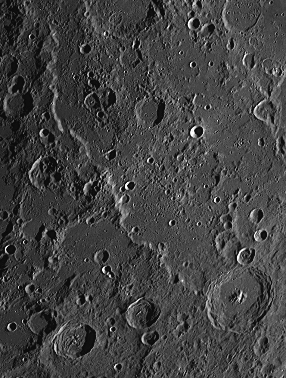
This photograph was taken from Nambour at 7:04 pm on July 30, 2017. The crater Catharina is at the top of the image. The Rupes Altai or Altai Mountains is a 450 kilometres long cliff or fault escarpment which runs in a huge curve from west of Catharina to the 90 km crater Piccolomini at the lower-right corner.
The cliff averages 700 to 1000 metres in height, with some summits approaching 2
kilometres high. One peak is 4 kilometres high. The curve of the Rupes
Altai is concentric with the large impact basin called Mare Nectaris (Sea
of Nectar), which is 420 kilometres to the north-east. The fault escarpment is
obviously contemporaneous with and caused by the
Nectaris Event. Mare Nectaris is off the image above to the upper right,
but is visible on the Full Moon chart preceding item
This feature, like some other lunar mountain ranges such as the Alps, Apennines
and Caucasus mountains, was named after a terrestrial range. The Altai Range on
Earth is located in central Asia, north of the Himalayas and the Tibetan
Plateau, and between the large lakes of Balkhash and Baikal. Russia, China,
Mongolia and Kazakhstan come together there. Four of its peaks are over 4
kilometres high. The name 'Altai' means 'Gold Mountain' in Mongolian.
24: August 2018
This month we will look at the Moon's North Polar Region.

These two images are of the area just south of the Moon's North Pole. The
upper image was taken at 6:50 pm on August 1, 2017, and the lower image at 8:11
pm on December 29, 2017. The images show extreme views of libration, when the
North Pole was tilted away from us and out of sight, and then when it was tilted
into view towards us. North is to the top, east (where the Sun is rising) is to
the right.
Libration causes the Moon to tilt its polar areas towards us and swing the areas
near the eastern and western edges or 'limbs' into and out of view in a monthly
cycle. The craters marked 'a'
and 'b'
are the same ones in each image, and may help the reader to match up the
moonscapes in the two views. Note the light-coloured streaks across the lunar
surface. They radiate from the fresh impact crater
Anaxagoras, 53 km in diameter, seen at the middle of the left-hand
margin. In the lower picture, a coloured ellipse encloses a 14.5 kilometre
crater named Whipple
which lies at latitude 89.137º North. It is on the northern rim of the 75
kilometre walled plain Peary. The North Pole itself lies within the
ellipse. South-east of Peary is a flat 94 kilometre walled plain named Byrd.
Adjoining Peary to its south is the 69 kilometre crater Florey.
Robert Peary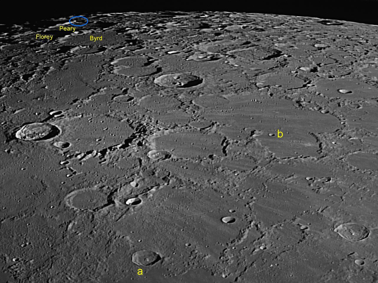
The American Robert E. Peary (1856-1920) was among the first explorers to attempt to reach the Earth's North Pole in the first decade of the twentieth century. His claim to have been the first to actually reach the Pole in 1909 may be true, but is disputed in favour of another polar explorer, Frederick Cook, who said that he had reached it the year before. The problem is that, unlike the Earth's South Pole, which is firmly fixed on an ice-covered continent, the North Pole is located on sea-ice floating on the Arctic Ocean. Although the Pole itself is a fixed geographical point, the sea-ice is constantly moving and changing, so any pole marker left by an expedition soon wanders far from the Pole, making a claim impossible to verify in the first half of the last century, but now able to be proven using GPS technology.
Richard E. Byrd (1888-1957), an American naval officer, was a pioneering aviator and polar explorer. He claimed to be the first to reach both Poles by aircraft - the North Pole in 1926 and to the South Pole and back in 1929. For this, he was promoted to the rank of Rear Admiral by a special Act of Congress. He was only 41 years old, the youngest Admiral in the history of the US Navy. (He had never had command as Captain of a ship.) He organised an expedition to Antarctica in 1934, conducting mapping of the coast and research on weather conditions. On this trip he spent five winter months alone in a meteorological station, recording data. He led US Government funded exploratory expeditions to Antarctica before and after World War
Howard Walter Florey (Baron Florey, 1898-1968), was born in Adelaide, South Australia, and became a world-famous pharmacologist and pathologist. He shared the Nobel Prize in Physiology in 1945 with Sir Ernst Chain and Sir Alexander Fleming, for his pivotal rôle in the development of penicillin. Although Fleming discovered and named this antibiotic in 1928, it remained a laboratory curiosity until 1940, when Florey and Chain and their team at Oxford University were able to purify it and mass-produce it as a prescription drug. This marked the beginning of modern antibiotics. Many millions of soldiers' lives were saved in World War II thanks to the use of penicillin to treat wounds and amputations. Australia was the first country to make the drug available for civilian use in 1945. Australia's longest-serving Prime Minister, Sir Robert Menzies, said, "In terms of world well-being, Florey was the most important man ever born in Australia."
25: September 2018
This
month we will look at the crater Gutenberg and its neighbours
Gaudibert and
Goclenius.
This image of the south-western margin of the Moon's Mare Fecunditatis
(Sea of Fertility) was taken at 5:19 pm on 18 July 2018, just five minutes after
sunset. A deep red filter was used to counteract the light of the sky.
North is to the top, east (where the Sun is rising) is to the right. The central
crater is 77 kilometre diameter Gutenberg. To its south-east is the 56
kilometre crater Goclenius, which is crossed by numerous clefts. Towards
the lower left corner of the image is the 34 kilometre crater Gauldibert,
which has a very unusual volcanic floor. One craterlet clearly visible in this
image, just north of the small hill at the centre of Goclenius, is only 830
metres across. Even smaller ones in the flat area due west of Goclenius may also
be detected.
Gutenberg is quite an old crater. It has been deformed by a 28 kilometre
crater, almost as old, on its eastern side, which is known as Gutenberg E.
Floods of molten lava from the asteroid impact which created the Mare
Fecunditatis have burst through and carried away some of the wall of
Gutenberg E, and filled up that crater to the same level of the outside Mare.
Lava has then burst through the western wall of Gutenberg E and pooled on the
floor of Gutenberg itself, where it has swamped the bases of the mountain ranges
and isolated peaks existing there, so that only their summits are visible today.
On the outside of Gutenberg's western wall is a much more recent crater,
Gutenberg A, which is still perfectly shaped as a circular bowl crater with
a diameter of 15 kilometres. South of Gutenberg and adjoining it is an ancient
45 kilometre crater, Gutenberg C. Its northern ramparts have been
obliterated by the later impact of Gutenberg itself, and debris from that event
has almost completely filled Gutenberg C, making it look more like a mountain
mass.
In the lower right corner is an interesting crater, Goclenius, 56
kilometres in diameter. Its walls are not very high, and its floor is depressed
well below the level of the surrounding Mare. Goclenius also has several
mountain summits protruding above the floor, but it is notable for the
interesting network of clefts crossing it. The main cleft begins near the south
wall and trends in a north-north-western direction. Before meeting the north
wall, it turns into a rille or graben, which is where a pair of parallel faults
pull apart, allowing the space between them to drop 100 metres or more. This
produces a feature like a rift valley on Earth, averaging a width between the
parallel walls of 2 to 5 kilometres. Some rilles stretch across the lunar
surface for hundreds of kilometres. The rille that starts in Goclenius can be
seen continuing past Gutenberg to the top margin. There are two similar but
shallower rilles running parallel to it on its eastern side, and together they
are called the Rimae Goclenius. A similar rille crosses the floor of
Gutenberg, and trending in the same direction. The third crater worthy of mention in this image is
Gaudibert, 34 kilometres in diameter and near the lower left corner. This
crater does not have a bowl-shaped or flat floor, but the whole crater and its
surroundings is a pyroclastic area, which means that it was not caused by an
impact, but was the centre of widespread explosive volcanic activity. Features
showing Gaudibert's tortured appearance are uncommon on the Moon. In the lower left corner can be seen part of the Mare
Nectaris, or Sea of Nectar. In the upper right corner is part of the
Mare Fecunditatis, or Sea of Fertility. The smoothness of the Mares or
Seas shows that they are much more recent features than the heavily-cratered
Terrae or Lands.
Paper (from the word ‘papyrus’) first appeared in China around 150 BCE and was
made of the crushed fibres of mulberry tree bark, hemp waste and old rags. It
spread to the Islamic world through Samarkand around AD 750, and reached Europe
around AD 1000. By this time, paper had become cheaper than vellum, and was made
by hand from hemp fibres and discarded linen. By 1400 paper mills were set up
around Europe, but the machines were very rudimentary and could only crush the
raw materials. The production of paper sheets was still very labour-intensive.
Books were only affordable by institutions or the well-off.
Up until 1450 all books were either handwritten manuscripts or printed using
hand presses based on the grape and olive screw presses then in common use.
Individual pages had to be chiselled out of blocks of wood in mirror-image,
which were placed in the presses and inked. The pages were then printed off by
hand, one at a time.
Johannes Gutenberg (1398-1468) was born in Mainz and moved to Strasbourg
in 1428. By 1438 he was working with three partners on a secret project, the
development of a new printing process. Gutenberg’s great invention was to work
out a way to cast individual letters by hand, out of a soft alloy of 82% lead,
9% tin and 6% antimony. The individual letters, called ‘sorts’ (for they needed
to be sorted, we call them ‘slugs’ today) were made in reverse, so that they
would print the right way round. Because of this, typesetters were admonished,
“Mind your p’s and q’s”. They could also have been warned to “watch their b’s
and d’s.” The letters were arranged into words, lines and paragraphs and clamped
together, the lines also being in reverse. The paragraphs were then assembled
into a frame or ‘forme’ to make complete pages for printing. If the typesetter
ran out of cast letters, the work would be held up until more were cast and he
could become irritable, leading to the saying, “he is out of sorts”.
After the run of pages had been printed, the letters were removed for later use.
They were stored in a wooden case of 'pigeon-holes', the top rows being used for
capital letters and the lower rows being used to house the small letters. This
is the origin of the terms "upper case" and "lower case". The letters had to be
consistent in size and shape so that they could be locked securely together for
use in the printing press, so a crucial part of the process was the precision
casting of the letters so that each line of type would match exactly with the
other lines. From the beginning, this was regarded as an essential requirement.
The typeface selected was a form of gothic script then used in Germany for
writing liturgical texts and still widely used today. As water-based inks would not
adhere or ‘take’ to the metal letters, Gutenberg developed new inks which would,
using lampblack and soot dissolved in linseed oil. This concept of re-usable
metal type, the use of new waterproof inks made of vegetable oil and carbon, and
the use of a wooden printing press based on a typical woodblock screw press,
combined to produce a truly epochal invention – a practical mechanical printing
system. Gutenberg had by this time returned to his hometown, Mainz, and there he
produced his first publication, a German poem, in 1450.
In 1455 (possibly starting in 1454), Gutenberg brought out 180 copies of a
beautifully executed folio Biblia Sacra (Holy Bible). It consisted of two
volumes of 300 pages each, with 42 lines on each page. Especial care was taken
in ensuring that the registration of the print on each page was precise. It is
estimated that Gutenberg and his workmen had to cast as many as 46 000
individual sorts for this job. After printing the pages of text on a kind of
paper made from rag-cotton and linen, each book was hand illustrated in the same
elegant way as Bibles from the same period handwritten by scribes were. The
paper pages, requiring the importation of 50 000 sheets from Italy, when printed
were supplied as loose sets, but 30 copies were printed and bound using vellum,
requiring an estimated 5000 calfskins. Most owners had the pages bound together
elsewhere by book binders, in a style to match their other books. The date of
1455 was documented on the spine of a copy bound in Paris.
The ink used contained carbon, copper, lead and other metallic compounds that
gave the printed text a lustrous, reflective sheen. The Gutenberg Bible
as it came to be known, sold for up to 30 florins, which was roughly three
years’ wages for an average clerk. Nonetheless, it was significantly cheaper
than a handwritten Bible that could take a single scribe over a year to prepare.
It immediately sold out, some of the first copies going to England. They were
mostly bought by monasteries, libraries, cathedrals, and by wealthy individuals
who wished to donate a copy to an institution. In the fifteenth century, only
one Gutenberg Bible was in private hands.
Today, forty-eight substantially complete copies are known to exist, including
two at the British Library that can be viewed and compared online. Although the
text lacks modern features such as pagination, indentation of first lines and
paragraph breaks, it is acclaimed for its high aesthetic and technical quality,
the printed letters being clearly defined and with consistent spacing. In fact,
the Gutenberg Bible is nothing short of spectacular, as online images
will attest.
The introduction of Gutenberg’s printing method and oil-based inks made possible
the development in Germany of intaglio engraving, in which artists improved on
the traditional woodcut methods by engraving copper sheets to make printing
plates for illustrations, diagrams and maps. Copper is a soft metal and easy to
engrave, but it had a disadvantage in that, after striking the first few hundred
copies, the plates would show signs of wear and deterioration. The engravers
would then have to go over the grooves on the plates to sharpen the images
produced. This is why printing runs were usually restricted to about 500 copies.
The introduction of these new technologies revolutionised book production – news
and books began to spread across Europe much faster than ever before. Also,
their cheaper prices made them accessible to impoverished scholars, as well as
the wealthy.
There were more books produced in the fifty years after the Gutenberg Bible
than had been produced in the 1000 years preceding it. Gutenberg’s invention is
considered to be the key factor in facilitating Luther’s Reformation, the
Renaissance, the Scientific Revolution and the modern world. Paper made from
pulped wood fibre only came into universal use when steam-powered machines made
it economically feasible in the 1840s.
26: October
2018
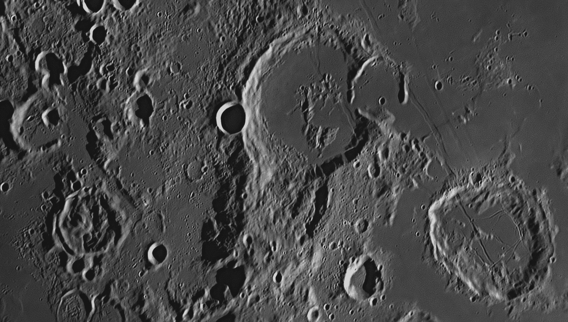
Johannes Gutenberg
The first documents were written on papyrus, made from the stalks of the
papyrus plant, crushed and pressed together. Egyptian examples from 2550 BCE
describing the building of the pyramids of Giza are the oldest in existence. As
sheets of papyrus were prone to cracking, parchment (named after the town
of Pergamum) became the writing material of choice from the Hellenistic period
to medieval times, as it was pliable and could be made into scrolls. Parchment
was made of scraped and dried animal skin. The best quality parchment was made
out of calfskin and called ‘vellum’.
This
month we will look at the area near the Moon's South Pole.

This image of the south polar region of the Moon was taken at 7:10 pm on 30 July
2017. Much of the Moon's near side is occupied by large, flat, dark
areas covered with cooled basaltic lava. These areas were once though to be
'seas' (Maria), and the lighter coloured areas 'lands' (Terrae). Galileo's first
observations of the Moon in 1609 showed that there were no bodies of water on
the Moon, and the seas were in fact lava plains. Strangely, the far side of the
Moon has no large maria, but is almost totally covered with large overlapping
impact craters. The south polar region of the Moon is unlike the rest of the
near side, and is very much like the far side. There is no mare material visible in the image above - on the
contrary, it shows thousands of craters crowded together. Seen from above
they are all more or less circular in shape, but due to their position near
the South Pole they are greatly foreshortened into ovals, but this is merely
due to perspective. The closer they are to the South Pole, the more
exaggerated is this effect. Craters along the Moon's edge or 'limb' are seen
in profile, as if from a low-flying spacecraft. The South Pole is marked
with a coloured dot.
There are two craters that are very close to the Moon's South Pole. The closer
one, marked with an '
Regarding the Earth, in the first years of the 20th century there was a race by
two teams of explorers to be first to reach the South Pole in Antarctica. There
was a Norwegian team headed by Roald Amundsen, which relied on ponies and
dogs to pull their sledges carrying supplies. Trying to beat them to the Pole
was a British team headed by Robert Falcon Scott, which used the new
motor-driven tractors then becoming available as well as dogs. Amundsen was
against using machines untried in polar conditions, saying that, in an
emergency, "you can't eat a tractor." All of Scott's motor vehicles failed
before they had gone very far, and his men towards the end had to pull the
sledges themselves.
History records that Amundsen, secretly starting before Scott, reached the
geographic South Pole first with four other team members on 14 December 1911.
They left a small black tent and Norwegian flag at the site. Scott and four
other men reached the Pole on 17 January 1912, 34 days after Amundsen. They were
bitterly disappointed to have been beaten and sadly began the return journey. A
relentless blizzard overtook them and they sheltered for days in a tent where
they perished from starvation and cold. Amundsen's team returned safely
from their expedition to world-wide acclaim, but their success has always been
overshadowed by the deaths of Scott and his men. Today there is a permanent base
at the South Pole where scientists live and work in air-conditioned comfort.
27: November
2018
Amundsen and Scott
This image of the craters Hercules (71 kilometres diameter) and Atlas
(90 kilometres diameter) was taken at 5:36 pm on 15 September 2018.
This
month we will look at a pair of craters named after the two strong men of
legend,
Hercules and Atlas.
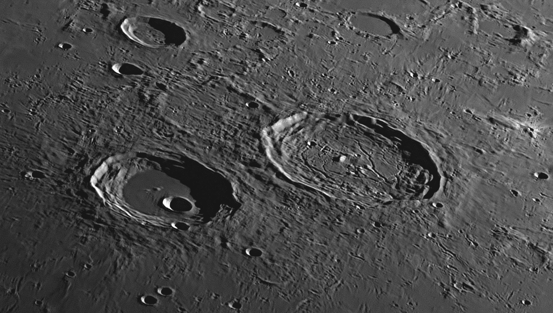
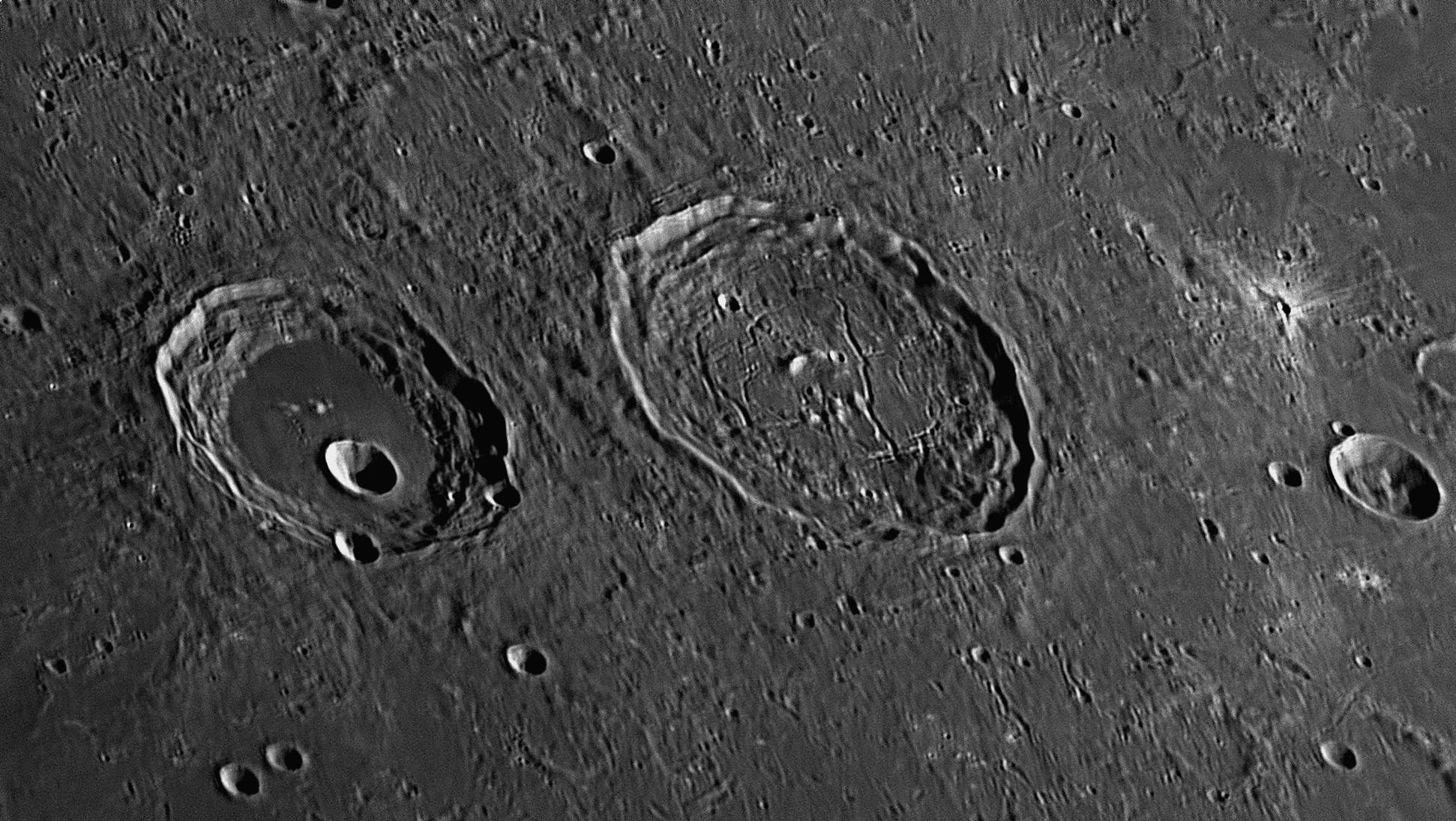
This image of the same locality was taken at 7:30 pm on 22
November 2020. The Sun was higher in this picture, reducing the shadows.
Due to the effects of the Moon's libration, the viewing angle from Earth is
different, thereby changing the perspective.
These images of Hercules and Atlas show the craters greatly foreshortened due to perspective, but they are both more-or-less circular. The floor of Hercules is lava filled and flat except for some low hills and tiny craterlets, but it is distinguished by the presence of a 13 kilometre crater known as G, which dominates the southern half. Atlas contains one mountain, some hills and many clefts. There are two ash volcanoes on its rugged floor, one in the northern half and one in the southern. The walls of Hercules and Atlas have both suffered large landslips, which have resulted in complex terraces around their circumferences, and large amounts of debris impinging on the floors. Near the eastern (right-hand) margin of each image is a small, anonymous craterlet only 3.5 kilometres across. It is very recent as it is sharply defined and is surrounded by a very light-coloured ray system. Solar radiation darkens the rays ejected from impacts, so the brighter they are, the fresher.
Hercules and Atlas
Hercules is a legendary hero and god, and is the Roman equivalent of the Greek Heracles, who was the son of the leader of the gods Zeus and a mortal woman, Alcmene, in classic mythology. He is famous for his great strength and many adventures, twelve of which are known as the "Labours of Hercules".
Atlas, in Greek mythology, was a Titan condemned to hold up the sky for eternity. He has become identified with the Atlas Mountains in north-west Africa. He was the son of the Titan Iapetus and the Oceanid Klymene. He had many children, mostly daughters, called the Hyades, the Pleiades and the Hesperides. Another daughter was the nymph Calypso. He was reputed to stand at the western end of the Earth. "Atlantic Ocean" means "Sea of Atlas", while " Atlantis" means "Island of Atlas". In the 16th century, books of maps began to appear. Gerardus Mercator published one in 1580, and it featured on the title page an engraving of the Titan Atlas holding up the world on his shoulders. This idea was adopted by other map publishers, and soon the books of maps became known as atlases.
28: December
2018
This month we will look at an interesting crater named after a famous Italian -
French astronomer, J. D. Cassini.

The largest crater in this picture is Cassini (60 kilometres diameter),
and it lies left of centre. This image of Cassini and its surroundings was taken
at 7:12 pm on 18 September 2018. North is to the top, east to the right. This crater Cassini lies on the easternmost margin of
the Mare Imbrium (the Sea of Rains). To its north are isolated mountains
connected to a large group known as the Montes Alpes (Alps), and to its
east are the Montes Caucasus (Caucasus Mountains). The creation of the
Mare Imbrium occurred between 3.8 and 3.85 million years ago, which makes it one
of the youngest of the lunar 'seas'. From its appearance, we can see that the
Cassini impact came a little later than that. Cassini is an interesting crater
in that it has two bowl-shaped newer craters on its floor. These are Cassini A
(17 kilometres) and Cassini B (9 kilometres). There is a craterlet on the
northern edge of the floor which has a diameter of 2.5 kilometres. Another
craterlet which is only 900 metres across straddles the crest of Cassini's
southern rim.
J. D. Cassini
King Louis Colbert enticed famous foreign scientists
to France to fill the ranks of the Academy, and invited G. D. Cassini to come to
Paris in 1669 to be the Director of the proposed Observatoire de Paris. Knowing
of the problems that had beset Galileo, Cassini felt that he had more freedom in
France to pursue his scientific work and so moved to Paris. He put down roots
there and never returned home to Italy. He changed his first names to their
French form, Jean-Dominique. Becoming a French citizen in 1673, he is remembered
in history as the French astronomer J. D. Cassini. From his post supervising the
construction of the new Paris Observatory in 1670, Cassini arranged for
Jean-Felix Picard (1620-1682) and a few assistants to travel to the island
of Hven in Denmark, to the ruins of Uraniborg, Tycho Brahe’s ‘castle of the
stars’. Using observations of eclipses of Jupiter’s satellites taken at these
two sites, Paris and Uraniborg, Cassini and Picard confirmed the latitude and
longitude of both places. Cassini also called on observers in Poland and Germany
to co-operate with France in an international effort devoted to the finding and
measuring of longitude, as gauged by the motions of Jupiter’s moons.
Cassini was the first to make successful
measurements of longitude by the method suggested by Galileo, using eclipses of
the satellites of Jupiter as a clock. Cassini’s work led to Galileo’s method for
finding longitude becoming generally accepted after 1675 – but only on land, as
Jupiter's satellites could not be observed from the unsteady deck of a ship at
sea. Surveyors and cartographers used Galileo’s technique to redraw the world,
and it was in the field of mapmaking that the ability to determine longitude
proved its worth. Earlier maps had underestimated the distances to other
continents and exaggerated the outlines of individual nations. Now global
dimensions could be set, with authority, by the Jovian moons. Indeed, King Louis In 1672 Cassini sent Jean Richer to Cayenne
in French Guiana while he himself stayed in Paris. The two made simultaneous
observations of Mars, and thus found its parallax as seen from Earth. This was
the first measurement of a planet’s parallax, and the result gave Cassini a
relationship between the orbit of Mars and that of the Earth. He then used
geometry to make a reasonable estimate of the radius of the Earth’s orbit in
French miles. From that he applied Kepler’s Third Law to extrapolate the
distances from the Sun of Mercury, Venus, Mars, Jupiter and Saturn. In future
years we would find that Cassini’s figure for the Earth-Sun distance was
excellent for his time but 7% too small, and therefore all his other planet-Sun
distances were similarly 7% below the true figures. Yet his work was
revolutionary and the astronomers of his time were amazed, for suddenly the
immense size of the Solar System was revealed. Cassini discovered four
satellites of Saturn, and the gap between its Ring A and Ring B which is now
known as the Cassini Division. He also timed the rotation of Jupiter's clouds
and made a detailed map of the Moon.
Cassini's walls reach a height of 1200 metres on the east, but in the west they
only reach 500 metres. Lava has flooded the western two-thirds of the floor, but
the eastern third has a very rugged pyroclastic area crossed by two parallel
valleys, basically straight but kinked in the middle so that they change
direction. Outside of Cassini's walls are large deposits of rock melt blown
outward from the impact, and fairly smooth in texture. All around Cassini are
crater-chains and gouges running in a rough north-south direction. These were
caused by material ejected from another impact that created the Aristillus
crater, 165 kilometres to the south-south-west of Cassini (see the image of the
waxing gibbous Moon at the top of this page). In
1665, Giovanni Domenico Cassini (1625-1712, right, note that he is
pointing at the long refracting telescope on the roof of the building in the
background), a professor of mathematics and astronomy at the University of
Bologna in Italy, quietly carried on the work of Galileo. He shared the
discovery of Jupiter’s Great Red Spot with Robert Hooke, and in 1666 he reported
the polar caps on Mars. He also measured the rotation period of Mars to be 24
hours 40 minutes. In 1668 he published the best set of predictions for eclipses
of the Jovian satellites yet seen, based on a multitude of carefully con¬ducted
observations. Cassini’s accurate ephemerides brought him to the attention of
people in Paris, at the royal court.
In
1665, Giovanni Domenico Cassini (1625-1712, right, note that he is
pointing at the long refracting telescope on the roof of the building in the
background), a professor of mathematics and astronomy at the University of
Bologna in Italy, quietly carried on the work of Galileo. He shared the
discovery of Jupiter’s Great Red Spot with Robert Hooke, and in 1666 he reported
the polar caps on Mars. He also measured the rotation period of Mars to be 24
hours 40 minutes. In 1668 he published the best set of predictions for eclipses
of the Jovian satellites yet seen, based on a multitude of carefully con¬ducted
observations. Cassini’s accurate ephemerides brought him to the attention of
people in Paris, at the royal court. 
The Cassini mission to Saturn
A spacecraft named Cassini (above)
was launched in 1997, and arrived at Saturn in 2004, where it went into orbit
around the ringed planet. This was a very successful mission, returning
thousands of photographs of Saturn and its satellites, and a host of physical
data. The mission was planned to end on 30 July 2008, but the spacecraft
performed so well that its mission was extended three times. In 2017, an
encounter with Titan changed
Cassini’s orbit in such a way that, at closest approach to Saturn, it
would be only 3000 kilometres above the planet’s cloudtops, below the inner edge
of the D ring. On 26 April 2017, Cassini conducted the first of 22 plunges
through the gap between Saturn and its innermost Ring, transmitting many
spectacular images to Earth. This sequence of new orbits was the ‘grand finale’
of the highly successful Cassini mission. These ‘proximal orbits’ ended
when another encounter with Titan sent the orbiter into Saturn’s atmosphere on
15 September 2017.
29: January
2019
This month we will look at an interesting pair of craters named after two Greek
scholars living in the fourth century BCE, both being students of Plato and
enrolled at his mathematical School of Philosophy at Akademia, a suburb of
Athens. (Ever since, any advanced school has been called an 'academy'.) These
two students were named
Aristoteles and Eudoxus.
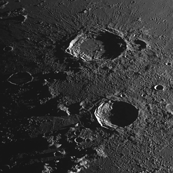
This image was taken at 7:37 pm on 18 September 2018. The Sun at the time was
much higher in the Moon's sky, fully illuminating the area.
These two craters lie to the east of the Mare Imbrium (Sea of Rains) and
north of the Mare Serenitatis (Sea of Serenity). Both are surrounded by
melted rock that splashed out from the original impacts. Both have terraced
walls where large sections of the walls have broken off the rim and slid down to
the crater floor. Each of the two craters has a cluster of small mountains at
its centre, which were formed when the shock wave from the impact travelled down
to the Moon's bedrock, where it was reflected back up, lifting the newly-formed
crater floor and fracturing it into blocks. Magma welled up through the
fractures and pooled around the blocks where it cooled into a lava plain, giving
each crater a flat floor with the tops of the blocks protruding through as a
cluster of mountains. More magma welled up in Aristoteles, because it was a
larger impact.
Eudoxus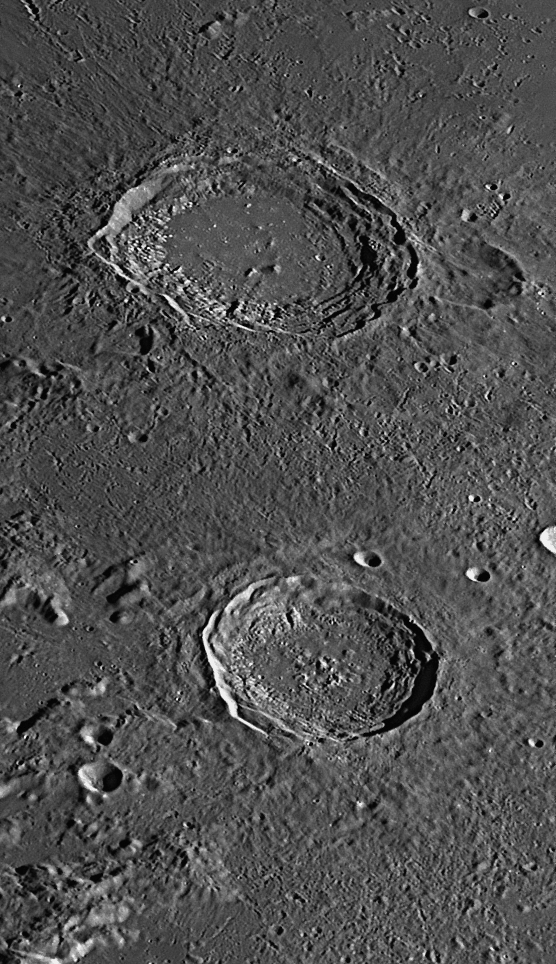
The philosopher Eudoxus of Cnidus (ca. 410-347 BCE) was a student of Plato. who had taught him that the Earth was the centre of the universe, and the Sun, Moon, five planets and fixed stars circled around it on eight transparent, crystalline spheres, once per day. Plato eventually realised that this concept did not adequately explain the movements of the planets, whose paths against the starry background (the outermost 'sphere of fixed stars') were not regular but included loops, S-bends and variations in brightness. He asked his students to add extra spheres to improve the predictions of planetary movements. Eudoxus devised a nest of spheres for each planet, rotating at different speeds and at different angles. The Sun and Moon were controlled by three spheres each, the five planets by four each, and there was one sphere to which the stars were fixed, enclosing the rest. This made 27 concentric crystalline spheres in all, with the Earth at the centre. This became known as the Homocentric Spheres world system. Eudoxus also measured the length of a year as 365 days and 6 hours.
Eudoxus wrote two books on spherical astronomy, Phaenomena (Appearances) and Entropon, which contained lists of star positions. These were measured from his home at Cnidus and from Egypt during his travels there. We know that about twenty of the Assyrian, Chaldean and Sumerian constellations as recorded on stone by Babylonian astrologers (including the twelve of the Zodiac) had reached the Greek city-states by 450 BCE, as Eudoxus described them in his Phaenomena. Another ten had the same stars but different names, e.g. the Assyrian Swallow equated to the Greek Pisces. About eighteen Greek constellations were home-grown, including Hercules, Leo, Draco, Ophiuchus, Serpens, Delphinus, Andromeda, Perseus, Cepheus, Cassiopeia and Cetus. Most of these constellations were quite ancient, and had originated during a 400-year period around 2000 BCE. Eudoxus described the names and positions of a total of 43 constellations, and mentioned other objects in the sky as well. Although his Phaenomena has since been lost, in the following century the astronomer-poet Aratus of Soli (southern Turkey, 315-240 BCE) rewrote it in verse. This long, didactic, hexameter poem of 732 stanzas, also named Phaenomena, was intended, like the original, to be an introduction to the 43 constellations, which it listed and described. It was popular at the time and has survived, passing down to us not only the constellations, but also the proposed homocentric spheres of Eudoxus.
In the fourth century BCE, the philosopher
Aristotle (384-322 BCE) studied natural history, philosophy and the natural
sciences, and his teachings and writings had an immense influence on future
scientific thought. Aristotle (not his real name: it means "the best purpose")
was a pupil of Plato and knew Eudoxus. Later, as tutor to Alexander the Great,
he became wealthy – legend has it that Alexander gave him an elephant as a
present. Aristotle wrote the
Meteorologica, the first book on the weather, and described in
detail an underwater device called a ‘diving bell’. Aristotle taught that people
have five senses (sight, hearing, taste, smell and touch), something still
accepted today despite commonly experienced other senses such as heat, cold,
hunger, thirst, balance, fear, pleasure, pain etc. In astronomical matters, he
supported the view that the Earth was spherical, but agreed that it was
at the centre of the universe, surrounded by transparent spheres made of aether
or 'quintessence', which carried the Sun, Moon, planets and stars around the
Earth each day.
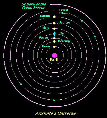
In his final conception (right), Aristotle placed an extra sphere outside the starry sphere that he called the Primum Mobile. This ‘First Moved’ sphere was black and opaque. It rotated east to west once in 23 hours 56 minutes at a constant angular velocity, and its motion turned the sphere of fixed stars at the same speed (a sidereal day). This motion was imparted downward from sphere to sphere, thus causing the whole universe to rotate. There was a little ‘lost motion’ or ‘slippage’, so that each main lower sphere turned slightly slower than the one above it. Two exceptions to this were Mercury and Venus, whose spheres rotated as one with the Sun’s sphere. This meant that each main sphere took a little longer to complete one rotation than the next one out, which accounted for the eastward drift of the seven planets through the constellations at varying speeds. The main sphere of the Sun took exactly 24 hours to complete a rotation, and the main sphere of the Moon about 24 hours 50 minutes.
This concept was later embraced by Christians, as they equated the Prime Mover
with God.
We know that, despite his fixation with homocentric spheres, Aristotle reached
some correct conclusions with regard to other astronomical matters. He observed
lunar occultations, and deduced that the Moon was the nearest sky object. He
also found that the Moon was smaller than the Earth and agreed that it shone by
reflected sunlight. On the other hand, he mistakenly taught that heavier objects
fall faster than light ones, stating categorically that an object ten times
heavier than another would fall ten times as fast. (No-one thought to test this
by experimentation until the time of Galileo.)
His ideas were a blend of scientific information and philosophical argument, but were biased by his preconceptions of what constituted a good and perfect universe. We must admit that his hypotheses did allow planetary movements to be explained, calculated and predicted with an accuracy acceptable for his time. Although mistaken in many of his beliefs, he was searching after truth, and was considered the ultimate, common sense authority on science. It is a pity that Aristotle dismissed out of hand the case for a heliocentric (Sun-centred) universe whenever suggested by the followers of Pythagoras, Heracleides, and Plato in his old age, saying dogmatically that it did not fit the observations. Aristotle's erroneous ideas received much support from Ptolemy in his Almagest, and were embraced by Arab astronomers after 350 AD. These beliefs returned to Europe in the Middle Ages, and became the 'accepted wisdom' for astrologers.
The idea of crystalline spheres
holding the Sun, Moon and planets in place while they circled around the Earth,
was widely believed by the general public as the true model of the cosmos. The
system was found by the Christian Church to be in accord with its religious
beliefs, for they equated the 'Prime Mover' with God, and the Bible said that
the Earth was fixed and could not be moved (Psalm 96.10). Therefore they
gave it their full support. By AD 1300, such ideas took on a new power as the
cosmogonies of Aristotle and Ptolemy (newly rediscovered in Europe after the
Dark Ages) had been carefully melded with medieval theology. This blending of
Christianity and ancient pagan Greek beliefs was undertaken by
philosopher-theologians such as the Dominican friar Thomas Aquinas (AD
1225-1274) in his book Summa Theologiae (Principles of Belief),
written between 1265 and 1274. In this book, he explains how he believes that
Heaven (he calls it the "Empyrean") lies outside the Primum Mobile. The Empyean
is described by him as "the Cœlum Empireum Habitaculum Dei et Omnium
Electorum (Heavenly empire inhabited by God and all the Elect)". He explains
how the crystalline spheres are pushed by angels to keep them moving as follows:
the Seraphim (Guardians of God's throne) push the Primum Mobile, the Cherubim
push the sphere of 'fixed' stars, the Thrones push Saturn, Dominions push
Jupiter, and Principalities push Mars. Potentates (or Powers) push the sphere of
the Sun, Virtues push Venus, Archangels push Mercury, and Angels such as Michael
push the Moon. Thomas Aquinas believed that the movements of the stars and
planets were physical evidence of the angels, and were visible manifestations of
God's will and control. The position of the Earth at the centre of the universe
indicated the importance of humanity to God.
Galileo Galilei, a Professor of Mathematics at the University of Padua near Venice, was the first to make a telescope that was not merely a toy but gave a useful magnification of 20 (later, 30) times. He turned it to the sky in late 1609 and found that Copernicus had been correct when he wrote in 1542 that the Earth travelled around the Sun and not the other way round as Aristotle had taught and the Churches believed. When he published this opinion in a book, A Dialogue Concerning the Two Chief World Systems, Ptolemaic and Copernican, some priests led by Father Tommaso Caccini reported him to the Holy Inquisition, which tried him for heresy in 1632. Pope Urban
VIII, a one-time supporter and friend of Galileo, was angered and had Galileo placed under house arrest for life for publicising this opinion. (For more about Plato's concept of the universe, scroll up to item #11. For Copernicus' revolutionary theory, scroll further up to item #8 .
30: February
2019
This month we will look at an interesting crater-plain near the centre of the
Moon's disc, Albategnius.
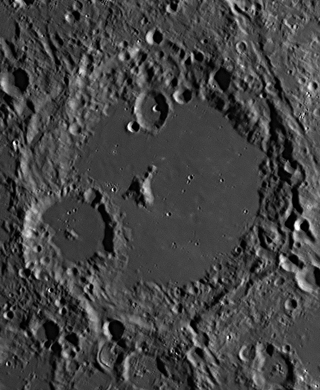
This picture is dominated by the large crater-plain Albategnius (139
kilometres diameter). Its south-western quadrant has been impacted by a later
asteroid, creating the 46 kilometres crater Klein. This image was taken
at 8:33 pm on 18 September 2018. North is to the top, east to the right.
This large crater-plain lies adjacent to Ptolemaeus to the west and Hipparchus
to the north. Both of those crater-plains are larger than Albategnius.
Like most other impact craters, it is surrounded by melted rock that splashed
out from the original impact. The terraces in the walls have to a large extent
been obliterated by later impacts by smaller bodies. As is typical, the impact
that formed Albategnius rebounded off the deep bedrock and fractured the floor
of the new crater and threw up massive blocks of rock as mountains. Molten magma
then welled up through the fissures and covered the floor to a great depth,
swamping the bases of the mountains so that only their summits remained visible.
This flooding of Albategnius' floor by lava occurred in two stages. In the
first, a lava plain was formed, which cooled and later was struck by further
impactors, producing craters on the new, flat floor. A second upwelling of lava
spread out on the floor, and swept over the new craters, covering them. These
swamped craters can be seen as shallow, circular depressions dotted over the
present floor like faint ghost craters, averaging 5 or 6 kilometres across.
There are at least a dozen visible above. These should not be confused with the
more recent craterlets, which are much smaller (2 kilometres across or less) and
are quite sharply defined. The central mountain peak is all that remains uncovered of the
central mountain cluster. At its summit is a crater, not as clearly defined as
the recent impact craters on the floor which are roughly the same size (2
kilometres). This latter fact, combined with its position exactly at the summit,
indicates that this crater is probably an extinct volcanic crater, not caused by
an impact. There are two recent impacts that have damaged the floor of
Albategnius. The largest is Klein, 46 kilometres across. It also exhibits
a typical central mountain. It has deformed the south-west wall of Albategnius.
At the northern end of Albategnius' floor and impinging slightly on the northern
wall is a 20 kilometres crater, Albategnius B. This crater itself has
been struck by an impactor, leaving a 4 kilometre crater a little to the east of
centre.
On note in this part of the Moon are numerous linear
features like grooves deforming the surface. These grooves run from
north-north-west to south-south-east. At least seven can be seen in the picture
above. They were caused by vast quantities of rock, many pieces as large as
flying mountains, skittering, crashing and bounding across the surface for
hundreds, even thousands of kilometres, radiating away from a major impact on
the Moon by a large asteroid about 3.8 billion years ago. This impact blasted
out a huge hole in the Moon 1287 kilometres across, which immediately filled
with molten magma to create the huge lava-plain known as the Mare Imbrium
(Sea of Rains). This titanic blast is called the 'Imbrium Event', and the
linear damage radiating across the near side of the Moon (partially shown in the
image above) is called 'Imbrium Sculpture'. All of the grooves shown in
the image, if traced back to their sources, radiate from the centre of Mare
Imbrium.
Abu Abdullah Al-Battani
Albategnius
Written in a new and refreshing style, al-Battani’s ‘zij’ did not slavishly repeat everything that had been set down in earlier works. Instead, it concentrated on recent developments and observations, such as his new figure for the obliquity of the ecliptic (and thus the tilt of the Earth’s axis) of 23⁰ 35’, and a figure for the precession of the equinoxes that was much more accurate than Ptolemy’s. Al-Battani also made improvements to the astrolabe. His work was praised by later astronomers such as Richard of Wallingford, Peurbach, Regiomontanus and Copernicus.
Albategnius also studied the changing apparent diameter of the Sun’s disc throughout the year, which we now know is caused by the eccentricity of the Earth’s orbit. He found that the point where the Sun’s diameter is smallest (and thus the Earth-Sun distance greatest, now called the aphelion), had moved from its position as recorded by Ptolemy. Modern astronomy has confirmed that the Earth’s aphelion point does in fact move around the orbit. Albategnius published his astronomical observations in a book On Stellar Motion which proved to be of great value to astronomers for centuries to follow. Copernicus mentioned his indebtedness to al-Battani and quoted him extensively in De Revolutionibus, the book that initiated the Copernican revolution.
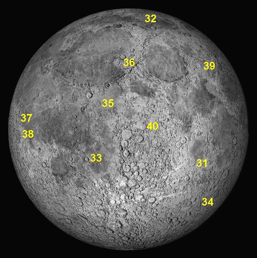
Key to features 31 to 40 below.
31: March 2019
This month we will look at an interesting crater-plain in the south-eastern
quadrant that has been flooded by lava, Fracastorius.
This picture is dominated by the large and ancient crater-plain Fracastorius
(128 kilometres diameter). To its north is a large, flat lava plain called the
Mare Nectaris or Sea of Nectar. This Mare dates from about 3.9 billion
years ago, when the Moon was only about 750 million years old. Yet Fracastorius
must be considerably older, as lava from the impact that created the Mare
Nectaris has flooded over its northern wall and pooled in the interior. In the
north-east corner of the image (top right) is a much more recent impact crater,
Rosse, which is 12 kilometres in diameter. Rosse may be only
about 1 billion years old. This image was taken at 5:40 pm on 18 July 2018.
North is to the top, east to the right. This large crater-plain appears like a huge bay on the southern
edge of Mare Nectaris. Roughly circular in shape, its position in the
Moon's southern hemisphere at latitude 21º and longitude 33º East makes it
appear elliptical due to east-west foreshortening. Once a typical bowl-shaped
crater with a low floor and central mountain peaks, all of the interior was
swamped by lava from the Nectaris impact to the north. This lava swept over the
north wall and filled the floor until it was level with the rest of Mare
Nectaris. The violence of this inundation dislodged a huge part of the north
wall about 10 kilometres across, and carried it south about 15 kilometres into
the interior of Fracastorius. It can be easily seen in the image above,
south of the demolished section of the north wall, and looks a little like a map
of Australia. The rest of the north wall can only be seen under a low Sun as a
number of low mounds. Shrinkage of the lava as it cooled and solidified opened up a
huge fracture or rille in the surface. This 200 kilometre long rille crosses the
floor jaggedly from west to east just below centre, then, as it approaches the
eastern wall, it turns north and follows the base of the wall until it reaches
the point where lava burst through the north wall. The lava has swamped the rest
of the rille. A secondary rille runs south from near the centre of the main
rille and peters out at a landslip from the southern wall. Near the centre of Fracastorius are some low hills, which are
the peaks of the original central cluster of mountains, the bases of which are
buried deep below the lava's surface. The walls of Fracastorius are damaged by
later impacts, the largest being on the western side. The eastern wall is quite
well preserved. The south-eastern wall shows slumping, where sections of the
wall have fallen down to the floor, forming a terrace and encroaching on the
floor. There are numerous craterlets on the interior, the largest being the 5
kilometre diameter Fracastorius L. Another, 4 kilometre Fracastorius M, is 10
kilometres west of the junction between the main rille and the secondary rille,
and actually impinges on the main rille.
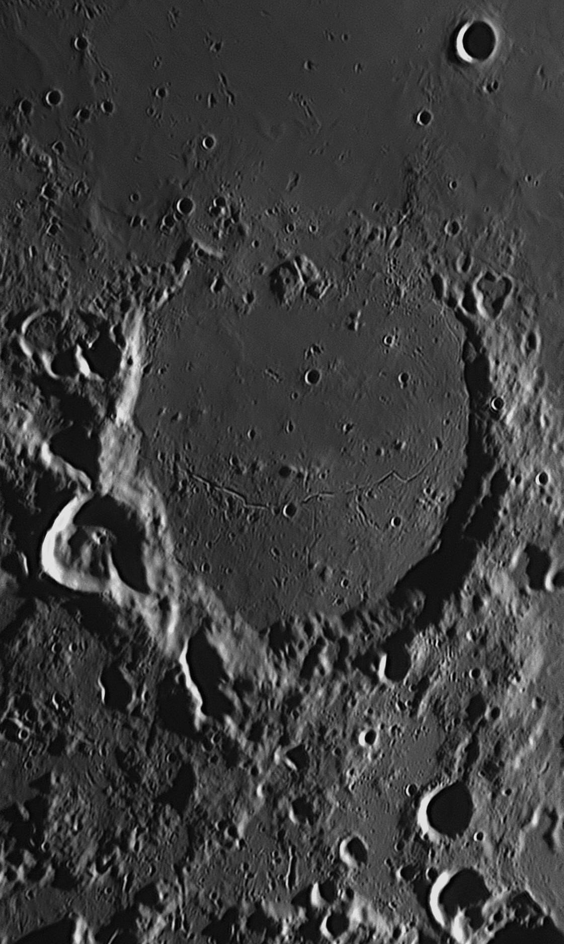
Fracastorius
Girolamo Fracastoro (Fracastorius, 1478-1553) was a Venetian
physician who was the first to realise how epidemics were spread. He also was
the first to declare that fossils were the petrified remains of living
creatures. He was also an astronomer, and in his Homocentrica of
1538 he tried to replace Ptolemy’s geocentric system of deferents and epicycles
by restoring the homocentric spheres of Eudoxus and Callippus, but without
taking the revolutionary step of replacing the Earth at the centre of the
spheres with the Sun, as Copernicus did. He advocated an inflexible system of 77
homocentric spheres as follows: 1 carrying the fixed stars, 7 carrying the
planets, 6 for the daily rotation and precession, 10 for Saturn, 11 for Jupiter,
9 for Mars, 4 for the Sun, 11 for Venus, 11 for Mercury, 6 for the Moon, and 1
for a sublunary sphere. He added that it would “do the Sun a great deal of good
to get two more spheres, making a total of 79.” He applied names to all of these
spheres, some examples being circumducens, circitor, contravectus, anticircitor
and ultimus contravectus. Where possible, they operated in sets of five. J. L.
E. Dreyer has written that this kind of thinking by Fracastorius (and others
like him) was like “trying to breathe life into a mummy”. Tycho Brahe would be
scathing about Fracastorius’ attempts to turn the clock back 19 centuries.
Fracastorius said that the sublunary sphere was not his invention, but had
originally been discussed by philosophers such as
Seneca (3 BCE-AD 65) in the seventh book of his Naturales
quaestiones. As its name implied, the sublunary sphere was above the
zones of air and fire, and below the Moon’s sphere. He claimed it was a sphere
of æther with dense and less dense parts. It provided a place for comets, which
were thought to be clouds of very dense æther moving through it. These explained
the variations in brightness of the planets, their light dimming as they passed
behind a denser part. Others argued that comets were flaming emissions high in
the zone of fire. Although very few astronomers followed Fracastorius’ lead, and
a few others tried to account for small errors in predictions made by the
Ptolemaic system by adding epicyclets onto epicycles, by far the great majority,
including all of those who produced famous almanacs, adhered to the original
system of Ptolemy as translated by Gerard of Cremona and Regiomontanus in their
versions of the Almagest. 32: April 2019
This month we will look at a large squarish walled plain near the Moon's North
Pole, W Bond.
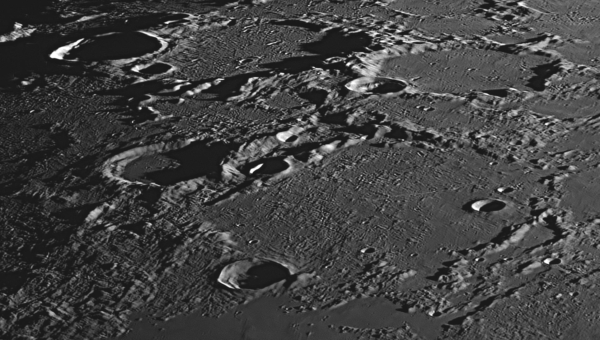
This picture is dominated by a group of large, contiguous and ancient crater-plains with flat floors. Their diameters range from 50 kilometres up. There are a number of more recent bowl-shaped impact craters ranging in size from 56 kilometres down to tiny craterlets. The largest feature in this image is the walled plain W Bond, a squarish feature with two damaged corners. It has a diagonal of 163 kilometres. In the image above, it occupies two-thirds of the lower half of the picture, trending to the right. This image was taken at 7:22 pm on 18 September 2018. North is to the top, east to the right.
This large ridge-bordered plain lies on the northern edge of the Mare Frigoris (Sea of Cold). As it lies at latitude 65º North, it appears greatly foreshortened. Straddling its south-western ramparts is the 33 kilometre bowl-shaped crater Timaeus, and just outside its north-western wall is is the 55 kilometre flat-floored crater Epigenes. Hundreds of small hills cover the floor of W Bond, being especially dense in the western half. The largest crater inside the walls of W Bond is near its eastern corner, and is designated W Bond B. It has a diameter of 15 kilometres and is relatively recent, as the rock melt surrounding it looks fresh and undamaged. North-east of W Bond B is a similar bowl-shaped crater known as W Bond C, which is only 7 kilometres across.
Starting about 15 kilometres to the north of W Bond C is a fine cleft about 95 kilometres long. After running in a westerly direction for about 60 kilometres it swings around to the north-west in a large arc, and heads towards the crater Epigenes.
Near the upper left corner of the image and filled with shadow
is the 51 kilometre crater Anaxagoras , which is surrounded by a
spectacular system of rays. Although very prominent at the time of Full Moon,
the rays are only faintly visible when the Sun is low to the horizon, but in the
image above they can be seen as west-to-east light-coloured streaks in the
upper-right quadrant.
W Bond
William Cranch Bond, 1789-1859) was born in Falmouth in the American
state of Maine. He became a watch and clock maker, working for his father in his
Boston shop. William was inspired to become an amateur astronomer after watching
a solar eclipse in 1806, when he was aged 17 years. He independently discovered
the Great Comet of 1811, and acquired a reputation as an adept observer. In 1815
the Harvard University sent him to Europe to collect information about
observatories. On his return he presented his findings to Harvard, but they
decided that an astronomical observatory was beyond their limited finances. In
the next decade, William married and fathered four sons and two daughters.
He was still interested in Harvard, and suggested to them that he bring his
personal astronomical equipment to Cambridge, Massachusetts, and become the
"Astronomical Observer to the University", for which he would require no salary.
They agreed and he and his family moved to Harvard in 1839. Later, in 1843, a bright sun-grazing comet aroused great
interest, and the public turned to Harvard University for information. But
Harvard didn’t have an observatory, or even their own telescope (Yale had built
an observatory with a 5 inch refractor in 1828). Citizens and Harvard officials,
now well aware of what they were missing, raised $25 730 towards the
construction of a state-of-the-art observatory. Bond designed the building and
the observing chair (both of which are still in working order today), and
Harvard bought a 38 cm (15 inch) refracting telescope, equal in size to the
largest in the world at the time. It was built by the German firm of Merz and
Mahler of Munich, the firm which had been made world leader in optical
excellence by Joseph Fraunhofer. It was a twin of the telescope completed in
1839 for Wilhelm Struve at the Pulkovo Observatory in Russia, and was the
largest refractor in the US until 1867. It has always been known as the "Harvard
Great Refractor", and is still in working order. The telescope was first put to use on June
24, 1847, when it was pointed at the Moon. Bond and his son George Phillips
Bond
discovered Saturn's moon Hyperion. (It was independently co-discovered at the
same time by William Lassell in Britain, and all three are given credit.)
Father and son were the first to observe the then innermost ring of Saturn,
termed the Crepe ring, when they pointed Harvard’s telescope towards Saturn in
1850. Working with John Adams Whipple, the Bonds pioneered
astrophotography, taking the first daguerreotype image of a night-time star
(Vega, in 1850) ever taken. In all, the three took between 200 and 300 photos of
celestial objects.
33: May 2019
This month we will look at an interesting impact crater in
the Mare Nubium (Sea of Clouds), Bullialdus.

At the centre of this image is a 63 kilometre diameter impact crater named Bullialdus. Located in the western part of Mare Nubium, it is more recent than most other features in the image, except for small craters and craterlets. North is to the top, east to the right. The morning Sun is rising over Bullialdus, but half of the crater floor is still in shadow. This image was taken at 7:05 pm on 2 August 2017.

This image was taken at 7:52 pm on 17 August 2019. The Sun was higher and the
shadows smaller for this image. Bullialdus has spectacular walls with many terraces,
formed when the newly-formed walls slumped down into the crater. There is a fine
cluster of central mountains, caused by the shock wave from the impact
rebounding off the deep base rock and returning to the surface to lift and
fracture the newly formed crater floor. Bullialdus is surrounded by a halo of
rock melt, some of which has poured into the 26 kilometre crater Bullialdus A
, which adjoins Bullialdus to the south-east. Running to the north-west from Bullialdus and passing south of
Lubiniezky is a broad but shallow vallley, about 140 kilometres long and 15
kilometres wide. This valley is crossed by two land bridges, the easterly one
narrow and high, and the westerly one broad and low.
Bullialdus
Ismaël Boulliau (Bullialdus, 1605-1694) was a French astronomer,
mathematician, and an early foreign member of England’s Royal Society. He was an
active supporter of the views of Copernicus and Galileo, and was friends with
Pierre Gassendi and Johannes Hevelius. He is shown assisting Hevelius to make
sunspot observations in a plate in the latter’s Machina Coelestis
of 1673.
One of Bullialdus’ most important works was the Astronomia philolaica
of 1645. In this, he strongly supported Kepler's hypothesis that the Sun holds
the planets in elliptical orbits around itself, but argued against the physical
theory Kepler had proposed to explain these phenomena. In particular, he
objected to Kepler’s proposal that the strength of the ‘magnetic’ force exerted
on the planets by the Sun decreased in inverse proportion to their distance from
it. Bullialdus argued that if such a force existed, it would instead have to
follow an inverse-square law, saying that it would behave as light does,
becoming fainter in proportion, not to the increase in distance, but to the
square of the increase. However, Bullialdus thought that it was all
hypothetical anyway, and Kepler’s magnetic force from the Sun holding the
planets in their orbits did not exist. After Johannes Hevelius determined a rough
period of 11 months for the cycle of the long-period pulsating variable star
that he had named ‘Mira’ (meaning ‘wonderful’) in his Historiola
Mirae Stellae of 1662, Bullialdus decided to make a more precise timing.
After observing Mira's cycle over many years, he arrived at a value for its
period of 333 days, very close to the modern timing of 331.96 days. This was an
excellent result, quite amazing really, as this was a long-term project, and
Mira’s period varies slightly from year to year anyway, and may even be slowly
changing over the centuries.
Near the northern margin, about a third of the way from the western edge, is a
46 kilometre crater which has been almost completely filled with lava from the
Mare Nubium. Called Lubiniezky, it is what is termed a "ghost
crater". Because it has nearly been filled with lava, the floor is flat and the
remaining walls not very high. The lava forced its way into Lubiniezky through a
breach in the south-eastern ramparts. Just above the south-eastern corner of the
image is a wrecked and deformed crater called Wolf, 26 kilometres in
diameter. A similar "ghost crater" to Lubiniezky is Wolf T, about 40
kilometres west of Wolf. Near the bottom margin, about one third of the way east
from the western margin, is the 24 kilometre crater König.
34: June 2019
This month we will look at an interesting valley in the Moon's south-east
quadrant, the Rheita Valley, or to give it its proper name, Vallis
Rheita.
1. Vallis Rheita, southern section.
2. Vallis Rheita, northern section.
At the bottom
left (north) of image 2 is a 71 kilometre diameter impact crater named
Rheita. Running south-south-east from the western side of Rheita (towards
the upper right corner) is a broad valley that is 515 km long, called the
Vallis Rheita, or Rheita Valley. The photographs were taken at
6:16 pm and 6:26 pm on 14 August 2021. The Sun is shining from the east, or
upper left corner. With an age of 3.9 billion years, the crater Rheita is
quite old and degraded. The whole area in this image is one of the oldest on the
Moon, and is completely covered with craters from large to tiny. It is also
smeared over with rock melt from newer impact craters in the vicinity. In
places, Rheita's walls are up to 4 kilometres high with some sharp crests. On
the flat floor of Rheita is a mountain mass, offset to the north-west from the
centre.
Rheita
The Vallis Rheita is much older, as it has been deformed at its northern
end by Rheita itself. The northern end is low and rounded, and the floor going
south gives the appearance that it may be a chain of ancient craters. In a few
places, the valley is crossed by substantial ridges. Heading south in image 2,
the valley crosses an extremely old crater, and has caused its floor to collapse
to the lower level of the valley. This degraded 75 kilometre crater is called
Young, after Thomas Young, the English scientist who passed a beam of light
through two slits to produce 'interference fringes' - the famous
Double-slit Experiment of 1801. The valley continues through Young
and immediately enters a later, fresh-looking 46 kilometre crater called
Young D
(near the upper right-hand corner of image 2, and also in the centre of image 1.
Young D has terraced walls, a central mountain peak and some small craterlets on
its floor. Once past Young D, the Vallis Rheita turns due south and continues
on, off the upper right-hand corner of image 1.
Anton Maria Schyrlaeus von Rheita, (1597 or 1604 - 1660), born in Reutte in Austria, was an astronomer and optician. He is credited with inventing several inverting and erecting telescopes, and with introducing the terms 'ocular' and 'objective' into the science of optics. It is rumoured that he made an erecting telescope for Kepler using a two-lens compound eyepiece, but this may need supporting evidence as Kepler had already received one from Galileo and then built one to a modified design himself. Kepler died in 1630.
Schyrlaeus von Rheita published in 1645 a very influential book on astronomy, Oculus Enoch et Eliae. In it was a drawing of the Moon which was very good for its time, and showed the outlines of the 'seas', the principal craters and the ray system of the crater Tycho to spectacular effect. The haloes of rays around the craters Copernicus and Kepler were also clearly depicted. He did not think to name any lunar features. This means that his map was overshadowed by that of Michael van Langren, which was also published in 1645. Van Langren's map had far more detail and he had given hundreds of the topographical features names. To find out more about van Langren's map, go to Item
35: July 2019
This month we will look at an interesting district near the Moon's centre, just
north of the crater Schröter.
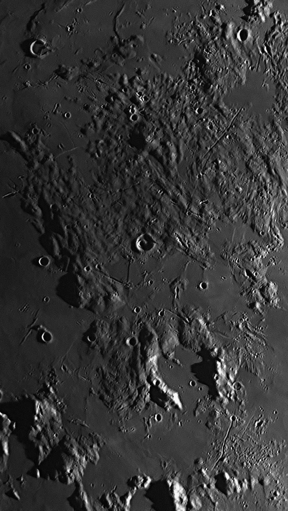
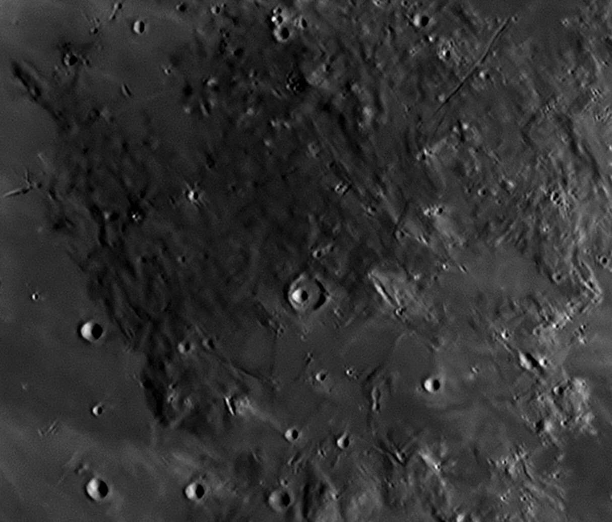
This image shows much of the same area under a higher Sun, with fewer shadows. Pyroclastic activity has covered much of the area with dark layers of basaltic lava and volcanic ash. It is one of the darkest areas on the Moon. This image was taken at 6:46 pm on June 20, 2021.
The crater Schröter is very ancient and is in a damaged condition, much
of the southern wall being missing. Although its walls to the north are severely
degraded and smoothed over, those to the south-west and east are sharply
defined. Some peaks in the eastern wall cast substantial shadows across the
floor in the image above, so they must be very high. A valley cuts though the
north wall, heading due north. The floor of Schröter is flat, being filled with
lava that has welled up from below. The lava has swept over the southern wall,
carrying it away and leaving a great breach about 7 kilometres wide at its
narrowest point. The lava has filled a low-lying area to the south of Schröter,
forming a flat plain. Just south of Schröter's centre is a 3 kilometre
craterlet, Schröter E. There is a fine network of clefts to the north,
east and south of Schröter.
Just north of the exact centre of the image is a 10 kilometre crater called Schröter W, inside of which is a 4 kilometre craterlet, Schröter A. This craterlet is not in the exact centre of Schröter W, but is displaced to the western half of the floor. North of Schröter W is a large area of volcanic hills, linear ridges and a few peaks. It is an active pyroclastic zone, volcanic ash having darkened the whole area, which is crossed by three clefts. In the 19th century, a few observers claimed to detect features in this area that looked artificial, so it became known as "Gruithuisen's City" (see below). We can see in the image above that there is nothing artificial there.
Schröter
Johann Hieronymous Schröter, (1745-1816) was a wealthy German lawyer in Hanover who made the acquaintance of two of William Herschel’s brothers and became interested in astronomy. In 1779 he acquired a three feet long (almost one metre) achromatic refractor with a 2½ inch (63 mm) lens by Dollond to observe the Sun, Moon and Venus. Herschel’s discovery of Uranus in 1781 inspired Schröter to pursue amateur astronomy more seriously. He moved out of Hanover to the darker and clearer skies of the countryside, becoming chief magistrate and district governor of Lilienthal. In 1784 he paid 31 Reichsthaler (about 600 Euros of today) for a Herschel reflector of 4 feet (1.22 metres) focal length and 4¾ inch (120 mm) aperture, and then purchased another Herschel reflector of 6 inches (152 mm) aperture. He quickly earned a good reputation from his observational reports in journals, but wished to improve the quality of his work. In 1786 he paid 600 Reichstaler (equivalent to six months earnings) for a 7 feet (2.14 metre) focal length, 9½ inch (241 mm) aperture reflector by Schrader, with eyepieces allowing up to a claimed 1200 magnification. He paid another 26 Thaler for a screw-micrometer. Schröter also built an 18½ inch (470 mm) aperture reflector of his own design, which turned out to be clumsy and inefficient to use.
With this instrumentation he systematically observed the Moon, Venus, Mars, Jupiter and Saturn. Schröter made extensive drawings of the features of Mars, yet curiously he always thought that he was seeing mere cloud formations as on Jupiter, rather than surface features. Soon he had become an accomplished selenographer, and in 1791 he published an important early study on the topography of the Moon entitled Selenotopographische Fragmente zur genauern Kenntniss der Mondfläche, (Fragments of the Moon’s Topography for a more accurate Knowledge of the Lunar Surface). By this time, Latin had been phased out as the language of science, and such books were being written in the common language of their authors. This book introduced the Latin word ‘crater’ (cup), and the German word ‘Rille’ (groove) to the lunar terminology.
Schröter knew his history of astronomy and named 80 new features, including the craters Alhazen, Bernoulli, Bradley, Cassini, Doppelmayer, Euler, Hadley, Kies, La Caille, Tobias Mayer, Mercator, Picard and Rømer. He named two craters Hooke and Newton, but, knowing of the bitter enmity between these two Englishmen in their lifetimes, he placed them as far apart on the Moon as he could, Hooke away up in the northern hemisphere and Newton near the South Pole. Also named were Mount Huygens, Mount Hadley, Mount Pico, Mont Blanc and the Leibniz Mountains. Like most astronomers, he preferred Riccioli’s names over those of Hevelius and Langrenus, and this fact influenced the official acceptance in the 20th century of most of Riccioli’s names by the International Astronomical Union (IAU, founded on 28 July 1919). A crater and a valley on the Moon as well as a crater on Mars have been named after Herr Schröter. In 1793 he was the first to notice the phase anomaly of Venus, now known as the Schröter Effect, where the phase appears near dichotomy to be more concave than it should. Schröter’s drawings of Mars and lunar features made him and his observatory renowned in the astronomical world.
"Gruithuisen's City"
The painstaking but incomplete mapping of lunar features begun by Johann Schröter in 1787 but cut short in 1813 when his observatory at Lilienthal was destroyed by Napoleon’s Grande Armée undoubtedly acted as an incentive for others to pick up where he had left off, or at least to take an interest in lunar observation. One such person was the Bavarian Franz von Paula Gruithuisen (1774-1852), who became a professor of astronomy in Munich. His publications on lunar and related matters began in 1821, and appeared in a variety of rather obscure journals and handbooks for some 28 years. He concentrated on observing and drawing quite small areas of the lunar surface, and it was here that his imagination carried him to extremes. He thought that he could detect evidence of lunar inhabitants, such as huge buildings, waterways etc. in various places on the Moon. The one item that drew the most attention, however, was what he called a “Wallwerke” or walled enclosure, which people interpreted to mean a supposed lunar city.
Below are shown a group of sketches of the formation made by
Gruithuisen and two other observers, Schwabe and von Schenk. In fairness we
should make clear that he was using a small refractor telescope of only 50 mm
aperture, which is scarcely enough to resolve the two sets of sub-linear
features of the ‘city’ into their separate, knobbly elements. Obviously, the
idea of a lunar city brought him ridicule from the astronomical community, who
deplored such fantastic notions. However, other observers with more powerful
telescopes felt obliged to examine the supposed city for themselves, and between
1834 and 1836 Wilhelm Beer and Johann Mädler used an excellent Fraunhofer
refractor to produce the first fairly accurate Moon map, the Mappa
Selenographica, which revealed the ‘city’ to be a natural formation,
although it is apparently unique on the Moon's near side.

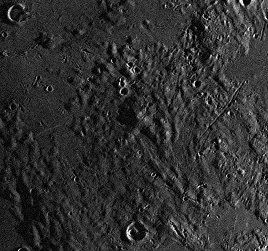
At right is a part of the Lunar Picture of the Month shown in full at the start
of this section, but cropped to roughly match the sixth drawing above, which was
Gruithuisen's last attempt at showing his "City". The photograph was taken just
after First Quarter, with the sunlight coming from the east (right). Shadows
extend towards the west (left). Gruithuisen's final drawing was made with the
Moon at Last Quarter, with the sunlight coming from the west (left), and shadows
extending to the east (right).
Photography reveals the region to be a remarkable pyroclastic zone with linear clusters of volcanic domes and ridges along fault lines. The vents of the many ash volcanoes have discoloured the whole area a dark, sooty grey.
A similar situation arose later in the 19th century, when what appeared to be narrow, dusky linear features were first observed on the planet Mars and described by Schiaparelli as ‘canali’ (‘channels’, but mistranslated as ‘canals’). Subsequent telescopic observations of the ‘canals’ and, later, photographs from various spacecraft, showed that these were only what had been suspected for many years: random blotches of darker surface markings.
36: August 2019
This month we will look at Hadley Rille, properly
called Rima Hadley, where Apollo 15 landed. 'Rima' is Latin for
'fissure'.

Rima Hadley and its environs, where Apollo 15 landed. The Rille is a V-shaped valley between 1 and 1.5 kilometres in width, and is 80 kilometres long. It appears as a wiggly line starting at an elongated gorge near the lower left margin of the image, and running north-east to the centre. There are many more rilles to the north. Its depth varies between 180 and 270 metres, but at the Apollo 15 landing site it is 370 metres deep. Comparing the image above with the NASA image below, from Nambour we see the area slightly foreshortened (by 12%) as we are at 27º South latitude while Rima Hadley is at 26º North. Image taken on 2 July, 2017.
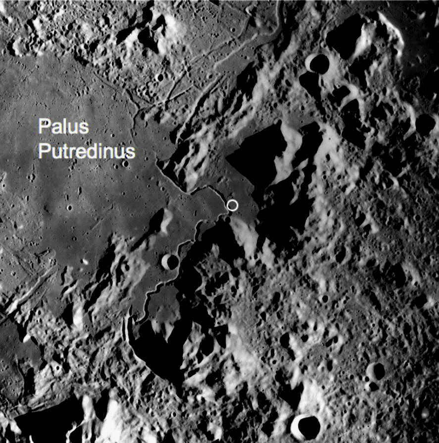
A photograph of Rima Hadley from an Apollo spacecraft, in orbit around
the Moon, to the same horizontal scale as the previous photograph taken from
Nambour, for comparison purposes.
The circle shows the exact landing site of Apollo 15, next to the rille. The
camera is looking vertically down, so there is no foreshortening. This was the
first mission to include an LRV
(lunar roving vehicle). 'Palus Putredinus' is a 17th century name for the plain
to the north-west of the rille, and means the 'Marsh of Decay'. -
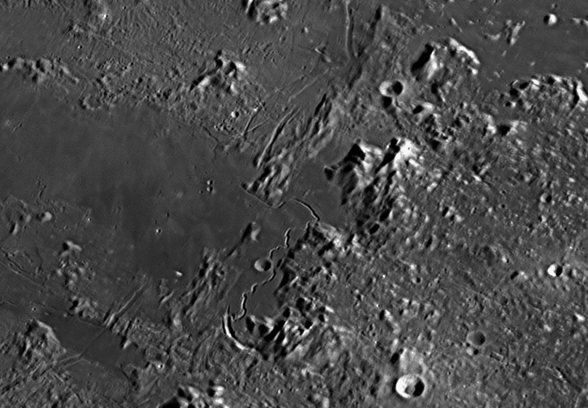
Rima Hadley under a higher Sun, which reduces the shadow effects on mountains and craters. The rille, though, being deep, remains filled with shadow. Image taken on 2 August, 2017.
37: September
2019
This month we will look at a large crater near the Moon's western limb,
Hevelius.
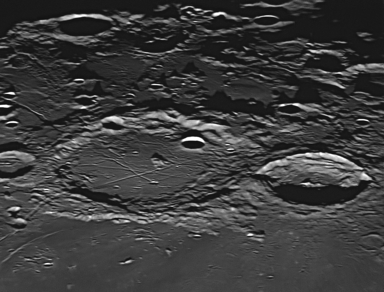
The walled plain Hevelius is very ancient. Many other impactors have
struck it since it was formed 3.9 billion years ago, and have left their craters
superimposed on it. Its neighbour Cavalerius is much younger, perhaps only 1.1
billion years old, and has crushed Hevelius' north wall. Hevelius itself is
remarkable for the pattern of six straight and narrow valleys or rilles which
are seen in the southern half of its floor. These rilles cross each other at
half-a-dozen places, the intersections being angular and clean, as if cut by a
pointed tool. Two rilles cut through each other at close to right-angles, one of
these junctions having a craterlet exactly on it. There are some 45 degree
crossings, too. At least three of these rilles continue their course outside of
Hevelius, running to the north-west (upper right), the south-east (lower left)
and the south-west (upper left). The latter two continue away from Hevelius for
over 100 kilometres each. The south-eastern one is particularly interesting for,
when it leaves Hevelius, it climbs over the crater wall and down the other side
like a road cutting. It then passes underneath an 11 kilometre crater before
heading into the Oceanus Procellarum, where it becomes obliterated by the lava
plain. The central mountain in Hevelius is volcanic with a summit crater, and is
surrounded by a small pyroclastic area.
Hevelius
Johannes Hevel (known to history as Hevelius, 1611-1687) was a wealthy brewer in the Hanseatic town of Danzig (later to become Gdansk in Poland), where he was a Councillor and sometime Mayor. He owned three adjoining houses, and in 1641 he built an observatory platform across the roofs of the houses, equipping it with a spindly 60 feet long (18 metres) telescope of rather small aperture and numerous other instruments such as sextants. He named his observatory Stellaburgum (Star City or Star Castle). The Polish King John
III Sobieski and Queen Marie Louise came to visit several times. Hevelius devised a number of new (but faint) constellations to fill in gaps between the 45 constellations known since ancient times. Of these, seven remain in use in the 21st century. Their names are: Vulpecula (the Fox), Canes Venatici (the Hunting Dogs), Leo Minor (the Small Lion), Lacerta (the Lizard), Scutum (the Shield), Sextans (the Sextant), and Lynx.Using a more manageable telescope 12 feet (3.6 metres) long, with a magnification of 50 times, Hevelius made telescopic observations of sunspots between 1642 and 1645, devoted four years to charting the lunar surface, and discovered the Moon's libration in latitude and longitude. He published his results in Selenographia: sive, Lunæ descriptio of 1647, a work which entitles him to be called a founder of lunar cartography. The book contained a hand-tinted map, and the colours chosen seem to indicate that his telescope was unable to convince him that the ‘seas’ on the Moon were not really water, for he had them coloured blue. The areas of the lunar surface that were revealed and then hidden by the monthly wobble or libration of the Moon were accurately shown. He also included drawings showing the Moon's appearance at different phases.
In his Selenographia, Hevelius used another map to devise a nomenclature for all the maria (seas) and terrae (lands) on the Moon and the smaller features. In all, he named 385 lunar features. He was probably unaware of van Langren’s almost contemporaneous attempt which had named lunar features after famous people (see item
#19 above), and chose to apply Latin and Greek names of classical features of Mediterranean geography. Independently, each man exhorted other astronomers to adopt his system of naming lunar features, and threatened litigation if anyone else should devise different systems of names in opposition to his. However, this was an empty threat, as there was no legal requirement for any competitor to comply with such requests.Why did Hevelius choose the names he did? People had argued since antiquity that the Moon is a mirror of the Earth. They had believed the patterns of dark and light on the Moon’s surface to be seas and continents that paralleled those on the Earth. Just as humans, animals and plants inhabit the Earth, so ‘selenites’ and other life-forms were presumed to inhabit the Moon. This parallel between the Earth and the Moon was important to Hevelius, and he compiled his lunar maps from multiple, detailed telescopic observations, adopting some of the symbolic conventions of geographical mapping. He did not seem to fully understand the interplay of light and shadow on the Moon’s surface, and mapped the shadow-casting ridges and crater rims as if they were chains of terrestrial mountains. For some reason, he called most hollowed-out depressions (craters) ‘Mons’, meaning ‘mountains’, e.g. the crater Tycho was named Sinai Mons (Mount Sinai), Copernicus was named Mons Ætna (Mount Etna), and Ptolemaeus was named Mons Sipylus. The three terrestrial mountains just named are all volcanic in origin, but only Mount Etna is active with an actual crater, which may be why Hevelius chose it for the great formation now called ‘Copernicus’. He called the dark crater-plain Plato ‘Lacus Niger Major’ (Large Black Lake), which is apt given his 50x telescope.
Van Langren's lunar names of 1645 never came into common use, but Hevelius' names of 1647 did, although in 1651 the Italians Giovanni Riccioli and Francesco Grimaldi produced their own Moon map with a set of names for lunar features that reverted back to naming craters after people as van Langren had done. Their work is described in the next item below, #38 .
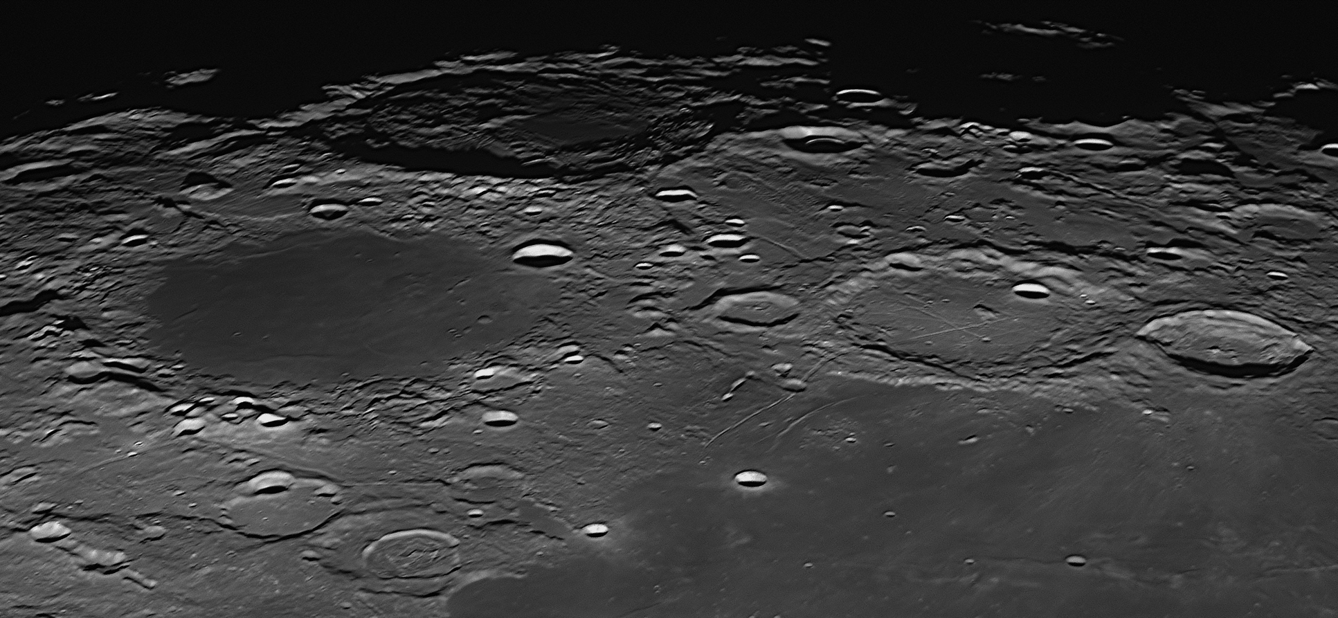
3
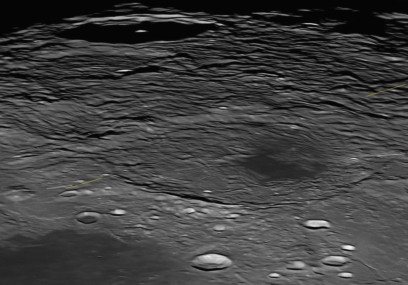
Grimaldi is a much foreshortened circular formation that gives the
impression of a small 'mare' or 'sea', due to a large proportion of its floor
being covered with dark lava. The walls are not very high, except in the
south-east where there are some rugged peaks, one attaining an altitude of 2.7
kilometres. In the north, the wall is discontinuous. There are some craterlets
on Grimaldi's floor, but otherwise it is fairly featureless in the southern
two-thirds. The northern third contains an active pyroclastic area, with three
main volcanic domes. In addition, there are some low ash volcanoes towards the
northern margin of the dark 'sea'. Impinging on the north-north-western edge of
the floor is a much newer 22 kilometre crater called Grimaldi B. There is
a network of clefts in the eastern wall, and more rilles and grabens further
east and found from the north-east to the south-east of Grimaldi. These are
called the
Rimae Grimaldi, and are clearly seen towards the lower margin of the
above image.
Giovanni Battista Riccioli (1598-1671) discovered the first binary star
(Mizar in Ursa Major) in 1650. He worked with his former pupil Francesco
Grimaldi
(1618-1663) at Bologna. Both were Jesuit clerics in the Catholic Church. They
shared an interest in astronomy, and decided to work together to produce an
accurate map of the Moon, among other things. This map, or selenograph, was
drawn by Grimaldi and was the result of his careful telescopic study of the
Moon's surface. It is fairly accurate in major details, although for some reason
the spectacular crater Cassini and the Vallis Alpes (Alpine Valley) are missing.
Riccioli, with some help from Grimaldi, contributed a new series of names for
lunar features, in which mountains and valleys were named as such, and the
bowl-shaped depressions (not yet called 'craters') were named after
famous astronomers and philosophers, some still alive. As was the custom of the
time, the names were Latinised. The maria ('seas') were named after various
meteorological concepts, for it was then thought that the Moon influenced the
weather and people’s behaviour. We still use Riccioli’s names today, and those
of Langrenus and Hevelius are dispensed with, although there are a few
exceptions. Riccioli published Grimaldi’s map in his two-volume work on
astronomy entitled Almagestum novum, astronomiam veterem novamque
complectens or New Almagest, in 1651. By necessity, as an
official of the Catholic Church, when writing about astronomical matters he had
to comply with Church doctrine. He therefore opposed the Sun-centred world views
of Copernicus, Kepler and Galileo, though he ventured to praise the heliocentric
theory as a useful hypothesis for calculating planetary positions. Riccioli and
Grimaldi experimented with falling bodies in an attempt to refute Galileo’s
findings. Instead, they found that Galileo was nearly correct, which impressed
them greatly.
It appears that, when they began assigning names to the lunar craters, Riccioli
and Grimaldi had a hidden agenda. Interestingly, despite their professed
opposition to Copernicus’ theory, they named the Moon’s most spectacular crater
after him, and a nearby prominent crater after Kepler. Another relatively close,
very bright crater was named after Aristarchus, the originator of the
heliocentric theory. Not far away, they named a large, whitish patch (Reiner
Gamma) after Galileo, mistakenly showing it as a crater. Twelve craters were
named after other Jesuit astronomers (Bettinus, Clavius, Curtius, Cysatus,
Furnerius, Gruemberger, Kircher, Moretus, Schomberger, Scheiner, Simpelius, and
Zucchius), but they were far away near the Moon’s south pole and the crater
Tycho, as the Society of Jesus supported the Tychonic world view. When asked
about this, Riccioli and Grimaldi said that they had “flung the heliocentrists
away into the Ocean of Storms”, far from the Jesuits. But they named the two
large adjoining craters shown above after themselves. Where are those craters?
Not in the far south of the Moon with other Jesuits, but near its Equator,
bordering the Oceanus Procellarum (Ocean of Storms), close to the ‘crater’
Galilæus, and in the same quadrant of the Moon as Copernicus, Kepler and
Aristarchus. This is considered to be covert support for the Copernican theory,
which as Jesuits they knew they could not publicly express. The earlier selenographer van Langren had
named a spectacular crater and a sea on the eastern side of the Moon after
himself (see items
Similarly, Riccioli named three adjoining craters Purbach, Regiomontanus and
Walter, and King Alphonsus at Toledo is with the Toledan astrologer al-Zarqali
(as ‘Arzachel’). The craters Aristotles, Plato, Eudoxus, Callippus, Aristillus,
Timocharis and Autolycus are all Greek neighbours in the northern hemisphere.
Julius Caesar adjoins Sosigines, Reinhold is close to Copernicus and
Longomontanus is near his mentor, Tycho. The two strong men Atlas and Hercules
are together (see item
The walled plain Riccioli has broken and discontinuous walls of no great
height except in the south-east. The northern (right) half of its floor is
flooded with dark lava, but the southern is much more rugged, and covered with
debris from the Mare Orientale impact basin which lies over 700 kilometres to
the south-west. This debris field trends from south-west to north-east, and
covers most of the image except where there are later flows of dark mare
material. A graben (between the two white lines) begins outside the northern
wall and runs past a very bright 2 kilometre craterlet and heads in a
south-south-eastern direction (right to left) along Riccioli's floor, where much
of it has been flooded over and obscured by molten mare lava. It emerges from
the dark mare material just south of Riccioli's centre where it branches into
three. Two of these branches are delicate and do not reach Riccioli's
south-eastern wall, but the third, easily seen above, continues in the original
south-south-eastern direction up and over the southern wall, where it peters
out. A wider graben (between the two yellow lines) runs from north-west to
south-east across the debris field on Riccioli's floor. As it is superimposed on
the debris, it must have formed later than the Mare Orientale impact, which
occurred about 4 billion years ago.
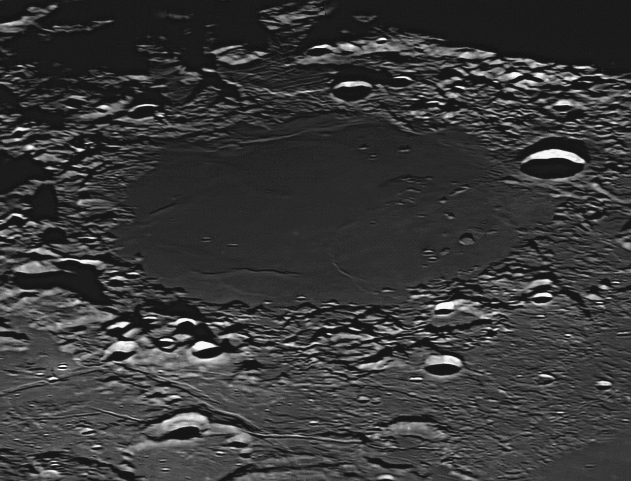
Riccioli and Grimaldi
39: November 2019
Cleomedes is the largest crater in this image, and with a diameter of 129
kilometres and a flat floor, can properly be termed a 'walled plain'. The image
was taken on 14 September, 2018. Cleomedes
is found about 100 kilometres north of the northern margin of the large, oval
Mare Crisium (Sea of Crises). It is quite ancient, being created about 3.9
billion years ago. The walls are very rugged, and reach altitudes of 1.6 to 1.7
kilometres above the floor. The highest peaks are on the western side (closest
to us in the image above). The floor is flat although slightly convex, being a
little higher in the centre than at the margins. It is marked by four more
recent impacts, the resulting craters being between 12 and 22 kilometres in
diameter. Its far (eastern) side is marked by a Y-shaped fissure or "Rima",
which is 61 kilometres long. There is a small group of three hills a little
north (left) of Cleomedes' centre, and its floor is dotted with numerous
craterlets. The north-west wall is damaged by the 44 kilometre crater Thalles,
which has forced much of the wall material to slip down to encroach upon the
floor in a huge landslide. A broad valley crosses the image, passing to
the south (right) of Cleomedes. It can be seen above, running from the top right
corner to the bottom centre margin. Other named craters in the image are 60
kilometre diameter Burckhardt (near upper left corner) and 34 kilometre
diameter Delmotte
(near upper right margin). Burckhardt is more recent than Cleomedes, and has
impacted on two older craters. Its lofty walls are 2.5 kilometres high.
This
month we will look at a large crater near the Moon's north-eastern limb,
Cleomedes.
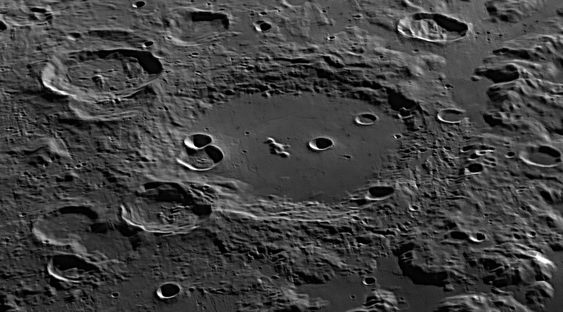
Cleomedes was a Greek astronomer active in the 2nd Century BCE. He was
the author of a book on the astronomy of his time, called "The Theory of
Circular Movements of Celestial Bodies". In this book he described the
discoveries of other astronomers, in particular, the work of Posidonius
and Eratosthenes. He passed down to us the stories of how these two
astronomers were able to determine the circumference of planet Earth, reaching
surprisingly good results.
As explained by Cleomedes, Posidonius used the elevation of Canopus to
determine the difference in latitude between Rhodes and Alexandria, and used the
estimated distance between the two cities to determine his result. Due to
observational inaccuracies, possibly caused by atmospheric refraction (Canopus
culminated only little more than one degree above the southern horizon at
Rhodes), his answer was 240 000 stadia (38 400 km), not quite as good as
Eratosthenes’ result.
40: December 2019
Hipparchus 190-120 BCE) was born at Nicæa in Bithynia (now Iznik in
Turkey, not far from Istanbul) and was named by Delambre as one of the most
astonishing men of antiquity. He worked on the island of Rhodes for a time, but
then moved to Alexandria so that he could have access to the Great Library. His
intention was to use the Babylonian observational data collected there to
improve the Greek models of the cosmos. When he had settled in, Hipparchus
gathered together everything he could find that was known about the heavens,
sifted it through, deleted the obvious errors and inaccuracies, and tested
measurements to confirm or correct them. He wrote a book, a commentary on the
Phaenomena of Aratus of Soli, which was then a hundred years old. This
was a Greek poem which rendered two books of Eudoxus, Phaenomena
and Entropon, into verse form. If it weren’t for this
poem, Hipparchus would have been unaware of the classic works of Eudoxus, the
originals having been lost (see item #29
above). It was in this poem that Aratus passed down to us the names of the
Pleiades or Seven Sisters: Alcyone, Merope, Celaeno, Electra, Sterope, Taygete
and Maia. All of the following information about the discoveries of Hipparchus
is found in this, his first book. Although he wrote many more, his commentary on the
Phaenomena of Aratus is the only one to survive to the present day. A
later astronomer, Ptolemy, based much of his own writing on that of
Hipparchus (see item He found, however, that the orbits would need to be
elliptical, not circular, to satisfy the observations. As this conflicted with
the conventional wisdom of the time that all objects in the sky must move in
perfect circles with uniform motion, he abandoned this line of inquiry,
rejecting it outright. He became firmly committed to Aristotle’s geocentric view
of the world, but agreed with Apollonius that the 55 homocentric spheres of
Eudoxus, Callippus and Aristotle should be reduced to eight. He also adopted the
system of small circles whose centres moved on large circles for Mercury, Venus,
Mars, Jupiter and Saturn, giving a total of thirteen spheres in all. In case
there were still residual errors between planetary predictions and actual
observations, he thought about adding smaller circles onto some of the regular
small circles – ‘wheels within wheels’ – to improve the accuracy. Each planet
would be located on the outermost, smallest circle. Hipparchus re-measured the inclination of the Earth’s axis by
studying recorded variations in the rising and setting points of the Sun at
various locations during the year, and checked the data by personal
observations. He drew up tables for the phases of the Moon and its position for
years ahead. In his spare time he invented trigonometrical tables. Before his
time, astronomers believed that, as the stars were fixed to the eighth sphere
and unchanging, there was no point in counting them or cataloguing them, but in
134 BCE, Hipparchus saw something that changed his thinking – a new star had
appeared in Scorpius that hadn’t been seen before. We don’t know if it was a
nova, or maybe only a comet; the important thing was, Hipparchus decided that he
would make a list of the stars and their positions, against which any
newly-appearing star could be checked. In compiling this list, completed in 129
BCE, Hipparchus made the first comprehensive tally of the stars, with 850 of
them catalogued in the 43 constellations that had been listed by Eudoxus and
another five that had been introduced by later astronomers. His instruments
included a gnomon, dioptra, sighting tubes, armillary sphere and an astrolabe
which he invented. He used these to measure the star positions with reference to
the ecliptic.
When organising his Catalogus stellarum fixarum (Catalogue
of Fixed Stars) and atlas, he divided the stars into six groups or
magnitudes, the brightest stars being first magnitude, and those so faint as to
be at the limit of visibility being sixth magnitude. We still use his system
today. While compiling this catalogue, Hipparchus compared his star positions
with some made by Eudoxus in Phaenomena and Entropon and quoted by
Aratus. He was surprised to discover that his results were slightly different to
those that had been made 240 years before. Hipparchus cross-checked his results
by comparing them with positions in the star catalogue produced by Aristillus
and Timocharis 128 years earlier. This revealed that all the positions had made
a small systematic change of nearly two degrees in two centuries, as if the
black starry sphere had tipped slightly, relative to the Earth. He also knew
that a temple to the god Menat built up-river at Thebes 3000 years previously
had been aligned with the star Spica, but now was noticeably out of alignment.
This led him to realise that the Earth’s axis did not always point to the same
position in the sky, but had a slow ‘wobble’, like a spinning top running down.
According to Hipparchus, the wobble altered every star’s position by about a
degree per century, and took 36 000 years to complete, after which all the stars
had returned to their original positions. He named this wobble the precession of
the equinoxes. We now know that precession moves star positions by about 50
arcseconds per year, or one degree in 70 years, a full cycle taking about 26 000
years. Hipparchus measured the length of the tropical year to an
accuracy of an hour, and confirmed the figure of Eratosthenes for the obliquity
of the ecliptic. By carefully observing the changing diameter of the Moon during
its monthly lunations, he found that it moved away from the Earth (to apogee)
for two weeks, and then closer to the Earth (to perigee) for the next two weeks.
He deduced that the greatest and least distances of the Moon from the Earth were
respectively 78 and 67 times the Earth’s radius. (In today’s measurements, this
gives average distances of 497 718 km and 427 527 km. Modern results average 406
370 km for apogee and 357 869 km for perigee. Using only his unaided eyes,
Hipparchus was within 20% of the true figures.) Hipparchus used a latitude /
longitude grid to define positions on the Earth, and determined the longitudes
of various locations across northern Africa, Europe and the Middle East by using
eclipses of the Moon. He fixed the positions of stars, using lines of celestial
latitude and longitude across the sky, but the 0º line of latitude was not the
celestial Equator, but the Ecliptic – the Sun’s path through the heavens. It is
therefore called an Ecliptical Co-ordinate System. The 90º latitude points (the
Ecliptic Poles) are displaced from the Celestial Poles by an angle of 23º 26’
21" (the same angle as the tilt of the Earth’s axis). The North Ecliptic Pole is
currently in Draco, and the South Ecliptic Pole in Dorado. His measurements of
stellar latitude were therefore quite different from Declination. The 0º line of
longitude ran from the North Ecliptic Pole to the South Ecliptic Pole, passing
through the point where the Ecliptic crossed the celestial Equator (the Sun’s
position at the northern vernal or spring equinox). He named this point the
First Point of Aries. Since his time, precession has moved the First Point of
Aries some 30º south-west into Pisces. Lines of increasing longitude then headed
east. The Ecliptical Co-ordinate System was especially useful for tracking the
Moon and planets with repect to the Sun, and so was eminently suitable for use
by astronomers in their main work, which was astrology. Hipparchus also invented a Right Ascension / Declination
grid aligned on the celestial Equator rather than the Ecliptic, but only used it
a few times. Known as an Equatorial Co-ordinate System, in this
arrangement the lines of Right Ascension and Declination were respectively
projections of lines of longitude and latitude on the Earth. The celestial
Equator was the line of 0º Declination. The First Point of Aries was again used
to define the 0 hours line of Right Ascension, but the R.A. lines all converged
on the North and South Celestial Poles, not the Ecliptical Poles. The Equatorial
Co-ordinate System did not replace the ecliptic latitude / longitude grid until
late in the 17th century, when astronomy parted company with astrology.
Ecliptical Co-ordinates are still widely used today in planetary science, as in
computing the positions of planets and satellites, and orbital elements such as
ascending and decending nodes. Both sets of co-ordinates drift out of date and
need to be regularly corrected (every 25 years or Epoch in modern
times), due to the effects of precession. Hipparchus also promoted dividing the
circle into 360 degrees, following the sexagesimal system of the Sumerians. For
all of this extraordinary work, he is regarded as the founder of the science of
astronomy, but he was firmly convinced that the geocentric model of the universe
was correct.
41: January 2020
Humboldt is the largest crater in this image, and with a diameter of
213 kilometres and a flat floor, is properly termed a 'walled plain'. The
largest small crater on its floor lies to the north (left) of the cluster of low
mountains and is 14 kilometres across. To the upper right (south-east) of
Humboldt is the crater Barnard, 104 kilometres in diameter. Barnard is
very ancient, being swamped by rock melt resulting from the Humboldt impact on
its north-western margin. In the foreground is the 128 kilometre crater
Phillips, also older than Humboldt and swamped by molten rock. The image was
taken at 5:18 pm on 14 September 2018 (23 minutes before sunset).
Humboldt is a circular walled plain, but as it is very close to the
Moon's eastern edge or limb, we see it at a low angle of perspective, looking
quite oval in shape. It is so close to the limb that the Moon's wobble or
'libration' often takes it so close to the limb that it is virtually
unobservable. Humboldt is one of the largest craters known that has a prominent
central peak. The floor of Humboldt has been bowed up by volcanic activity in
the past, the uplift causing a network of cracks to appear in the floor. In the
south-western part of Humboldt's floor (the lower right in this view), molten
magma has been extruded out onto the floor, which cooled and hardened into a
dark patch of basaltic material. In the process, the part of the crack where the
magma came out was covered over by the magma. Another eruption of magma occurred
on the opposite side of Humboldt, making a second but smaller dark patch on the
floor. The eastern wall has slumped down onto Humboldt's floor in huge
landslips, leaving a line of cliffs averaging 4500 metres high and about 150
kilometres long. There is an unusual crater within a crater
like a 'bull's eye' on the far side of Humboldt's floor. It is the middle one in
a cluster of three and is clearly seen in the image above.
By 1760 only a few astronomers still held on to the
ancient idea that the universe was contained within a ‘celestial sphere’, but
most still believed that the Sun was at the centre of the universe. The question
of whether the universe had boundaries in space and time had captured the
imaginations of people since they first looked up at the night sky, and it had
attracted the attention of philosophers and scientists throughout the
seventeenth and eighteenth centuries. Some thought that the universe had existed
forever, while others believed that the universe was created and thus had a
beginning in space and time. The second thesis immediately raised additional
issues about what existed beyond its spatial and temporal boundaries. Could it
be nothingness? But then, what is nothingness? Is it the absence of matter, or
is it the absence of both space and time? The German philosopher Immanuel
Kant (1724-1804) dealt in detail with this problem. In his book
Critique of Pure Reason he concluded that the question cannot be
answered reliably within the limits of human understanding, as we cannot know
anything that is beyond what our senses can experience. Echoing Averroës in the
12th century, he implied that religious faith is not the same as knowledge,
postulating instead that space and time were not fundamental attributes of the
universe itself, but were artefacts of human perception. Yet he correctly
guessed that some of the faint nebulae which were then being catalogued by the
French comet-hunter Charles Messier (1730-1817) might be stellar systems
like the Milky Way, very distant and external to our own Galaxy. Kant coined the
name ‘Welt-inseln’ or ‘world-islands’ for some nebulae, but the
term did not ianets had condensed out of a cloud. He was careful not to use the
word ‘nebula’, as he wished to use this term solely for his ‘Welt-inseln’, not
to be confused with any planetary systems being formed. In his book,
Allgemeine Naturgeschichte und Theorie des Himmels (Universal Natural History
and Theory of the Heavens) of 1755, he described and elaborated on both
of these theories. Alexander von Humboldt (1769-1859, see image
Karl Wilhelm von Humboldt (1767-1835) was a Prussian
philologist (expert in oral and written languages in historical sources). He
pioneered the field of ethnolinguistics, with particular reference to the Basque
language. The crater above was named after him.
Cleomedes also repeated Eratosthenes' experiment in Egypt by measuring the
shadows of vertical gnomons at Alexandria and Syene during a winter solstice,
achieving a difference in the incidence of solar rays of 7.2 degrees, the same
as Eratosthenes. This gave a circumference of the Earth of 250 000 stadia, or 40
000 kilometres. These stories are already recounted in more detail on this
website, and may be found in items
This month we will look at a large crater near the centre of the Moon as we see
it, Hipparchus.
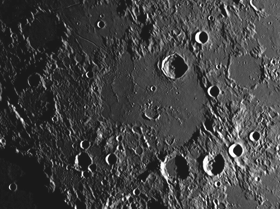
Hipparchus is found about 130 kilometres north-east of one of the Moon's
most prominent craters, Ptolemaeus, the north-east quadrant of which can
be partially seen in the lower left corner of the above image. Although both
craters were formed very early in the Moon's history, the floor of Ptolemaeus
must be relatively recent, as apart from one 9 kilometre crater Ammonius, the
floor is smooth and undamaged, apart from small craterlets. On the other hand,
the floor of Hipparchus shows a large impact in its northern section (the 31
kilometre crater Horrocks), a 17 kilometre 'ghost crater' near the centre of
Hipparchus, and at least ten major impact craters in its vicinity. These include
the named craters
Pickering, Hind, Halley and Muller. The western half
of Hipparchus' floor contains two low ridges, and the southern part of its floor
shows more small craters, ghost craters and craterlets.
Hipparchus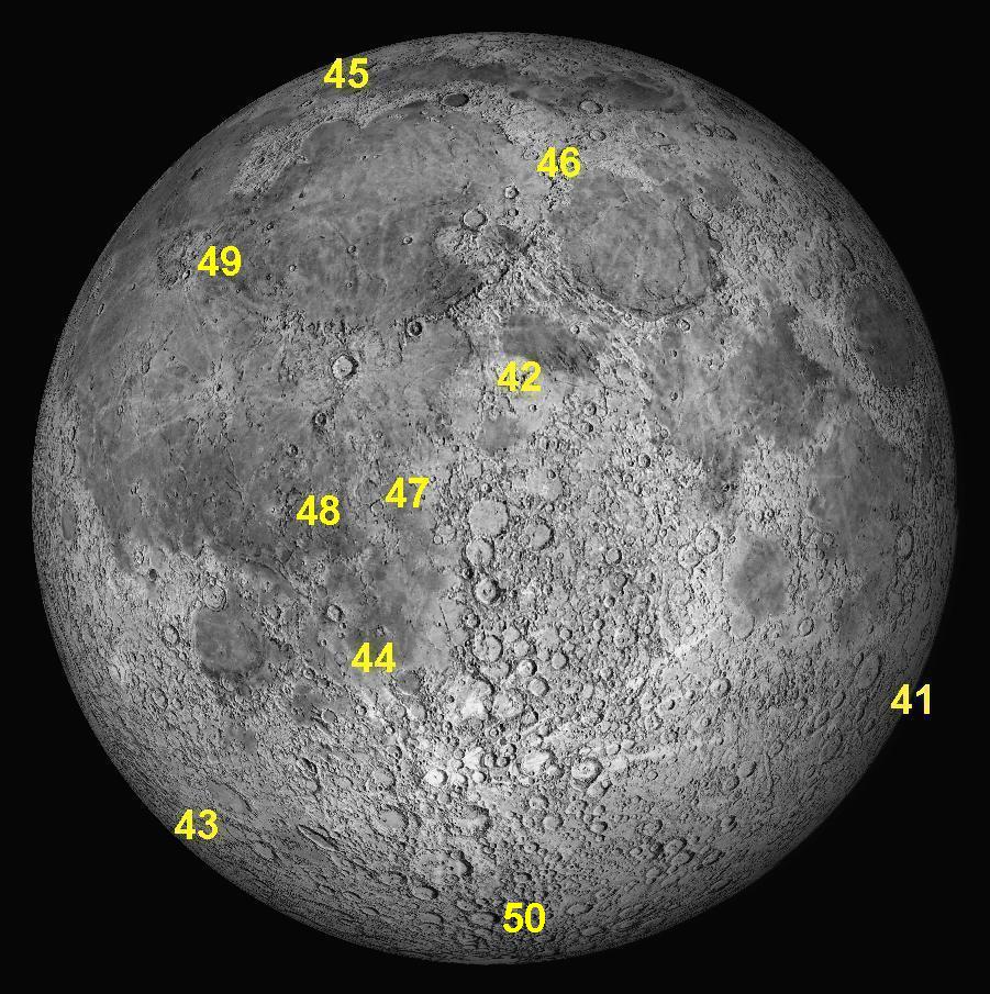
Key to features 41 to 50 below.
This month we will look at a large crater near the south-eastern limb (edge) of
the Moon as we see it a few days after New Moon, Humboldt .
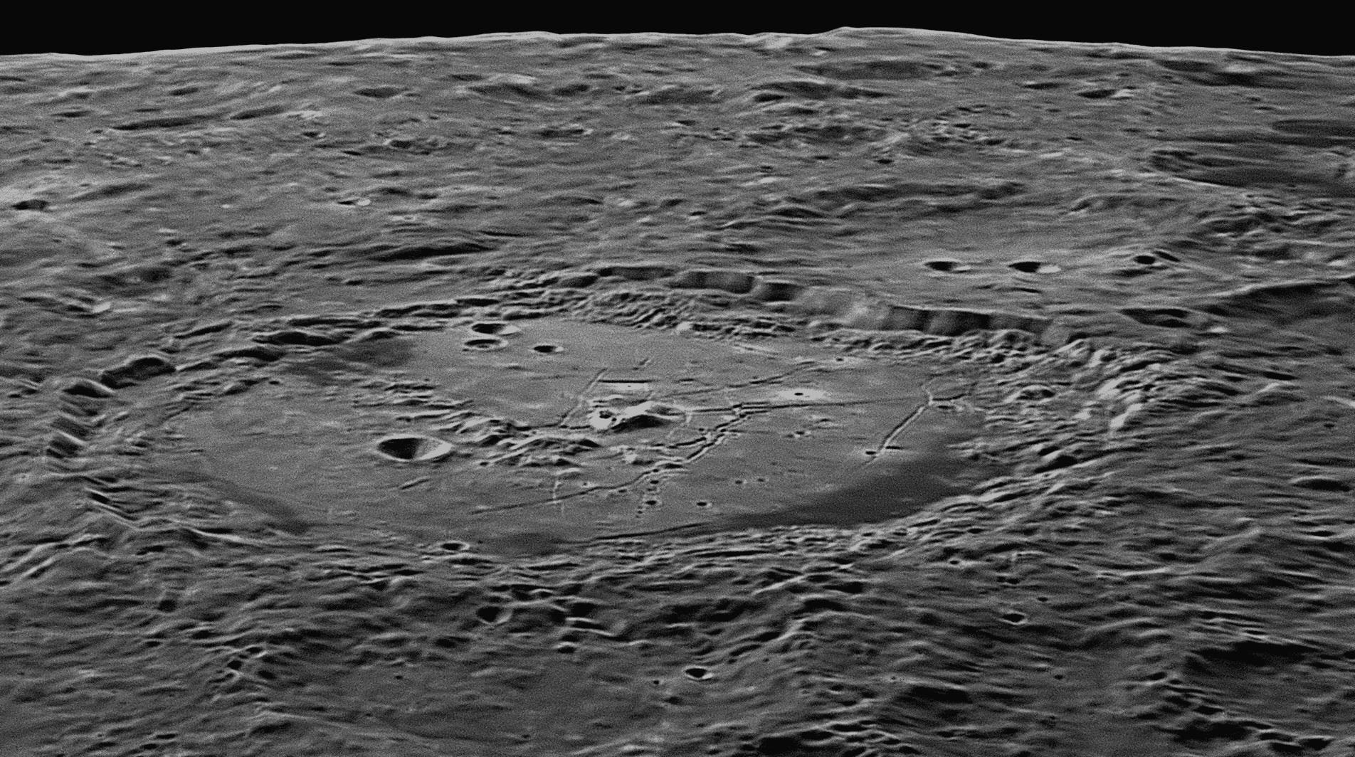
Immanuel Kant
Karl Wilhelm von Humboldt
42: February 2020
The Rima Hyginus runs east and branches in two (near the right-hand
margin). The northern branch connects with the Rima Ariadaeus, also 226
kilometres long, which at its eastern end is swamped by the lavas of the Mare
Tranquillitatis (Sea of Tranquility) but reappears again as the Rima Hypatia
(184 kilometres long) south of the Apollo 11 landing site (see item
This month we will look at a small crater with a long cleft passing through it,
Hyginus .
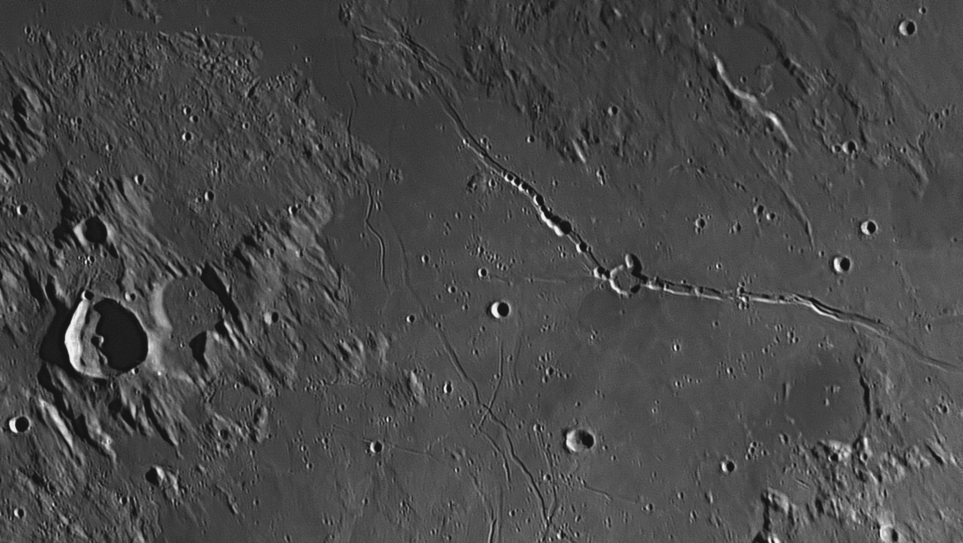
Hyginus was not created by the impact of a meteor striking the lunar
surface, as all the other circular features in the above image were. Impact
craters of such a small size generally have a bowl-shaped floor and all of them
have raised rims. Hyginus, though, has no rim at all, and gives the appearance
that it is a portion of the lunar surface that has collapsed down into a void
beneath, like a 'sinkhole' on Earth. The obvious conclusion is that Hyginus and
its cleft were both formed by vulcanism in the area. This is supported by close
examination of the flat-floored cleft. Hyginus sits squarely on it, and further
along the cleft can be counted at least 20 similar but smaller craterlets, all
rimless, where the floor of the cleft has collapsed into voids underneath it.
Beneath the cleft there must be a long fissure where molten magma has been able
to reach the surface, and flood out in all directions, creating the huge flat
lava plain which forms about 60% of the above image. The extrusion of this magma
has left linear voids below the surface, which have collapsed down to create the
cleft and Hyginus itself. A void alongside Hyginus has also collapsed, deforming
the crater's northern wall.
South of Hyginus there is a complex system of clefts, partially seen above. This network is in the environs of the 27 kilometre crater Triesnecker, and can be examined in full in
#21 above.Hyginus
For information about Gaius Julius Hyginus (64 BCE - AD 17), see
#21 above.
43: March 2020
This month we will look at a very large crater in the Moon's south-western
quadrant, Schickard, which has a very unusual neighbour, Wargentin
.


In this image, taken when the Sun was higher, the south-western half of
Schickard is seen above the bottom margin. Wargentin now appears on
the horizontal centre line of the image, left of centre. The image was
taken on 26 July 2018, at 9:11 pm.
Although Schickard is circular in shape, its position near the Moon's edge or 'limb' means that perspective makes it appear oval from Earth. All objects near the Moon's limb exhibit this effect, which becomes more noticeable the closer the object is to the actual limb. There is a huge impact basin on the far side of Schickard, but it is beyond the limb and never visible from Earth, being on the Moon's far side. That impact basin is called Mare Orientale (Eastern Sea), and debris from that impact has collided with the area above, leaving gouges, grooves and other damage in the surface. These are plainly elongated, and different from normal impact craters, which are nearly always circular. There are some of these on Schickard's flat floor, which is a lava plain caused by molten magma rising through cracks in the floor and then covering them over. The lava was not homogeneous, for some of it is more basaltic, and creates darker patches on the floor.
On the far side of Schickard in the image above is a feature unique as far as we can tell. It is a circular feature called Wargentin (W) and has a diameter of 85 kilometres. As with most craters of that size, the impactor that caused Wargentin sent a shock wave down to the Moon's bedrock. This was reflected back up and fractured the newly-formed crater's bowl-shaped floor. These fractures released the pressure on the hot magma beneath, which immediately became molten and forced its way to the surface through the cracks. In most such cases, e.g. with nearby Schickard, the magma covered the floor until it reached a level equal to the lunar surface outside the crater, whereupon it cooled, becoming a walled plain. With Wargentin, however, the magma continued to rise until it filled the initial crater to the top of its north-western wall. It then spilled over that wall and flowed down outside the crater, flooding over the landscape to create a level lava plain. Wargentin's eastern and southern walls were higher, and were not overflowed by the lava. The result is that Wargentin has no hollow interior but appears as a tableland, level on top except for three low wrinkle ridges and a few craterlets. A person climbing up the north-western slopes of Wargentin would be surprised when they reached the top, for instead of a great depression in front of them, they would see a flat plateau.
Wilhelm Schickard (1592-1635) was a German mathematician who was a correspondent and friend of Johannes Kepler. Pehr Wilhelm Wargentin (1717-1783) was a Swedish astronomer who became the first Director of the Stockholm Observatory when it opened in 1753.
44: April 2020
This month we will look at a large 'ghost' crater in the Moon's southern hemisphere, Kies .

Kies was once a bowl-shaped impact crater like most of the others in its
neighbourhood, but is much older than most of them. The huge flat area that
occupies most of the image above is the Mare Nubium (Sea of Clouds). It
is a lava plain caused by magma released when an asteroid-sized impactor struck
the Moon early in its history. Kies was already a crater in the area, and the
lava flooded and levelled its surroundings and breached its western wall,
filling up the original bowl-shaped interior until it was level with the outside
plain. Only the summits of Kies' rim remain above the new lava surface. These
summits are highest in the south-western rim, reaching altitudes of about 750
metres. The floor of Kies is dotted with numerous craterlets, ranging in size
from the two largest at 2.5 kilometres diameter down to the limit of visibility.
A streak of light-coloured ray material from the Tycho impact (
#18
100 kilometres to the north-east (upper right) of Kies is a similar ghost crater which is only 27 kilometres across. In the case of this example, the walls of the crater have virtually been swamped by lava entirely, making it a better example of a 'ghost crater' than Kies. Two 49 kilometre craters, almost twins, can be found south-west of Kies, near the lower left corner of the image. These are named, from left to right, Campanus and Mercator. The floor of the former is completely in shadow, while some of Mercator's floor is catching the rising Sun.
Numerous 'wrinkle ridges' (solidified ripples in the lava flows) can be seen in the image, some over 100 kilometres long. Just off the northern margin of this image is the large 63 kilometre impact crater called Bullialdus (see item
#33Secondary impacts to the landscape caused by debris blasted out of Bullialdus have damaged the plains in the top half of this image, all being radial to Bullialdus. In the lower right-hand corner is the 44 kilometre crater Hesiodus, which appears in item #14
There is a volcano in this image, probably extinct. It is called Kies Pi and can be seen 21 kilometres to the west-south-west of Kies' wall. It is just to the left of the Greek symbol for Pi, shown as
π. It is a low dome, perfectly round, 10 kilometres across the base, and about 300 metres high. At the summit is a volcanic caldera 1500 metres across. Such domes are only visible when the Sun is very low to the horizon, revealing the faint shadow behind the dome.
Johann Kies (1713-1781) was a German
mathematician and astronomer. He collaborated in astronomical and
mathematical research with the Frenchmen Lalande and de Lacaille, and with his
compatriot Leonhard Euler.
Kies
45: May 2020
This month we will look at a very large crater near the Moon's
north-western limb, Pythagoras.

Although Pythagoras is circular in shape, its position near the Moon's
north-north-western edge or 'limb' means that perspective makes it appear oval
from Earth. All objects near the Moon's limb exhibit this effect, which becomes
more noticeable the closer the object is to the actual limb. Pythagoras is one
of three craters that were named in the first accurate Moon map produced in 1645
by Michael van Langren, whose names are still used today (see item
#19
Pythagoras of Samos (ca. 570-495 BCE) was
the first person to describe himself as a philosopher (lover of wisdom). He
travelled widely, seeking knowledge from Egypt, Babylon and possibly India,
before settling in Croton, Italy. The first true mathematician, he is best known
for his famous geometrical theorem regarding triangles. He began a religious
brotherhood called the Pythagoreans, to promote his philosophies. They believed
that numbers are the ultimate reality, and everything is related to mathematics.
It was he who gave the name kosmos (order, or the interconnectedness
of all things) to the universe. He had observed that the North Star appeared
higher in the sky when he journeyed north, and lower in the sky when he went
south, and came to the conclusion that the Earth was not flat, but is shaped
like a sphere. This was a major advance.
Since his time, no sensible person has ever
believed in a flat Earth, but he also taught that all the planets revolve around
a central point with uniform, circular motion, and that the stationary globe of
the Earth was located immovable at this central point. Pythagoras then took this
thinking further, postulating that the globe of the Earth is surrounded by a
spinning series of eight concentric, crystalline spheres of impenetrable
hardness, on which are fixed objects that shine, namely the Sun, Moon, planets
and stars. The first seven spheres needed to be transparent so that the stars on
the black sphere beyond could be seen.
Pythagoras’ ideas, quite novel in the sixth
century BCE, had a major influence on Plato (see item
Pythagoras
Philolaus of Croton (470-385 BCE) was born in southern Italy and moved to Greece. Although Pythagoras had died, his ideas had devoted followers who called themselves Pythagoreans. Philolaus shared their beliefs and joined them at their community at Thebes, between Athens and Delphi. Like the other Greek philosophers, he was devoted to perfection. The circle was the perfect plane figure, and the sphere the perfect solid figure. Pythagoras had claimed that the number ‘10’ was perfect, as it was the sum of the first four integers (1 + 2 + 3 + 4). Therefore Philolaus thought that there should be 10 celestial bodies, but he could see only nine – the Sun, Moon, the Earth, the five naked-eye planets, and the heavenly sphere of fixed stars (counted as one item). Aristotle tells us that this was the reason that Philolaus decided that there must be a tenth planet, which he called the Antichthon or ‘counter-Earth’.
He set all of these bodies, including the Sun, in orbit around Hestia (the central fire of Pythagoras), which men could never see because the side of the Earth on which men lived was always facing away from it. He went on to say that the counter-Earth was also never seen, because it was on the opposite side of the central fire from the Earth, and therefore was always hidden from view. This erroneous cosmology was based more on philosophical principles and wishful thinking than on real astronomical observations, but it had one remarkable feature. For the first time in history, it described the Earth as one of a family of planets moving in circular orbits, though not around the Sun, but around Hestia, the central fire. It was the first suggestion of a planetary system revolving around a central body, with its various components also rotating upon their axes. Two thousand years later, Nicolaus Copernicus would carefully consider the ideas of Philolaus when developing his own truer conceptions.
Philolaus has his own crater 370 kilometres east of
Pythagoras, in the same northern part of the Moon where we also find craters
named after other famous Greek philosophers such as Anaximander, Anaxagoras,
Plato, Eudoxus, Calippus, Aristoteles, etc.
46: June 2020
This month we will look at a cluster of mountains forming a boundary between the
Mare Imbrium (Sea of Rains) and the Mare Serenitatis (Sea of
Serenity) - the Montes Caucasus (Caucasus Mountains).
The Montes Caucasus is the mountainous area stretching from north to
south (top to bottom) in this image, a distance of 225 kilometres. It occupies
most of the eastern (right-hand) side. The left-hand side is dominated by the
spectacular crater Cassini, which has a diameter of 58 kilometres.
The image was taken on 15 November 2018, at 7:52 pm. The Montes Caucasus is a complex of
mountains and hills, rather than a range. The mountains are highest on the west
- the loftiest peak (almost in the centre of the above image) rises over 6
kilometres above the plain to its west. Its great altitude is indicated by the
length of its shadow, far longer than those of neighbouring peaks. To its south
are other peaks rising to heights between 1500 and 3000 metres. Near the
upper margin, right of centre, is a line of peaks, the highest reaching an
altitude of nearly 4 kilometres. In the centre of this mountain massif is a
deformed crater with a diameter of 33 kilometres. This is Calippus, of
which a large portion of the western wall has broken free and slumped down to
the crater floor. The largest crater in this image is the beautiful and peculiar
crater Cassini, which has a diameter of 60 kilometres. What makes this
one so fascinating is the presence of two medium-sized impact craters on its
floor, Cassini A (17 kilometres) and Cassini B (9 kilometres), and
a rough pyroclastic area with two more-or-less parallel ridges adjacent to
Cassini A. Cassini is seen under different lighting conditions in image
#28
Near the lower-right margin of the image is a small part of the north-western
corner of the huge lava plain known as the Mare Serenitatis (Sea of
Serenity). Visible in this corner is the 40 kilometre long Rima Calippus,
which has an average width of 1500 metres. At its southern end it branches into
three. Other narrow valleys like this can be found elsewhere in the image. They
are not water-worn valleys, but are caused by tectonic forces, and some may be
collapsed lava tubes. In the lower-left corner of the image and south of the
crater Cassini is the south-eastern margin of the Mare Imbrium (Sea of
Rains). The Montes Caucasus acts as a partial barrier between the Mare
Serenitatis and the Mare Imbrium.
The Montes Caucasus is named after a rugged mountainous area on Earth
that runs from the eastern coast of the Black Sea east-south-east to the western
coast of the Caspian Sea in central Asia. It is composed of two ranges, the
Greater Caucasus and Lesser Caucasus. The Greater Caucasus Mountains form the
border between Russia, Georgia and Azerbaijan, and the Lesser Caucasus Mountains
run parallel, and form a frontier between Turkey, Armenia and northern Iran. The
Caucasus Mountains are regarded as the boundary between Eastern Europe and
Western Asia. There are numerous high peaks in the Greater Caucasus Range, many
over four kilometres high. Europe's highest summit, Mount Elbrus, is 5642 metres
high and is located near the western end, and is regarded as the tenth most
prominent peak in the world. It is snow-covered and is a dormant volcano. Its
permanent icecap feeds 22 glaciers.
47: July 2020
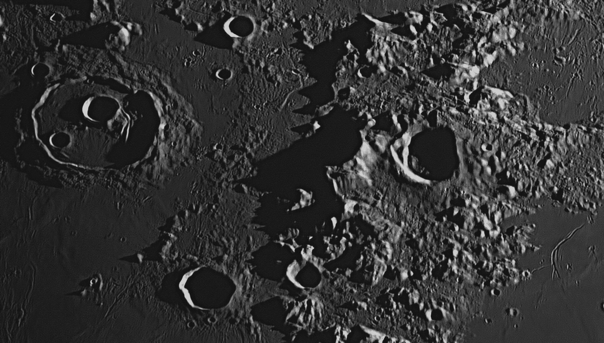
Montes Caucasus
This month we look at a rugged area where the Apollo 14 astronauts landed
on February 5, 1971, near the ancient crater, Fra Mauro .
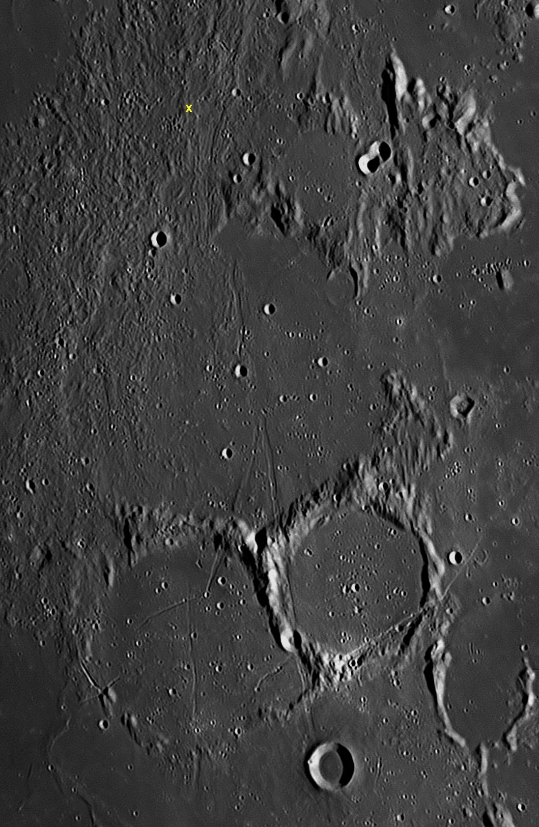
This Apollo 11 landing site in the Mare Tranquillitatis (Sea of Tranquility) was
chosen as it was very flat and marked with only relatively small craterlets with
diameters of 20 metres or less. It is shown in image
South of Fra Mauro and deforming its southern wall are two large, flat-floored
crater plains. The larger of the two is called Bonpland, and is 60
kilometres across. To its east (right) is Parry, 48 kilometres across.
Although these two crater plains are similar in structure to Fra Mauro and all
three are ancient, Parry must be slightly younger as it overlaps the other two.
Crossing these three crater plains is a network of rilles or grabens, called the
Rimae Parry. Their combined lengths total 300 kilometres, and they traverse
the flat plains and climb over mountainous crater walls without deviating from
their path.
Fra Mauro (c.1400-1464) was a cartographer
(map-maker) who lived in the Republic of Venice in what it now northern Italy.
He was a monk, hence his title 'Fra' or 'Father'. He was widely travelled, and
was commissioned by King Alfonso V of Portugal (a nephew of Prince Henry the
Navigator) to create a 'mappa mundi' (world map) that would be much more
accurate than existing maps. Venice was at the time the "crossroads of the
world", a hub where travellers, explorers, soldiers, sailors, merchants, traders
and refugees all passed through as they moved between Europe, Africa and Asia,
following in the footsteps of Marco Polo, a Venetian who had found a land route
to India, Cathay and Cipango (Japan) in the previous century. It was an ideal
place for a cartographer to gather information about the world, and Fra Mauro
questioned hundreds, perhaps thousands of these people in his quest for
knowledge. Information he received was filed and then cross-checked at the
extensive library in his monastery overlooking the Venetian lagoon. In modern
terms, he was using crowd-sourcing to create the Google Earth of his time.
The map he produced in 1450 was 2.4 metres square.
It contained almost 3000 annotations of pertinent information. Known as the
greatest of all medieval maps, it remained in the Biblioteca Nazionale Marciana
in Venice for the last 550 years. It left Venice for the first time in 2013, and
made a visit to the National Library of Australia in Canberra for an exhibition.
A wonderful work of art, many of the countries in Europe are accurately shown,
and are easily recognisable to the viewer, except that south is at the top, as
opposed to the modern convention. The further one examines the map from the
Mediterranean, the more noticeable are inaccuracies, and imagination plays a
part. Far Mauro's map shows a sea-route to India, which was not discovered until
Vasco da Gama's voyage in 1495. As Columbus would not sail across the Atlantic
to the New World for another 42 years, the Americas (and Antarctica and
Australia) are not shown at all. Click
here to see videos
describing the visit of Fra Mauro's map to Canberra in 2013-14.
48: August 2020
To the west of the centre of the range is an uplifted,
dome-shaped pyroclastic area, quite rugged and containing a cluster of over a
dozen volcanic hills, some with small summit craters. At the western extremity
of this raised area is a 12 kilometre impact crater called
Euclides (Euclid). In the image above, this crater is half-way down the
western (left-hand) margin. The whole area contained in this image exhibits linear damage
appearing as striations running from the top right to bottom left. This damage,
called 'Imbrium Sculpture', was caused when a large asteroid about 250
kilometres across collided with the Moon's northern hemisphere 3.8 billion years
ago. The impactor was shattered in the collision, and large masses of broken
rock and other debris was blasted out in all directions, leading to damage to
the surrounding landscape in the form of grooves and trenches that are radial to
the point of impact, which was north-north-east of the Montes Riphaeus. The huge
crater formed in the impact was filled with upwelling magma which erupted up
into the newly-formed basin, levelling out the surface to form the Mare
Imbrium. The second person to produce a detailed map of the Moon (after
Michael van Langren's effort in 1645, see item
Giovanni Riccioli and Francesco Grimaldi (see item
Fra Mauro
This month we look at at the Montes Riphaeus (Riphaeus Mountains). 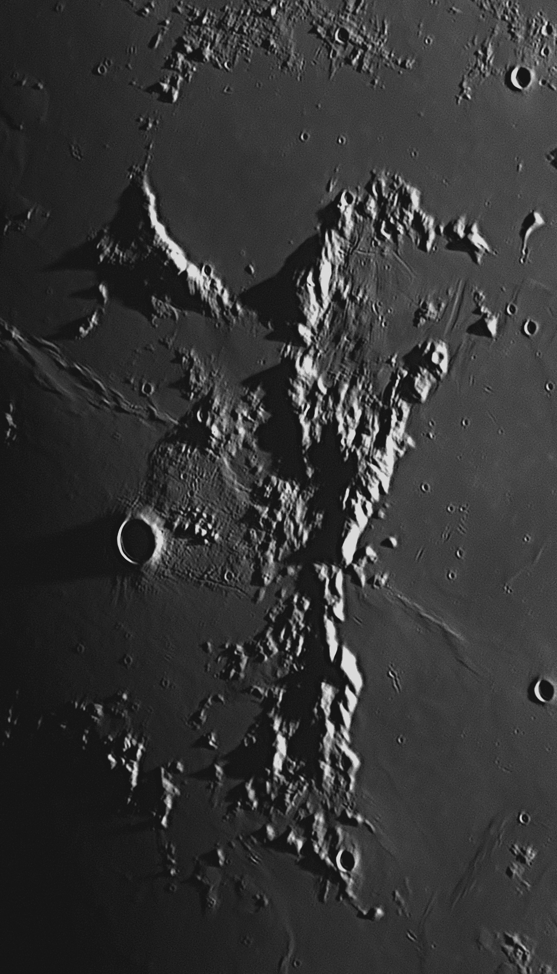
Montes Riphaeus
The Montes Riphaeus (Riphaeus Mountains) are named after a mountain range mentioned by authors in ancient times, but it is uncertain which range that would be. The Roman historian Pliny the Elder identified the Montes Riphaeus with the Ural Mountains, a 2500 kilometre-long range running north-south in Russia, marking the boundary between Europe and Asia. The Montes Riphaeus also run north-south, so the identification appears feasible, and is probably correct.
49: September 2020
This month we will look at the network of grooves or 'rilles' adjacent to the
ghost crater, Prinz and near the bright crater Aristarchus.
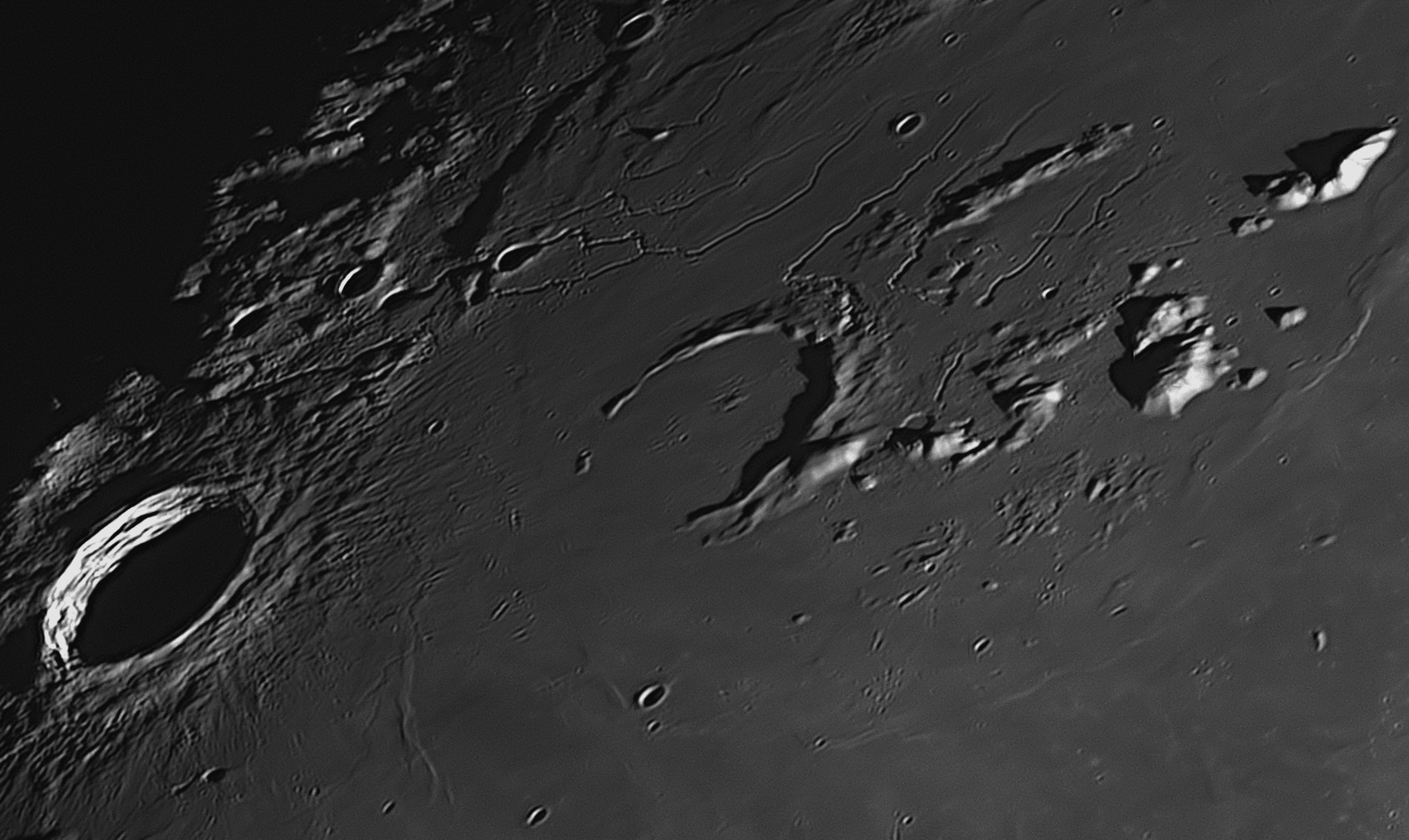
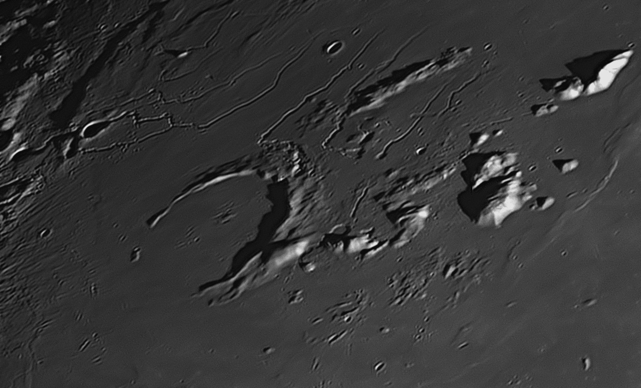
Much older is the nearby crater Prinz, which was formed well before the Imbrium Event of 3.8 billion years ago, and was badly damaged by that Event, and then almost swamped by the great lava flood that created the Mare Imbrium (Sea of Rains). The southern wall of Prinz has been carried away, but the northern and eastern portions of the wall are intact. Their bases are submerged beneath the lava plain, but some peaks protrude up to 1000 metres above ground level.
To the north of Prinz are numereous rilles, together known as the Rimae Prinz. These are groove-like valleys that often start in a small, more-or-less circular depression without a rim, much like a terrestrial sinkhole or subsidence. Some extend for up to 80 kilometres. Similar features can be found on Earth, the subsidence being associated with volcanic activity, where a magma chamber below ground has been emptied, with the molten lava running off through an underground tube, which becomes a tunnel when the lava has drained away and the tube cooled. These tubes generally become narrower the further they go, finally petering out. The tubes are usually just below the ground surface. Some 'lava tubes' formed in this way can be found near Ravenshoe in North Queensland - Google "Undara Lava Tubes".
If the roof of a lava tube collapses into the empty tube, a long, narrow,
sinuous valley is formed, starting at the sinkhole and then becoming narrower
the further it extends. It is thought that the rilles seen above formed in this
way. The mystery is not completely solved however, for one rille in the image
above is crossed almost at right-angles by a 7 kilometre long rille with
straight sides, rounded ends and a perfectly flat floor. You can find this
feature, which hardly looks natural, midway between the centre of Prinz and the
upper right-hand corner of the image.
See image
Prinz
Wilhelm Prinz (1857-1910) was a German-Belgian astronomer noted for his early lunar photographs. He worked in the Belgian Royal Observatory at Uccle, and his photographs reached such a high standard for his time, that he was given access to the new 36-inch refractor at Lick Observatory in America, in order to produce a lunar atlas. This he completed and self-published as 'Agrandissements de Photographies Lunaires' in 1894. There was only one edition of this book, for technology was advancing rapidly and better lunar photographs were soon being produced by others around the world.
50: October 2020
This month we will look at a crater in the Moon's rugged south polar region,
Moretus.
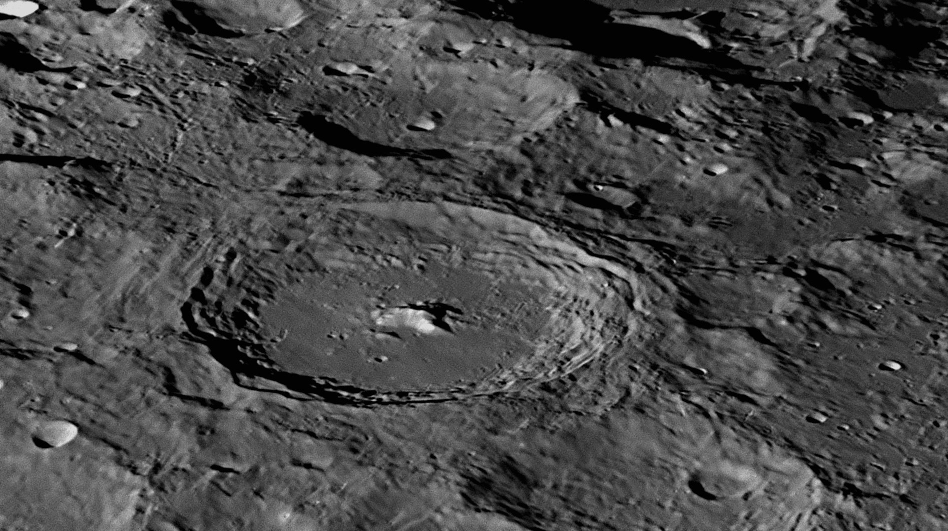
Moretus is the large, well-defined crater a little left of centre in the above picture. It is only 580 kilometres from the Moon's South Pole and so is greatly flattened by perspective. Each month libration takes it closer to the Moon's southern limb, but on the date that the above image was acquired, libration had brought it to a more favoured position. The whole of the Moon's southern hemisphere up to a distance of 7000 kilometres from the Pole itself is very ancient, and so is totally covered with impact craters overlapping each other. The sizes of these craters vary from the giant crater Bailly (303 kilometres across, the largest on the near side of the Moon) to the tiniest craterlets, some of which can be seen above. The oldest craters are deformed by more recent impacts, and their features are smoothed out by rock melt blasted over the moonscape as a consequence of those impacts. The more clearly defined a crater is, then the younger is its age.
From its crisp and undamaged appearance, we can assume that Moretus is the youngest large crater in the photograph above. Its rim is complete with quite sharp edges, and the walls have collapsed down to the floor, forming huge terraces around the circumference. The crater floor is flat, having been covered with lava, upwelling through fissures created by the original impact. Projecting from the centre of the floor is a large, monolithic mountain, at 2.7 kilometres one of the highest central mountains on the Moon. We only see the summit, the mountain's base being under the lava floor. There is a 1000 metre craterlet just east of its summit, which may be volcanic.
North of this mountain and halfway across the floor to the north rim is a 4 kilometre craterlet with a 1000 metre craterlet on its eastern flank. Between this pair and the eastern wall is a very fine fracture in Moretus' floor, barely visible. The western and southern parts of the floor of Moretus are quite rugged, with numerous craterlets and hills.
On the far side of Moretus is the 50 kilometre crater Short, which has a 9 kilometre craterlet in the centre of its bowl-shaped floor. Behind Short to its south-west (upper-right) is 80 kilometre diameter Newton, damaged by later impacts and only partly shown.
Theodorus Moretus (1602-1667) was a Flemish Jesuit priest who was also a mathematician, geometer, theologian and philosopher. He published in 1664 a treatise providing a mathematical analysis of the harmony of sounds. The crater honouring him was named by Riccioli in 1651.
Key to features 51 to 60 below.
51: November 2020
This month we will look at a group of mountains on the southern boundary of the
Mare Serenitatis (Sea of Serenity), the Montes Haemus (Haemus Mountains).
The Montes Haemus is a group of mountains on the southern boundary of
the Mare Serenitatis (Sea of Serenity). They are seen in the lower
(southern) half of this image which was taken at 6:31 pm on November 15 2018.
This range of mountains is 560 kilometres long and 50 kilometres wide, and runs from west to east. It is divided into two sections, of which the western one is shown here. The tallest peaks reach heights of 2400 metres. The range forms the south-western wall of the huge impact basin that flooded with molten magma to create the Mare Serenitatis about 3.9 billion years ago. Some of the magma forced its way through the mountains to form 'lakes' which are seen along the southern edge of the image. These cooled to form solid lava beds. Similar features were thought by early astronomers to be actual lakes of water and named as such, but these features were too small to be noticed by them and so remained anonymous until 1976, when the International Astronomical Union (IAU) decided to name them, retaining the old idea of calling them lakes. So we have just left of centre along the bottom margin Lacus Odii (Lake of Hate), and to its right is Lacus Doloris (Lake of Sorrow) and at the lower right margin is Lacus Gaudii (Lake of Joy). Ripples or waves in the solidified lava of the Mare Serenitatis are clearly seen along the top margin of the image. Such features are known as 'wrinkle ridges', and this particular one is named the Dorsum Buckland. Its total length is 369 kilometres, although less than half of it is shown here. Its height above the surrounding plain varies between 200 and 300 metres.
The largest crater appearing in this image is also one of the newest features, as can be seen from its fresh, sharp and undamaged appearance. This is called Sulpicius Gallus, and is 12 kilometres across and only about one billion years old. As the magma, coming from the north, cooled near the bases of the mountains, it contracted in size and fractured, creating a series of clefts or 'rilles'. Although these formed billions of years before the impact that formed Sulpicius Gallus, they are called the Rimae Sulpicius Gallus, and the main one is 90 kilometres long and 2 kilometres wide. Near the centre of this image is a 5 kilometre diameter crater called Sulpicius Gallus M. This recently-formed crater has blasted a large amount of light-coloured subsoil to the east, covering the local topsoil which has been turned a grey colour by radiation from the Sun over millions of years. The resulting bright spot is easily seen with a small telescope.
The Montes Haemus are named after a range in Rumania. Hevelius had used this name for some mountains on the other side of the Mare Serenitatis in his map of 1647, but when most of his names for craters and other features on the Moon were abandoned in favour of Riccioli's nomenclature of 1651, the name Montes Haemus was moved to the mountains in the area pictured above. In the western (left) side of the image are the eastern foothills of the Montes Apenninus (Apennine Mountains) - see image
#15
Sulpicius Gallus
Gaius Sulpicius Gallus was a general, statesman and orator of the Roman Republic in the second century BCE. He was a very learned man, an excellent Greek scholar, and in his later years devoted himself to the study of astronomy, on which subject Pliny says that he was an authority. He was able to predict an eclipse of the Moon in the year 168 BCE, which brought him great fame. His name was given to the crater in 1651 by Riccioli.
52: December 2020
This month we will look at the area containing the craters Hippalus,
Campanus and Mercator, in the Moon's southern hemisphere.
Hippalus, an ancient crater with a diameter of 58 kilometres, is found in
the top left-hand corner of this photograph. It lies at the eastern margin of
the Mare Humorum (Sea of Humours), and its south-western wall is missing.
Mercator is the 48 kilometre crater near the right margin of the image.
Although equally ancient, it has survived largely undamaged since its creation
nearly 4 billion years ago. To the left (north-west) of Mercator is a crater
nearly as big and almost as old,
Campanus. These two are almost twins, except that the floor of Campanus
is more interesting. The three craters Hippalus, Campanus and Mercator are the
largest craters in this image. Three concentric rilles called the Rimae
Hippalus dominate the western half of the area shown. The centre of
curvature of these rilles lies in the centre of the Mare Humorum, about 150
kilometres off the left-hand margin of this image, which was taken at 7:04 pm on
July 1, 2020.
North of Campanus and Mercator is
another lava plain, the Mare Nubium (Sea of Clouds). In the extreme
top-right corner of this image is part of the wall of the 45 kilometre 'ghost'
crater, Kies, which also appears in the centre of image
Lava spreading out from the impact that created the Mare Humorum (the eastern
margin of which is seen along the left edge of the above image) has overwhelmed
and destroyed the south-western wall of Hippalus, allowing the lava to
enter the previously bowl-shaped crater and partially fill it, creating a flat
floor. The north-eastern quadrant of this floor is a pyroclastic zone, the
volcanic hills that have formed in this area being related to the 4 km wide
rille that crosses the floor from south to north. There are two parallel rilles
to the east of Hippalus, each with a total length of about 240 km. The mountain
mass in the lower left-hand corner of the image is named the Promontorium
Kelvin.
21 kilometres to the west (left) of Kies' wall can be seen a slight bulge in the surface of the Mare Nubium. This faint bulge is a shield volcano with very gentle slopes. It is called Kies Pi and is 10 kilometres in diameter across the base, but is only 300 metres high. At its summit there is a volcanic caldera 1500 metres across. It has probably been extinct for at least 3.2 billion years.
Hippalus was a Greek navigator who lived in the first century BCE and
into the second. He is credited with finding a sea route from the Egyptian port
of Berenice near the northern end of the Red Sea, down that sea and the Gulf of
Aden and across the Arabian Sea to the west coast of India. This greatly
facilitated trade between Egypt (then under Roman control) and the Orient. The
crater was named by Mädler in 1837.
Giovanni Campano (1220-1296) was an Italian
mathematician, astrologer and physician. He is known in history as Campanus
of Novara. He served as Chaplain to four Popes. He translated Euclid's
Elements into an edition of fifteen books, and 186 years after his death his
version was so highly regarded that it was the first one to be printed using the
newly-invented printing presses. His name was given to the crater in 1651 by
Riccioli.
Gerardus Mercator (1512-1594), a Flemish map-maker, became very adept at
producing accurate maps. He was imprisoned for seven months in 1544 as a
heretic, due to his Protestant beliefs and suspicions aroused about his
frequent, wide-ranging travels. 43 others were imprisoned with him, but he was
the only one to be released, thanks to the intervention of university
authorities. Also, various governments needed his maps for planning military
campaigns. In 1541 Mercator perfected the method we use today to produce
educational globes of the world and sky. Building on the earlier work of his
contemporary Johannes Schöner, he used flat paper engravings cut into twelve
‘gores’ that were connected at the equator and tapered to separate points at the
poles. He glued these to hollow papier-mâché spheres that were built up with
plaster in a wooden mould. Circular metal caps called ‘calottes’ were placed in
position over each pole. The globes were then hand coloured and set into
innovative four-legged wooden stands with wooden horizon and metal meridian
rings. To produce flat maps, in 1568 he devised the Mercator
Projection, in which lines of latitude were drawn as parallel horizontal lines,
and lines of longitude as parallel vertical lines. Such maps were distorted, in
that they increased dramatically in scale as the Poles were approached. In maps
of the world, this resulted in polar regions such as Greenland being greatly
exaggerated in area and their shapes deformed, but a real advantage was that
such maps were able to show lines of constant sailing course (known as rhumb
lines or loxodromes) as straight-line segments with true compass bearings, which
was a great benefit to navigators. Mercator’s 1580 book of maps showed a picture
of the Titan Atlas (son of Iapetus) holding a celestial globe on his shoulders,
and so Mercator's book of maps became known as an ‘Atlas’ – the first
usage of the term in that way. He also introduced a form of cursive writing that
became popular.
Hippalus
53: January 2021
This month we will look at the area containing the conjoined craters Stofler
and Faraday in the Moon's southern hemisphere.
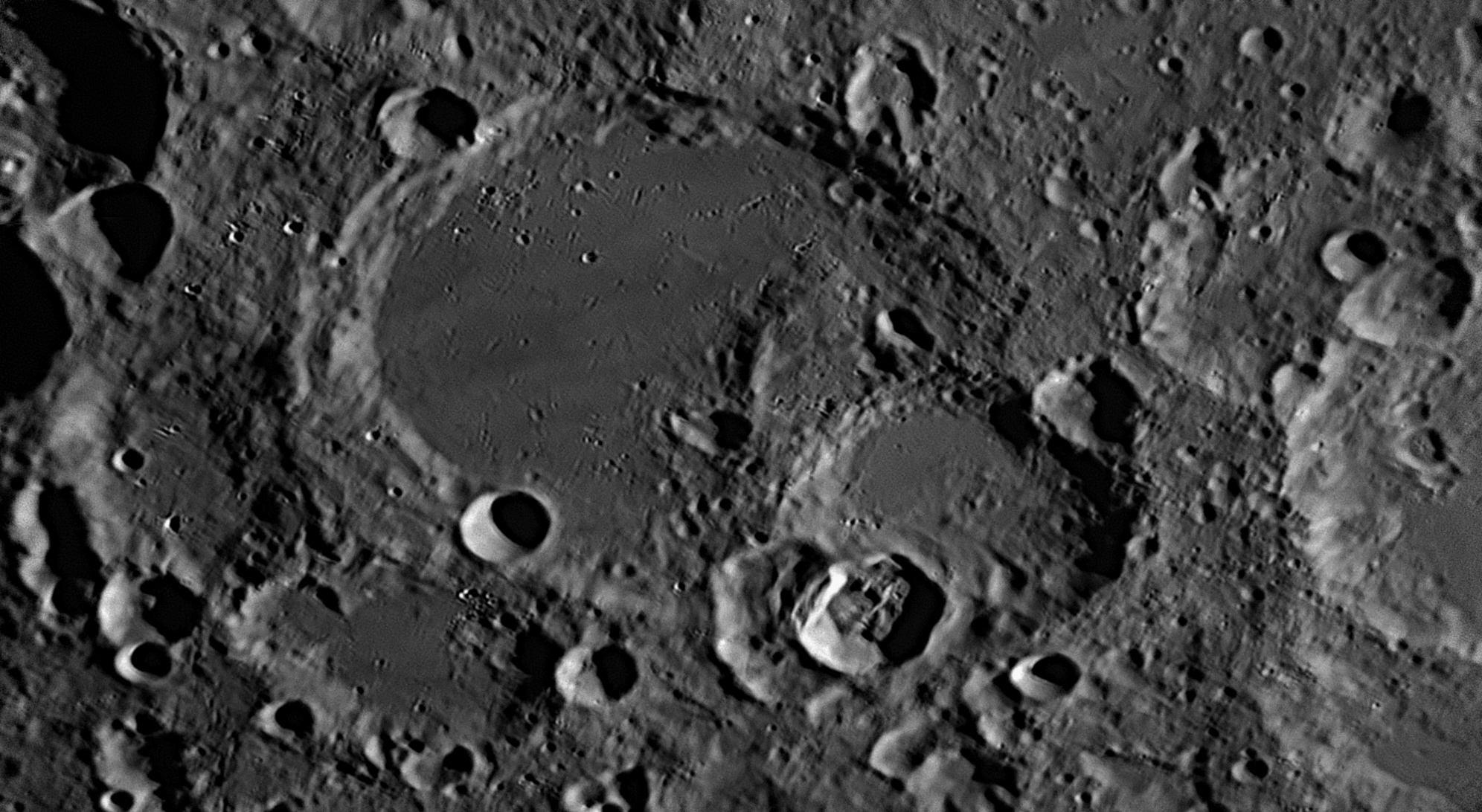
Stofler's northern, western and
south-western walls are intact except that parts of them have slumped down to
the crater's floor. The summits of the north-west and south-west walls each have
a later bowl-shaped impact crater of 19 kilometres and 18 kilometres diameter
respectively. The western half of Stofler's floor is a flat lava plain on which
are found many craterlets, the two largest being 3 kilometres across.
Not long after Stofler's
formation, another large impactor, incoming from the south-east, struck the
south-east wall, producing a 70 kilometre crater now called Faraday. Much
material was blasted across Stofler's floor, completely covering the eastern
half. Later impacts have struck Faraday as well, deforming it. In the last
billion years, another incoming impactor struck the lunar surface 400 kilometres
to the south-west, creating the crater Tycho, one of the freshest craters
on the Moon - see image
#18
Stofler is a
spectacular depression in the Moon's southern hemisphere at latitude -41º. The
whole area surrounding it is peppered with craters, most smaller than Stofler
but a few considerably larger. This is because this part of the Moon's surface
is very ancient and degraded, but there were no impacts large enough to cause
lava eruptions large enough to cause the formation of 'Mare' ('Seas' or lava
plains). The Moon's age is 4.55 billion years, and the large features shown
above were formed within 660 million years of its birth. The smallest features
are the youngest, the most recent ones being the smallest and brightest, having
haloes of white topsoil.
In the fifteenth century, Regiomontanus was the leading astronomer and first printer of astronomical tables and books. He read many ancient texts, and knew that the Earth-centred world view was not the only one possible, although he adhered resolutely to the geocentric world view of Ptolemy. If he had lived, he might eventually have come to the realisation that the Earth orbits the Sun, which would have led to other great discoveries. He translated a Greek version of Ptolemy's Almagest into Latin as the Epitome of the Almagest, and used it to produce the Nuremberg Ephemerides, an astronomical almanac that included longitude measurements calculated by lunar distances, an idea far ahead of its time. It listed all celestial phenomena from 1 January 1475 to 31 December 1506 and went on sale in the early 1470s. The Epitome of the Almagest went on sale in 1496 after Regiomontanus had died aged only 40.
None of Regiomontanus’ contemporaries was equal to the task of following in his footsteps and taking astronomy forward, except perhaps Johannes Stöffler (1452-1531), who followed the new Epitome of the Almagest of Regiomontanus faithfully. In 1499 Stöffler produced a continuation of the Nuremberg Ephemerides as the Almanach nova plurimis annis venturis inserentia, and he is therefore regarded as a successor to Regiomontanus, though not of the same intellectual stature. His book had a large circulation with 13 editions until 1551, and strongly influenced Renaissance astronomy. Stöffler also published Elucidatio fabricae ususque astrolabii, a manual for the construction and use of the astrolabe. His name was given to the crater in 1651 by Riccioli.
The English scientist Michael Faraday (1791-1867) had little formal education, but rose to become one of the most influential scientists in history. Having discovered in 1821 the ‘lines of force’ that surrounded magnets, he also found that if a magnet moved near a wire, it induced an electric current in the wire. Not only that, but an electric current in a wire produced magnetic lines of force around the wire. Therefore, there was a close relationship between electricity and magnetism. Faraday also found that magnetism could affect rays of light and that there was an underlying connection between the two phenomena. He similarly discovered the principle of electromagnetic induction, diamagnetism, and the laws of electrolysis. His invention of electromagnetic rotary devices formed the foundation of electric motor, dynamo and alternator technology, and it was largely due to his efforts that electricity became practical for use in the everyday world.
n the field of chemistry, Faraday discovered benzene and the system of oxidation numbers, and invented an early form of the Bunsen burner. He popularised such terms as anode, cathode, electrode, and ion. In 1845, Faraday discovered that the plane of polarisation of linearly polarised light is rotated when the light rays travel through and interact with a transparent magnetic field, an effect now known as Faraday Rotation. This was the first real evidence that light was indeed related to electromagnetism. In 1846 he speculated that light might be some form of disturbance propagating along magnetic field lines and the following year he improved on this by suggesting that light was a high-frequency electromagnetic vibration which could propagate across space even if it were a vacuum, and lacking any medium such as a luminiferous æther. Faraday and his mentor Sir Humphry Davy attracted around themselves a coterie of English Romantic poets who were keenly interested in science, including William Wordsworth, John Keats, Robert Southey, Samuel Taylor Coleridge and William Blake. This group watched the experiments, and participated in some entertaining “research” with nitrous oxide (laughing gas).
54: February 2021
This month we will look at the crater Maurolycus, in the Moon's southern
hemisphere. This area adjoins that for Stofler and Faraday
immediately preceding as image
This image was taken two minutes later than the one of Stofler that was
featured as image
#53
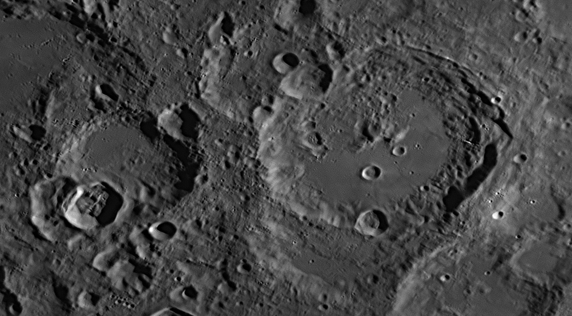
Maurolycus
55: March 2021
This month we will look at the crater Marius and
the hundreds of volcanic hills and domes in its vicinity. This image adjoins
#56
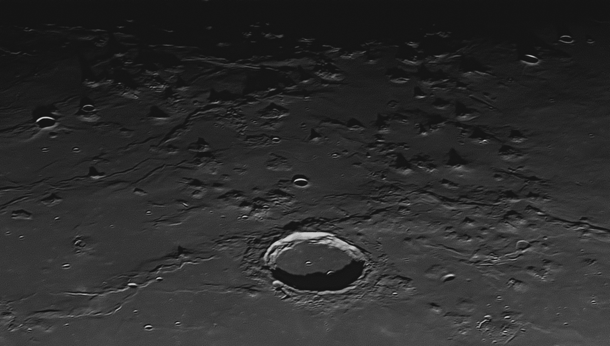
Over thirty of the more prominent volcanoes are indicated in the
above image. All appear to be extinct, or possibly dormant, as no activity has
ever been recorded with certainty.
West of Marius are more than 200 domes, cones, shield volcanoes, and hills, and
they vary between 200 and 500 metres in height. The largest ones average about
10 kilometres across their bases, the smallest between one and two kilometres.
Some may be dormant volcanoes, although no activity has yet been detected, but
there are quite a few instances in the image above where a dome-like hill has a
circular crater about a kilometre across precisely at the summit. Such craters
are probably volcanic vents, and larger ones could be calderas. A "wrinkle
ridge" (a solidified ripple in the ocean of lava that formed the Oceanus
Procellarum) can be seen running from the lower left-hand corner of the image
past the upper rim of crater Marius.
Although Galileo always referred to the Jovian moons he had discovered in late
1609 as Jupiter I,
Jupiter II,
Jupiter III
and Jupiter IV,
in 1614 the German astronomer Simon Mayr (Marius) (1573-1624)
published a book Mundus Jovialis (The World of Jupiter), in which
he claimed to have discovered the four satellites over a week before Galileo.
The two men had a history between them as, many years before, Galileo had forced
Mayr to leave Padua University. Although Mayr’s claim was possibly true, Galileo
responded that he did not believe it, and, in any case, Mayr lived in the
Lutheran city of Ansbach which had not yet adopted the Gregorian calendar, and
was therefore ten days behind Catholic Padua where Galileo lived. Mayr called
the Jovian moons ‘the Brandenburg stars’ after his own patron, and, following a
suggestion from Kepler, gave them the individual names of
Io,
Europa,
Callisto and
Ganymede. These names did not come into official use until the 20th
century, after Edward E. Barnard had discovered Jupiter V in 1892. At that time, the French
astronomer Nicolas Camille Flammarion
suggested naming the new satellite Amalthea, in line with a system of
nomenclature suggested by John Herschel for naming the satellites of the other
planets. In the 20th century, the International Astronomical Union (IAU,
founded in 1919) ratified Herschel’s and Mayr’s names for planetary satellites,
and subsequent discoveries were named in like manner.
Mayr had worked with Tycho Brahe in Prague for four months in 1601, and was the
first European to observe the Andromeda Galaxy, which he saw with his new
‘Perspicilli Belgici’ (Belgian lenses).
56: April 2021

Marius crater has a flat floor due to being filled with magma welling up
from below until it reached about the same level as the lunar plain outside the
crater. A few craterlets are visible on the floor of Marius. The largest is half
in shadow, and has a diameter of 3 kilometres. The second largest, near the
centre, is 2 kilometres across. The others are less than a kilometre across. The
Marius Hills is the highest concentration of volcanic features on the Moon.
Marius crater has a flat floor due to being filled with
magma welling up from below until it reached about the same level as the lunar
plain outside the crater. A few craterlets are visible on the floor of Marius.
The largest is half in shadow, and has a diameter of 3 kilometres. The second
largest, near the centre, is 2 kilometres across. The others are less than a
kilometre across. The Marius Hills is the highest concentration of
volcanic features on the Moon, and some are seen to the north (right) of Marius.
There are more than 200 domes, cones, shield volcanoes, and hills, and they vary
between 200 and 500 metres in height. The largest ones average about 10
kilometres across their bases, the smallest between one and two kilometres. Some
may be dormant volcanoes, although no activity has yet been detected, but there
are quite a few instances in the image above where a dome-like hill has a
circular crater about a kilometre across precisely at the summit. Such craters
are probably volcanic vents, and larger ones could be calderas.
This month we will take another look at the crater Marius and the long
volcanic rille in its vicinity. The image below adjoins image #55
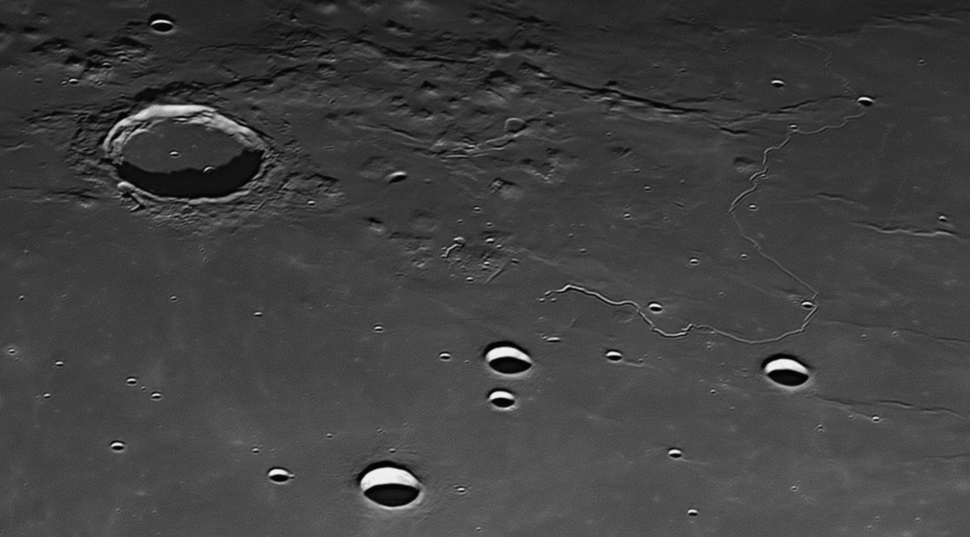
57: May 2021
This month we will look at the feature known as the Lacus Mortis in the
Moon's Northern Hemisphere.
Lacus Mortis is an ancient crater that was formed over 3.9 billion years ago. A
few million years later, there was a bombardment of the Moon's northern
hemisphere, in which large asteroids struck the Moon to the west and south of
Lacus Mortis, fracturing the crust and unleashing floods of lava which cooled to
form the Mare Imbrium (Sea of Rains), Mare Serenitatis (Sea of
Serenity) and Mare Frigoris (Sea of Cold). The lava spread to the
north-east and demolished the eastern and north-eastern walls of the ancient
crater. It flooded into and filled up the old crater, so that the new interior
surface was level with that outside the crater. As the lava cooled, it
contracted and cracked, producing the fissures, faults, fractures and rilles
that can be seen inside Lacus Mortis today.
The northern-most part of the floor of Lacus Mortis contains a dome volcano with
a diameter of 25 kilometres. It can be seen near the centre of the top margin of
the above image. There are two later impact craters that have demolished the
southern wall of Lacus Mortis. These are Plana (45 kilometres across),
and Mason (43 kilometres across). Both have lava-filled flat interiors,
Plana having a central mountain as well.
Much later in the Moon's history, less than 1.1 billion years ago, another
smaller asteroid struck Lacus Mortis a little to the east of its centre,
creating the 40 kilometre impact crater Bürg. This crater has a group of
mountains at its centre, and the walls have slumped down, creating huge terraces
around the circumference. The impact which created Bürg threw great quantities
of melted rock across the eastern half of Lacus Mortis, and may also be
responsible for some of the clefts and rilles seen above, which are collectively
known as the Rimae Bürg.
58: June 2021
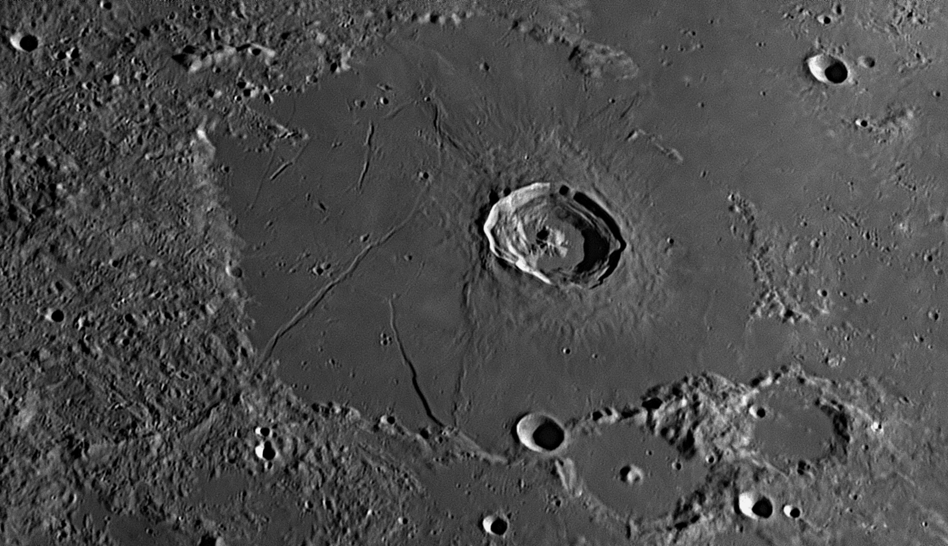
A high peak can be seen in the far distance, protruding above the centre of the
horizon. This is the central peak of the crater Compton that straddles
the horizon in this image. Libration usually places Compton out of view below
the Moon's eastern horizon. On the far side of the Mare Humboldtianum can be seen a large
walled plain 58 kilometres across with a perfectly smooth floor surrounded by a
low wall. This is called Bel'kovich A. Foreshortening makes it look
elliptical, but actually this walled plain is perfectly circular. On the near
side of this walled plain is a fresh crater straddling the wall. This crater is
13 kilometres across and is called Bel'kovich B. To the left of
Bel'kovich A and only partially shown in this image is a huge but very ancient
walled plain 199 kilometres across, which is Bel'kovich itself. It is in
the zone of libration.
Alexander von Humboldt (1769-1859) was a
Prussian polymath, geographer, naturalist, explorer and influential proponent of
philosophy and science. Between 1799 and 1804, he travelled extensively in the
Americas, exploring and describing them for the first time from a modern
scientific point of view. His description of the journey was written up and
published in an enormous set of volumes over 21 years. Humboldt was one of the
first people to propose that the lands bordering the Atlantic Ocean were once
joined together (South America and Africa in particular). Humboldt resurrected
the use of the word cosmos from the ancient Greek and assigned it to his
multivolume treatise, Kosmos, in which he sought to unify diverse
branches of scientific knowledge and culture. This important work also suggested
that the universe was one interacting entity.
He embraced Kant's idea that many nebulae in space were not
merely clouds of gas or clusters of stars, but were great star systems similar
to our own Milky Way, with millions or even billions of stars, and perhaps
planets which might be populated by living creatures. He modified Kant's term ‘Welt-inseln’
or ‘world-islands’, and made it popular as ‘island-universes’ in
his four-volume scientific book Kosmos in 1845. The term
'island-universes' continued to be used after the spiral nebulae were proven by
Edwin Hubble in 1925 to be remote star systems far from the Milky Way. It can
still be found in astronomical books although since 1950 the term 'galaxies'
has been preferred. He was the brother of Karl Wilhelm von Humboldt (see
image #41 59: July 2021
This month we will look at the feature known as the Mare Humboldtianum at
the Moon's north-eastern limb.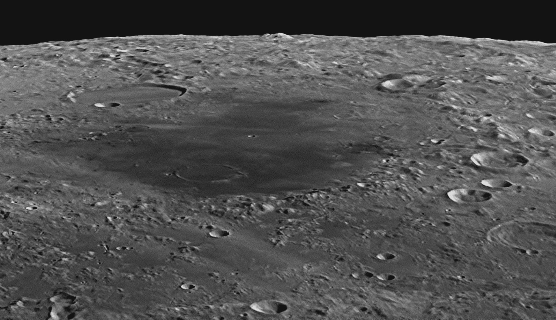
Alexander von Humboldt
Endymion is a 126 kilometre diameter walled plain
south-west of the Mare Humboldtianum. The image was taken at 7:53 pm on
22 November 2020, and its upper margin links with image
#58
Most "craters" on the Moon were formed by impactors ranging in size from islands
to pebbles flying through space at high speed and striking the Moon. Larger ones
are vaporised on impact in an explosive blast that creates a circular cup- or
bowl-shaped depression in the surface that will range in size from a hundred or
so metres to 50 kilometres or more ("Crater" is the Latin word for "cup", and
was first applied to circular lunar features by Johann Hieronymous Schröter
around 1800. For more details, see
#35
above.
If the impactor is very large, the explosion will send a pulse of energy down to
the bedrock, which will bounce it back to the surface, fracturing the floor of
the newly-formed crater and forcing it upwards to create a cluster of central
mountains. A good example of a large bowl-shaped crater with a cluster of
central peaks is Bullialdus, which can be seen as
#33
above.
It is common that molten rock will force its way upwards through the fissures
and spread over the floor, filling it to a great depth and creating a level
surface. Sometimes the summits of the new central mountains protrude above the
lava floor, but in the case of Endymion they are completely swamped and
no trace of them is seen. (Molten rock underground is called "magma"; when it
reaches the surface and cools, it is called "lava".) Craters that have flat
floors of cooled lava are very common, and if they exceed 80 kilometres in
diameter they are known as "Walled Plains".
Endymion is an excellent example, but we see its circular shape greatly
foreshortened due to its position near the Moon's edge or limb, so it is seen at
a low angle. If Endymion were located not near the limb but towards the
centre of the Moon, it would be similar to Plato
This month we will look at a large walled plain that often goes unnoticed by
observers as it is close to the Moon's north-eastern limb and is therefore
visible for only a few days after New Moon and Full Moon. Its name is "Endymion".
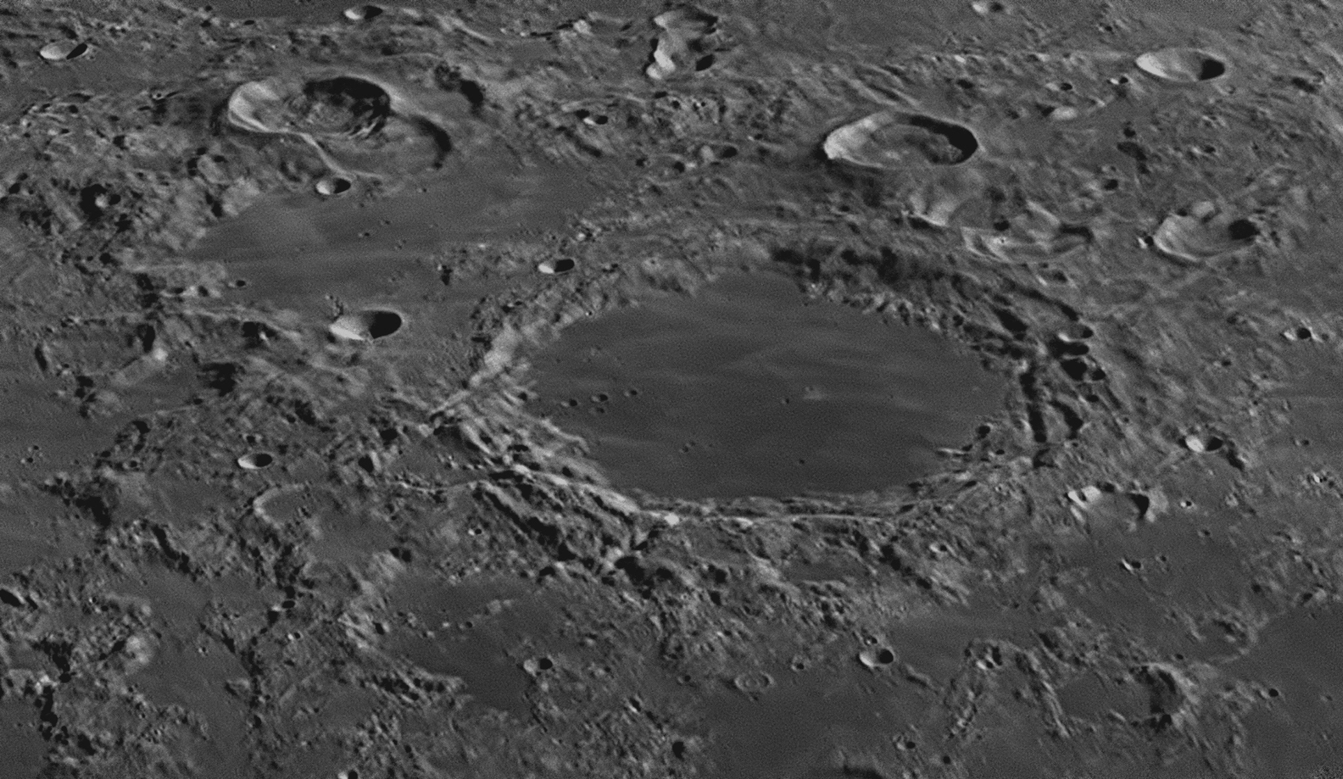
The flat floor of Endymion is crossed by light-coloured streaks radiating from a recent impact crater to the north (left), probably Strabo, 250 kilometres away. In the image above can be seen an unusual concentric crater between Endymion and the centre of the lower margin. It is only 7 kilometres in diameter, and has a smaller 3 kilometre crater within it, centred almost exactly, giving the appearance of a bulls-eye. There are only a dozen or so similar examples on the Moon.
60: August 2021
This month we will look at the Montes Carpatus (or Carpathian
Mountains ).
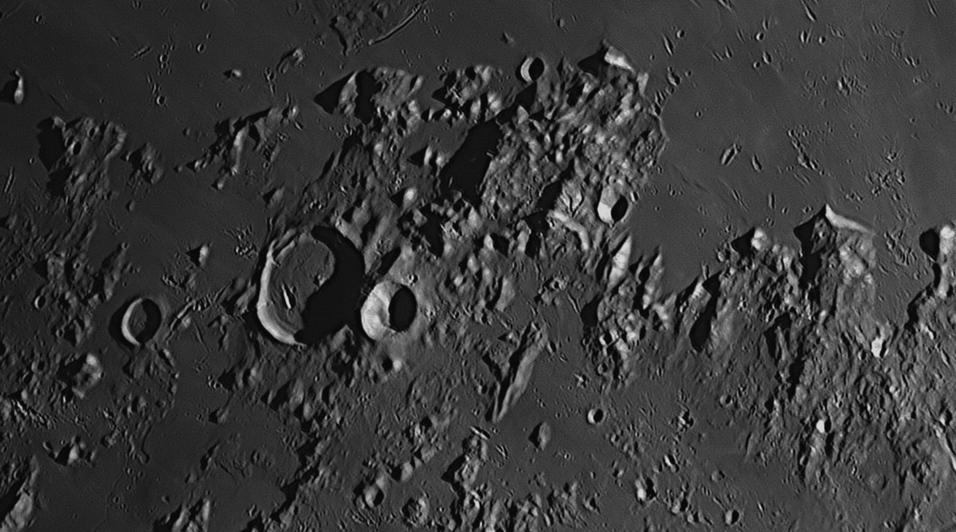
The Montes Carpatus is a cluster of
mountains that is 350 kilometres long and 60 kilometres wide. They are not in a
clearly-defined row like the Montes Riphaeus (
#48
The entire range is discontinuous, and consists of isolated mountain masses of varying heights, some reaching elevations of over 2 kilometres. They are roughly lined up in a northerly direction, pointing to the site of the impact about 1100 kilometres north. The moonscape in the area shows extensive damage caused by ejecta from the later Copernicus impact to the south-east, about 1.1 billion years ago. This appears as numerous gouges in the surface that radiate from Copernicus
#8The largest crater in the image is 34 kilometre diameter T. Mayer, left of centre. It has a flat floor formed from up-welling magma, which has a 9 kilometre long gouge caused by a flying mountain from Copernicus. Alongside its eastern wall is the 16 kilometre crater T. Mayer A. Both date from soon after the Imbrium Event. Near the centre of the top border of this image is a 20 kilometre long rille which begins in a tiny craterlet and then heads north-east. Similar rilles starting in craterlets can be found in image
#49Tobias Mayer (1723-1762) was a German astronomer who was very interested in the Moon. In 1749 he used one of the new achromatic refractors to produce the most accurate lunar map made up to that time. As the map was only 7½ inches (19 cm) in diameter, each of 89 major lunar features was given a number. Surrounding the map was a key, in which the numbers were listed, and for each one firstly the ‘Ricciolum’ name, and then the ‘Hevelium’ name. The reader could choose between the two systems of nomenclature. Mayer selected 24 features and used a micrometer eyepiece to accurately measure their positions. They were then charted on a latitude and longitude grid to an accuracy of one arcminute, and used as guides to plot the remaining features. Mayer was the first to do this, and his map was not surpassed until the work of Beer and Mädler in 1834.
Mayer also made progress in mapping Mars, finding how Jupiter and the Earth
perturb the orbit of Mars, and finding easier ways to predict eclipses. He was
the first to actually measure the proper motions of stars, and obtained data on
80. Mayer also worked on a method to find one’s longitude, using the position of
the Moon with respect to the background stars. Basing his work on the elegant
equations that Leonhard Euler had developed, Mayer produced in 1753 a set of
tables showing the location of the Moon in the sky at various times and dates.
These were the first lunar tables to have a precision consistently better than
one minute of arc, and therefore good enough for a sailor to fix his longitude
at sea within an accuracy of 100 kilometres. This was the first time that
sailors could be given something that would help them to find their longitude
with a degree of certainty, so Mayer sent a preliminary copy of his tables to
the Board of Longitude in London in 1755.
On the verge of great success, and a possible winning of the Longitude Prize of
£20 000, Tobias Mayer died suddenly in 1762 from a virus infection at the early
age of 39 years. When his widow took the final draft of his work to London in
1770, the Board of Longitude awarded her £3000. Leonhard Euler received £300 in
recognition of his contribution, in producing the mathematical equations that
Mayer used. Mayer’s solution to the longitude problem by using the lunar
distance method and his spectacular and accurate lunar map are his main claims
to fame.
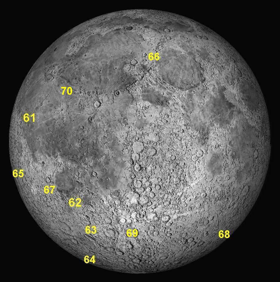
Key to features 61-70.
61: September 2021
This month we will look at a small crater in the Oceanus Procellarum. Its
name is "Galilaei". How can it be that the first and most important
person to examine the Moon through an early telescope, Galileo Galilei in 1609,
has only a tiny, insignificant crater named after him, while lesser people like
Clavius, Petavius, Langrenus and many others are honoured with their names being
attached to huge and spectacular craters and walled plains? Why has Galileo been
treated so badly ?
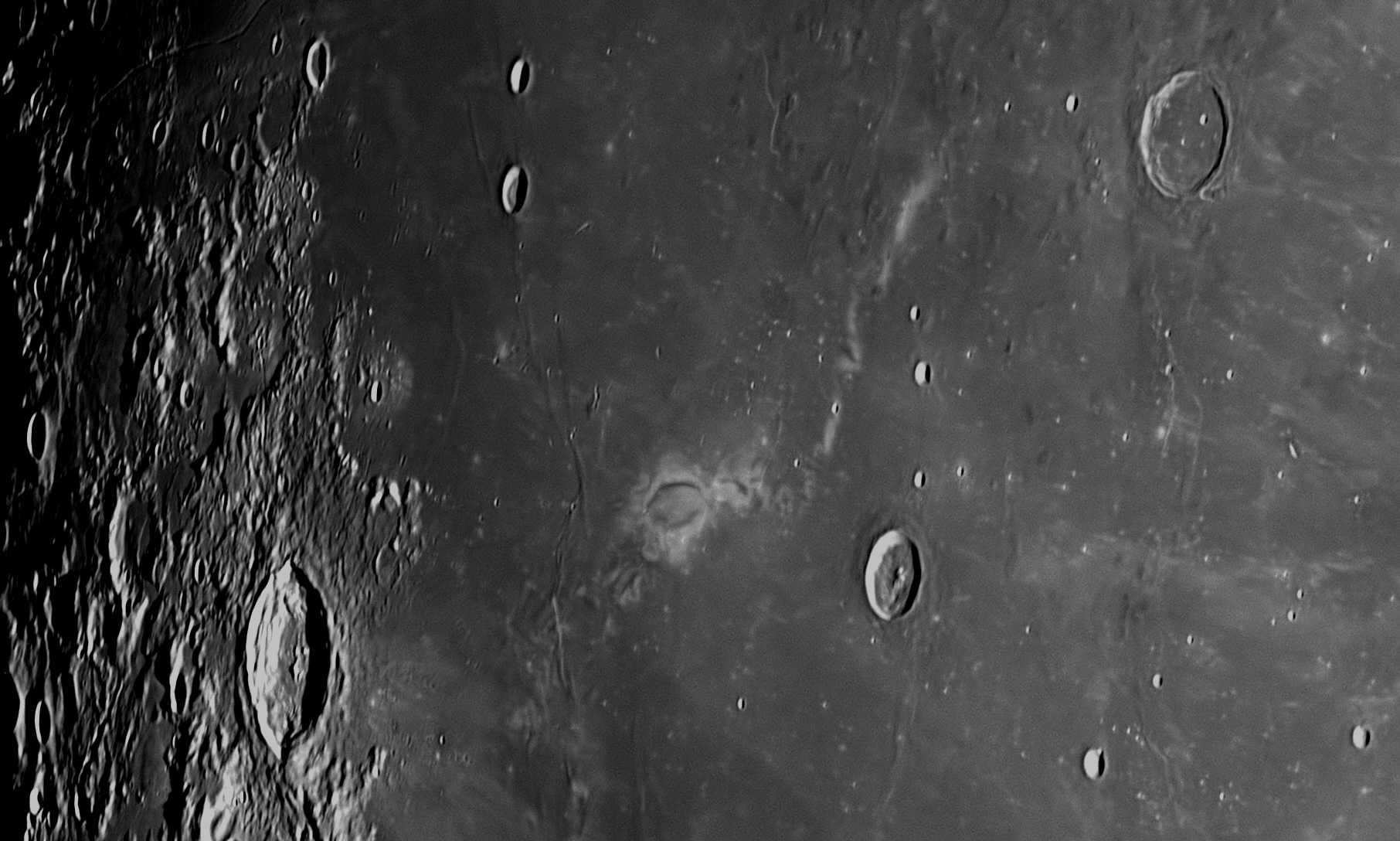
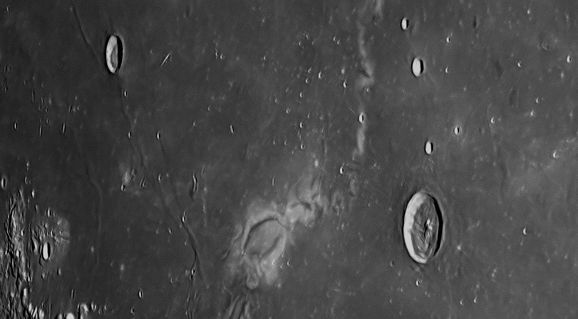
Firstly, it was no-one's intention that Galileo be insulted or demeaned. What
happened was simply a mistake on the part of the two men who named 243 of the
Moon's craters in 1651. Their names were Riccioli and Grimaldi,
and they created one of the first recognisable Moon maps nine years after
Galileo's death.
Giovanni Battista Riccioli (1598-1671) discovered the first binary star (Mizar in Ursa Major) in 1650. He worked with his former pupil Francesco Grimaldi (1618-1663) at Bologna. Both were Jesuit clerics in the Catholic Church. They shared an interest in astronomy, and Riccioli wrote and published a two-volume work on astronomy entitled
Riccioli was aware of previous attempts by Michiel van Langren ( #19 above), and Johannes Hevelius ( #37 above), to map the Moon and name its features, and wanted to include a Moon Map in his book, but neither he nor Grimaldi was impressed with what had gone before, and they decided to work together in producing a more accurate map of the Moon. This map or 'selenograph' was carefully drawn by Grimaldi using a small telescope that was quite good for its time. The map is fairly accurate in major details, although for some reason the spectacular crater Cassini and the Vallis Alpes (Alpine Valley) are missing. Riccioli, with some help from Grimaldi, contributed a series of names for lunar features, in which mountains and valleys were named as such, and the bowl-shaped depressions (not yet called ‘craters’) were named after famous astronomers and philosophers, some still alive. As was the custom of the time, the names were Latinised, usually by adding "-us" to the name. 63 names used by their predecessor van Langren were used, although all but three were attached to different features.
The maria were named after various meteorological concepts, for it was then thought that the Moon influenced the weather and people’s behaviour. We still use Riccioli’s names today, and those of van Langren and Hevelius are dispensed with, although there are a few exceptions. A high-resolution copy of Grimaldi's Moon map showing Riccioli's names can be found here .
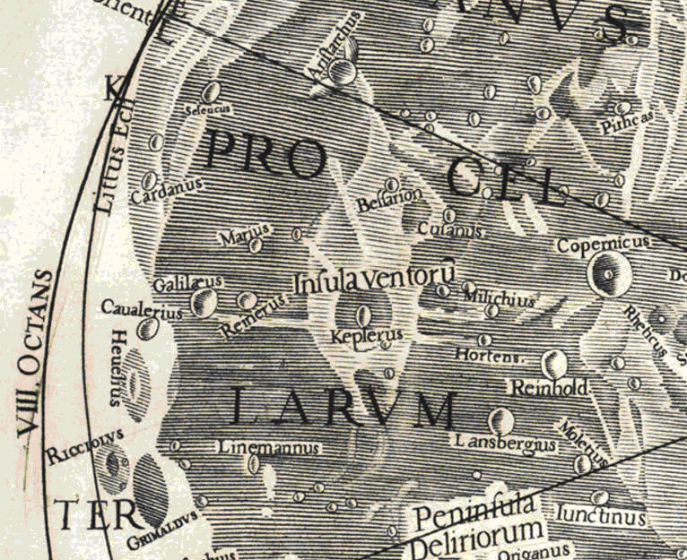
When asked about this, they said that they had “flung the heliocentrists away into the Ocean of Storms”, far from the Jesuits. But Riccioli and Grimaldi named two large adjoining craters near the Moon’s limb after themselves. Where are those craters? Not in the far south of the Moon with other Jesuits, but near its Equator, bordering the Oceanus Procellarum, close to the ‘crater’ Galilæus, and in the same quadrant of the Moon as Copernicus, Kepler and Aristarchus. This is considered to be secret support for the Copernican theory, which as Jesuits they knew they could not publicly express. Grimaldi's map therefore shows a large crater named Galilaeus, a worthy feature for such an important man.
180 years later, telescopes had improved to the extent that the best ones could show features on the Moon very clearly, and two men, Wilhelm Beer (1797-1850) and Johann Heinrich Mädler (1794-1874) decided to collaborate in producing a new map of the Moon with Beer's excellent Fraunhofer refractor of 95 mm aperture. This map was published in 1834 as the Mappa Selenographica, and used Riccioli's system of names plus others that had been added over the years. The Fraunhofer refractor was able to resolve hundreds of small features that previous observers had been unable to detect, and Mädler gave names to 133 of them, which are officially used today.
When producing their maps, they discovered an error in Riccioli’s map. It
referred to a large crater named by Riccioli “Galilaeus”, after the most
important observer of the Moon ever, Galileo Galilei. Mädler studied the area
intently, but could find no crater in that position. He referred to the
map
produced by Michael van Langren
in 1645, and saw a crater near there marked "Bullialdi" (this was probably the
one named "Reinerus" by Riccioli in his 1651 map). Mädler also checked the
chart drawn by
Johannes Hevelius in 1647 - it showed no craters near the same spot, but a
mountain which he had named "Mons Audus" (Hevelius had made a fundamental
mistake in naming all craters as mountains, e.g. the crater "Copernicus" was
named by him "Mount Etna"). After thoroughly checking all the old maps he could
find, Mädler realised that Riccioli's “Galilaeus” was not a real crater at
all, but a strange light-coloured marking on the Moon near the crater Reiner.
This marking is 40 kilometres across, and has a 110 kilometre tail like a kite
or comet. It casts no shadow under any lighting conditions, so has no height
above the surface. It seems to be unique on the Moon, and is a variation in the
reflectivity or ‘albedo’ of the lunar surface. Mädler gave names to many
features on the Moon, but never named albedo markings such as ray systems or the
marking near the crater Reiner. He chose to transfer Galileo’s name to the
nearest unnamed real crater. Unfortunately, only an insignificant 15 kilometre
example 120 kilometres to the north-west was available. This is why the name of
one of the greatest astronomical pioneers is attached to a nondescript little
crater in the Oceanus Procellarum. At least it is not far from the magnificent
craters Copernicus #8, Aristarchus #9, Kepler #83, Hevelius #37, Grimaldi and
Riccioli #38, so "Galilaei" is in
good company. The peculiar light-coloured marking is now known as Reiner
Gamma, and its cause is completely unknown. It is associated with a local
anomaly in the Moon's magnetic field, but not with any particular irregularities
in the surface which is quite smooth.
As Galileo Galilei (1564-1642) is such an important figure in astronomy,
his story is not summarised here, but is available on this website as a 28 page
PDF (portable document format) file. It is recommended that you use Adobe
Acrobat Reader to see this file in its correct layout. It is available by
clicking on
62: October 2021
This month we will look at an interesting area in the Moon's south-west
quadrant, centred on the complex of rilles around the crater Ramsden.
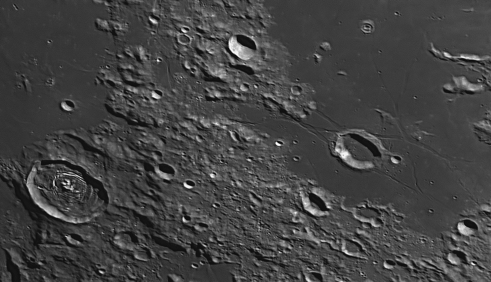
The two largest craters in this image are Vitello (just above the lower left corner) and Ramsden (right of centre). Dunthorne is just below the centre of the top border. North of Vitello is the Mare Humorum and surrounding Ramsden is the Palus Epidemiarum. The image was taken at 10:30 pm on 14 June 2019. The area above adjoins the one shown in image
#52 above, which lies immediately to the north. The right side of this image faces south-east.
At the upper-left corner of the above image can be seen the south-eastern
extremity of the Mare Humorum (the Sea of Moisture). Occupying most of
the right side of the image is another flat lava plain, this one being called
the Palus Epidemiarum (the Marsh of Epidemics). A short connecting
corridor of lava fields connects the two. The 41 kilometre crater Vitello
is clearly defined, so it must be more recently formed, compared with the rugged
area on which it sits. There is a complex of four mountain peaks projecting
above the floor, but it is a little off-centre. Surrounding these peaks and
centred on them is a double concentric set of clefts, very irregular and clearly
defined. The walls of Vitello have a sharp rim, with slumping only being found
onto the southern floor. Melted rock from the impact has blanketed the moonscape
to the north, north-east and east.
Right of centre, the 25 kilometre crater Ramsden is smaller than Vitello. Molten lava from the Palus Epidemianum, flowing from the east, has breached the southern wall and flooded the interior. The level floor is dotted with a handful of craterlets of about 1 kilometre diameter. The summit of the western wall is damaged in places by impacts leaving small 1 kilometre craterlets. The southerly one of these has caused a landslide of whitish material down the inside slope to impinge on Ramsden's floor.
There is a complex network of rilles surrounding Ramsden and obviously connected with it. These Rimae Ramsden are similar to grabens on Earth, where the land between parallel faults has fallen to create a type of 'rift valley'. The rilles around Ramsden have widths varying between 3 kilometres and 1 kilometre, and shallow depths of around 100 metres. Those to the north have an unusual configuration, much like a letter 'N'. One of these rilles enters the flat corridor and follows it in a westerly direction towards the Mare Humorum. Much of it has been covered by later lava flows. It leaves the corridor before it reaches the Mare, and strikes north, passing through a deformed 6 kilometre crater (Dunthorne A) before reaching the northern margin, where it has become the westernmost rille of the three Rimae Hippalus that are clearly shown in image #52 above. The easternmost rille of the Rimae Hippalus enters this image north-west of the crater Dunthorne, then curves around to the east, skirting the southern ramparts of Dunthorne before heading south to Ramsden.
The Rimae Hippalus, the Rimae Ramsden and the Rima Hesiodus are all therefore part of a giant network of grabens and clefts that are the result of the huge impact that created the Mare Humorum 3.9 billion years ago.
Above Ramsden in the image above and near the top margin is a 7 kilometre wide concentric crater called Marth. It has a smaller craterlet on its floor, so that it looks like a 'bull's eye'. To the left of Marth is the fresh 17 kilometre crater Dunthorne, which appears to have almost completely escaped damage by later impacts.

Piazzi was aware of Ramsden’s reputation for quality, but knew that he was easily diverted from ongoing projects, wanting to investigate new designs or manufacturing techniques. This meant that orders for new telescopes often took many years to fill. The unfortunate astronomers at Dunsink Observatory in Dublin had to wait for 23 years for their Ramsden telescope, which was completed by an assistant after Ramsden died. The King himself fared no better – Ramsden once arrived for a royal function at the pre-appointed hour, except that he was exactly a year late. During an extended stay in London, Piazzi actually ensconced himself for hours in Ramsden’s Piccadilly shop on numerous occasions, to keep the capricious craftsman focused on the Palermo Circle. His persistence paid off – Ramsden completed the telescope in 1789, and it turned out to be his most celebrated instrument.
Piazzi took the Circle back to Sicily and set it up in the
Palermo Obervatory, which was commissioned on 1 July 1790. With it, he assembled
his own catalogue of stellar positions and motions. Of the more than 7600 stars
in his catalogue, a fifth magnitude orange one in Cygnus (61 Cygni) stood out as
having an extremely rapid proper motion. This became known as "Piazzi's Flying
Star", and it became famous among astronomers when Friedrich Bessel used it to
solve the stellar parallax problem which finally allowed the distances of the
stars to be measured. Piazzi also used the Circle to discover the first
asteroid, Ceres.
63: November 2021
The largest walled plain in this image is named Schiller. Most craters
and crater plains on the Moon are circular in shape, although all of those
towards the Moon's edge or "limb" appear elliptical due to the effects of
perspective. Schiller, although it is located near the Moon's
south-western limb, appears very decidedly elliptical, not only because of the
obvious perspective effects, but because it really is elliptical, measuring 179
kilometres long by 71 kilometres across at its widest part. This makes it a very
unusual, possibly unique, lunar feature. The Sun is shining from the lower left
corner of the image (east). The circular crater between Schiller's eastern end
and the bottom margin is 48 kilometre diameter Bayer. This view, facing
south-west, was taken at 10:04 pm on 4 May 2020.
There has been much speculation about how this peculiar elongated crater plain
came to be formed. Some say that it is the fusion of two craters, others think
that it is possibly the result of a huge meteor striking the surface at a low
angle. It has been known since the First World War that artillery shells hitting
the ground at a low angle and then exploding, always seem to create circular
craters, not elongated. The crater is formed by the explosion, not the angle of
impact. As meteors striking the Moon at speeds averaging 25 kilometres per
second also explode on impact (being instantly vapourised as their kinetic
energy is converted into heat energy in a few milliseconds), then they also
produce circular craters irrespective of the angle of impact. The heat of their
impacts melts tremendous amounts of lunar rock depending on their size, and this
is why major craters like Copernicus, Tycho and Cassini ( #8 , #18
and
#28
on this webpage respectively) are without exception surrounded by haloes of rock
melt. In the image above, there are large patches of rock melt seen on the
nearest and furthest sides of Schiller, but very little at its ends. This does
not seem to support the 'low angle impact' theory. The phenomenon that caused
Schiller is still a mystery.
The common elongated craterlets or gouges seen around impact craters are caused,
not by a small space rock hitting the surface, but by rocky debris ejected from
a large crater that formed explosively moments before. The major impact from
which they were flung can be ascertained by following the long axis of the gouge
back to its source, as these gouges are usually more or less radial to the
source.
Johann Bayer (1572-1625) produced the first comprehensive and accurate
star atlas, Uranometria, in 1603 in Augsburg, Germany. A full set
of charts from his atlas may be examined by clicking
This month we will look at an interesting elongated crater plain in the Moon's
south-west quadrant, named Schiller.
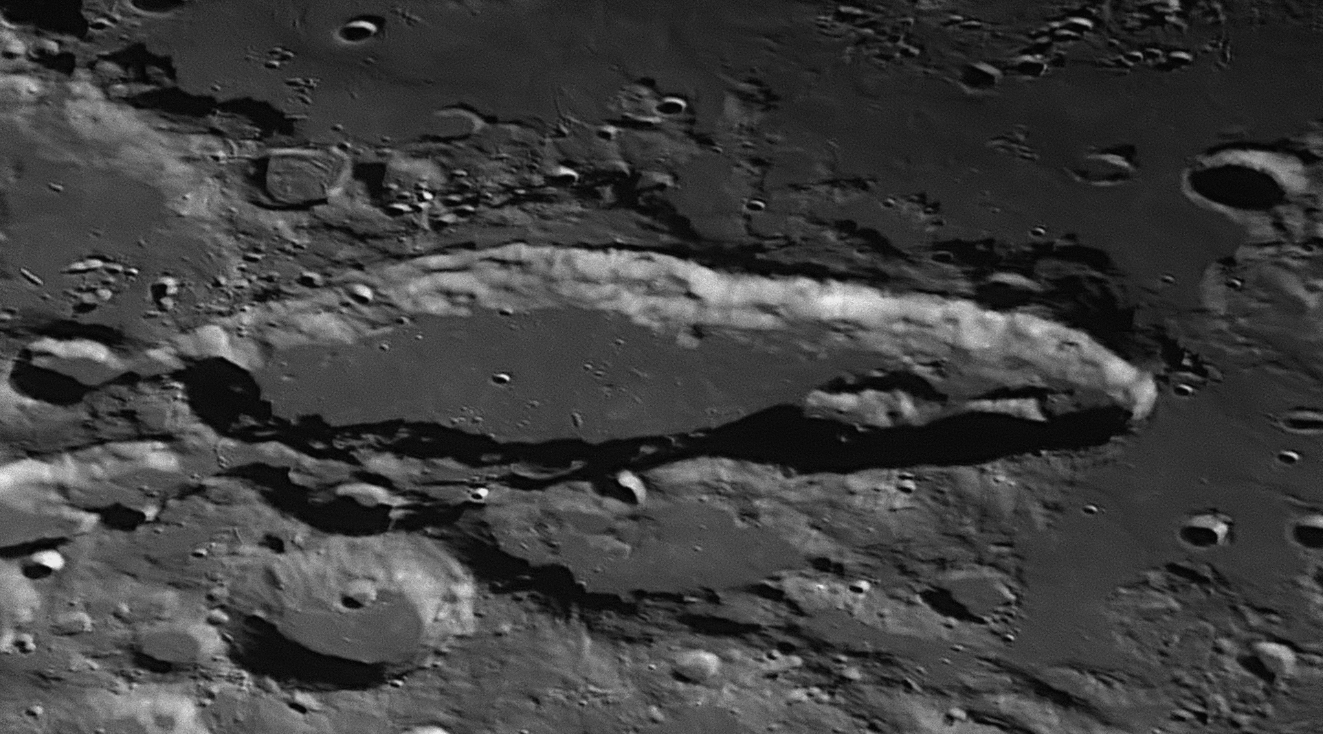
The south-eastern half of Schiller averages 25% wider than the
north-eastern half. Whereas the south-eastern two-thirds of the floor have been
flooded with upwelling lava and now exhibit a flat surface slightly damaged by
smaller impacts, the north-western third is very rugged, with a mountainous
spine occupying most of the space. This range is 50 kilometres long and is in
two sections with a gap in between. The southern section is higher and more
rugged. The walls have slumped down in the south-eastern half of Schiller,
creating terraces in places, and impinging onto the floor. In the centre of the
south-eastern half of Schiller is a recent, well-defined circular craterlet 2.4
kilometres across. To its right (north) is what looks like a 4 kilometre gouge
in the floor, extending away from the viewer. When the Sun is higher, this gouge
is revealed to be three contiguous craterlets, each a little over a kilometre
across, which appear to have been caused by ejecta from an impact that created
the fresh-looking 10 kilometre wide crater on the summit of Schiller's near
wall, called Schiller G.
Bayer and Schiller
Schiller published his star atlas as the Coelum Stellatum Christianum in 1627. Johann Mathias Kager drew the pictures and Lucas Kilian produced the excellent engravings. There were 49 plates, each centred on one of his main constellations with neighbouring constellations 'ghosted in’. The charts were not hand-coloured. The star positions were as accurate as in Bayer’s Uranometria, and each chart was accompanied by a page of Latin text explaining the original form of the constellation depicted, and the new form suggested by Schiller. The Linda Hall Library in Kansas City in the USA has a copy of the atlas available on-line. All pages of text (in Latin) and all charts are available, but the pdf file is large (1.2 GB) due to the finely-engraved exquisite detail in the charts. Click
To examine other old star atlases and books in the Linda Hall Library, click
When he was naming the lunar features in 1651, Giovanni Riccioli knew the story about the friendship between Bayer and Schiller, and so placed them together on the Moon, as adjoining craters. If he had known that Schiller's Christian constellations would fail to replace the traditional constellations used by Bayer in Uranometria, perhaps he would have named the larger and more spectacular crater-plain after Bayer, and given Schiller's name to its much smaller neighbour.
64: December 2021
This month we will look at the largest crater on the near side of the Moon. It
is named Bailly, and has a diameter of 303 kilometres. Circular features
of this size or larger are properly termed 'Basins'.
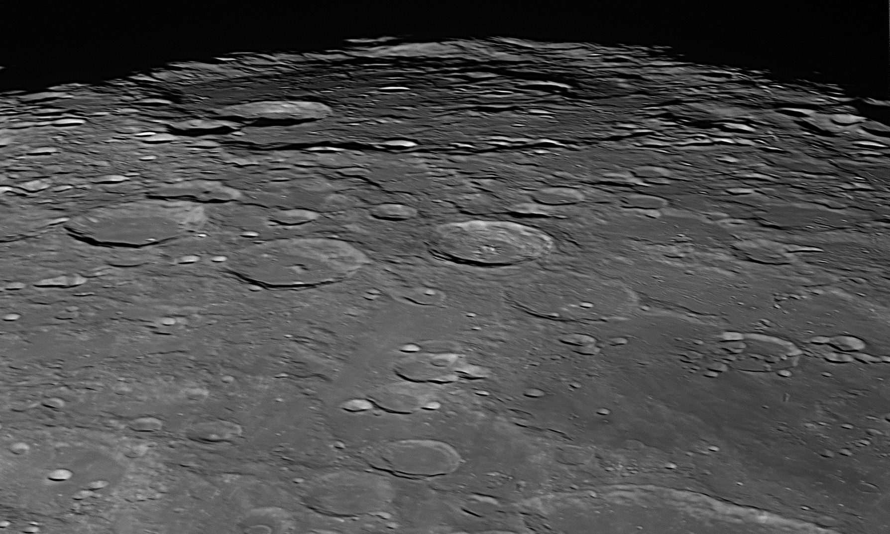
Bailly
is perfectly circular, but its position near the Moon's south-western limb means that it is always seen greatly foreshortened. This area was photographed at 10:42 pm on 25 May 2021.
There are five craters on Bailly's floor in the 16 to 23 kilometre range, and hundreds that are smaller. Probably the freshest crater is Bailly F, which can be seen just to the left of Bailly's centre. The floor also exhibits numerous low hills but is generally fairly flat. It is possible that lava pooled on Bailly's floor to level it out, otherwise one would expect to see the floor bowl-shaped with perhaps some central peaks, but the floor is so old and damaged that there is no sign that this ever happened. If it had, we would expect Bailly to be a twin of nearby Schickard ( item
There is a row of three large craters close to the horizontal centre line of this image. They are in a gentle curve from the left, with the third one being just right of centre. Giovanni Riccioli named them after his Jesuit colleagues in 1651. From the left, the three are Kircher (73 kilometres, a walled plain with a flat lava floor), Bettinus (71 kilometres with a similar floor except that a central mountain protrudes through it), and Zucchius (65 kilometres, has a small lake of lava on its floor, but not enough to intrude on a cluster of over a dozen mountains.)
The south-eastern portion of Schiller (previous image)
appears near the lower-right corner. There is a shallow valley about 60
kilometres wide with low walls, that runs north-east from Zucchius for 160
kilometres and then turns north-west for 200 kilometres until it runs into the
south-eastern end of Schiller, with which it is aligned.
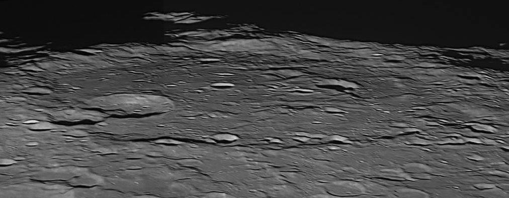
This image of Bailly was secured the previous month (26 April 2021), when libration was slightly more favourable and there were fewer shadows.
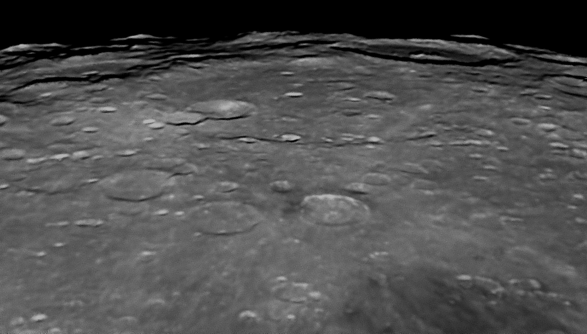
This image of Bailly was secured at 8:55 pm on 18 March 2022, when libration was near its most eastern extreme and the Moon almost exactly Full. The extent of the distant crater Hausen (see below) is revealed almost completely.
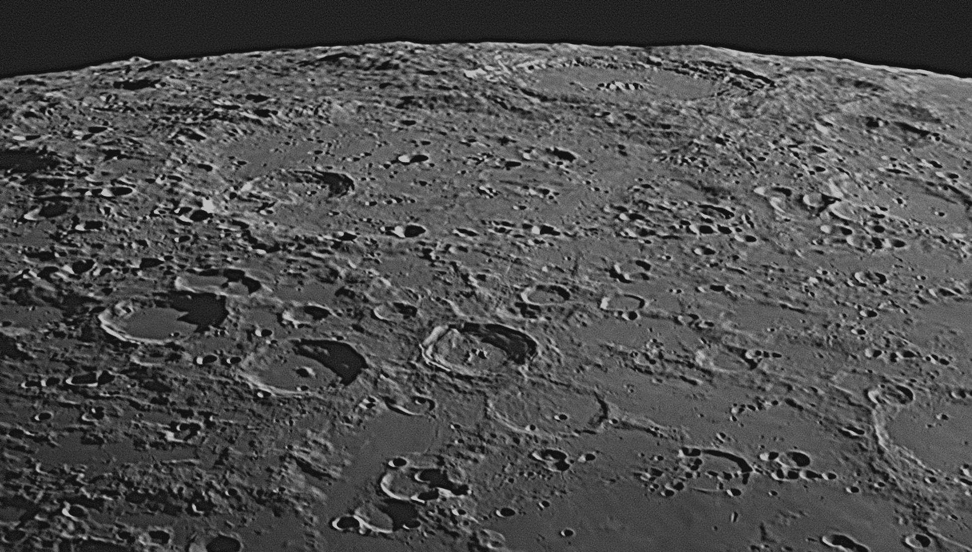
This image of the Bailly area was
taken when the sunlight was coming from the Moon's west and so the shadows are
different. The time of the picture was chosen when libration was at its maximum,
to bring more of the Moon's far side into view. This also revealed a large
crater behind Bailly, which is rarely seen and not often photographed. This
crater is called Hausen, and it has a diameter of 167 kilometres. It is
much younger than Bailly, and its walls are steep with many terraces. Its floor
is flat with a central cluster of a dozen peaks. Its eastern wall has impinged
slightly into ancient Bailly. In order to satisfy the requirements for this
image (maximum libration at a time of suitable lighting), the Moon needed to be
a waning crescent, and as high in the sky as possible. These criteria were
satisfied on 18 November 2022 at 6:15 am (sunrise was at 4:49 am). The Moon's
phase was 38%, and its altitude was 50 degrees, 39 minutes before culmination.
The Sun was 18 degrees above the eastern horizon and 76 degrees east of the
Moon.
Bailly
Jean Sylvain Bailly
65: January 2022
This month we will discuss three mountain ranges that are very difficult to
observe. They are called the Montes Cordillera (Cordillera Mountains),
the Outer Montes Rook (Outer Rook Mountains) and the Inner Montes Rook
(Inner Rook Mountains), and they are located at the western limb of the Moon.
Orbiting spacecraft have revealed that these ranges are actually the rims of the
largest impact basin on the Moon. It is named Mare Orientale or
Eastern Sea, and it has a diameter of 900 kilometres. There is a problem in that
it is located on the Moon's far side, and we can't see it from Earth. We can,
though, enjoy tantalising glimpses of parts of it, when favourable libration
brings its eastern ramparts into view at the same time as the Moon is close to
Full and the sky is clear. Such occasions are not rare although quite uncommon,
and one occurred in April last year. The next two images are from the
Virtual Moon Atlas, which is an atlas of the whole Moon composed of
montages of actual images taken by spacecraft in lunar orbit. The basic freeware
atlas can be downloaded by clicking
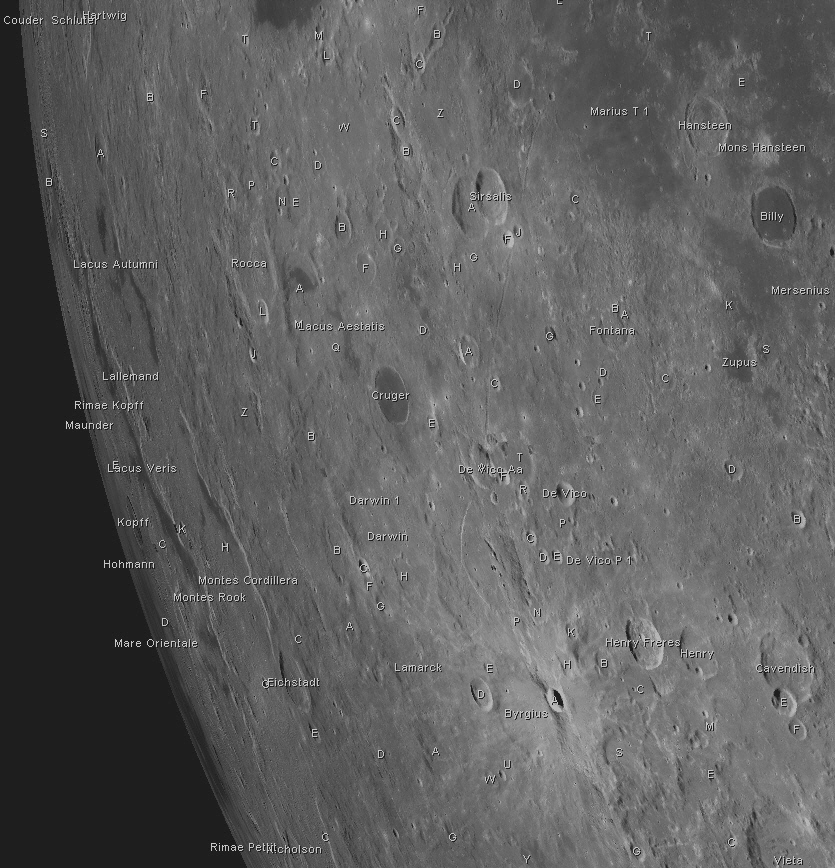
1 - (north at top).

The images
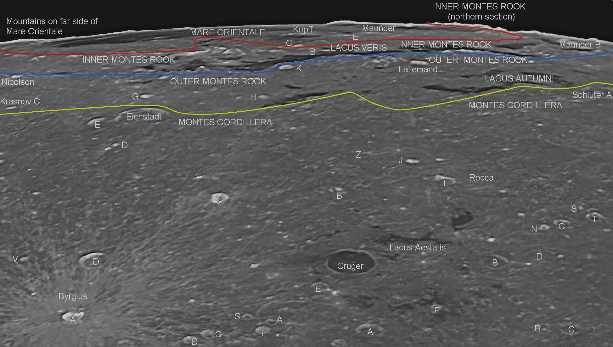
The above image was taken from Starfield Observatory when the Moon was close to
Full. As the Sun was almost vertical to the lunar surface, there are few shadows
visible except behind the rims of some craters, behind some of the higher
mountain peaks, and on the far side of the Outer Montes Rook and the
Montes Cordillera. These shadows are very thin and black, and should not be
confused with the dark grey lava beds of the Lacus Veris and Lacus
Autumni, which themselves have thin black shadows from the adjoining
escarpments on their eastern (nearest) edge. This is most noticeable just to the
west (behind) the 13 kilometre crater marked "K" ("Eichstadt K") on the
far edge of the Montes Rook escarpment which is quite high at that point. The
numerous bright craters and craterlets are the most recent impacts. This type of
illumination also emphasises ray systems around the newest craters, the most
noticeable one radiating from the crater Byrgius A. This ray system is
also visible in the lunar satellite image
This close-up image
Mare Orientale
The Mare Orientale proper is a dark lava plain in the interior of the great
impact basin. It has a diameter of 300 kilometres. Surrounding this are three
concentric mountainous rings. The innermost one has a diameter of 480 kilometres
and is most prominent around the western half of the Mare. It is known as the
Inner Montes Rook
(Inner Rook Mountains). The middle ring has a diameter of 600 kilometres.
Its eastern side can occasionally be glimpsed from Earth, and is known as the
Outer Montes Rook (Outer Rook Mountains). The outside ring has a diameter of
930 kilometres and its eastern mountains are quite often seen from Earth in
profile on the Moon's limb at the time of Full Moon. These eastern mountains are
known as the
Montes Cordillera (Cordillera Mountains). Between the Montes Rook and the
Montes Cordillera is a ring-shaped flat plain that varies between 100 and 165
kilometres wide. The highest peaks in these ranges are up to 8.5 kilometres
high. The centre of Mare Orientale is 280 kilometres beyond the horizon (Inner
Montes Rook).
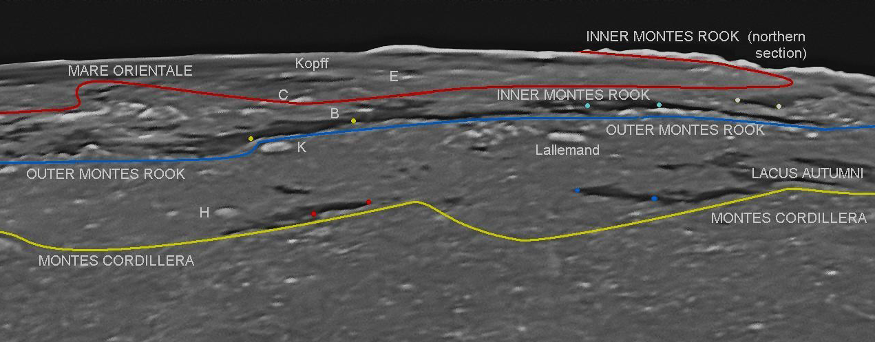
4 - The thin black shadows on dark grey lava beds can be better seen in this
enlargement of part of image 3. One of these shadows can be discerned between
each pair of dots of the same colour.

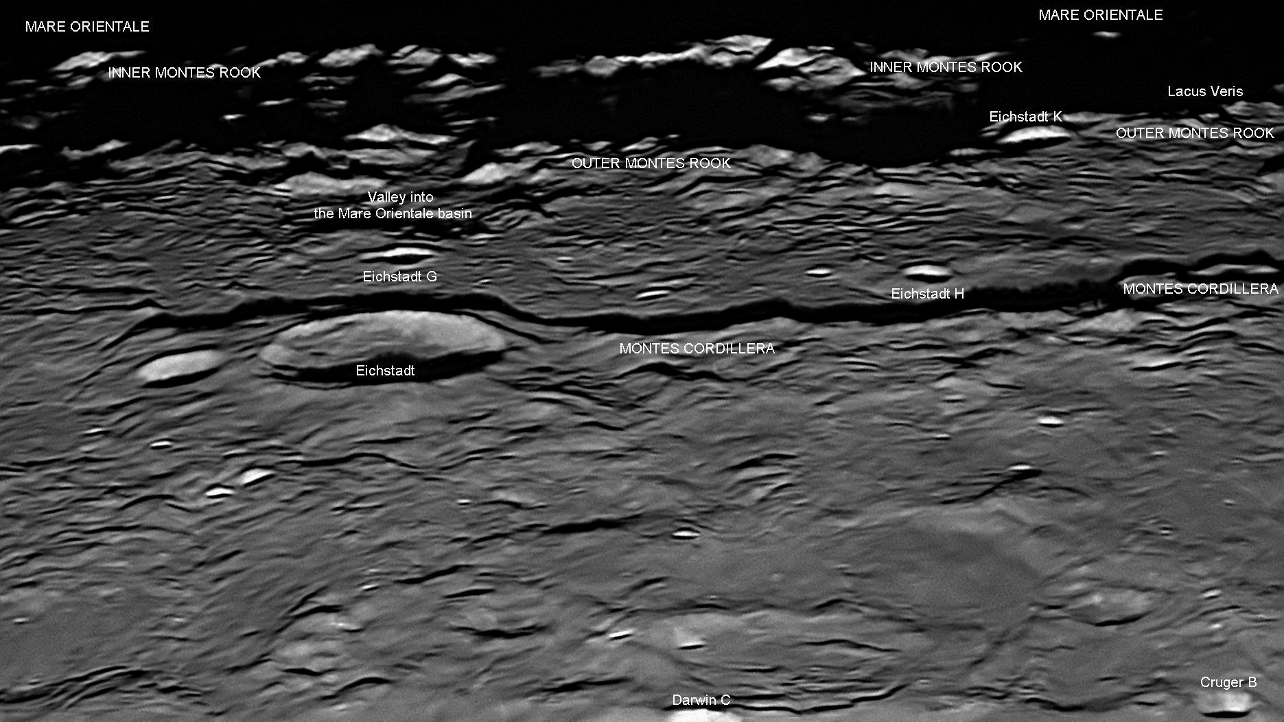
The three following images, like images 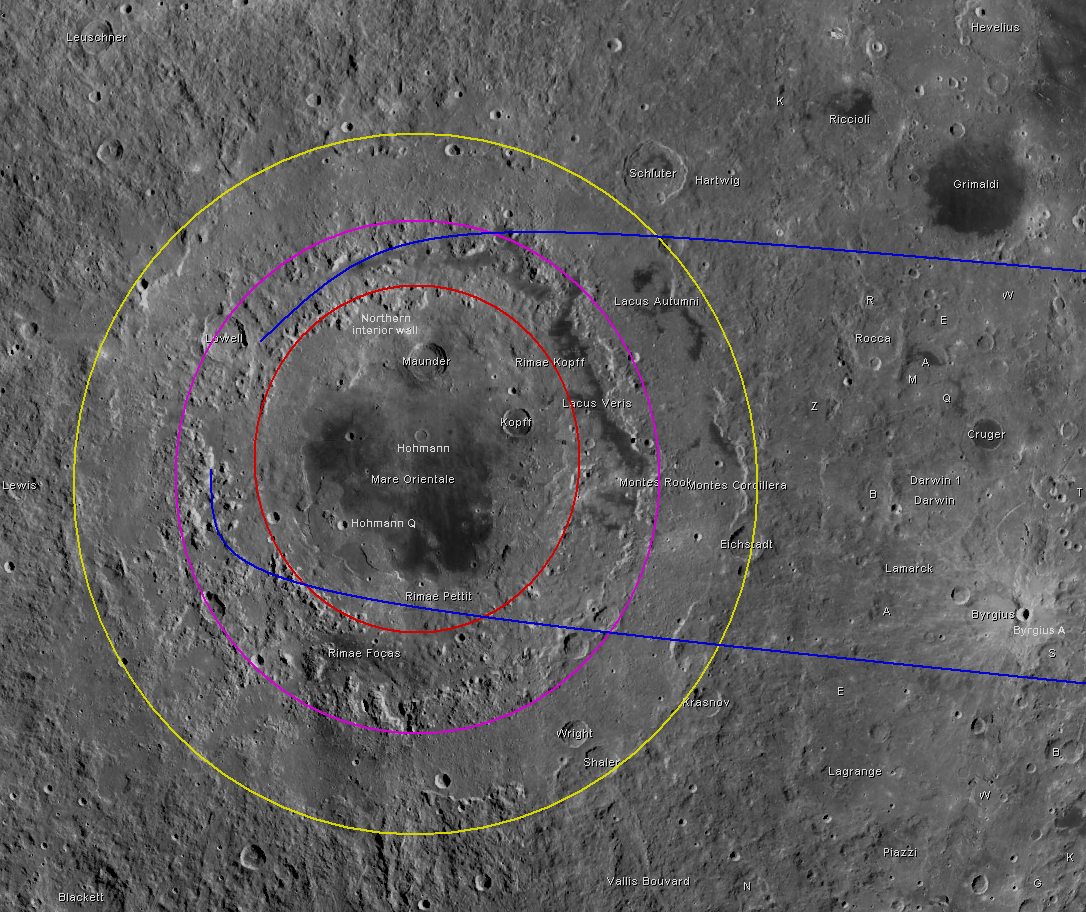
7 - This image shows the great circular impact basin Mare Orientale
on the Moon's far side, as seen from a spacecraft looking vertically down to it.
The three concentric mountainous rings are shown in different colours. The two
blue lines define the edges of the view from Earth as shown by the Starfield
image 3 above, looking west from the right-hand margin towards the left.
In image 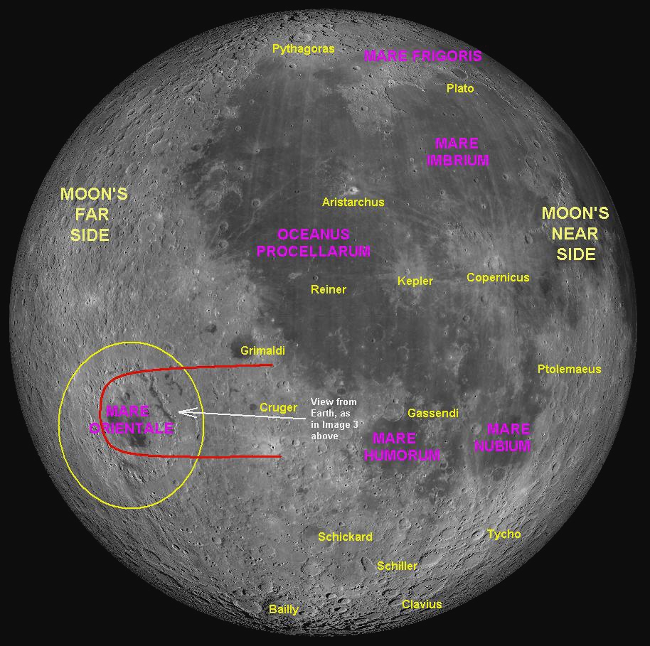
8 - The white arrow labelled "View from Earth" shows the direction the camera
was pointing from Nambour to capture image 3. The view looks over the crater
Cruger towards the Montes Cordillera and Montes Rook,
which are enclosed by the red arc which also marks the far horizon in image 3.
66: February 2022
9 - The normal view of the Full Moon from Earth.
This month we will discuss two neighbouring craters that make a remarkable
two-some in the eastern end of the Mare Imbrium, (Sea of Rains). These
two are named Aristillus and Autolycus.
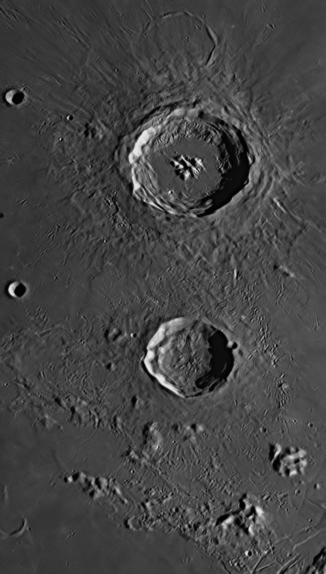
At the top (north) of this image is Aristillus, which is a typical impact
crater with a diameter of 55 kilometres. It is one of the youngest of the big
craters, being less than 1.1 billion years old. About 50 kilometres to the
south is a smaller crater of about the same age. This is Autolycus, with
a diameter of 40 kilometres. The image was taken at 7:47 pm on 15
September 2021.
Each
of these craters is surrounded by a halo of debris, but the impact that created
Aristillus must have been more violent, as ejecta from the blast has resulted in
a huge amount of rock melt surrounding the crater. The impact which created
Autolycus must have been at a lower temperature, as there is less rock melt.
There are numerous craterlets, gouges and rays radiating from Aristillus, caused
by solid ejecta, but not as many from Autolycus. To the east of Autolycus is a
long, almost straight chain of craterlets, but as it is radial to Aristillus it
was probably caused by huge flying rocks blasted in a nearly southerly direction
across the surface from that crater.
Aristillus has a flat floor of cooled lava which has welled up
through sub-surface fractures in the bedrock. The largest craterlet on this
floor is a bright 2.3 kilometre example adjoining the south-western wall. Next
to the south-eastern wall is a 1.7 kilometre craterlet. Three linear mountain
groups trending in a south-east to north-west direction protrude above the flat
floor. The summits of these mountains reach altitudes up to 1800 metres. The
smallest craterlet visible inside Aristillus in this image is a 700 metre
example about 2.5 kilometres south-east of the south-eastern end of the central
mountain group. All around the inside rim of Aristillus, the walls have slumped
down to the floor in huge landslides, creating spectacular terraces.
Autolycus has a bowl-shaped floor which has not been flooded by magma, but is
quite hilly, with a couple of small craterlets. As with Aristillus, the walls
have slumped down, but in this case one huge terrace runs around most of the
circumference, except for a landslide in the north which has impinged onto the
floor. The eastern side of Autolycus has been damaged by a small impact, which
has left a 4 kilometre craterlet called v Autolycus A perched on
the main crater's rim.
There were craters in the area before the Imbrium Event occurred 3.85
billion years ago (see image
Two 8 kilometre craterlets can be seen near the left-hand margin - Aristillus
B (upper) and Archimedes C (lower). Spurr and Archimedes C can also
be identified in image
The scholars
at the Great Library of Alexandria (see image
In 300 BCE
Euclid wrote his Elements, which introduced and systematised
geometry, a Greek term meaning ‘land measurement’. It was Euclid who,
when King Ptolemy
At about the same time, Aristillus (active between 310 and 250 BCE) and
Timocharis (320-240 BCE) both worked at an observatory attached to the Great
Library. Their equipment was simple, most likely consisting of gnomons, sundials
and maybe an armillary sphere, but with it they created the first star catalogue
in 257 BCE.
Aristillus
and Autolycus
In Greece, Autolycus of Pitane (360-290 BCE), supported the geocentric system being tweaked by his contemporaries Eudoxus and Callippus, but found a major flaw in their thinking, in that it was unable to explain changes in the brightness of planets that were observed. Because the spheres which carried the planets were said to be concentric with the Earth, the planets would always remain at the same distance from Earth, and should therefore maintain the same brightness. Autolycus’ surviving works include a book on spheres entitled On the Moving Sphere and another On Risings and Settings (of celestial bodies). The former is the oldest complete mathematical book we have from ancient Greece.
67: March 2022
This month we will discuss a walled plain that lies to the west of the Mare
Humorum, (Sea of Moisture), that is surrounded by a system of rilles and
clefts. This walled plain is named Mersenius.

The largest crater at the centre right (north) of this image is Mersenius, which is a typical walled plain with a diameter of 85 kilometres. It is quite an
old crater, having occurred about 3.9 billion years ago
Walled plains are formed when the initial impact shatters the deep bedrock,
releasing the pressure on the underlying superheated rock layers and allowing
them to liquefy into molten magma. The magma forces its way up through the new
fissures and spreads out inside the crater, creating a flat floor which cools
and hardens. Often, at a later stage, pressure builds up below the floor and it
bulges upwards, slightly doming the floor so that it is somewhat higher in its
centre than around its circumference. On occasion, the doming is such that it
fractures the lava floor, and there are numerous examples of this. One is
Mersenius above, where the floor exhibits numerous fractures in the form of
groove-shaped rilles. There is another network of rilles at the lower left-hand
margin, which is the western "shore" of the Mare Humorum. These are
called the Rimae Doppelmayer, and have a combined length of 130
kilometres. The average width of these rilles is 1.5 kilometres.
Different again are the other linear features in this image.
There are grabens (also called "Rimae") which are like rift valleys with
parallel sides and flat floors. The ones visible in the upper left-hand side of
this image are called the Rimae Gasparis after the 30 kilometre crater
De Gasparis from which they appear to radiate. The 37 kilometre crater between
De Gasparis and Mersenius is called Liebig.
There is also long cliff, brightly illuminated by the rising
Sun, which lies above (west of) the network of rilles previously mentioned. This
cliff, called the Rupes Liebig, is 180 kilometres long and is
interrupted along its length by a bright 9 kilometre craterlet.
Mersenius
68: April 2022
This month we will discuss a walled plain that lies in the libration area near
the Moon's south-eastern limb. This ancient walled plain is named Lyot.
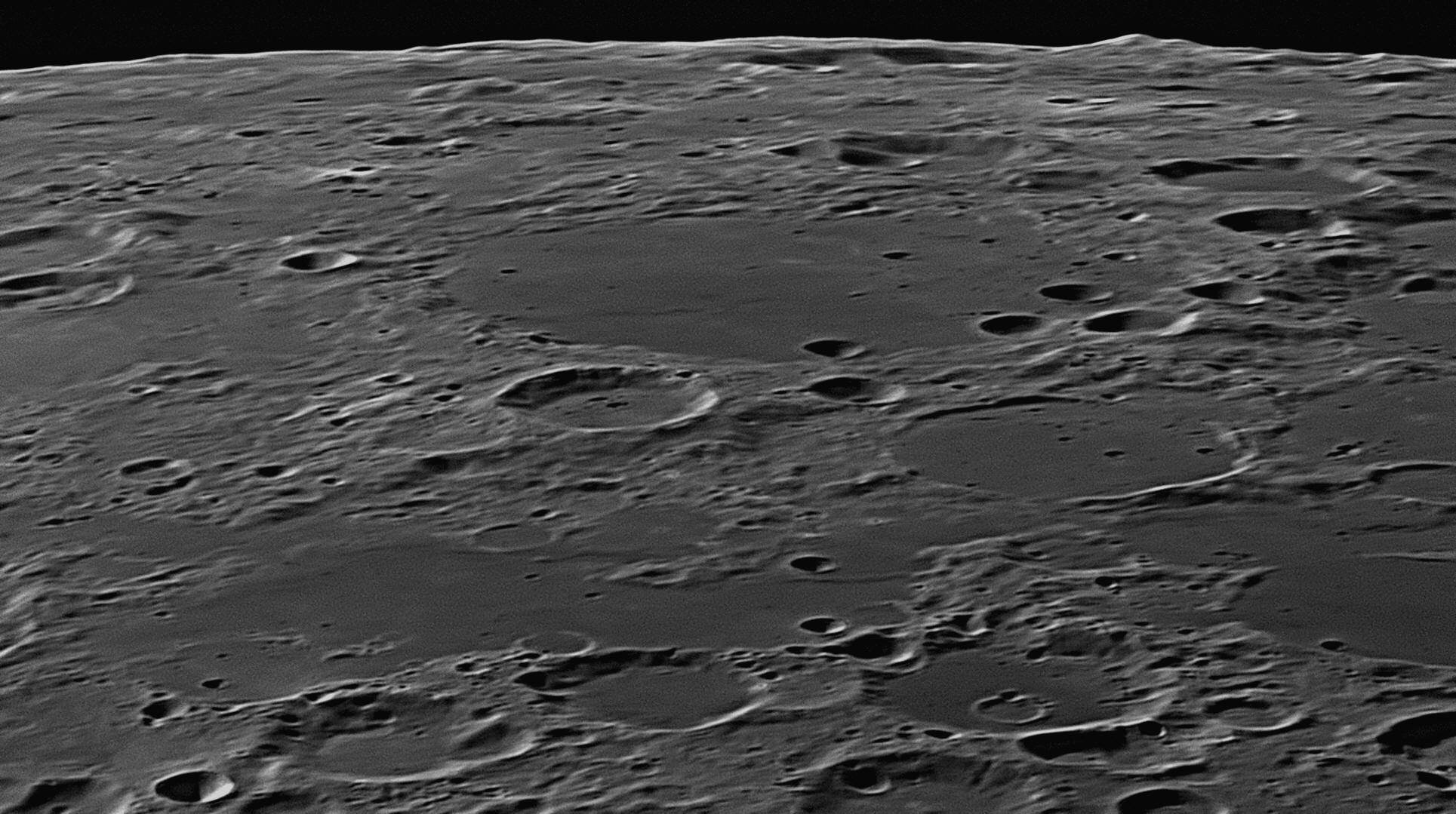
In
the middle distance (east) of this image is Lyot, which is a typical
walled plain with a diameter of 141 kilometres. It is quite an old crater,
having occurred before the events that created most of the lunar "seas" (maria).
It is the largest circular object in this image, but is greatly foreshortened
due to its location near the limb. The image was taken on 14 September 2018 at
5:26 pm.
The formation of walled plains like this one was described last month. This
example was originally formed when the Moon was only 14% of its present age. For
the rest of that time it has been bombarded by impacts large and small, until
its circular rim has been worn down and degraded to a ring of hills. One large
impactor struck Lyot's floor early in its history, leaving a crater 17
kilometres across. Subsequently, magma welled up through fractures in Lyot's
floor, filling it up until its floor was level and colour-matched with the lunar
surface outside. This created the flat -floored walled plain we see today, and
almost totally swamped the 17 kilometre crater previously mentioned. Its rim can
still be detected, protruding slightly above Lyot's floor as a ghost crater. The
southern part of it can be seen faintly in the image above, about 20 kilometres
inside Lyot's far rim. Three later impacts have struck the south-western part of
Lyot's floor (the right-hand side in the image above), leaving fresh-looking
bowl-shaped craters in the range of 9 to 21 kilometres in diameter, and another
four have struck the south-western and western rims. These are named Lyot A,
B,
C, D, E, F and N. Otherwise the floor is
level with only a few craterlets, one small hill and a wrinkle ridge running
from the north rim (at left) towards the centre of Lyot.
On the far side of Lyot can be seen craters with some discontinuous darker lava
plains between them. These lava plains have been made by upwelling volcanic
basaltic magma filling a pre-existing basin almost 1000 kilometres in diameter.
Together these plains are called the Mare Australe (Southern Sea). Two
thirds of the way along the bottom margin of the image there is a 45 kilometre
crater partially shown, with a 9 kilometre craterlet on its opposite rim. This
is the crater Brisbane, named after a Scottish astronomer who became the
Governor of New South Wales between 1821 and 1825. He built an observatory at
Parramatta near Sydney, and also gave his name to the City of Brisbane and the
river which runs through it.
69: May 2022
This month we will discuss a feature that lies between
Clavius and Tycho in the Moon's Southern Hemisphere. This ancient walled plain
is named Maginus.
The
battered walled-plain Maginus occupies most of this image, which was
taken on 15 September 2021 at 6:29 pm. South is to the top.
Maginus is a walled-plain that is 164 kilometres in diameter. It lies in
the heavily-cratered southern uplands of the Moon, between the well-known
craters Tycho and Clavius, which are off this image. Circular in shape, it is
greatly foreshortened in a north-south direction due to its position at latitude
50º South. Like most others in this area, it is a very ancient crater and in its
first billion years of existence it suffered relentless bombardment by space
rocks ranging in size from flying mountains to pebbles. On its floor can be seen
the summits of small central mountains protruding through the extruded lava
plain.
Maginus
Giovanni Antonio Magini (1555-1617) was an Italian astronomer who supported Ptolemy's geocentric model of the universe, i.e. that the Earth was fixed at the centre, and the Sun, Moon, planets and stars all circled the Earth every 24 hours on transparent, crystalline spheres. He differed from his colleagues in claiming that there were eleven spheres. He rejected the heliocentric view of Copernicus that the Earth was just another planet orbiting the Sun every year. When the chair of mathematics at the University of Bologna became available in 1588, Magini was chosen over another applicant, Galileo Galilei. He stayed there until he died. (Galileo won the chair of mathematics at the University of Pisa the following year, and then the chair of mathematics at the University of Padua in 1591.) Magini totally rejected the ideas of Copernicus and Kepler, but lived long enough to see that Galileo's first observations with a telescope in 1609 proved that Copernicus had been on the right track all the time, and that he, Magini, had been barking up the wrong tree, and teaching a fallacy for all of his life.
70: June 2022
This month we will discuss a small crater that lies in
the eastern part of the Oceanus Procellarum (Ocean of Storms). This
crater is named Bessarion.
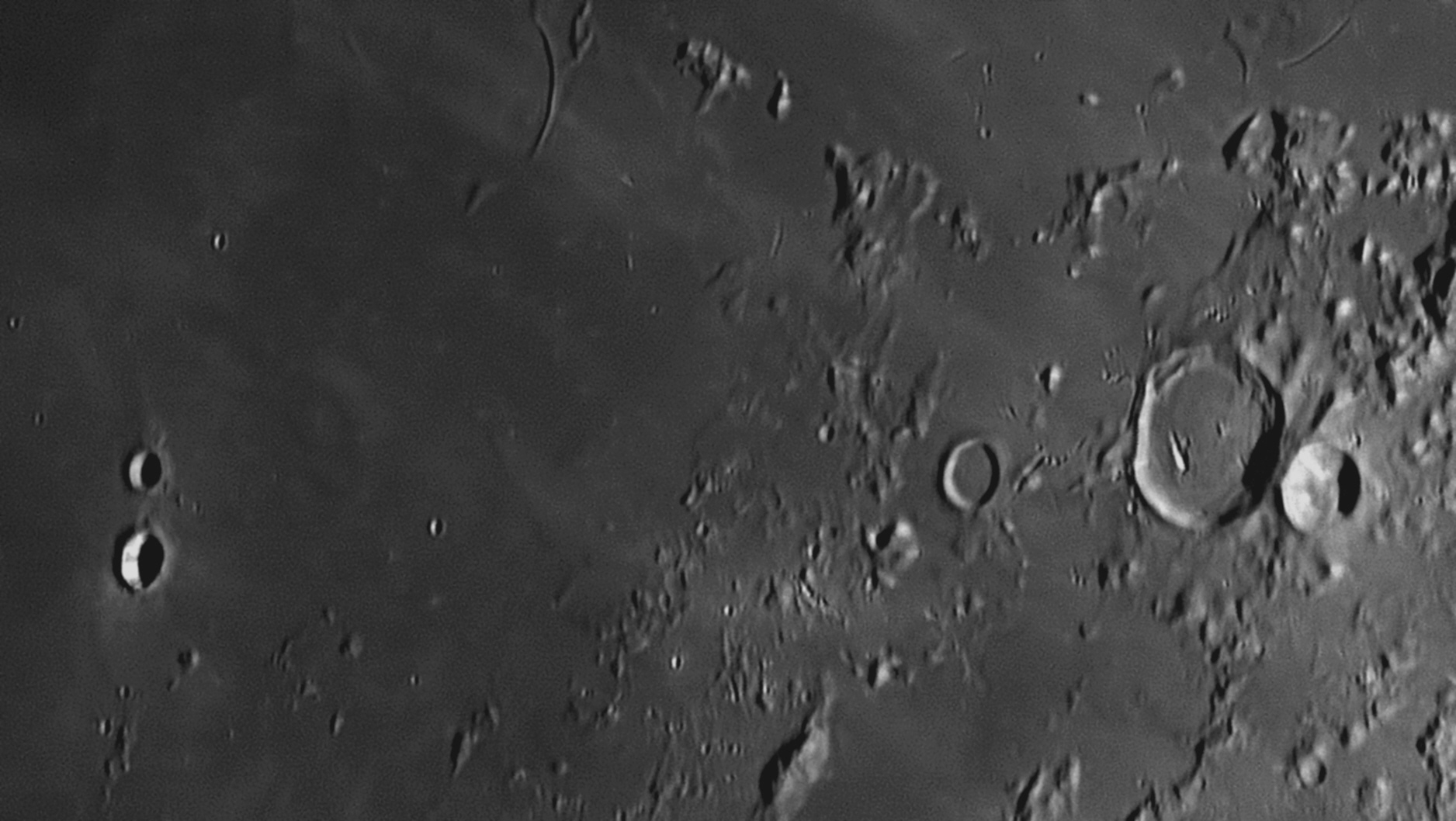
Bessarion is a small
impact crater on the Mare Imbrium (Sea of Rains) which has a diameter of
10 kilometres. It is visible in the above image near the lower left-hand
(south-west) corner. Above it is an 8 kilometre crater, Bessarion E. The
largest crater in this image is 34 kilometre T. Mayer, which is near the
centre of the right-hand margin. T. Mayer and the surrounding mountains
(the Montes Carpatus) also appear in image
Bessarion is quite an insignificant crater that formed quite late in the
Moon's history. Its rim is not very high and it has a bowl-shaped floor. In the
centre of the floor is a tiny flat section made of debris that has detached from
the walls and rolled down to the floor. Its walls are quite whitish and bright,
and it is surrounded by a small system of bright rays. The brightness of these
features indicate that they are among the newest on the Moon. The interior walls
show several radial dark bands - two are seen above. Crossing diagonally the
lava plains of the Mare Imbrium are several light-coloured streaks. These
were caused by debris thrown out from the Copernicus impact and striking the
surface. They radiate from the crater Copernicus ( #8
Ptolemy's 'Almagest'
Until
about 1450, Europe experienced an intermittent flow of knowledge from the
ancient world, most of it filtered through the Muslims. But, unknown to people
in the old Western Roman Empire based in Rome, there had been a treasure-house
of knowledge from the Great Library of Alexandria preserved by scholars in the
capital of the Eastern Roman Empire. This was the old city of Byzantium, rebuilt
as a Christian city by the Emperor Constantine and renamed Constantinople. The
language used by the scholars of Constantinople was Greek, but this language was
unknown in Europe. Except for some monks and the occasional individual such as
the Englishman Roger Bacon, few scholars could read Greek well enough to work
with the few Greek books and scrolls that became available. The ancient texts in
Constantinople therefore remained to a large extent unknown to scholars in
western Europe.
The 'Almagest' finds its way to Europe
 George of Trebizond (1395-1473) was a Greek
philosopher born on the island of Crete, who lived at the Greek outpost of
Trebizond, a port on the Black Sea coast of Turkey. He went to Italy to attend
the Council of Florence, quickly mastered Latin and was offered a position as a
translator of Greek texts for Pope Nicholas
V in Rome. It seems that a copy of the original Greek Almagest
of Ptolemy came into the pope’s hands during the Council, and George was given
the task of making it available to selected Catholic scholars. He translated it
from the original Greek into Latin with explanatory notes (left),
and it was distributed as his Commentary on the Almagest in 1451.
Soon his work was being compared with that of Gerard of Cremona, and although
his translation was thought to be very good, the accompanying commentary, just
as long, was heavily criticised as being inferior, hurried and full of errors.
The whole work therefore became disparaged.
George of Trebizond (1395-1473) was a Greek
philosopher born on the island of Crete, who lived at the Greek outpost of
Trebizond, a port on the Black Sea coast of Turkey. He went to Italy to attend
the Council of Florence, quickly mastered Latin and was offered a position as a
translator of Greek texts for Pope Nicholas
V in Rome. It seems that a copy of the original Greek Almagest
of Ptolemy came into the pope’s hands during the Council, and George was given
the task of making it available to selected Catholic scholars. He translated it
from the original Greek into Latin with explanatory notes (left),
and it was distributed as his Commentary on the Almagest in 1451.
Soon his work was being compared with that of Gerard of Cremona, and although
his translation was thought to be very good, the accompanying commentary, just
as long, was heavily criticised as being inferior, hurried and full of errors.
The whole work therefore became disparaged.
Bessarion
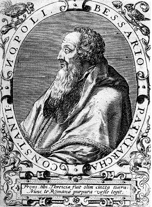
Cardinal Basilios Bessarion (1403-1472, right), born in Trebizond, was a Patriarch of Constantinople who attended the Council of Florence in an official capacity. He advised them that a union of the Latin and Greek Christian churches was the only way to stop an expected Muslim invasion of Europe. In a prescient move, he had brought all of his possessions with him, including a magnificent personal collection of over 600 books and manuscripts of the ancient texts of Archimedes, Apollonus and other great thinkers. Included in his collection was a complete copy of Ptolemy’s history of astronomy, called the The Mathematike Syntaxis
or the Almagest, in Ptolemy’s original Greek. When the negotiations between the churches failed, he decided that it would be safest to remain in Italy. In 1453 the anticipated Muslim attacks came and Constantinople fell to the armies of the Ottoman Turks, who renamed the city ‘Istanbul’ and converted the great multi-domed Christian cathedral of Hagia Sophia (Greek for ‘Holy Wisdom’) into a mosque. The Christian scholars living there fled to Italy, taking with them their vast collections of historic books, manuscripts and scrolls holding the ancient wisdom of the Greeks and early Romans.A large number of these refugees came to Venice, where Bessarion had also settled, so that he likened the city to another Byzantium. He later donated his entire collection of books and scrolls to that city’s St Mark’s Cathedral. In time the ancient texts brought by scholars from Constantinople found their way into the libraries of the Vatican, Florence and Venice, where important collections were built up. Basilios Bessarion was fluent in Greek as it was his native language, but he knew very little Latin. He had seen George of Trebizond’s version of the Greek Almagest, and was very critical of it, particularly of George’s bitter attacks on Plato. He wished to translate his own original copy of the Almagest directly into Latin himself, so studied that language until he became proficient. He then began work on translating his original, authentic Greek Almagest of Ptolemy into the language of European scholarship, free of any Arabian modifications.
Cardinal Bessarion was made Papal Legate to the Austrian Emperor in 1460, and then had little time to work on translating the Almagest. Arriving in Vienna, he asked at the local University if there was anyone there who could help him to understand and translate into Latin Ptolemy's complicated mathematics. In this way he met Georg von Peurbach who said he was keen to assist, but as he had a limited understanding of Greek, one of his students, Johannes Müller who knew some Greek, was co-opted to help, too. ..... continued below.
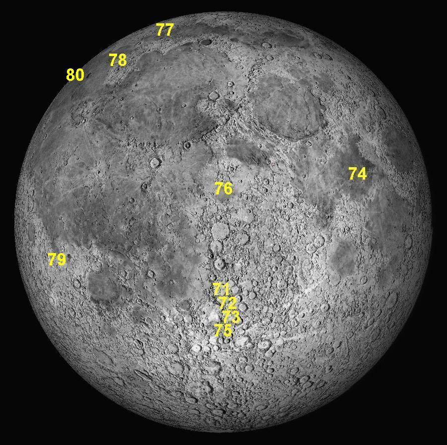
Key to features 71-80.
71: July 2022
This month we will discuss a large crater in the
southern hemisphere called Purbach. It is the northernmost in a group of
three craters that were named by Riccioli after men who worked on a project to
bring the original Greek version of Ptolemy's Almagest
to Europe in the late 15th century.
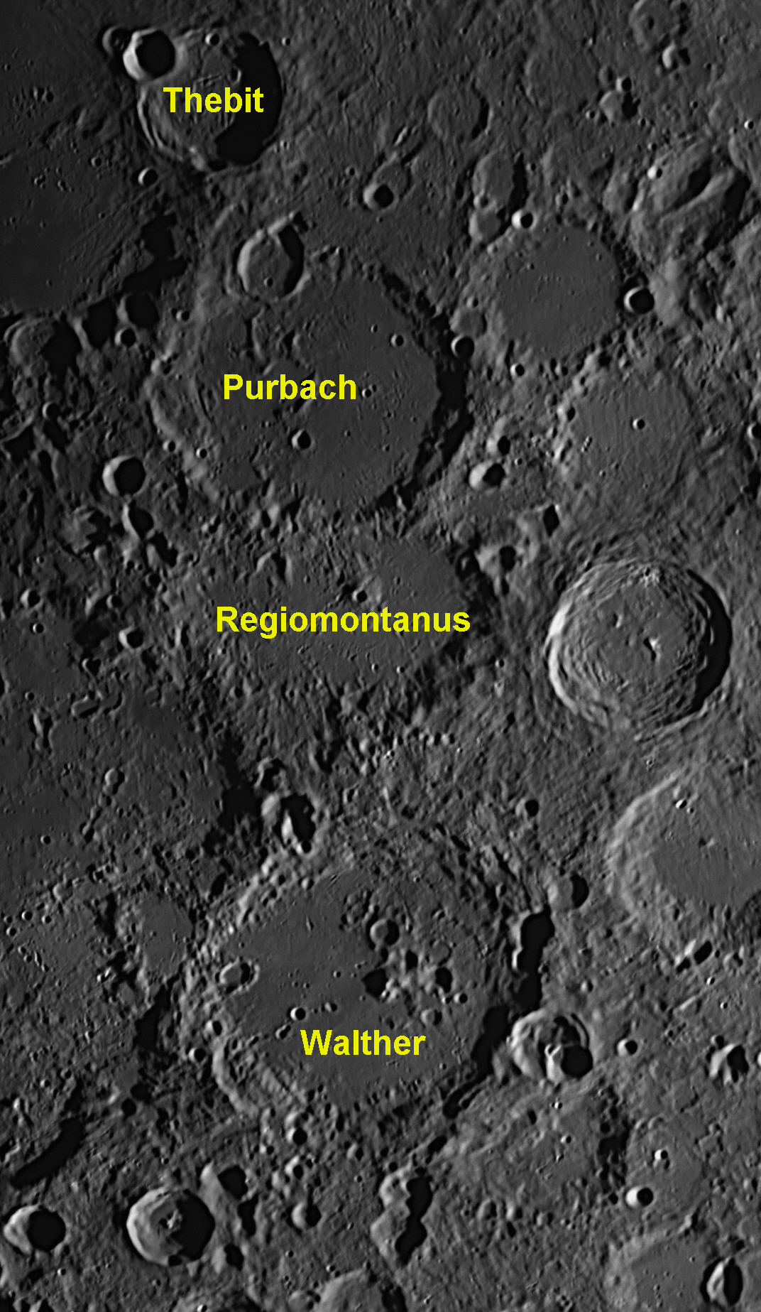

Purbach's flat floor contains some very old ghost craters. The four largest
impact craters on the floor have diameters ranging from 8 kilometres and 5
kilometres down to 4 kilometres, but there are hundreds of smaller craterlets
dotted about. The northern wall of Purbach is severely damaged by a flat-floored
crater, Purbach G, which has a diameter of 27 kilometres. The eastern
wall is high with narrow terraces where the land has slumped down to the floor.
There is a major landslide on the western wall.
Peurbach told his students how very imprecise the Latin translations of the Arabic versions of the Greek Almagest were, and how the errors had affected the accuracy of the Alfonsine Tables. One of his students, Johannes Müller (1436-1476), listened carefully to the lectures, and published them as a book sixteen years later, after his teacher had died. In 1454 Peurbach and Müller together began a six-year program of observations of stars, planets and comets, all recorded with care.
Cardinal Bessarion was made Papal Legate to the Austrian Emperor in 1460, and then had little time to work on translating the Almagest. Arriving in Vienna, he immediately heard of Peurbach’s understanding of Ptolemy’s complicated mathematics, so Bessarion asked him to help with the translation. As Peurbach had a limited understanding of Greek, he asked his student Johannes Müller (who knew some Greek) to help, too.
By 1461, six books of Ptolemy’s thirteen had been translated. Bessarion was called to Rome, and arranged for Peurbach and Müller to accompany him so that the translation could continue uninterrupted. Unfortunately, Peurbach died suddenly on the eve of departure at the early age of 37. Müller accompanied Bessarion to Rome and continued working on the translation by himself. ..... continued below.
72: August 2022
This month we will look at the centre crater in the trio
seen in the left-hand image below. It is named Regiomontanus.
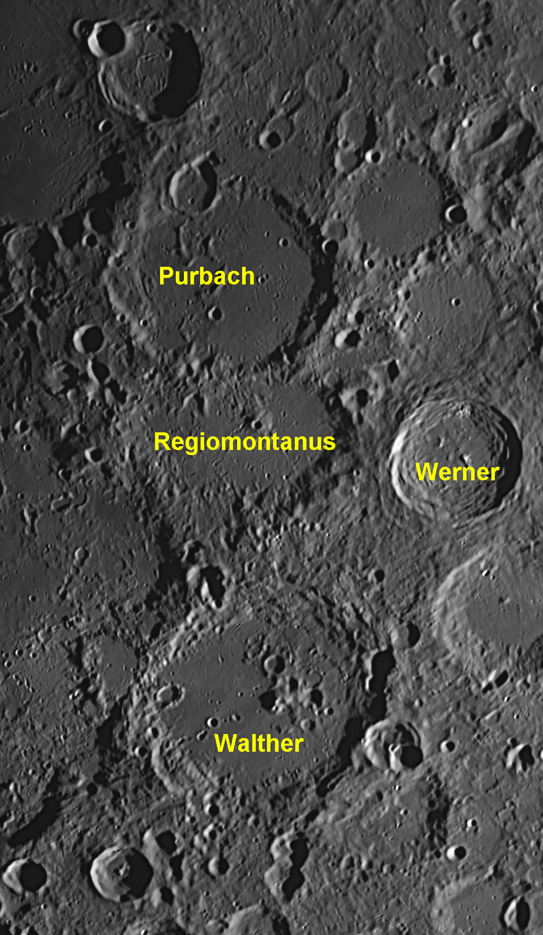
Regiomontanus has been damaged by the later impact of Purbach which obliterated the northern wall. This means that Regiomontanus is older. The walls on the south and west are also severely degraded. There is an elongated central peak on the flat floor of Regiomontanus, which has a 6 kilometre crater called Regiomontanus A on its summit which was once thought to be a volcanic vent and evidence of vulcanism on the Moon. It is true that the Moon has volcanoes, some of which may be active. No proof of eruptions has yet been observed, although some mysterious glows and clouds have been reported. Probably the most credible observation was made by the Russian astronomer N. Kozyrev in November 1958, when he saw a glow on the central peak of the crater Alphonsus (see image #6 above). It persisted long enough for him to obtain a spectrogram of the glow, which confirmed that it was an emission of hot gas. Other volcanoes may be found in images #16, #44, #49, #55, #56, and #57 ). Regiomontanus A has been found to be merely an impact crater which by chance struck the central mountain of Regionmontanus, a little to the south-west of the summit.
In the small-scale image at left above, it will be seen that there is a 70 kilometre diameter crater named Werner close by the eastern side of Regiomontanus. It is the newest of the large craters in that image, the evidence being that it looks much fresher, with its features sharply defined, rather than being eroded and degraded by later impacts. In the adjacent high-resolution image, rock melt from the Werrner explosion can be seen to have swamped the eastern walls and part of the floor of Regiomontanus. There are a few small impact craterlets on the rock melt layer, which are sharply defined. This indicates that they are less than one billion years old, which is very young in lunar terms.
Regiomontanus
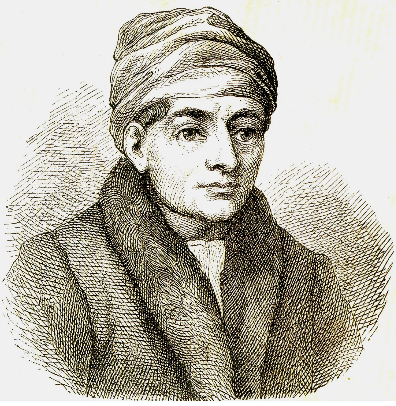
Johann Müller (1436-1476, left) had been a child prodigy who enrolled
at the University of Leipzig at the age of 11. When 15 years old he moved
to Vienna and enrolled in the university there, where he became a pupil and
friend of Georg von Peurbach (see notes for image
By 1461, six books of Ptolemy’s thirteen had been translated. Bessarion was called to Rome, and arranged for Peurbach and Müller to accompany him so that the translation could continue uninterrupted. Unfortunately, Peurbach died suddenly on the eve of departure at the early age of 37. Müller accompanied Bessarion to Rome and continued working on the translation by himself.
While in Rome, Müller acquired so much knowledge of Greek and astronomy that he could understand all of the obscure points of the Almagest. During his stay in Italy, he continually observed the Sun, the Moon and the planets. He searched every library he could find for ancient Greek manuscripts. After the conventions of scholars of his time, Müller Latinised his name, firstly to Monte-regio, then to Regio Monte, and finally to Regiomontanus, after Königsberg (‘King’s Mountain’, once known as ‘Regimontium Prussorum’ – the ‘Prussian King’s Mountain’), the town where Müller
was born. This is his name in history.
He completed the translation of the main points of the Almagest, and
called it the Epitome of the Almagest as Peurbach had desired.
Regiomontanus also published a book Theoricae Novae Planetarum (A New
Theory of the Planets), which contained a cosmological description of
the celestial spheres, which most at the time still believed to be real. It had
been put into manuscript form by Peurbach from the lecture notes he had used
when Regiomontanus was a student, so is attributed to Peurbach, although he had
been dead for eleven years when Regiomontanus published it in 1472. Errors that
had appeared in Gerard of Cremona’s version of the Almagest had been
corrected by Peurbach, and Regiomontanus ensured that the text was much more
readable.
Theoricae Novae Planetarum relied heavily on data from the Alfonsine Tables, although both Peurbach and Regiomontanus recognised that the tables had become inaccurate over the 200 years since they had first appeared. Their book became the primary astronomy textbook, replacing Sacrobosco’s 240-year-old De Sphæra (The Sphere) of 1230. ..... continued below.
73: September 2022
This month we will look at the most southerly crater in
the trio seen in the left-hand image below. It is named Walther.
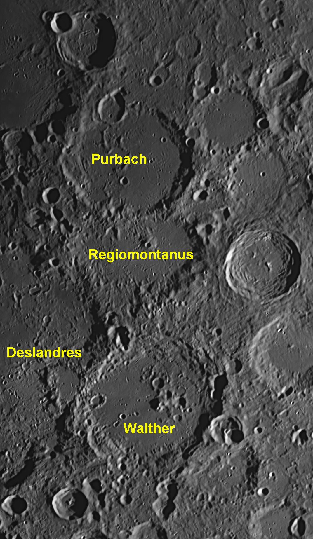
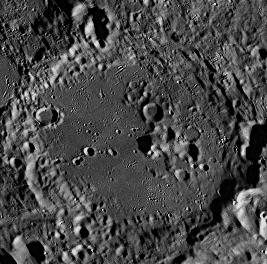
Walther is the largest of the three crater plains in this group. Having formed about 3.9 billion years ago, it is slightly younger than the other two. When it struck the Moon, it demolished the eastern wall of the huge, ancient basin called Deslandres, which is 235 kilometres across and is one of the oldest formations on the Moon. Walther was once a large crater plain with a great lake of solidified lava filling the interior up to same level as the outside surface. Since then it has suffered serious damage from later impactors, particularly in its north-eastern quadrant. There is a mountain protruding above the floor, slightly displaced to the east of centre. To the north-east of the mountain is a group of craters, ranging in size from 12 kilometres diameter down.
There is a mountain protruding above the floor, slightly displaced to the east of centre. To the north-east of the mountain is a group of craters, ranging in size from 12 kilometres diameter down. These have made this third of Walther's floor extremely rugged and disturbed, while the rest of the floor is more-or-less flat, only being disfigured by a few small craters. The south-western quadrant of the floor is slightly darker in colour, and there are some faint light-coloured streaks crossing the floor.
The walls are rugged, with massive landslips creating terraces in the north-east
and south-west sectors. Peaks on the crests rise to heights of up to three
kilometres, and there are numerous places where later impacts have damaged
Walther's rim. The western part of rim is lower than the eastern. Regiomontanus and Walther After four years of painstaking observations, Regiomontanus
found new ideas crystallising in his head. In developing these, he suggested
that the occurrences of eclipses, cometary orbits, and lunar distances from
fixed stars could be used to find the longitude of an observing site, and
offered a practical approach by means of the cross-staff, which had been
invented in the previous century. These proposals were correct in theory, but in
practice they did not actually help much as the cross-staff and similar
naked-eye instruments were not sufficiently accurate.
Columbus consulted the Ephemerides and saw that a
lunar eclipse was predicted for 29 February, a few weeks away. He warned the
natives not to annoy their gods or the Full Moon would be eaten up. They were
greatly awed when the Moon rose on the given night with a bite out of it
already. Columbus, knowing that totality would end at about 8 pm (using his
hour-glass), told them that if they complied with his wishes, he would ask the
gods to restore the Moon. They agreed, and when it began to reappear, he told
them that they had been forgiven. They ran to the beached ships laden with
provisions and he had no more trouble, being rescued by a passing Spanish ship
four months later.
The methods used by Regiomontanus were not bettered until the eighteenth
century, when astronomers had access to powerful telescopes. Regiomontanus
became internationally famous and recognised for his work, but his scientific
activity in Nuremberg was brought to a sudden halt after only four years by a
letter from Pope Sixtus
IV, calling him to Rome for the purpose of finally settling the
reform of the calendar. It was known to be well over a week in error, but no-one
had been able to fix it.
Within a year of arriving there, Regiomontanus died at age 40 in 1476, possibly
from the plague. It has also been suggested that he was poisoned by the two sons
of the recently-deceased George of Trebizond, whom he had never met but whose
1451 translation of the Almagest
he had scathingly criticised in print, disparaging George for being a flawed
mathematician and astronomer. On his death, much of Regiomontanus’ work,
including that on calendar reform, was lost. His Epitome of the Almagest
was not published until 1496, twenty years after his death. It made the highest
levels of the original, unadulterated Ptolemaic cosmology widely accessible to
European astronomers for the first time.
In the fifteenth century, Regiomontanus was the leading astronomer and first
printer of astronomical tables and books. He read many ancient texts,
and knew that the Earth-centred world view was not the only one possible,
although he adhered resolutely to the geocentric world view of Ptolemy as
described in the Almagest. If he had lived, he might eventually have come
to the realisation that the Earth orbits the Sun, which would have led to other
great discoveries.
None of Regiomontanus’ contemporaries (except possibly Johannes Stöffler,
see image
74: October 2022
This month we will look at a fresh 13 kilometre crater
called Cauchy. It lies in the eastern part of the Mare Tranquillitatis
(Sea of Tranquility), and is unremarkable in itself. What makes it notable is
that there is a 210 kilometre long rille called Rima Cauchy to its north,
and to its south there is a 245 kilometre long escarpment called Rupes Cauchy.
The rille and the escarpment run almost parallel in a north-west to south-west
direction, and are almost straight. They average about 45 to 55 kilometres
apart.

Most of the interesting features in this image are on the western (left-hand) side. It was taken at Starfield on 15 September 2018.
Cauchy is a bowl-shaped impact crater that is less than 1.1 billion years old. In the image above, it is located midway between the north (top) and south (bottom) margins, and about one third of the way across from the west (left) margin to the east (right) margin. Towards the lower right-hand corner is a 25 kilometre crater named Lawrence, and above that is a 38 kilometre badly damaged crater called Da Vinci. Both of these craters are very old. Along the top right-hand margin is a "bay" in the Sea of Tranquility called the Sinus Concordiae or "Bay of Harmony".
North of Cauchy is a long rille or graben called the Rima Cauchy. It is in two parts, with a slight gap between the ends of the two sections. In this gap is a 2 kilometre craterlet. The width along the lengths of the two rilles varies between 1.5 and 4 kilometres.
South-east of Cauchy, another rille starts in
a lava-filled, unnamed ghost crater. (In the image above, this ghost crater,
with a diameter of 35 kilometres, sits at the mid-point of the bottom margin.)
The rille, quite faint, starts just inside the ghost crater's eastern wall, and
then heads north-west across the flat floor, through four subsidence craters
which must be caused by volcanic activity, as all of them sit squarely on the
rille (see image
South of Cauchy, the fault passes beneath a 4 kilometre crater called Cauchy E and then bifurcates for a length of 70 kilometres before becoming single again. Towards its western end (not shown) it becomes a rille again, and passes through a 4 kilometre subsidence crater before terminating in another small subsidence crater.
South of this fault and close to the bottom-left margin are two bulges or domes in the surface, revealed by the faint shadows on their western (left-hand) sides. These are in fact large shield volcanoes. The left one is called Cauchy Tau and is 12 kilometres across the base and only 150 metres high. The right one is called Cauchy Omega and measures 12 kilometres across the base and is 413 metres high. At its summit is a volcanic caldera named Donna, which is 1.8 kilometres across. There are seven other volcanic domes in the area of this image. For other clusters of lunar volcanoes or single examples, see images
Augustin-Louis Cauchy (1789-1857) was a French mathematician, engineer and physicist who made great advances in wave theory, number theory and complex mathematical functions. He also made contributions in the field of celestial mechanics. On the Eiffel Tower in Paris are inscribed the names of 72 French engineers, mathematicians and scientists, 24 on each side, under the first balcony. Cauchy's name is the first on the south-east side.
75: November 2022
This month we will look at a group of four overlapping
craters near the Moon's southern highlands. Their names are Orontius, Huggins,
Nasireddin and Miller.
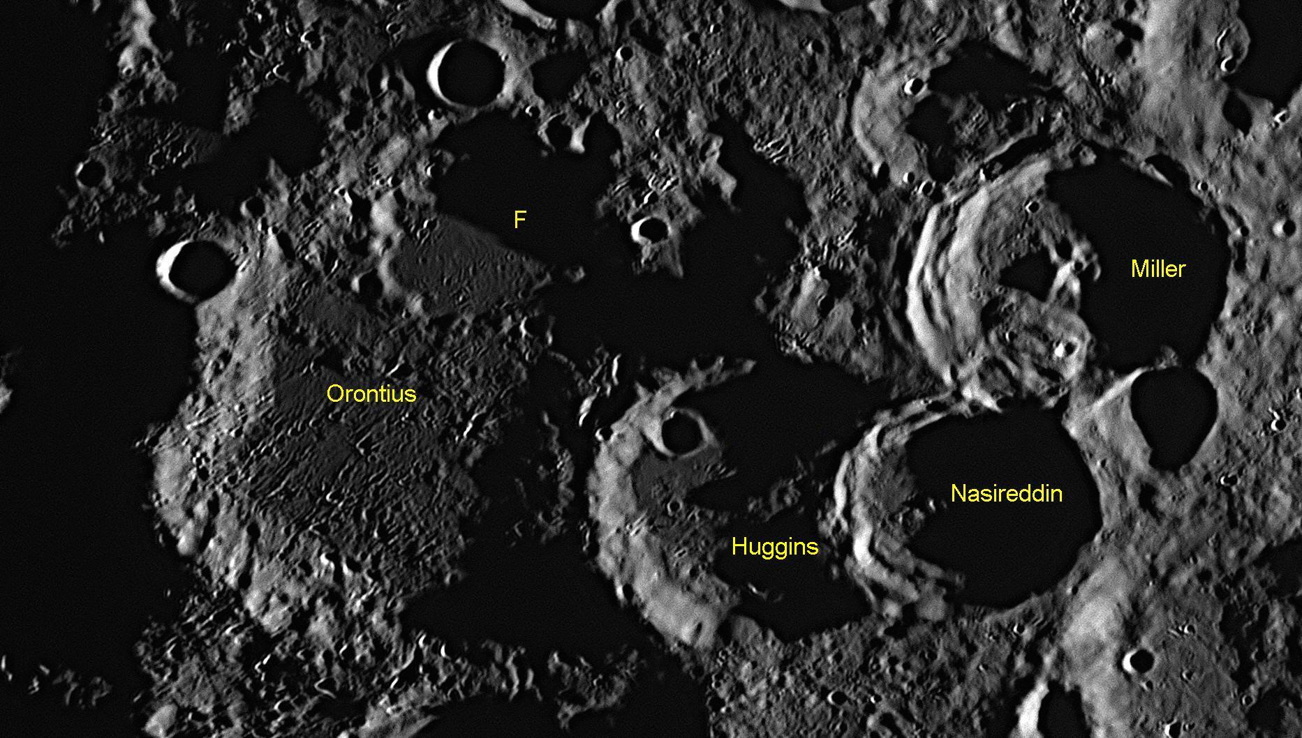
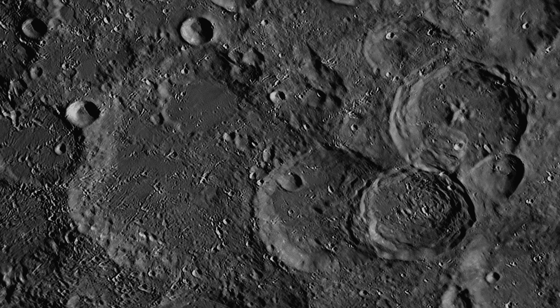
This image was taken two Earth days later, when the Sun was high in the Moon's
eastern sky, on 20 June 2021. The shadows are much reduced. The appearance of
lunar features changes considerably according to the angle of illumination.
Orontius is the largest and most ancient of the four craters named above.
It lies about 200 kilometres south-south-east of Walther (see image
Orontius Finaeus (1494-1555) was a French mathematician and cartographer
(map-maker). He published a textbook on astronomy called De Mundi Sphaera (On
the Heavenly Spheres) which explained the geocentric world system, in which
the Earth was at the centre of the universe and was surrounded by transparent
spheres carrying the Sun, Moon, planets and stars around the Earth, as described
by Peurbach and Regiomontanus in The Epitome of the Almagest
(see images
William Huggins (1824-1910) was an English amateur astronomer who at the age of 30 was elected a Fellow of the Royal Astronomical Society (RAS). That year, 1854, he sold the family’s silk mercery business and moved with his ailing parents to a new home at Upper Tulse Hill , five miles south of London. This site turned out to be very suitable for astronomy, as prevailing winds blew the smoke of the city away from it, so he built an elevated observatory there in 1855, on top of the house’s first storey. William equipped it with an excellent refracting telescope of 8 inches (200 mm) aperture by Alvan Clark and a Cooke equatorial mount and began by drawing detailed views of Mars during the opposition of 1856, and also of Jupiter.
He later wrote, “I soon became a little dissatisfied with the routine character of ordinary astronomical work, and in a vague way sought about in my mind for the possibility of research upon the heavens in a new direction or by new methods. It was just about this time that the news reached me of Kirchhoff’s great discovery of the true nature and the chemical constitution of the Sun from his interpretation of the Fraunhofer lines. This news was to me like the coming upon a spring of water in a dry and thirsty land. Here at last presented itself the very order of work for which in an indefinite way I was looking."
The story of Bunsen and Kirchhoff’s discovery in 1859 (that spectral emission and absorption lines revealed the composition of the source) had come to Huggins in 1861 through another RAS amateur Fellow, Warren de la Rue, and in January 1862 he attended a lecture given by his friend and neighbour, William Allen Miller (1817-1870), Professor of Chemistry at King’s College, London, where the latest spectroscopes were demonstrated. Driving home by horse and carriage with Dr Miller, (the winter was cold and dark), Huggins found out everything he could about spectroscopy, and soon acquired a spectroscope and fitted it to his telescope with accessories of his own design. For the first time, an astronomical observatory took on the appearance of a laboratory, with battery cells, a large induction coil, Leyden jars, Bunsen burners, vacuum tubes and bottles of chemicals – especially of specimens of pure metals.
From 1861, William Huggins and William Miller (by now close and enthusiastic astronomical friends) visually explored the spectra of the Sun and stars, thus becoming the first persons to use spectroscopy to reveal the compositions of astronomical objects. Hydrogen, iron, calcium, sodium and magnesium were detected first. Huggins wrote excitedly: “Iron from our mines was line-matched, light for dark, with stellar iron from opposite parts of the celestial sphere. The time was one of strained expectation and of scientific exaltation for the astronomer almost without parallel, for nearly every night’s work was crowned by some interesting discovery.” Working visually, they determined that the Sun and stars were made mostly of hydrogen, and examined the spectra of nebulae and comets as well. From 1863 they began trying to photograph the spectra of stars, but the wet collodion process they used was unable to show dark lines even in the spectra of Sirius, the brightest star. From 1864 on they tried again with the dry collodion process, and were more successful. They were the first to describe the spectrum of a planetary nebula when they analysed NGC 6543 (the ‘Cat’s Eye Nebula’). They also were first to show that some nebulae, such as M42 (the Great Nebula in Orion) yielded pure emission (bright-line) spectra and therefore must be glowing gases, while others, such as M31 (the Andromeda Nebula) had continuous spectra with dark lines that are characteristic of stars. Therefore there were two types of nebulae, clouds of gas and clouds of stars.
They were fortunate to witness the eruption of a star on 12 May 1866. We now know that the star, T Coronae Borealis, called the ‘Blaze Star’, is a recurrent nova. Usually resting at tenth magnitude, it flared up to second magnitude that year. Huggins said, “The view in the spectroscope was strange, and up to that time unprecedented.” This was because the continuous spectrum of the star was marked both with dark absorption lines from the normal parts of the expanding cloud, and bright emission lines from the highly-excited, fluorescing parts of the cloud. It erupted again on 9 February 1946, brightening to magnitude 3. In 1867, Huggins and Miller were jointly awarded the Gold Medal of the Royal Astronomical Society for their spectroscopic studies of the composition of stars, and soon professional astronomers began to follow their lead.
After his marriage in 1875, his new wife Margaret took an active role in his work despite an age difference of 24 years. She was an expert in the latest innovations in photography, and showed her husband how achieve more success when photographing the spectra of stars, nebulae and comets with the new gelatino-bromide emulsion process. They were equal partners in one of the first husband-and-wife observing teams, and co-authored many publications. Huggins was knighted by Queen Victoria in 1897. He became the President of the Royal Society from 1900 to 1905, quite an honour for an amateur scientist. The Huggins' major contribution was to radically change the direction of professional astronomical research from "where the stars and nebulae are" to "what they actually are".
Nasir al-Din al-Tusi (1201-1274) lived in Persia and was a polymath. With the support of his Mongol employer Hulagu Khan, in 1259 he established the Maragheh (or Maragha) Observatory, on a hill overlooking the town of Maragheh, which was the largest observatory of its time. It consisted of a group of buildings occupying a square area with each side 350 metres long. Over a hundred people worked there. One of the buildings had a dome which allowed the Sun’s rays to enter for observing. A large mural quadrant was built for observing meridian transits. Maragheh Observatory became the most prestigious in the world, with a library of 400 000 volumes which was eventually plundered by a later generation of Mongol invaders.
The Maragheh astronomers attempted to solve the problems inherent in the Earth-centred model of the universe, and to produce an alternative to the Ptolemaic view. They were more successful than previous astronomers in producing non-Ptolemaic configurations which eliminated the transparent spheres, deferents, epicycles and equant. This was the 'Maragheh Revolution', but they were still describing an Earth-centred universe.
For his planetary models, al-Tusi invented a geometrical procedure called a
Tusi-couple, which can generate a linear motion from the sum of two circular
motions. This gave predictions for the movements of Mercury and Venus that were
more accurate than those produced using the Ptolemaic model with its epicycles
and equant. It first appeared in his Tahrir al-Majisti (Commentary on the
Almagest) of 1247. It is possible that he may have read of something
similar in an Arabic translation of A Commentary on the First Book of
Euclid, written by one of the last of the Greek Neoplatonist
philosophers Proclus Lycaeus in Athens eight centuries earlier. The
Tusi-couple is a mathematical device in which a small circle rotates inside a
larger circle that has twice the radius of the smaller circle. Rotations of the
circles cause a point on the circumference of the smaller circle to oscillate
back and forth in linear motion along a diameter of the larger circle. This is
how al-Tusi described his discovery:
"If two coplanar circles, the diameter of one of which is equal to half
the diameter of the other, are taken to be internally tangent at a point, and if
a point is taken on the smaller circle — and let it be at the point of tangency
— and if the two circles move with simple motions in opposite direction in such
a way that the motion of the smaller [circle] is twice that of the larger so the
smaller completes two rotations for each rotation of the larger, then that point
will be seen to move on the diameter of the larger circle that initially passes
through the point of tangency, oscillating between the endpoints."
It is very likely that al-Tusi experimented with internal circles of sizes bigger and smaller than half of the diameter of the outer circle, and observed the ellipses and other more complex paths that were generated by a fixed point on the smaller circle as it revolved inside the larger. He would then have compared these paths with the loops and S-bends the planets traced out against the starry sky. Copernicus borrowed heavily from the work of al-Tusi when writing his ground-breaking book De Revolutionibus 300 years later, but neglected to give credit to his predecessor. This was despite the fact that he copied some of al-Tusi's diagrams showing Tusi-couples - see image
After many years, Al-Tusi's observatory was destroyed by severe earthquakes. The ruins still exist in Iran, protected under a white geodesic dome. The site is still used by amateur astronomers as a focal point for their activities. It is about 550 kilometres north-west of Tehran, at latitude 37º 23' 45" North, longitude 46º 12' 33" East, near the border with Turkey. The dome is visible on Google Earth.
76: December 2022
This month we will look at two conjoined craters, named
Pallas and Murchison.
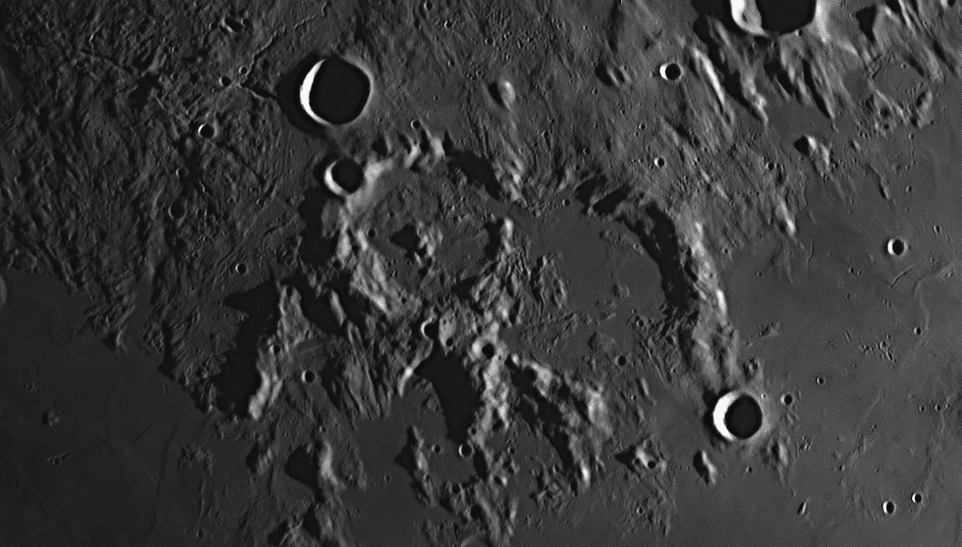
Murchison is 58 kilometres in diameter and it has a flat floor created by
upwelling magma, released after the impact. So much magma was released that it
burst through the south-eastern crater wall and flooded out into the Sinus Medii
(Central Bay) to the south. Not long after, a second impactor, almost as huge,
struck the Moon just to the west of Murchison, superimposing itself on that
crater's western wall. This formed the crater Pallas, which has a
diameter of 50 kilometres. Pallas has a complex of seven mountain peaks at its
centre, while Murchison only has some isolated hills and ridges. The eastern
wall of Pallas has wrecked the western wall of Murchison, but there is a narrow
pass at the north end which has allowed a lava flow to solidify between the two
craters, providing a connection from one to the other. There are three other
craters in the picture that are smaller but much more recent, as they appear
fresh and undamaged. They are Bode (top left, 18 kilometres diameter),
Ukert, (partly shown at top right, 23 kilometres diameter, and
Chladni, (bottom right, 14 kilometres diameter). A long, sinuous rille
starts from Bode's western wall and runs north until it peters out. Known as Rimae
Bode, it is full of small S-bends and is about 170 kilometres long.
Sir Roderick Impey Murchison (1792-1871) was a Scottish geologist in the 19th century. He is known for discovering, naming and describing the Silurian, Devonian and Permian periods of the Paleozoic era of geology. About fifteen geographical locations on Earth are named after him, including the Murchison River in Western Australia where the Murchison Wide-Field Array is located, and the town of Murchison in New Zealand's South Island.
Pallas
Peter Simon Pallas (1741-1811) was a German naturalist, botanist, zoologist and explorer in the 18th century. He identified a new type of stony-iron meteorite which is now called a 'pallasite'. The crater was given its name by Beer and Mädler in their moon charts published in 1837.
77: January 2023
This month we will look at a large, rugged walled plain,
J Herschel.

J Herschel is the large walled plain taking up most of the upper half of
this image. 156 kilometres in diameter, its floor is very rough and peppered
with small hills, cracks and craterlets. It contrasts strongly with the smooth
lava plain in the southern half of the image, which was formed millions of years
later. The area which was flooded by lava is now known as Mare Frigoris (Sea
of Cold), and the ancient land forms were to a large extent covered over,
although there are many instances of small craters being partially flooded and
still visible - these are known as 'ghost craters'. Over twenty of these are
visible in the Mare Frigoris. The lava was released during the huge cataclysm
know as the "Imbrium Event", which occurred about 3.8 billion years ago
and was caused by an asteroid striking the Moon's northern hemisphere. The lava
swept up to the southern wall of J Herschel, but did not breach it, as occurred
with the crater plain called Fracastorius (see image
William Herschel (1738-1822) was a self-taught astronomer who was active
in England between 1773 and 1822 (see image
In 1828 he was amazed at a presentation given to the RAS by Sir Thomas Brisbane and James Dunlop, describing their work in cataloguing the nebulae and star clusters of the southern skies from their Parramatta Observatory near Sydney, NSW. He resolved to make a trip to the southern hemisphere in the near future to complete his father’s northern Catalogue of Nebulae and Clusters of Stars of 1786. In 1831 John Herschel published A preliminary discourse on the study of natural philosophy, which set down methods of scientific investigation with logical relationships between observations and theorising. He described nature as being governed by laws which were difficult to discern or to state mathematically, and the highest aim of natural philosophy (science) was to understand these laws through inductive reasoning, and to find a single unifying explanation for each phenomenon. This became an authoritative statement which had a wide influence on science, particularly at Cambridge, where it filled the student Charles Darwin with ‘a burning zeal’ to contribute to this work.
By 1833 John was ready to head south. Taking his wife, three children, and his father's Twenty-foot Telescope (aperture 47 cm or 18.5 inches), he set up an observatory at Feldhausen near Cape Town in the British Cape Colony. They stayed for five years, during which three more children were born. While at the Cape, Herschel made extensive surveys of the southern skies and completed his father's work in cataloguing star clusters and nebulae. He raised the total of his father's list of double stars to over ten thousand. He studied Halley's Comet on its 1835 return, and deduced that gas was being evaporated from the comet and forced away by the solar wind. In 1836 he reported that Betelgeuse was a variable star. One of the star clusters he discovered near the Southern Cross has become known as 'Herschel's Jewel Box'. The Herschel family returned to England in 1838, where six more children were born. Ten of the twelve children (three sons and nine daughters) lived into the 20th century.
In a 1847 publication, Herschel provided names for seven satellites of the planet Saturn. He named them after the mythical brothers and sisters of the Roman god Saturn: Titan, Rhea, Iapetus, Dione, Tethys, Enceladus and Mimas.
In 1864, John merged his own discoveries with his father’s to publish the General Catalogue of Nebulae and Clusters of Stars with 5000 entries. Later, the catalogue was supplemented by the General Catalogue of 10,300 Multiple and Double Stars which was published posthumously. J. L. E. Dreyer’s New General Catalogue (the famous NGC) of 1888 was based on John Herschel’s General Catalogue. For his services to science, John is buried in Westminster Abbey, next to Charles Darwin and near Sir Isaac Newton. The first American to orbit the Earth on 20 February 1962 in the Mercury spacecraft Friendship 7 was named John Herschel Glenn Jr.
78: February 2023
This month we will look at a long rille in the Moon's
north-western quadrant, called Rima Sharp.
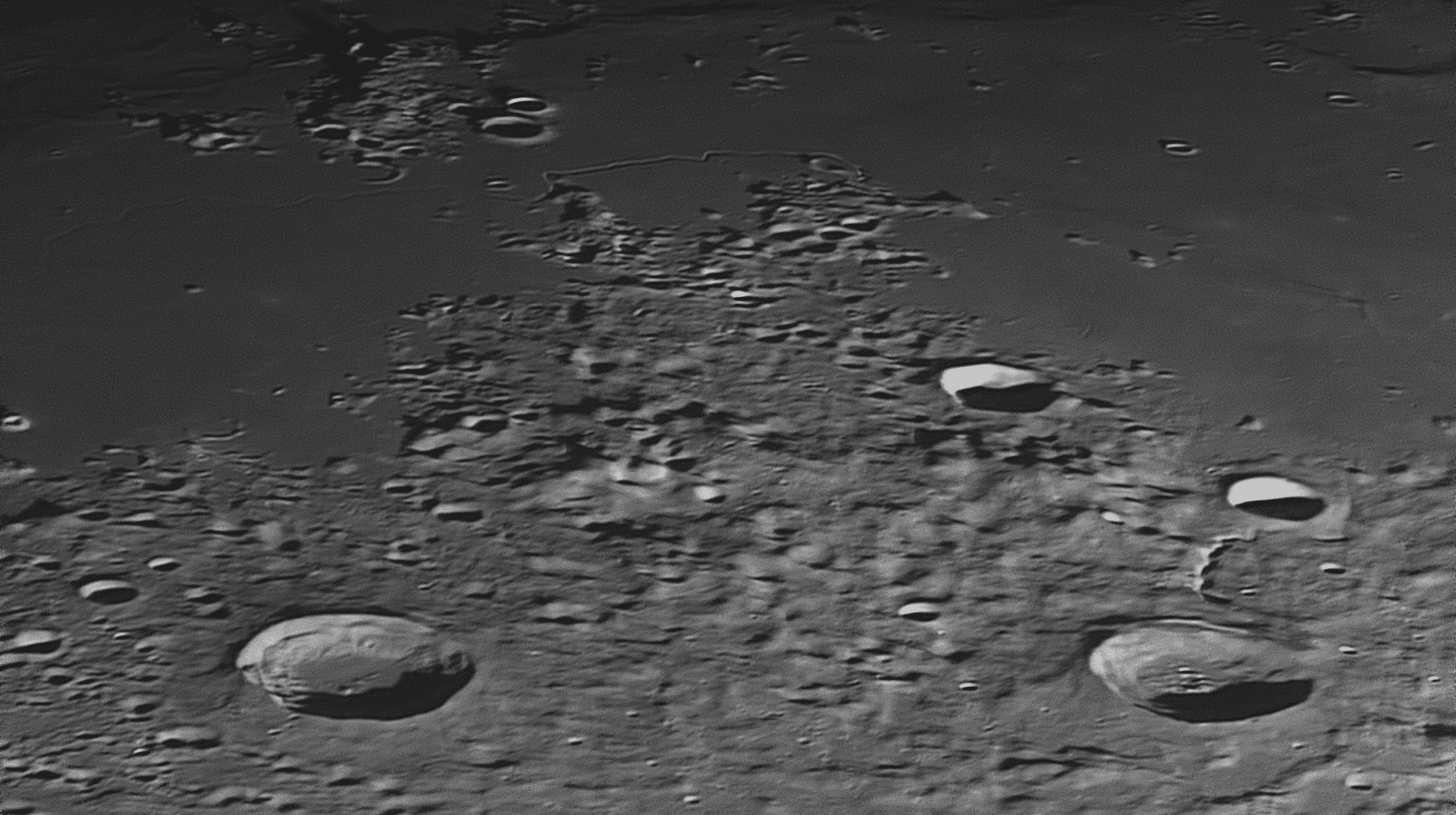
Mairan
is a 40 kilometre diameter impact crater near the lower left-hand corner of the
above image. Half-way up the left-hand margin is an isolated volcanic dome
called Dome Mairan T. It has a diameter of 10 kilometres and has a gaping
3 kilometre wide caldera at its summit. Sharp is a crater of similar size
to Mairan near the lower right-hand corner. The large flat area in the upper
half of the image is the Mare Frigoris or Sea of Cold (see images
This area lies just west of the Sinus Iridum or Bay of Rainbows (see
image
Sharp
Abraham Sharp (1651-1742) was a British astronomer who worked at the Royal Greenwich Observatory under the first Astronomer Royal, John Flamsteed. Joseph Crosthwait was another assistant. King Charles II of England had set out the sole aim of the Observatory. It was simply to "“rectify the Tables of the Motions of the Heavens, and the Places of the fixed Stars, so as to find out the so much desired Longitude at Sea, for the perfecting the art of Navigation". In other words, they were to be the first to use telescopes to map the stars with precision, so that sailors would have a much better chance of knowing their ship's longitude at sea when out of sight of land. They worked on this project from the Observatory's opening in 1675 until Flamsteed's death in 1719 with the star positions almost complete but not prepared for publication.
Sharp, Crosthwait and Flamsteed's widow Margaret spent the next ten years working on the star catalogue and drawing the charts. The Atlas Coelestis (Celestial Atlas), the largest star atlas so far produced, finally appeared in 1729. It was the most celebrated, important, and influential star atlas of the eighteenth century, superior to all its predecessors, and was the first full set of star charts made with a telescope.< p style="text-align:justify">
79: March 2023
This month we will look at a pair of craters in the
Moon's south-western quadrant, Hansteen and Billy.

North is at the top. In this image there are two large craters having almost the same diameters, but in other respects they are quite dissimilar. Both are circular, although their position in the Moon's south-western quadrant causes fore-shortening east to west of about 35%. The northerly one is Hansteen, and it has a diameter of 45 kilometres. It has a rugged floor with terraced walls. Billy has a diameter of 46 kilometres and has a lava-filled flat floor. Its walls show only a few small landslips and no terraces. North of Billy and to the south-east of Hansteen is a triangular-shaped mountain massif of volcanic origin. Although its official name is Mons Hansteen (Mount Hansteen), this upland area is widely known as the 'Arrowhead'. It becomes quite bright under a high Sun. The picture was taken at 8:41 pm on 24 May 2021.
Hansteen's floor has concentric ridges and cracks, but magma has been
unable to force its way to the surface except at a small area in its
north-eastern quadrant. Billy though has been filled with so much lava
that all the features on the floor have been completely covered over, leaving a
featureless lava plain of dark grey colour, on which there are a few quite
recent craterlets dotted about. There are several small land slips around the
circumference of the floor, but none is as spectacular as those in Hansteen.
Billy's lava floor has a darker colour than the lava plains of the Oceanus
Procellarum (Ocean of Storms) which surround it. This indicates that the
lava comprising Billy's floor is probably much newer that that in the plains
outside the crater.
Running between two craterlets on Hansteen's south-western flank is a small
rille about 25 kilometres long and 3 kilometres wide. It is called Rima
Hansteen, and after a gap of about 50 kilometres can be seen heading due
south past the crater Billy. It continues into a mountainous area and passes out
of the picture near the south-western corner, where its name has been changed to
Rimae Zupus. There is a second rille near the western (left) margin of the
image, 60 kilometres due west of Billy. It is 14 kilometres long, and has not
yet been given a name. A third rille, slightly longer and less well-defined, can
be seen 28 kilometres east of Mons Hansteen and near the eastern (right) margin
of the image. Also un-named, this particular rille appears to be actually a line
of conjoined craterlets and crater pits, similar to the formation of the Hyginus
Rille (Rima Hyginus - see image
Hansteen
Christopher Hansteen (1784-1873) was a Norwegian astronomer, physicist and geophysicist who founded the Oslo Observatory in 1833. He is best known for his mapping of the Earth's magnetic field.
Billy
80: April 2023
This month we will look at the largest shield volcano on
the Moon, Mons Rümker (Mount Rümker).
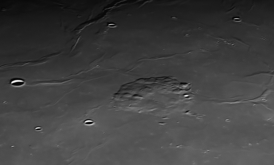
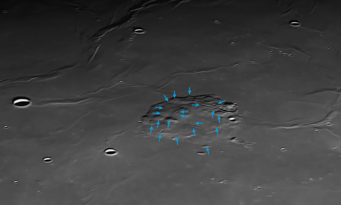
This area lies between the Sinus Iridum (Bay of Rainbows)
The lava plain covering the whole image contains numerous "wrinkle ridges". These form when molten basaltic lava spreads out over the lunar surface, sweeping over and obliterating pre-existing features such as craters and mountains. As the lava cools, ripples in its surface solidify and form ridges that may be several hundred kilometres long and have heights up to a few hundred metres. These lava plains and ridges must have occurred late in the Moon's history, as they have not been damaged very much by later impacts. The lava must have swamped a volcanically active area, which then renewed its activity, pushing up the surface to form Mons Rümker.
Carl Ludwig Christian Rümker (1788-1862) was a German sailor who began to study astronomy after meeting the Hungarian astronomer Baron Franz Xaver von Zach in 1817.
Sir Thomas Brisbane (1773-1860) was a keen amateur astronomer for all his life. He had an observatory built at his ancestral home in Scotland in 1808. From this observatory he was able to contribute to the advances in navigation which were then taking place, work which earned him royal approbation as a Knight Commander of the Order of the Bath (KCB). He joined the army and served in many theatres of war, rising to the rank of Major-General. When Brisbane was appointed as Governor of New South Wales on the recommendation of the Duke of Wellington under whom he had served, he took all of his astronomical instruments and two helpers, Carl Ludwig Christian Rümker (astronomer) and James Dunlop (1793-1848, second assistant) to Sydney with him. They set up Australia’s first properly equipped observatory next to Government House at Parramatta, west of Sydney, in 1821. Brisbane hoped that it would become a “Greenwich of the Southern Hemisphere”.
He received no financial assistance or encouragement from the British government for his Parramatta Observatory – he had to pay for everything out of his own pocket. The instruments included a 3¾ inch (9.5 cm) transit telescope and mural circle by Troughton; a 3¼ inch (8.25 cm) refractor by Banks; a 16 inch (40.6 cm) repeating circle with twin 2 inch (5 cm) refractors made in 1814 by Reichenbach, Utzschneider und Liebherr of Munich; and a precision regulator clock by Breguet and Sons. While waiting for Governor Lachlan Macquarie to finish his term, Brisbane interested himself in making astronomical observations, and is therefore known as the first patron of science in Australia. He was praised as such by Sir John Herschel when he presented Brisbane with the Gold Medal of the Royal Astronomical Society. In 1823 the explorer John Oxley named the Brisbane River after the Governor, and two years later the city of Brisbane was founded on its banks.
When Brisbane returned to Scotland in 1825 he continued his studies and built another observatory on his wife’s estate near Kelso. Brisbane had sold his Parramatta Observatory to the colonial government, and Dunlop and Rümker remained in New South Wales and continued to work there as government employees. Dunlop used its 9 inch reflector to discover the galaxy NGC 5128 in 1826. The following year, Rümker was appointed the first Government Astronomer thanks to a comet he had discovered in 1824, so Dunlop rejoined Brisbane in Scotland. On 20 December 1827 they presented the First Dunlop Catalogue of 629 nebulae and star clusters to the Astronomical Society of London (renamed the Royal Astronomical Society in 1831), and it was later published in the Philosophical Transactions. This was the first survey of southern nebulae and clusters since the time of La Caille, 75 years before. In recognition of their work, the President of the Society, Sir John Herschel, presented Gold Medals to both Sir Thomas Brisbane and James Dunlop in February 1828. The Second Dunlop Catalogue of 253 double stars was presented to the Astronomical Society of London four months later. It was Herschel’s enthusiasm for Dunlop’s pioneering discoveries that motivated him to take his family and his father's Large Twenty Foot Telescope to South Africa in 1833 to chart the southern skies for five years, using James Dunlop’s catalogues as references, in order to complete his father’s northern survey.
Carl Rümker returned to Europe in 1829 and James Dunlop was invited to return to the Parramatta Observatory as Superintendent. He took over in 1831, and discovered his own comet in 1833. He worked there until it was closed in 1847, due to the buildings becoming dilapidated and Dunlop’s poor health. He died the following year, aged 54. The instruments were in good condition, so were stored. They were transferred to the new Sydney Observatory that was built in 1855 and commissioned in 1858 overlooking Circular Quay. They are still there. Two transit telescope piers still stand in Parramatta Park today.
Key to features 81-90.
81: May 2023
This month we will look at the large compound crater
known as Meton.
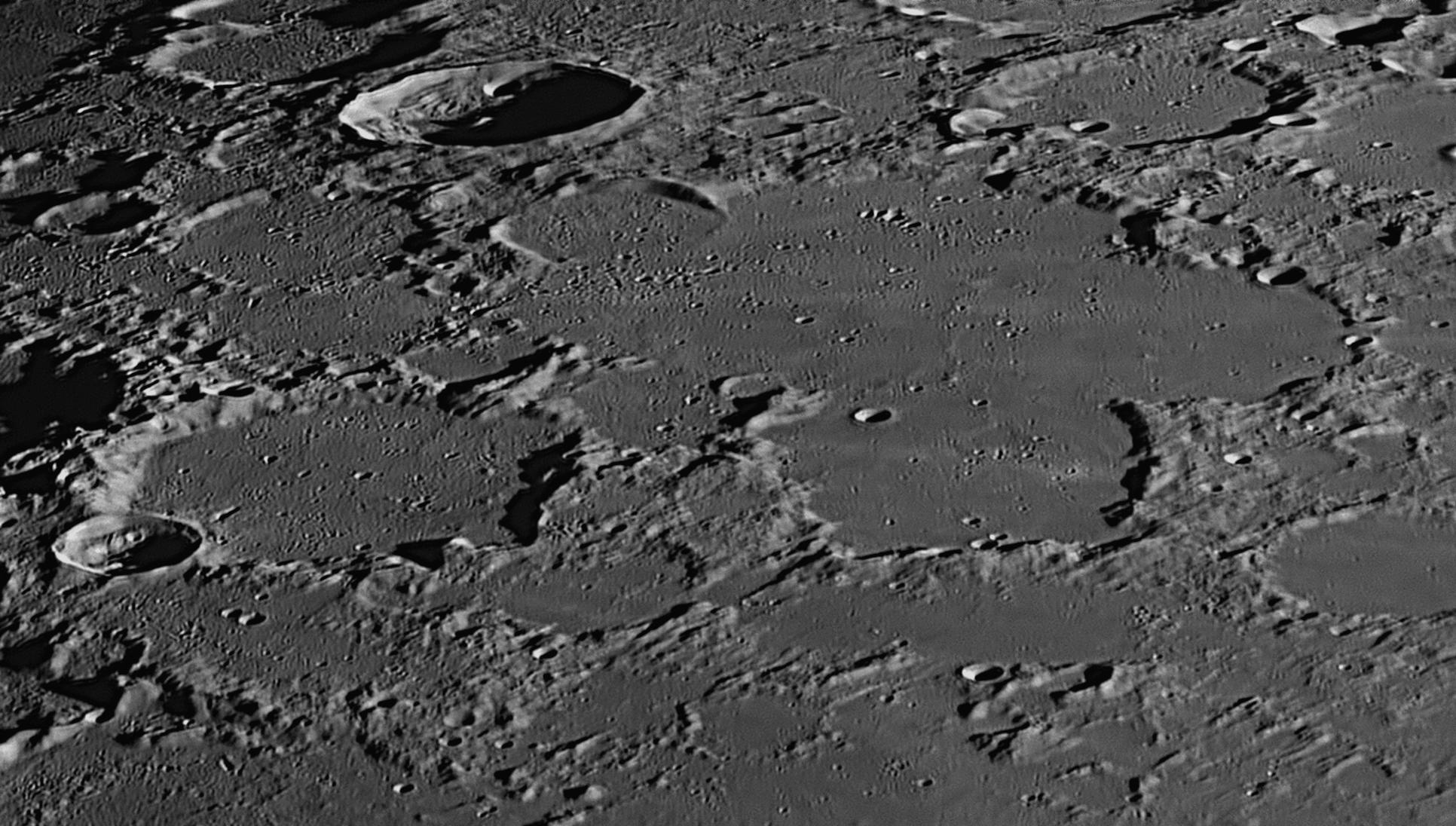
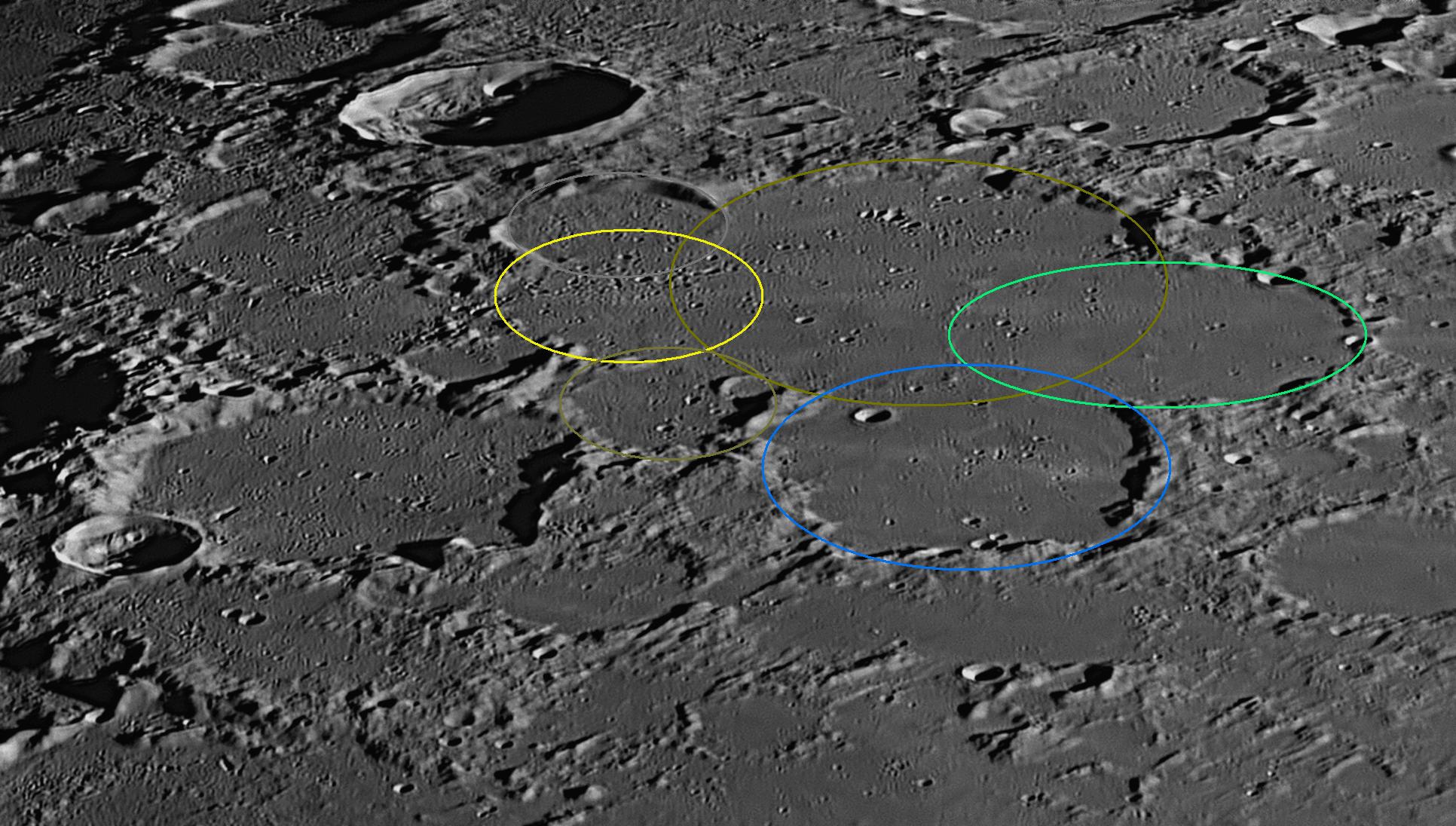
The largest of these coloured ellipses is on the north side, and has a diameter
of 122 kilometres and is Meton proper. Overlapping it on the east and south are
two more enclosures, of 77 and 78 kilometres diameter. On the western side are
three smaller enclosures, of 42, 38 and 51 kilometres diameter. The walls
between these six enclosures are mostly demolished where they intersect, as lava
has flooded them all up to the same level as the lunar surface outside.
Overall, Meton has a diameter of 175 kilometres east to west, and 210 kilometres
north to south. The floors of all the walled plains in this image are
marked by light-coloured streaks which can be seen to radiate from an unseen
crater off the left margin. This crater is called Anaxagoras, and its
diameter is 53 kilometres. When it struck the Moon, debris was scattered over
the whole of the area above, the streaks being radial to Anaxagoras. As this
event happened less than 1.1 billion years ago, the light-coloured streaks
have not had enough time to be darkened by solar radiation like the rest of the
lunar surface.
The
relationship between Meton and Anaxagoras can be clearly seen in the images at
The 93 kilometre crater Barrow adjoins the south-western (left-hand) rim
of Meton, and has been filled up by the same lava flow to the same level as its
larger neighbour. To Meton's north-west (upper-left), there is a much more
recent impact crater known as Scoresby. It has a diameter of 56
kilometres, and its bowl-shaped floor is much deeper and fresher-looking.
Meton
In ancient times, ordinary people knew enough about the seasons to enable them to successfully provide food for themselves through growing crops, hunting and fishing. They knew about the movements of the Sun and Moon across the sky, and maybe a planet or two but, generally speaking, the changing spectacle overhead by day and night was mysterious and impossible to explain. Yet every group had a few people who seemed to have more knowledge about the sky than was common. These people became recognised as wise men, shamen, prophets, sooth-sayers, magi, or chiefs. As religions developed, they became priests. Watching the night sky became important, and the first 'pictures in the sky' (we call them constellations) came into use in Babylon in about 3500 BCE. The first were the Lion, the Bull and the Scorpion. The wise men were able to predict when these constellations would appear throughout the year, and soon they developed reputations as being able to prophesy.
Predicting the future was an attribute many seemed to have - they could announce when the seasons would change, when there would be a Full Moon, and when the different constellations would appear. Such information held by the astrologer-priests was arcane, esoteric and closely guarded, denied to the common people and divulged only to initiates by adepts. One such secret was the Saros cycle, which had been discovered by Chaldean and Babylonian wise men.
The Saros had originally been named after it had been discovered that the cycle of lunar and solar eclipses repeated itself every 223 months. By the seventh century BCE its accuracy had been refined by the systematic elimination of errors, so that the astrologer-priests knew that all eclipses repeated themselves with the same latitude and duration every 18 years 11 days.
We now know that this is because the Sun, Moon and Earth return to almost the same positions (relative to each other) after that period of time. Each Saros contains 43 solar and 28 lunar eclipses. Tiny accumulating errors mean that after a number of Saroses (71 for solar eclipses and 48 for lunar) an eclipse cycle ends and a new one begins.
Knowledge of the secret Saros cycle enabled the astrologer-prients to accurately predict coming eclipses of the Sun and Moon, their success in doing so greatly impressing common people and also important people such as governors and kings who were not aware of the secret. People came to believe that the priests were also prophets who were able to make other predictions and thereby foretell the future.Another secret was the Metonic cycle, in which it was known
that after 235 lunar months (6940 days or 19 years), the Moon's different phases
repeat at the same time in the year. The Athenian astronomer Meton (circa
430 BCE) discovered this fact after studying Chaldean and Babylonian records,
and used it as the basis of a luni-solar calendar. The Babylonian and Hebrew
calendars were based on the Metonic cycle, and it is still used in the modern
world to compute the date of Easter. That is why the date of Easter Sunday is
not fixed on a certain date as Christmas Day is.
The common folk were kept in ignorance of these matters, and based their
concepts of the world more on mythology, superstition, imagination, what they
thought was common sense, and the declarations of their priests, rather than on
their own scientific observations.
82: June 2023
This month we will look at a recent impact crater of
average size known as Eratosthenes.
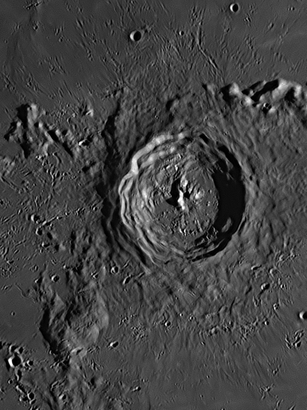
Eratosthenes is a 60 kilometre diameter impact crater in the centre of the above image, which was taken at 8:51 pm on 13 December 2021.
The impactor that caused this crater struck the
Moon at the south-western end of the Montes Apenninus (Apennine Range), well
after the Imbrium Event, but before the nearby Copernicus impact (see
images
The story of this amazing ancient Greek thinker may be found in item
83: July 2023
This month we will look at a recent impact crater with a
remarkable ray system, called Kepler.

Kepler is the 31 kilometre diameter impact crater in the centre of the above
image. Near the centre of the lower margin is another crater of similar size,
called Encke. The feature of interest in this image is the system of rays
radiating across the whole picture from the central crater. This image was taken
at 9:56 pm on 25 May 2021.
The Copernican Period in the lunar geologic timescale runs from approximately
1.1 billion years ago to the present day. It is defined by impact craters that
exhibit bright, fresh-looking rays made of light-coloured ejecta that radiate
from the site of the impact. Four notable examples are Tycho, Copernicus,
Anaxagoras and Kepler, but there are many craters of this period which, for one
reason or another, do not exhibit ejecta rays, such as Zucchius and Philolaus.
The Copernican period is based on the discovery that freshly excavated materials
on the lunar surface have a high albedo (they appear bright when lit by the
Sun), and they become darker over time as a result of irradiation by the solar
wind. This 'wind' is a stream of charged particles released from the upper
atmosphere of the Sun, called the corona. It is a plasma consisting mostly of
electrons, protons and alpha particles, but it also includes trace amounts of
heavy ions and atomic nuclei such as carbon, nitrogen, oxygen, neon, magnesium,
silicon, sulphur and iron. There are also rarer traces of some other nuclei and
isotopes such as phosphorus, titanium, chromium and nickel.
As there is no atmosphere, the observable effect of the solar wind on the Moon’s surface is to darken it, an effect called ‘space weathering’. This only affects the top layer of soil to a thickness of a few centimetres – the subsoil retains its original, much lighter grey colour. In general, one can say that the lighter in albedo an area is, then the shorter the time that it has been exposed to space weathering. As the brightest area on the Moon is the interior of the crater Aristarchus, then it was thought to be the youngest large crater. Current estimates give its age as 450 million years. Proclus was rated as the second youngest, and is thought to be less than a billion years old. Many quite small craters (diameter < 5 km) are very bright and young, but not so noticeable due to their small size. Two examples are Censorinus and a 2 kilometre craterlet just north-east of 4 kilometre Hell Q, the craterlet achieving fame as ‘Cassini’s Bright Spot’.
Other than Copernicus itself, there are many examples of Copernican craters. Large examples on the near side include Tycho, Aristillus, Autolycus, Stevinus, Kepler, Theophilus, Taruntius, Eudoxus, Bürg, Römer, Harpalus, Carpenter, Philolaus, Anaxagoras, Glushko, Hayn, Zucchius and Rutherfurd. Tycho is now thought to be the youngest large crater, being only a quarter as old as Aristarchus. Examples on the Moon's far side include Crookes, Giordano Bruno, Jackson, King, Necho, O'Day, Ohm, Robertson, Sharonov and Vavilov.
These ray systems are best seen at Full Moon. Probably the one most easily recognised is that radiating from Tycho, which is thought to have formed only about 108 million years ago. The bright streaks are in essence 'fresher' subsoil that hasn't experienced the same intensity of solar radiation as the rest of the lunase of smaller craters such as Kepler above, the explosion caused during the initial impact with the Moon's surface excavated the light-coloured soil and rock and spread it around the new crater like a halo. The material in these haloes is called 'primary crater ejecta'. Eight small examples of such light-haloed craterlets can be seen in image
Kepler
Johannes Kepler (1571-1630) was a brilliant mathematician who worked in Prague with the famous Danish astronomer Tycho Brahe (see image
84: August 2023
This month we will look at a most unusual sinkhole in
the great lava plain known as the Mare Serenitatis (Sea of Serenity). It
is called the Vallis Krishna (Krishna Valley).
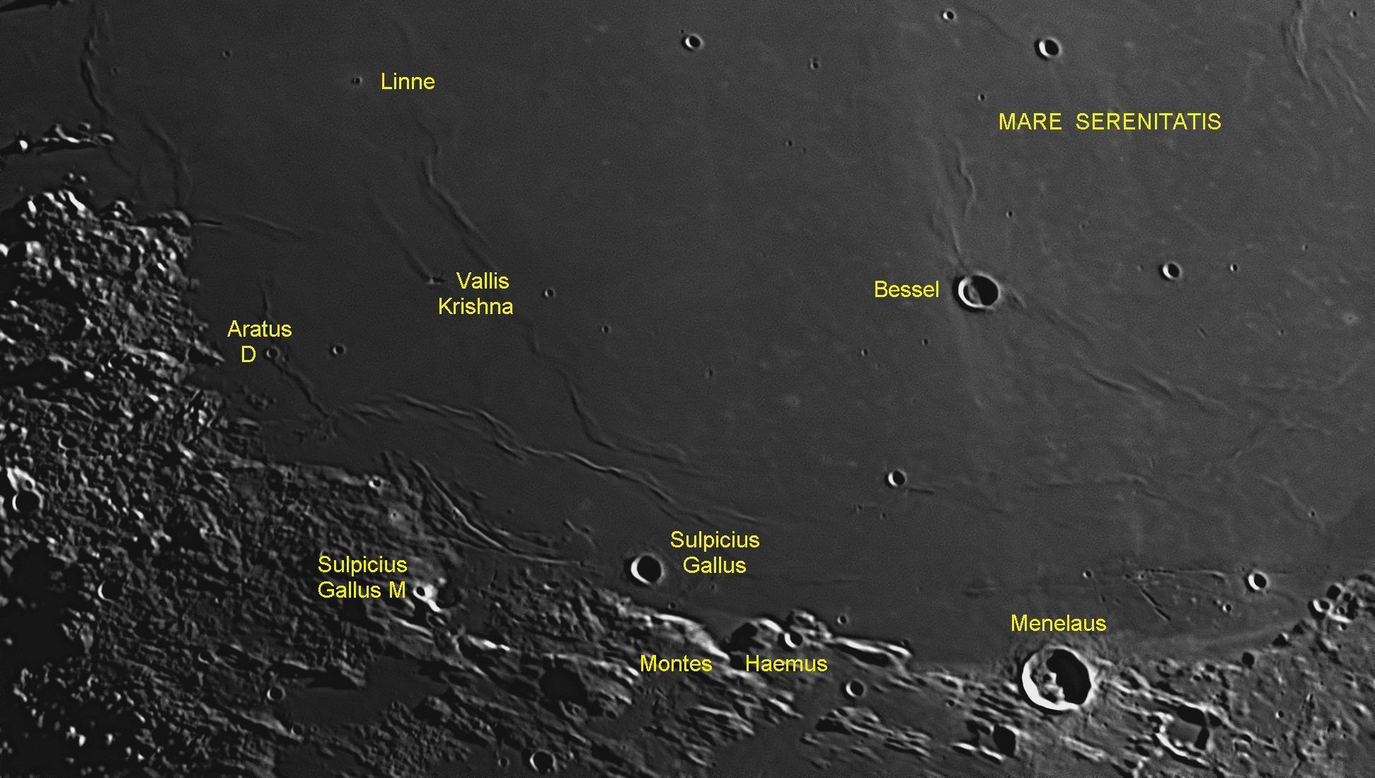
A band of shattered uplands runs in a southerly direction from the junction of
the Mare Imbrium (Sea of Rains) with the Mare Serenitatis to the western
(left-hand) quarter of the image above. Then the mountains become higher and
form a range called the Montes Haemus (Haemus Mountains), which begins
near a very bright 5 kilometre craterlet called Sulpicius Gallus M and
runs south-east past the right-hand margin and then diminishes into a line of
hills.
This line ends at the Promontorium Archerusia (named after a cape on the
Black Sea). This promontory lies at the junction between the Mare Serenitatis
and the Mare Tranquillitatis (Sea of Tranquility).
The huge impact that created the Mare Serenitatis created a vast crater 650
kilometres across. This void released pressure on the superheated rock below the
surface, and it immediately turned to liquid magma which rose to the surface and
completely filled the great crater, cooling down to make the level surface that
we call the Mare Serenitatis.
Ripples and waves in the lava flow hardened at they cooled, producing the 'wrinkle
ridges' that we see today. As the lava cooled, it shrank in some areas,
withdrawing from the 'shore' to create patterns of clefts or 'rilles',
especially to the north and north-west of Sulpicius Gallus.
Vallis Krishna is a depression in the Mare
Serenitatis, and is shaped roughly like a small triangle. It is located at the
southern end of a wrinkle ridge called Dorsum Owen, with which it is obviously
associated. Vallis Krishna (
K Left: This image was taken on 15 November 2018. It shows the
south-western sector of the smooth Mare Serenitatis. The 4 kilometre
diameter craterlets
Aratus D and Aratus C are identified, Aratus D appearing in
both images. Linne is a 3 kilometre diameter craterlet that in the 19th
century was widely suspected of changing its appearance, a belief that we now
know to be in error. Linne is surrounded by a halo of light-coloured subsoil.
The most remarkable object in this image is the peculiar (possibly unique)
sinkhole in the lava surface of Mare Serenitatis, called the Vallis Krishna
(Krishna Valley).
Left: This image was taken on 15 November 2018. It shows the
south-western sector of the smooth Mare Serenitatis. The 4 kilometre
diameter craterlets
Aratus D and Aratus C are identified, Aratus D appearing in
both images. Linne is a 3 kilometre diameter craterlet that in the 19th
century was widely suspected of changing its appearance, a belief that we now
know to be in error. Linne is surrounded by a halo of light-coloured subsoil.
The most remarkable object in this image is the peculiar (possibly unique)
sinkhole in the lava surface of Mare Serenitatis, called the Vallis Krishna
(Krishna Valley).
These features appear to have formed when the
surface of the Mare collapsed into a cavity, forming a 'sinkhole'. Although
there are similar instances on the Moon where the surface has subsided, the vast
majority of these are small, and more-or-less circular in cross-section. Most
are associated with rilles. For examples of the circular kind, see image
Krishna is a major deity who has been worshipped in the Hindu religion for over 2000 years. He is one of the most popular and widely revered Indian divinities.
85: September 2023
This month we will look at a

The walled plain Archimedes is described in detail as i
It has been suggested that the asteroid that created Archimedes approached the
Moon at a low angle from the north, and struck the surface near the southern
margin of Mare Imbrium. The accompanying blast of superheated and shattered rock
from the impact created Archimedes, but much rocky debris was ejected to the
south where it landed on the surface, forming the Montes Archimedes. A large
amount of this material is contiguous with the southern rim of Archimedes.
Further south, it landed in three huge clumps, and half-a-dozen smaller clumps,
forming mountain massifs. Between the mountains are gorges, wide valleys,
sinuous rilles and chains of craterlets.
I
nformation on this famous Greek philosopher can be found in the text following
86: October 2023
This month we will look at the longest rille (narrow
valley) on the Moon, the Rima Sirsalis.
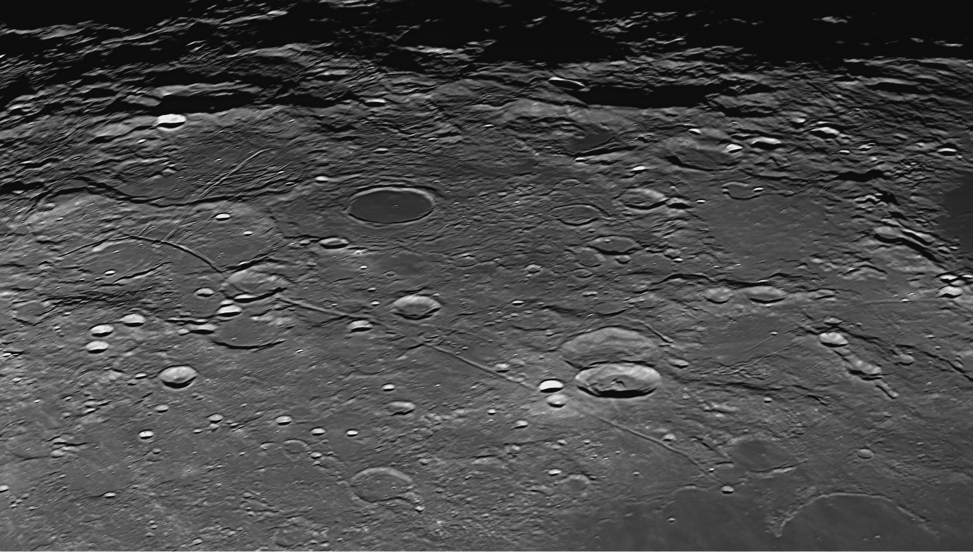
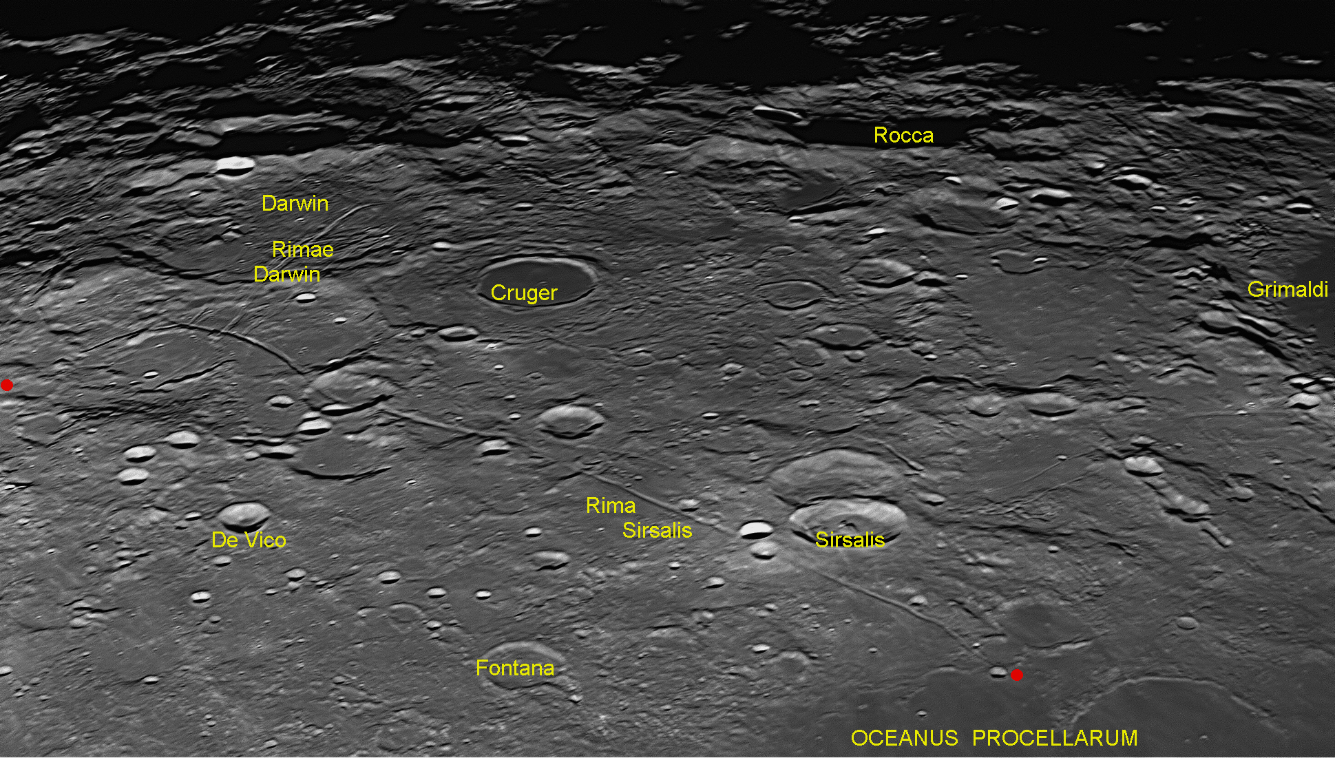
The Rima Sirsalis originates near the red dot
● which lies at the mid-point of the left-hand (southern) margin and heads north-west into a large, un-named walled plain east of a similar-sized walled plain called Darwin. The Rima Sirsalis immediately curves around to the right and heads north-east. It is crossed by four large but shallow rilles called the Rimae Darwin, which begin as a single rille to the west of the 46 kilometre flat-floored crater plain called Cruger, and then enters the 131 kilometre diameter Darwin, where the single rille splits into four which head south-east and cross the Rima Sirsalis. This latter rille runs north across the moonscape, passing the overlapping twin craters Sirsalis (41 kilometres diameter) and Sirsalis A (42 kilometres). Nearby, two new, bright craters Sirsalis F (13 kilometres) and Sirsalis J (12 kilometres) have struck the rille and severely damaged it. Further on, the rille reaches the Oceanus Procellarum where lava flows have swept over and obliterated the end of the rille, which is marked by a second red dot.
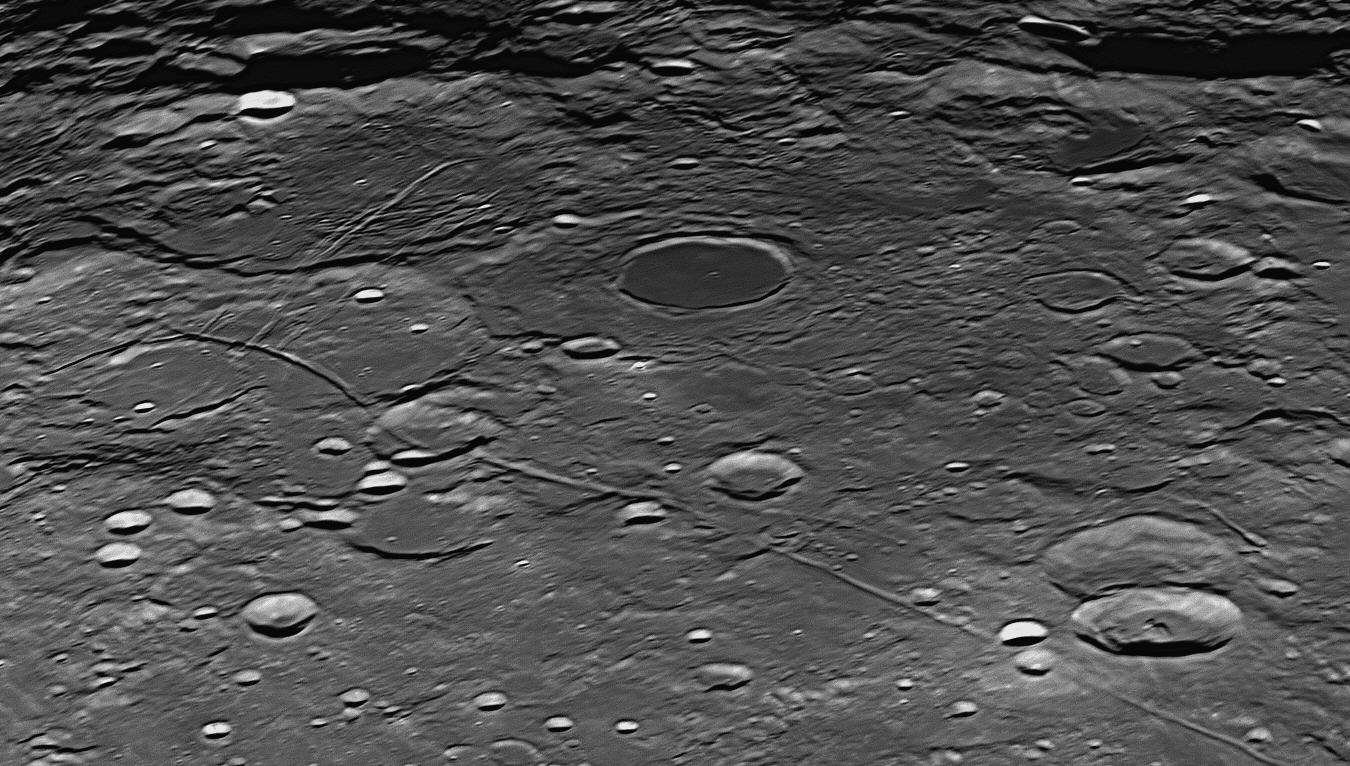
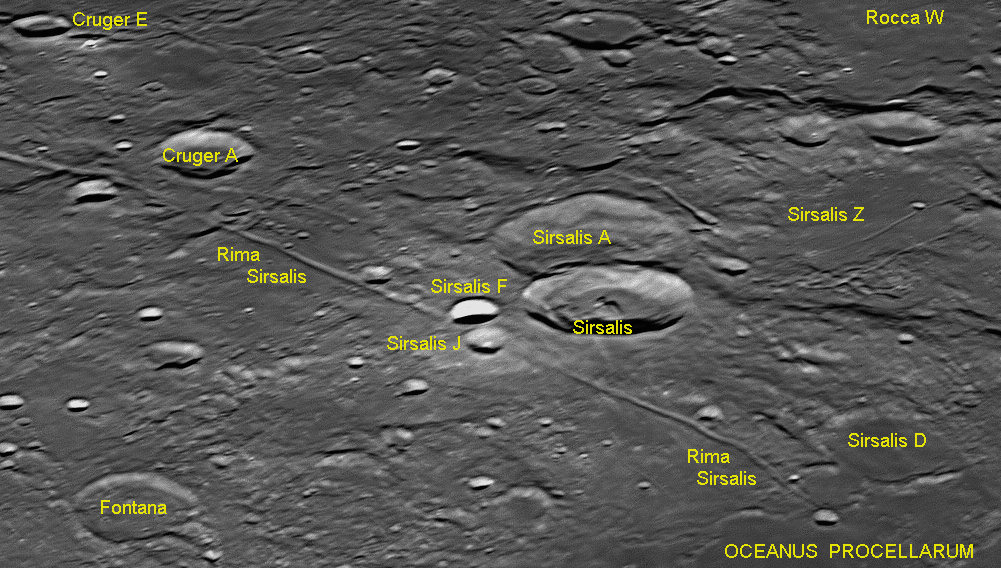
The northern half of the Rima Sirsalis, showing where it has been partially demolished by two later impactors, Sirsalis F and Sirsalis J, and its terminus under the Oceanus Procellarum (Ocean of Storms).
Gerolamo Sersale (1584-1654) was a Jesuit priest who was one of the first
Italians to follow in Galileo's footsteps by using an early telescope to study
the surface of the Moon. In 1650 he drew a fairly accurate map of the lunar
features but did not name any of them. Another selenographer, Michael van
Langren, had mapped and named features on the Moon five years earlier in 1645 -
see
87: November 2023
This month we will look at an unusual square walled
plain that is named after Charles Babbage, who is regarded as the "Father
of the Computer".
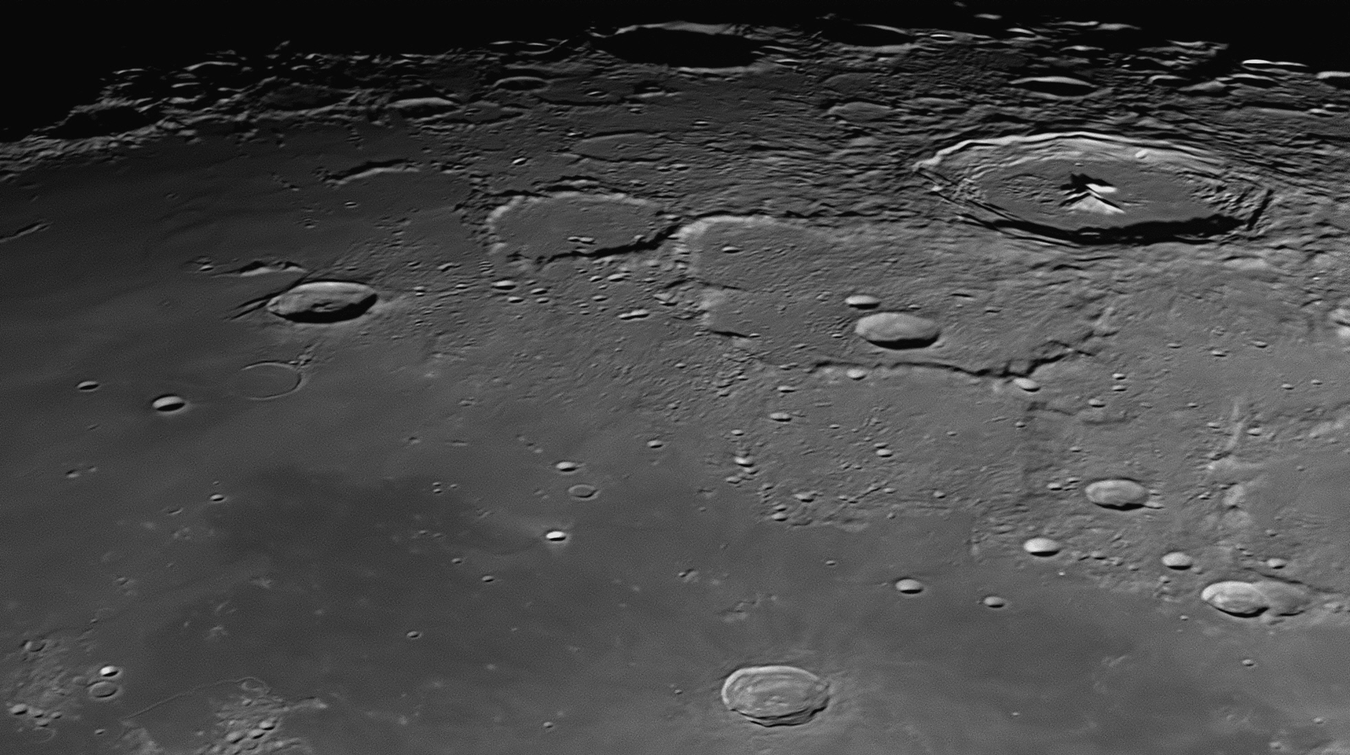
Just to the right of this image's centre line is found the walled plain named Babbage. It is squarish in shape, each side being about 144 kilometres long. The two closest corners (on the southern side) are rounded. The north-eastern corner has been damaged by a blast of rock melt from the more recent crater Pythagoras. The two largest impact craters on the floor of Babbage are Babbage A (26 kilometres diameter) and Babbage C (14 kilometres diameter). The image was taken at 10:07 pm on 31 July 2023.
In the upper right of this image is the crater Pythagoras, which was
described previously and can be found in close-up as image
A 40 kilometre diameter fresh impact crater called Harpalus is seen in the Mare Frigoris near the centre of the lower edge of the image. Between Babbage and Harpalus is another squarish walled plain, but very ancient and ruined, and hardly recognisable. This is South, named after James South, a 19th century English astronomer. To the east (right) of South and partially shown on the lower-right margin is the crater J Herschel (see image
Babbage
Charles Babbage (1791-1871), John Herschel and some friends formed the ‘Analytical Society’ in 1812. Soon after, Babbage designed the first mechanical computer. Called his ‘Difference Engine’, it would have weighed 15 tonnes if completed. In 1991 the London Science Museum, working to mechanical tolerances achievable in Babbage’s time, built a fully-functioning example of the Difference Engine from Babbage's plans. Nine years later, they produced a successful printer to go with it, also designed by Babbage. He also proposed an ‘Analytical Engine’ which used punched cards for programming, but it too was never completed.
In this work he was assisted and encouraged by the English mathematician and writer Ada Lovelace (1815-1852), who was Lord Byron’s daughter - Mary Somerville was her tutor. Ada Lovelace realised that the machine had applications far beyond pure calculation, and created the first algorithm intended to be run on such a machine. As a result, she is often regarded as the first person to recognise the full potential of a ‘computing machine’, and was the first computer programmer. She would likely have developed this work to an advanced level had not serious illness cut short her life at the tragically early age of 36 years. Both the ‘Difference Engine’ and especially her work on the ‘Analytical Engine’ provided the concepts and groundwork which led directly to the first modern computers, the code-breakers Colossus and Alan Turing’s Bombe at Bletchley Park during World War II.
Babbage’s son, Benjamin Herschel Babbage, became an English engineer, scientist, explorer and politician, best known for his work in the colony of South Australia where he lived for 27 years.
88: December 2023
This month we will look at some unusual features near
the impact crater Plinius.
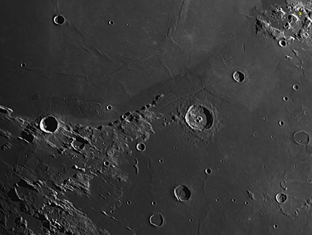
Plinius is the largest crater in this image and has a diameter of 43 kilometres. It is located just right of centre, near the 'strait' where the Mare Serentitatis (Sea of Serenity, north-west of Plinius) joins the Mare Tranquillitatis (the Sea of Tranquility, south-east of Plinius. The 'strait' is between 190 and 200 kilometres wide. One oddity is that the two 'seas' of cooled basaltic lava are of slightly different composition and age. This has resulted in the Mare Tranquillitatis, being at least 70 million years older than Mare Serenitatis, seems to be darker in colour. What is strange is that the boundary between the two maria is so clearly defined and nearly straight. The image was taken on 30 July 2017. North is to the top.
About 45 kilometres to the left of Plinius and just above the centre of
the image is a rocky finger of land pointing north-east across the 'strait'.
This promontory is called Promontorium Archerusia, and it points across
to a mountain on the far side, called Mons Argaeus. Between that mountain
and the upper-right corner of the image is a cluster of mountains with valleys
in between. The valley closest to the upper-right corner has a small, bright
mountain in it like a white dot. Just north of that 'dot' is the flat area where
Apollo 17 landed in 1972, marked by a yellow cross '
Between Plinius and the left-hand margin is a rugged curve of mountains which
form the southern boundary of Mare Serenitatis. A 27 kilometre crater on this
curve of mountains is called Menelaus. The uplands west of Menelaus
adjoin the Montes Haemus (Haemus Mountains), which have previously been
described in
Other impact craters worthy of mention include 17 kilometre
Plinius
Gaius Plinius Secundus (AD 23-79, generally called Pliny the Elder) was a Roman author, naturalist, natural philosopher (scientist), and naval and army commander of the early Roman empire. He lived in the first century after the birth of Jesus. He wrote an encyclopedia called Naturalis Historia (Natural History) which was published as 37 books organised in 10 volumes. In AD 79 he was killed in the town of Stabiae while attempting to rescue a friend and his family caught up in the eruption of nearby Mount Vesuvius, which wiped out the seaside town as well as Pompeii and Herculaneum. His encyclopedia was completed and published by his nephew Pliny the Younger.
Menelaus
In Homer's epic stories The Iliad and The Odyssey, Menelaus was a central figure in the Trojan War. As the King of Mycenaean Sparta, he led the Spartan contingent of the Greek army under his elder bother Agamemnon, King of Mycenae when they went to war with Troy. This war occurred when Menelaus' grandfather died and Menelaus sailed to the funeral on the island of Crete. During his absence a Trojan prince named Paris either enticed Menelaus' wife Helen to run away with him or abducted her. When Menelaus returned and found her gone, he and Agamemnon declared war on Troy. They organised a huge army, put it on a fleet of 1000 ships, and sailed to Troy to bring her back. According to Homer, the war lasted for ten years. It is a Greek myth, but could be based on some true events. We will never know for sure, but the archaeologist Heinrich Schliemann is believed by many to have located the ruins of Troy in 1873.
89: January 2024
This month we will look at an impact crater just south of
the centre of the Moon's disc, Arzachel.
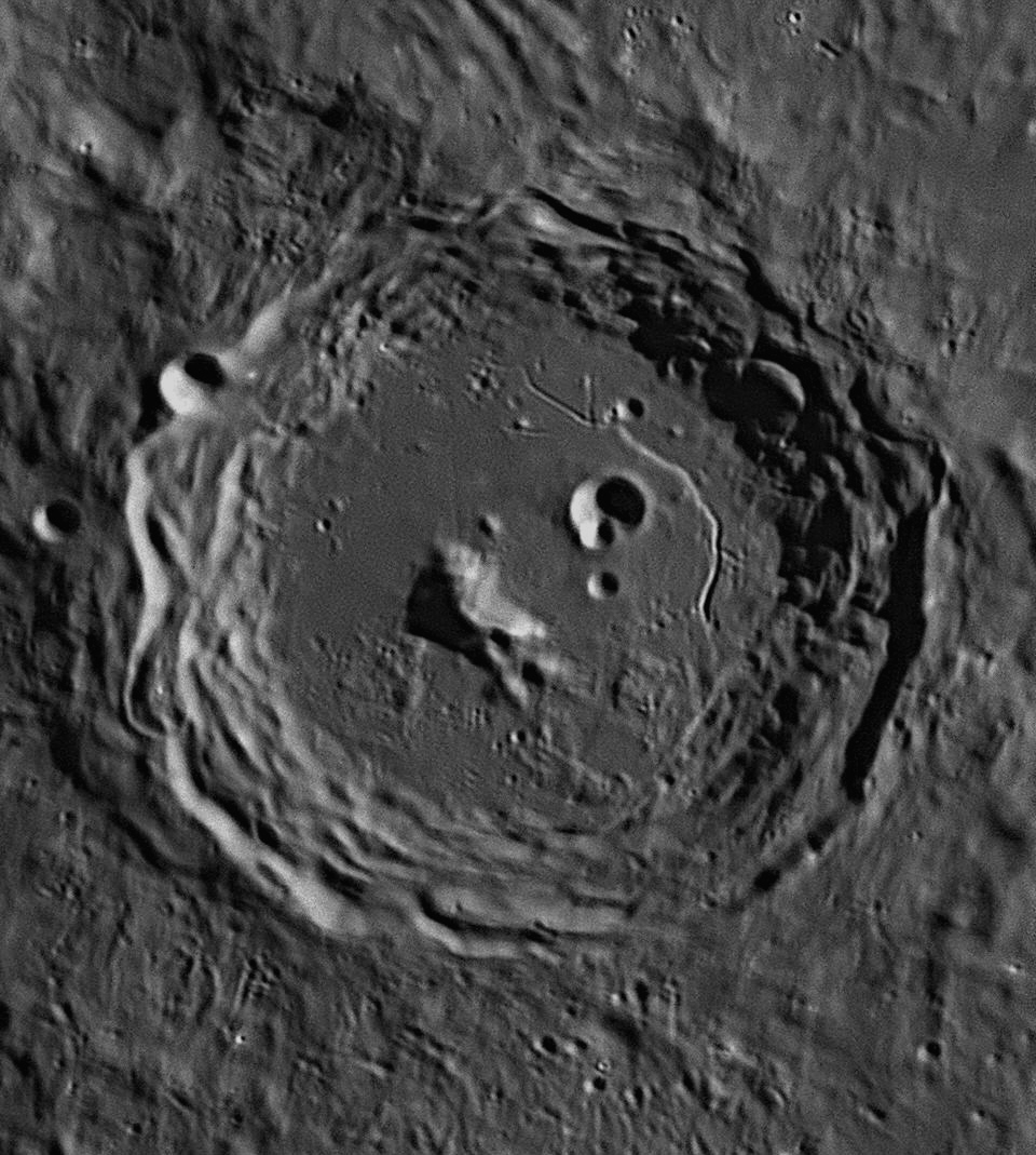
Arzachel is the largest crater in this image and has a diameter of 98 kilometres. The image was taken at 8:09 pm on 15 September 2021.
Arzachel is the most southerly in a prominent group of three walled
plains arranged in a north-south line near the centre of the Full Moon as we see
it. The other two are Ptolemaeus and Alphonsus, and both can be found above
Arzachel
Abu Ishaq Ibrahim al-Zarqali (Arzachel, AD 1028-1087) was a Muslim astronomer living in Toledo, Spain when King Alfonso decided to drive the Muslims out. As the king’s forces approached, al-Zarqali escaped to Córdoba where he continued his work. He laboured to adjust and correct Ptolemy’s geographical data, specifically, the length of the Mediterranean Sea. He prepared accurate ‘zijes’ (a ‘zij’ was the Arabic name for a table of positions of stars and planets), using the more recent observations of al-Khwarizmi and al-Battani to update Ptolemy’s work and correct for precession. It is quite possible that he implemented his own program of observation, or utilised even more sources, to modernise the older material. In 1087 he published the Almanac of Azarqueil. The entries found in the almanac "give directly the positions of the celestial bodies and need no further computation." The work listed the true daily positions of the Sun, Moon and planets for four years from 1088 to 1092, as well as many other related tables. Such books of zijes or tables were known by their Spanish-Arabian name al-manakh (calendar), from whence Europeans derived their own word ‘almanac’. Latin translations and adaptations of Arzachel’s almanac appeared as the Tables of Toledo in the 12th century and the Alfonsine Tables in the 13th century. These almanacs were very much sought after, as their use meant that astrologers need never actually observe the sky directly in order to cast horoscopes and predict events. Their ‘work’ could now all be done indoors, using books. Arzachel also considered the motion of Mercury, which Ptolemy had claimed was caused by the revolving of a secondary epicycle on a primary epicycle, which itself revolved on a deferent. Arzachel thought that the whole process could be simplified by having Mercury revolve on an oval, instead of a perfect circle. He then thought that the orbits of all the planets could be oval, instead of circular. In this, he anticipated Kepler’s discovery five and a half centuries later that all planetary orbits are elliptical.
90: February 2024
This month we will look at the landing site for the
Apollo 16
mission.
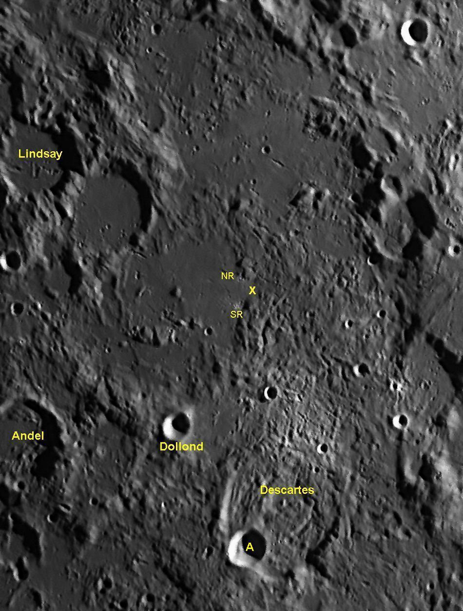
The landing site for the Apollo 16 mission is marked with a yellow cross 'x'. The astronauts John Young and Charles Duke were there for almost three days, April 21-23, 1972. Two small fresh craterlets with tiny white ray systems were navigational aids to indicate the correct place to land. These were North Ray crater (NR, 1 km diameter) and South Ray crater (SR, 680 metres diameter). Both of these can be detected a little to the west (left) of the yellow cross 'x
This was the fifth and second-last landing on the Moon by an Apollo Lunar Module and was the first mission to venture a landing in a rugged area, in this case the Descartes Highlands. These hills lie to the north of the ruined crater Descartes, which has a diameter of 48 kilometres. In more recent times this ancient crater has been struck on its south-west rim by a large impactor which has created the 16 kilometre crater Descartes A, which must be new as it still looks sharply defined.
The landing site was chosen as it was in an area once called a "terra" (land) as opposed to the "maria" (seas). Terrae on the Moon are lighter in colour than the maria, and are the most ancient parts of the lunar surface. Scientists were very keen to obtain samples that were much older than ones collected from previous missions which were sited on flat area on or close to maria. The two astronauts Duke and Young took with them the second Lunar Roving Vehicle (LRV), and toured the site for 26.7 kilometres. They collected 95.8 kilograms of rock samples which were brought back to Earth for analysis.
The astronauts drove to North Ray crater, which is the biggest lunar crater ever visited on the Moon. They also set a lunar land speed of 17.1 kilometres per hour (downhill), and collected the biggest lunar rock brought back to Earth, an 11.7 kilogram lump of breccia consisting mainly of shocked anorthosite attached to a fragment of troctolitic "melt rock". The rock's cosmic ray exposure age has been found to be 1.8 million years, which means that it is debris ejected from the impact that formed South Ray crater that long ago. Its true age, prior to the impact that brought it to the lunar surface, is 3.97 billion years.
Descartes
René Descartes (1596-1650) was born in France and is regarded as the father of modern philosophy. His first principle was "cogito ergo sum" ("I think, therefore I am.") His influence in mathematics was fundamental, in that he invented the Cartesian co-ordinate system that allows algebraic equations to be portrayed as geometric shapes such as parabolas and hyperbolas. He also invented analytic geometry and exponential notation. His work provided the basis for the calculus of Newton and Leibniz that followed.
After hearing in 1633 that Galileo had been arrested for his Dialogues, Descartes thought that the malign influence of the Roman Inquisition could spread to Catholic France. He therefore abandoned his plans to publish A Treatise on the World, his work of the previous four years, and moved to Protestant Sweden for safety. Even so, in 1663 (13 years after his death) the pope placed all his other works on the Index of Forbidden Books, despite the fact that Descartes, like Galileo, was a devout Roman Catholic. Descartes was also one of the key figures in the Scientific Revolution. He made significant contributions to the field of optics, and showed that by using geometric construction and the law of refraction (also known as Descartes’ Law) that the angular radius of a rainbow is 42 degrees.He also supported the contention made in 1621 of Willebrord Snel van Royen (Snellius, 1580-1626), that spherical aberration (the blurring shown by optical lenses having spherical curves) which was a problem in simple refracting telescopes of the time, could be reduced significantly if the objective (front) lens had as shallow a curvature (or as long a focal length) as possible. He went on to say that chromatic aberration (the failure of a simple lens to bring all colours to the same focal point because of their different refractive indices – this produced coloured fringes around images) would be reduced as well. This encouraged observers such as Hevelius, Huygens, Cassini and Flamsteed to build the extremely long refractors that were the instruments of choice until the achromatic doublet appeared in the following century. Descartes also independently discovered the law of reflection, and his essay on optics is the first published mention of this law. Descartes contributed to the development of telescope lenses and mirrors in two books, Le Monde, ou traité de la lumière (The World, and properties of light), (1634) and Dioptrique (Dioptric), (1637). Both remained unpublished until after his death in 1650. In these books, he showed how spherical aberration prevented the light from being brought to a clear focus, and originated the idea that a better focus can be achieved if the surfaces are paraboloidal, instead of spherical.
Descartes tried to explain gravity in 1644 in his Principiorum Philosophiæ, saying that Kepler’s idea of action-at-a-distance was not based on nature but the occult. He agreed with Plato’s idea that space was not a void or vacuum, but filled with æther, and linked this with Aristotle’s statement that “nature abhors a void”. He said that, at the creation, God had made the æther in order to carry light, and had stirred it into motion. It had formed ‘tourbillon’ (translated as ‘turbulences’ or, more usually, ‘vortices’) that carried the planets and other sky objects around in orbits, thus producing the effects of gravity. It also offered a solution to the problem of where the centre of the universe was, by claiming that the Earth was at rest in the centre of its own vortex, the Sun was at rest in the centre of the solar vortex, and the planets likewise in the centres of their individual vortices. The swirling vortices themselves provided the movement.
Huygens and Newton initially supported this theory, but Newton later used geometry and his new fluxions to thoroughly demolish it in his Philosophiæ Naturalis Principia Mathematica of 1687 (the Principia), when he realised that vortices could not possibly explain elliptical orbits or anything else. The very title of Newton’s book distinguished it from that of Descartes by emphasising Newton’s requirement of mathematical rigour and proof, which was missing from the vortex theory.
ay.

Key to features 91-94.
91: March 2024
This month we will look at the south-western shore of the
flat lava plain known as Mare Crisium (the Sea of Crises).

Mare Crisium is a huge oval basin 620 kilometres across (east to west)
and 570 kilometres across (north to south). Its position near the Moon's
north-eastern limb means that foreshortening makes it appear that its
north-south axis is the longer one. Mare Crisium was created about 3.85 billion
years ago, so it is remarkably undamaged considering its age. The other maria
are aged as follows: Australe, Fecunditatis, Smythii, Tranquillitatis,
Insularum, Marginis and Nubium (4.55 - 3.92 billion years), Frigoris (4.55 -3.85
billion years), Humorum, Nectaris and Humboldtianum (3.92 - 3.85 billion years),
Imbrium (3.85 - 3.8 billion years), Oceanus Procellarum (3.85 - 3.2 billion
years), Serenitatis (3.2 billion years to present day). The eastern half of Mare
Crisium is marked only by craterlets, but there are a few large impact craters
in the south-western quadrant shown above.
Picard (23 kilometres diameter) is the most recent of these and looks quite fresh. It obviously occurred after the lava flooded the Mare, filling it up to a level similar to that of the surrounding Maria. The two craters Yerkes (36 kilometres diameter) and Lick (31 kilonmetres diameter) are slightly older (3.82 billion years) and were formed before the extrusion of magma that levelled the whole interior of the Mare. This magma (called 'lava' once it has reached the surface) forced breaches in the walls of Yerkes and Lick, and flooded their interiors to the same level as the Mare outside, turning them into 'ghost craters'.
The craters Tebbutt (31 kilometres diameter) and Shapley (23 kilometres diameter) are found embedded in the south-west wall of the Mare. North-west of Yerkes is a small pyroclastic area with clefts and domes.
Jean-Felix Picard
(1620-1682) and some assistants travelled to the site of the ruined Uraniborg in Denmark in 1671, so that observations and timings of the eclipses of Jovian satellites could be done as close to simultaneously as possible by himself at Uraniborg and by Cassini in Paris. Cassini also wanted to check the exactness of a selection of Tycho’s other observations from the same site, to see if his pre-telescopic star positions were as accurate as claimed. If they were, they could possibly be utilised in dealing with the longitude problem, using the ‘close approach of the Moon to bright stars’ technique of Johannes Werner – the lunar distance method. One of the local Danish astronomers who took part in these projects was Ole Christensen Rømer
George Ellery Hale (1868-1938) was born into a wealthy family. His
father, who had made a fortune after the great Chicago fire of 1871 by supplying
elevators for the new skyscrapers being built, encouraged his interest in
astronomy and the Sun by equipping him with bigger and better telescopes and
spectrometers. By the time he was 23, Hale had his own private solar
astronomical laboratory with a 12 inch Brashear refractor. He was educated at
the Massachusetts Institute of Technology (MIT) and Harvard University, and as
an undergraduate he invented the spectroheliograph, with which he made his
discoveries of solar vortices and the magnetic fields of sunspots. In 1892 he
was offered and accepted a position on the faculty of the University of Chicago,
and immediately launched into a life-long campaign to fund and build ever bigger
and better astronomical observatories with huge telescopes.
He had heard of the giant new Lick refractor near San Francisco, and decided to
build one a little larger. He proposed that the University order a 40 inch (1.02
m) Alvan Clark & Son refractor for a new observatory to be built at nearby
Williams Bay in Wisconsin, and convinced Charles Tyson Yerkes to donate
$ 300 000 to pay for it, the intention being to "lick the Lick”. Yerkes was a
mass-transit railroad magnate who had made a fortune from take-overs of local
Chicago streetcar systems. He apparently felt that being known as the benefactor
of the world’s largest telescope would greatly enhance his ability to raise
credit, for he expected his business to expand rapidly. This was indeed the
case, as from 1900 he became heavily involved in building the London
Underground.
Harlow Shapley (1885-1972), was offered a position working under George Hale at the Mount Wilson Observatory in 1914. At the time, astronomers were concerned with the nature of "spiral nebulae". These were clouds of gas and stars that had been discovered in their hundreds by William Herschel with his home-made reflecting telescopes between 1784 and 1815, and then in their thousands as telescopes improved and astrophotography became possible. Many had a spiral or 'whirlpool' shape, which led people to believe that they were spinning. Astronomers were unsure about what they were. Pierre-Simon de Laplace thought that they were small clouds in the Milky Way, and were possibly new solar systems being born. Kant thought that they were other Milky Ways lying at at such a great distance that they looked small - he called them "welt-inseln (world islands)". Von Humboldt suggested calling them "island-universes", which made the idea popular.
By 1920 Harlow Shapley had decided that the spiral nebulae were small objects inside our own galaxy, and the Milky Way itself comprised the whole observable universe - there was nothing else. He based this claim partly on the work of one of his colleagues, Adriaan van Maanen, who had closely studied photographs of some individual spiral nebulae taken decades apart. Using a blink microscope to switch from an old plate to a new one, he reported that he had seen evidence that the spirals were rotating. Shapley accepted van Maanen's claim uncritically. The Director of Mount Wilson, George Hale, encouraged Shapley’s investigations and assumptions, but sounded a note of caution, warning him, “substitute new hypotheses for old ones as soon as the evidence may demand.”
On 26 April 1920 a 'Great Debate' was held at the Smithsonian Museum of Natural History in Washington, regarding the nature of the spiral nebulae and the scale of the universe. It was organised by George Hale, to debate whether the spiral nebulae were small
objects in the Milky Way, or huge, remote island universes. He asked his employee Shapley to defend the first position, and asked Heber Doust Curtis of the Lick Observatory to put the case that the spirals were other giant Milky Ways in deep space. Oddly
enough, Shapley and Curtis both travelled from California across the United States on the same Southern Pacific express. (Curtis was heading east to become Director of the Allegheny Observatory at the University of Pittsburgh.) In their conversations
en route, both avoided the topic of spiral nebulae, even during an extended stopover in the middle of nowhere when the locomotive broke down. The thrust of the debate was concerned with the size of our Galaxy, and whether the spiral nebulae were part of
it or remote ‘island-universes’ in their own right. Shapley was by then fully convinced that our Galaxy was the total universe, and was of sufficient size to contain these mysterious objects, although some astronomers believed that the spiral
nebulae were clouds in our Galaxy which were condensing into stars or solar systems, in the manner suggested by de Laplace over a century before.
It was not a debate in the true sense. Each speaker was allotted forty minutes, and both used lantern slides to illustrate their talks. Shapley spoke first, and spent most of his time speaking at a level suitable for the general public, e.g. showing slides of
open and globular clusters and describing the term ‘light-year’. He presented the evidence for his distances to globular clusters, and described how he had measured the immense size of the Milky Way without going into what he called “dreary technicalities”.
A major point was the location of the solar system far from our Galaxy’s centre. Shapley knew that in the audience were two representatives from the Harvard University Board. Edward Pickering had recently died, and they were casting around for a new Director
for their Observatory. His talk was aimed to impress them with his maturity and scientific ability, rather than to convince the audience of his point of view. For this reason, he hardly mentioned the spiral nebulae, and his teacher Henry Norris
Russell spoke lucidly from the floor in support of Shapley. As it turned out, the person who most impressed the Harvard people was Russell. They offered him the Directorship, but he refused
it, not wishing to devote his time to administration. Russell lobbied instead for Shapley, who was offered a one-year temporary Directorship in 1921, which was made permanent before it had expired.
Working at Harvard in the first two decades of the twentieth century was Henrietta Swan Leavitt (1868-1921). Her research interest was photometry – the determination of the brightness or apparent magnitude of a star from its photographic image. She measured the brightnesses of star images on plates of the Magellanic Clouds (two dwarf galaxies in the southern sky) taken at the Boyden Field Station at Arequipa in Peru, and in 1907 discovered 1777 variable stars on them. In 1908 Miss Leavitt reported that 16 of the variables in the Small Magellanic Cloud (SMC) were bright, yellow, short-period pulsating stars known as Cepheids. These stars change brightness as they expand and contract on a regular basis (often in a few days): as they expand they fade, and as they contract they brighten. She noticed that the brightest of these Cepheids were the slowest to complete a cycle of variation – the fainter ones cycled faster, so in this group there was a relationship between each Cepheid’s period and its apparent magnitude. As the Cloud was compact, she could assume that the Cepheids were all at the same distance from us, and brighter ones were so because of their own intrinsic luminosity. This meant that differences in apparent magnitude were the same as differences in absolute magnitude, so each Cepheid’s period was also related to its absolute magnitude or luminosity. Also, as they could be resolved individually in the SMC, they had to be giant stars. By 1912 she had measured the changing brightnesses of 25, and announced her discovery which is now known as the period-luminosity relationship.
In a nutshell, if a person measured the period of a Cepheid's cycle, this would give its absolute magnitude. Simple arithmetic in comparing its absolute magnitude with its apparent magnitude would tell us how far away it was, which would be the same as any cluster or galaxy in which the Cepheid was located. To find the distance of a spiral nebula, you would first locate a Cepheid in it. Then find the Cepheid's apparent brightness and do a simple calculation. This is what Edwin Hubble (1889-1953) determined to do when he started work at Mount Wilson Observatory in 1920 after wartime service as a Major in the Army.
The 100 inch Hooker Telescope at Mount Wilson Observatory near Los Angeles had been commissioned in November 1917, and one of the handlers (called ‘mule skinners’) who used mule teams to drag loads of building materials
and telescope parts up to the summit of Mount Wilson was Milton Humason (1891-1972). On arrival at the Observatory site, Humason had asked the Director George Hale for a job there, and had the good fortune to be appointed as a
caretaker. In 1919, Harlow Shapley promoted him to a position in the photo lab, then to Night Assistant (operator of the telescopes for the astronomers). When Hubble arrived, he asked Humason to assist him by using the new telescope to
photograph nearby spiral nebulae. The canny Humason quickly earned the egocentric Hubble’s support and friendship by always addressing him as ‘Major’. Between them, they found that the superlative Hooker Telescope, then the world’s
largest, could resolve the outer arms of some nearby spirals into individual stars, which was strong evidence that they were the ‘island-universes’ outside the Milky Way that Kant and Curtis had believed. To finally prove that the
spirals were indeed extragalactic, their distances needed to be known, so Hubble and Humason began to search for Henrietta Leavitt’s Cepheid variable stars in those close spirals.
Harlow Shapley, like Hubble born in Missouri, could not abide Hubble’s pretentious English accent, English mannerisms (saying “What-ho!“ and "Bai Jove!"), and affectations such as pipe-smoking and wearing jodhpurs, a cape and riding
boots to work (all acquired while spending nearly a year at Cambridge University after the war), so when offered the Directorship of Harvard Observatory in 1921, Shapley left Mount Wilson permanently. This took him away from the centre of the
action, which he had to observe from the other side of the country. Meanwhile, Humason spent many hours guiding the 100 inch telescope for each photograph, some exposures being 70 hours long, spread over weeks. By 1924 Hubble had found Cepheids
in a number of nearby spirals, and was using them as ‘standard candles’ to find their approximate distances. He began by measuring six Cepheids in the Andromeda nebula M31. The first of these reached only 18th magnitude at maximum, yet its
long period of 31 days indicated that it was a giant star, thousands of times brighter than the Sun, and dim only because of its great remoteness. The application of Leavitt’s period-luminosity relationship gave a distance of
930 000 light-years. For M31 to loom so large at such a distance, then it had to rival the Milky Way in size. (This was notable work, but if a more exact distance-luminosity calibration for Cepheids determined from parallax had been
known at the time, then the results might have been closer to the modern value of 2 540 000 light-years, nearly three times the distance.) Hubble wrote to Shapley at Harvard to let him know before the public announcement was made, that the
Cepheid distances proved that the spiral nebulae were indeed huge accumulations of millions of stars, far from the Milky Way. Shapley glumly showed the letter to his staff member Cecilia Payne saying, "Here is the letter that has destroyed my universe."
At a joint American Astronomical Society + American Association for the Advancement of Science meeting in Washington DC on 1 January 1925 (99 years ago), the eminent astrophysicist Henry Norris Russell read Hubble's paper for him, announcing that M31 was much too far away to be considered a part of the Milky Way system, but had to be a separate galaxy. Therefore, the Milky Way was not alone, but was merely an ordinary galaxy, surrounded by thousands of other galaxies. The Great Debate was finally settled in Curtis’ favour by Hubble, thanks to Henrietta Leavitt’s Cepheids. Cecilia Payne was at the meeting and reported back to Shapley, who regretted his error for the rest of his life, but went on to do valuable work on what he now fully accepted to be external galaxies in the depths of space, entirely remote from the Milky Way. Hubble’s protégé Allan Sandage wrote, “What are spiral nebulae? No-one knew before 1900. Few people knew in 1920. All astronomers knew after 1924.”
Hubble never gave Vesto Slipher credit for originally discovering the expansion of the universe in any of his published papers, nor to Humason, who did the hard graft. We can now give credit where it’s due. Hubble always felt that the rate of the cosmological expansion was too high to be real, always calling the velocities of spiral nebulae ‘apparent velocities’, hedging his bets in case the redshift was due to some unknown cause. When Shapley suggested that the external star systems be known as ‘galaxies’, Hubble refused to use the term, preferring to call them ‘non-galactic nebulae’, and then ‘extra-galactic nebulae’. The term ‘galaxies’ only came into general use after Hubble had died in 1953, and the new Mount Palomar 200 inch and 48 inch Schmidt telescopes had begun operation.
92: April 2024
This month we will look at a long graben or rift valley
known as the Rima Ariadaeus.

The Rima Ariadaeus is a spectacular valley-cleft that was discovered by
Schrӧter in 1792 and is easily seen in today's small telescopes. It begins in a
rim-less depression filled with lava called Hyginus Z (28 kilometres
diameter, one-third of the way down the left margin) and heads towards the lower
right-hand corner. Soon it is joined by another cleft which is shallower and
part of the Rima Hyginus system. From this junction the Rima Ariadaeus
becomes wider and deeper, and the walls on each side very steep. At this point
the valley enters a rugged area and then climbs over a mountain range just to
the north of a 13 kilometre recent impact crater called Silberschlag. The
valley then proceeds in a more-or-less straight line, except that at 60
kilometres from Silberschlag there is a break in the valley, the remaining part
it being displaced north by about 5 kilometres. There must be a north-south
fault line below the visible surface to have enabled such a large section of the
moonscape to have been moved north such a distance after the rille had already
been formed. Three north-south clefts near the right-hand margin called the
Rimae Sosigenes may provide a clue. The displaced section of the Rima
Ariadaeus continues east-south-east for 100 kilometres to its end near the
young, bright 12-kilometre crater Ariadaeus. It passes over two small
ridges on its way, ending at the western wall of the lava-flooded crater
Ariadaeus E (24 kilometres). Before it reaches the end, a less-sharply
defined branch heads south.
Julius Caesar (91 kilometres) is a large and battered formation, open to
the east. Recent lava flows have covered the northern portion of the floor which
is almost featureless, while the southern portion is peppered with craterlets.
Just to the east of Julius Caesar is an undamaged flat-floored crater called
Sosigenes (18 kilometres diameter)r).
Agrippa
Agrippa was a Greek astronomer in the first century AD. The only thing
that is known about him regards an astronomical observation that he made in 92
AD. Ptolemy writes that in the twelfth year of the reign of Domitian, on the
seventh day of the Bithynian month Metrous, Agrippa observed the
occultation of a part of the Pleiades star cluster by the southernmost part of
the Moon. The purpose of Agrippa's observation was probably to check the
precession of the equinoxes, which was discovered by Hipparchus.
Whilst in Egypt in 46 BCE, Caesar commissioned Sosigenes of Alexandria to
reform the Roman calendar, which was now over two months ahead of the seasons.
Sosigenes suggested that they adopt King Ptolemy
93: May 2024
This month we will look at a damaged crater plain near the Moon's
equator called Guericke.


Between the 48 kilometre crater Parry and Guericke are two craters whose interiors have been flooded by lava from the east, which breached their northern and eastern walls 3.2 to 3.85 billion years ago. The craters Parry and Tolansky
(13 kilometres) also have lava-filled floors, but without any gaps in their walls, indicating that the molten magma oozed up through fissures in the crater floors. There are some fresh-looking craters visible which are of much more recent origin, one being
Kundt (12 kilometres). There are hundreds of small, bright craterlets scattered across the image, and numerous clefts and rilles
are found in the lower-left quadrant.
Guericke is a greatly damaged walled plain of 58 kilometres diameter, found at latitude 12º South and longitude 14º West.
It occupies the right-hand third of the above image.
William Edward Parry (1790-1855) was a Royal Navy officer and explorer of Arctic waters. He was the most successful explorer in the long quest in the 19th century to find a north-west passage through the Arctic Ocean from Labrador through the Canadian Arctic Archipelago to the Bering Strait and thence into the North Pacific Ocean. The way through was not found until 1906, when Roald Amundsen achieved success. In 1827 Parry also attempted to reach the North Pole, reaching 82º 45' North before having to turn back.
94: June 2024
This month we will look at a chain (catena) of craterlets crossing an ancient crater plain adjoining the more recent 35 kilometre crater Davy. The chain is called Catena Davy.

Catena Davy is a linear chain of 23 tiny craterlets which is found crossing the flat floor of the walled plain Davy Y. It was probably formed by an impactor striking the surface at a very low angle
and skittering across the moonscape for 50 kilometres. The craterlets showing where the impactor touched the surface are very close together, many being contiguous. The chain has a maximum width of four kilometres. No. 1 (also known as Davy C)
starts at a point south of Davy Y's mid-point, and the line heads off to the east on a slightly curved trajectory. No. 20 is on the top of Davy Y's eastern wall, and the chain peters out as it approaches the 16 kilometre
slightly ovoid bowl-shaped double-crater Davy G. The craters in the chain vary in size from 4 kilometres (Davy C) to about half-a kilometre. Some of them have been given odd names by NASA, but these names were officially recognised by the
International Astronomical Union (IAU) in 1976. No. 12 is called Susan (<1 kilometre), No. 13 is Osman (1.7 kilometres), No, 14 is Priscilla (1.5 kilometres), No. 15 is Alan (1.4 kilometres), No. 16 is Delia (1.6 kilometres), and No. 17 is Harold (1.5
kilometres). The others are not named.
Some say that the Catena Davy is not due to secondary cratering (being caused by large flying mountains bouncing across the lunar surface after the impact of a large meteor or comet, which subsequently broke up), as there seems to be no nearby crater aligned with the chain which could have been the primary impact point. Some claim, however, that Davy G is exactly in line with the chain, and must surely be connected with its formation.
The most likely event that resulted in this chain is believed to be a single body that broke apart prior to impact due to tidal effects. High resolution Lunar Orbiter images show that the string of craters must have formed simultaneously as the ejecta from each craterlet does not overlie neighbouring craters. As the craterlets look fresh and undamaged, it is likely that the chain is less than one billion years old, and could be much younger. Other linear surface damage that trends across the image from the top down in a south-south-easterly direction was caused by material blasted across the moonscape from the Imbrium Event, and is called 'Imbrium Sculpture'. See items
Davy
Sir Humphry Davy (1778-1829) was a British chemist and inventor who invented the Davy Safety Lamp for miners and a very early form of arc lamp. He used electricity to isolate several elements for the first time: potassium and sodium in 1807 and calcium, strontium, barium, magnesium and boron the following year. He also discovered the elements chlorine and iodine. In this work he invented the new field of electrochemistry. His work formed the basis for the discoveries of Michael Faraday, and led to the work of James Clerk Maxwell. Davy experimented with nitrous oxide ("laughing gas") and described its potential as an anaesthetic for relieving pain during surgery.